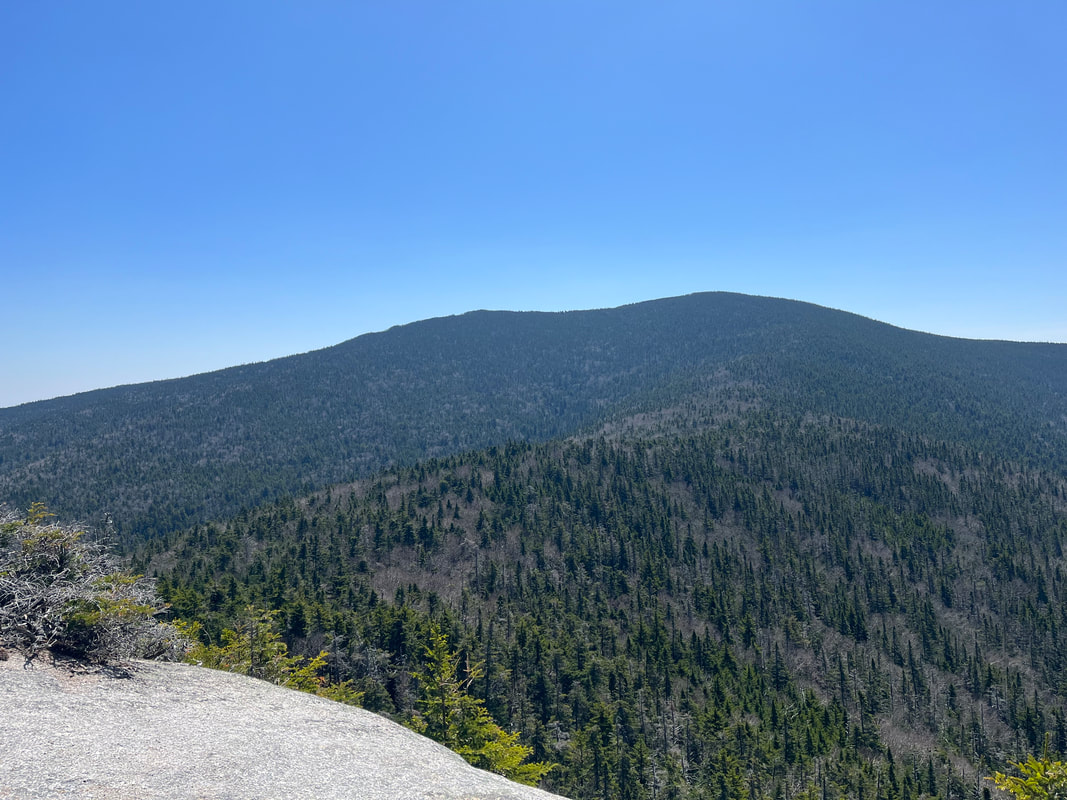
 The view of Sandwich Dome from Jennings Peak. The view of Sandwich Dome from Jennings Peak. Hiked On May 13, 2023 I have been wanting to do this loop for a long time. It was on my list in the fall but got bumped because Allison and my brother Dan wanted to climb Adams and Madison. We did that and my knees still hurt today! This, however, is no walk in the park either. Sandwich Mountain is the tallest of the 52 With a View peaks and the star of the Sandwich Range. Noon is more of a ledge than a peak. Jennings is it's own thing--reachable by a spur off the main trail--and counts to the 52 on its own. This means plenty of elevation. Also, there were tons of fallen trees on the trail. This happens sometimes. A storm will hit the side of a peak and chaos will ensue. Down below we hardly notice but up on the slope...wood starts swirling. This appears to have occurred some time over the winter. At times the trail was concealed and we needed to bushwhack a bit to find our place again. Still, the degree of difficulty did not conceal the beauty of the trip. It will be one of the most memorable and enjoyable hikes of the year I am sure.  Older broken trees on our way down Sandwich. Older broken trees on our way down Sandwich. I will let the video tell the story. That said, it was part of our slow increase in degree of difficulty after the winter. Allison had to take a break for graduate school stuff. I hiked alone in the snow during that time. Mostly I did smaller peaks. With snowshoes on I tend to be interested in high-satisfaction-for-effort hikes like Watatic. Of course, it has all been a workout for me!
0 Comments
HIKED ON APRIL 29, 2023 Stinson is considered one of the easiest hikes on the 52 With a View list. It is also one of the closest to where we live. It made sense as a half day trip on a busy weekend as we prepare for bigger things. As I note in the video, lots of people don't particularly like it. It is a common compliant on multi-use trails that the hikers become a bit of an afterthought in winter. Also, mountains like this lose a bit of their "wild" feel when they are super-accessible. This is even more true on the famous mountains like Washington, so it isn't Stinson's fault. That said, it was a lovely day for a walk. The leaves hadn't really even begun to appear, leaving the greens of moss and small flowering plants to distract us from the browns and grays. I go on quite a bit in the video about skunk cabbage. It is usually one of the first plants to appear after the snow. Finally, on a frustrating note, I lost my poles on Stinson and still haven't quite relaced them...  Fabulous view with some of the most interesting cloud cover. Hiked on April 15, 2023 It is fun to get to make a new post! Through the late winter I was mostly revisiting old hikes that I had already written up. Of course I made videos for most of them--which was different--but I just placed those vids with the older weblog entries. This hike, however, was a new one. Also...it was about a week late. We tried it the week before and the water was high. Instead of risking advanced wetness, we turned around and hit Hedgehog instead. Hedgehog is always a winner. We changed strategies for this attempt. Instead of parking in the Hedgehog/Potash lot we pulled over next to an access road that avoids the stream. We were not the only ones, either. There weren't many of us on the trail, but those that were took this little detour. It isn't "cheating" of course. It feels a bit strange to be off the regular route. That said, when we have done this in the past--as with Carter Dome--it made the journey more interesting. In this case--having hiked a bit of the other way--I think it was a lateral move. There are a number of Potash Mountains in northern New England by the way. The wood on this and other similarly named mountains (and lakes and streams) was used to produce a variety of potassium salts that were--and still are--used in products we use today. When I was in high school I was taught to pronounce this word with a long "o" sound. Of course, since the word derives from one of the earliest methods of obtaining these salts--soaking then burning wood in a pot--the short "o" is fine. My US History teacher Steve Morris would not approve of me going rogue like that. Therefore it's the o-sound of potassium in his memory for me.  This video is one of the shortest I have done. This is not a reflection of how I feel about the walk! The hike was lovely and the view was excellent. It is just that I didn't have much to say. I didn't have any special insights. Nor were the views all that different from what I had seen in other places. Allison and I have hiked quite a few mountains now. I, in particular, have been exploring the Sandwich range and its environs. Many of the peaks in the distance seem like old friends. I could see Hedgehog, Chocorua, the Sisters, Passaconaway, and Whiteface, among others. All of those were good memories. Some new mountains appeared--like "the Captain" and Green Cliffs. Both of those require bushwhacking to the summit. So I think I will enjoy them from afar. I would recommend the trip to Potash. Just don't climb it right after Hedgehog.  Most of my best pictures were from Mount Webster because I wasn't busy falling down. HIKED ON NOVEMBER 14, 2022 Yesterday was "Thanksgiving Sunday" which is the Sunday before Thanksgiving. It was lovely and peaceful and--at least for me--quite moving. Today, however, I am on screech. Thursday is actual Thanksgiving, then Sunday is the beginning of Advent. There is so much to do. All I see is a long string of tasks stretched out until December 26. This is not unusual for any of us, particularly for clergy, so I am putting my head down and getting on with it... That said, I did hike Mount Jackson and Mount Webster a week ago in a freak snow situation. The weather--which was unseasonably warm--had turned on a dime. Al got sick. I had a reservation in New Hampshire. All this added up to a very beautiful, very cold, very slippery hike!  This stand of trees were on the ridge between Jackson and Webster in one of those quiet places you find even on the windiest days.  One of the many stream crossings that probably wouldn't be that difficult...except for the ice. One of the many stream crossings that probably wouldn't be that difficult...except for the ice. There are plenty of things that I would do differently. I would have perhaps not gone. I would have done better research (I was planning on a different I hike with Al). However, I did go. I do not love snow but I have done quite a few winter hikes at this point. I knew it would be gorgeous at the top and that the trails themselves would have a lot to offer. The only thing that gave me any pause was that I was by myself. With that in mind, I double checked my pack, put on my microspikes, and went on up. It turned out that--while I passed two people heading down Webster--I was the only one hitting Jackson on this particular day. It is a popular mountain. It is rare to have it to oneself. The sound of the high wind in the trees and the rush of water under (and over) the ice created the background music to my solo climb as I negotiated some deadfalls and, of course, the icy stream crossings. I was careful and took lots of breaks, too.  Taken near where I fell on Jackson. That flat-looking thing to the left is the ridge I took to Webster. Finally, I reached the tree line. What followed was a brief period of complete chaos! I was pushed around by the wind. I later learned that the wind chill put the temperature at -2 degrees Fahrenheit. My hat almost blew off. I got turned around and--most exciting--I fell and slid on the ice while trying to avoid the worst spot. It was dangerous but--thanks to the speed of falling and the need to figure out what to do so as not to freeze to death--I kept moving. In fairly short order I found my way to the peak and then started down toward Webster. Those few moments of free-fall, though, became my reflection for Sunday. Every once in a while I have the experience of a sermon or prayer coming to me in its whole form. This was one of those times. Collecting myself before trying to stand, the first few ideas came to my head. We humans are always grateful for the peace--in this case an extremely dramatic and windy peace--after a fall. Time stopped while I sat there on the edge of the earth. All I experienced was the smallness of me and the vastness of what was around me. Nature doesn't really care about you. Sometimes that is properly frightening. Sometimes it is liberating.  The ledges on Webster The ledges on Webster There are a lot of different ways to fall. Each time we are saved we crave welcome and assurance. We are grateful for how we made it through the crisis or the climb. We give thanks and praise the acts of kindness and love--from ourselves and others--that we experienced in the darkness. After taking that moment where I fell, the rest of the hike unfolded before me. What a blessing to be alive on this dynamic planet! I slowly brushed myself off and continued on to Mount Webster.  In a way there isn't much to say, except that the ridge between peaks was spectacular. So, too, was the view--from a much more secure perch--off Mount Webster. On the way down I passed a few more people sensibly just doing the smaller mountain. None of them were by themselves. I also witnessed a beautiful waterfall on the way down. Snow really does its job on the landscape, making it feel other-worldly. This is our world, though. That is another thing to be grateful for. Winter hiking, itself, is beautiful. Solo hiking is special and dramatic. However, I will keep my solo winter hikes to the 52 With a View list and look for companions on the big mountains going forward. The glory of the mountains is color. A great many people think that they see all that there is to be seen of the White Hills in one visit...but what if you could go into a gallery where the various sculpture took different attitudes every day? ...Would one season be sufficient to drain the interest of it? Thus the mountains are ever changing. They are never two days the same. --Thomas Starr King  As always, the trail begins under the trees. 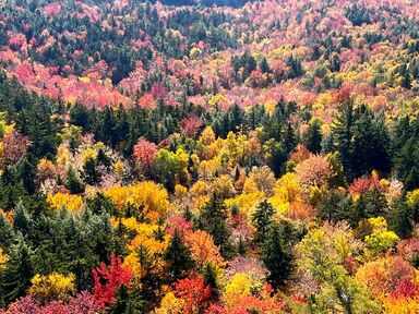 Spectacular foliage as seen from Allen's Ledge that I hiked under the next day...in the rain. Spectacular foliage as seen from Allen's Ledge that I hiked under the next day...in the rain. Hiked On October 12, 2022 Many years ago my mother-in-law came across a Walter Launt Palmer painting in a thrift shop in New Jersey. That painting eventually got her an appearance on the Antiques Roadshow. Back then this name was new to me. Palmer worked mostly in New Hampshire in the White Mountains and his work was heavily influenced by the Hudson River school that began about a generation earlier. Since that time I have seen his work in many American museums. I remember, too, an exhibit of "New Hampshire school" painting at Fruitlands where the emphasis was on the use of light, how it falls, and how it changes a scene. Light and color are both evident in his work. Somehow his paintings seem both over-the-top and true-to-life at the same time. He creates spaces the viewer can recognize and inhabit, while also understanding that the perfection of these works makes them somewhat other-worldly. It turns out Palmer is a big deal. Looking at his paintings--easily available for viewing online--you can experience some of the dynamism of the natural world. They draw us in. They compel us with their familiarity. We inhabit the scene because it is magical, too. The appearance of our lived landscapes alters with the season and the time of day. We experience this in all its glory when we leave our homes to journey farther into the wild. However, we are familiar with it from our own more mundane lives as well. Looking at the trees outside my window I can see them cycle through the seasons; from brown, to green, to yellow and red, then back to brown. When it rains they look different from when they are in the sun or the snow. We are used to this phenomenon. Still, for most people it remains fascinating. The Universalist and Unitarian minister, Thomas Starr King also saw this aspect of light and color. He is most associated these days with California, where he ministered and where a seminary is named in his honor. However, Starr King was a New Yorker and a New Englander before that. In fact, he wrote a book in the 19th Century style about what he called the "White Hills." Now one of those "hills" is named after him and resides on the 52 With-a-View List. The quote at the top of this post refers to something that many people who visit regularly have observed. The light changes constantly. So, too, does the color...and not just in the fall. The mountains "are never two days the same." This is why we go out into the natural world more than once a year. When we return to the same place at a different time, we are reminded that this thing called life is dynamic and ever-moving. We are all these things as well.  The massive back of Passaconaway, only 2 miles away.  The narrowest part of the trail. The narrowest part of the trail. I climbed up Hedgehog on my own about 30 seconds after peak foliage. The weekend before--when we did the Carter Loop in the snow--was the busiest the Whites had ever been...or, at least, had been since the previous Indigenous People's Day weekend. Our drive home after that hike was a bit of a nightmare, actually. As I mentioned in my previous post, most peaks were crawling with people. This past week it was still crowded. However--just as with the Carters--one can find hikes where the more casual tourist doesn't go. They are looking for either the easy view or the famous mountain. I don't really blame them and have done so occasionally myself. Driving down the Kancamagus Highway on my way to the trailhead for Hedgehog, I saw overflow parking--cars along the road--at all the major trails and viewpoints. Random pedestrians popped out into my path to get a better angle on pictures of the Saco River and God knows what else. It was a bit chaotic even for the tail end of foliage season. Since I was in New Hampshire for a few days this time, I had planned at least a couple of more obscure hikes. This was the first of them. Pulling in the trailhead parking there was only one other car. The little mountain was pretty much neglected in favor of the more famous ones. That, of course, was my gain. After a quick conference with the couple in the car next to me, we chose different routes. My new acquaintances had a steeper climb straight to the peak. I decided to go counter-clockwise. I wanted to start with a clear view from a series of ledges over the Oliverian Brook valley toward Chocorua, Paugus, and then--most strikingly--to Passaconaway only two miles away. Passaconaway is a massive mountain I would rather look at than climb a second time. I knew that the direction I was going would put it front-and-center as I walked along.  A look from the first set of ledges up to the peak of Hedgehog. The early ledges were pretty much all that I expected them to be. Colorful hardwoods crawled up the slopes from their lower vantage point, attempting, maybe, to pull the dark, massive, pines back down toward them. I had to concentrate a bit on the early ledges that ended abruptly in a steep drop toward the valley floor, but that was not too much of a challenge. Also, having to focus on the ground gave me the opportunity to look at some of the reddish alpine communities growing in the cracks and crevices near my feet. Eventually those ledges ended, followed by a dip and then a steep climb toward the top. Somewhere before that final climb, I encountered the couple from the parking lot who told me that we no longer had the place to ourselves. Still, I only saw a few more groups over the course of the day. Some encounters were welcome. Resting at the peak, in fact, I had a conversation with a young person from Germany. She had rented a van and was spending a month or so hiking on the east coast. We got maps out, identified some peaks, and compared notes on our respective future and past hikes. She was also concerned about some older folks she had passed on her way up. They were moving quite slow to her mind. As a somewhat older person myself who is known to hike slowly, I told her I would check on them. They were fine. They had chosen to move steadily toward the seat we had recently vacated, careful to monitor their progress and their condition. This wasn't their first rodeo. They knew what they wanted from the climb. One can accomplish a great deal with an awareness of one's own strengths and limitations. The people I worry about are more confident--or overconfident--ignorant, and ill-prepared.  My favorite view off Allen's Ledge 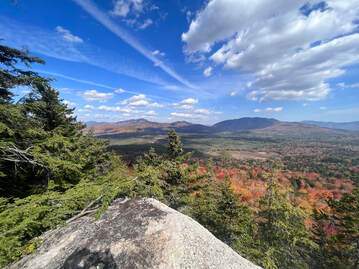 Another from Allen's Ledge looking toward Carrigain. Another from Allen's Ledge looking toward Carrigain. After the peak I started down. With a little gas left in my metaphorical tank, I decided to take the diversion out to Allen's Ledge. Here, again, I could look over the Oliverian Brook valley. These ledges were off the main trail. There was no one else around. I spent about 40 minutes admiring the silence and the colorful display. It was easy to imagine being up there in other seasons. Probably winter, in particular, would be delightful on the ledges here. Maybe I will go see it then. The change of seasons that we witness in this way--just by looking out our windows every month or week of the year--can reflect our own personal seasons. Spring and fall have their easy, spectacular demonstrations of life and death. However, we also live through the pulsating heat and drought of summer. We survive the freezing cold of our winters. It is important to understand that there is beauty in times of desperate survival as well. Otherwise we will not get through the journey as well, will we? 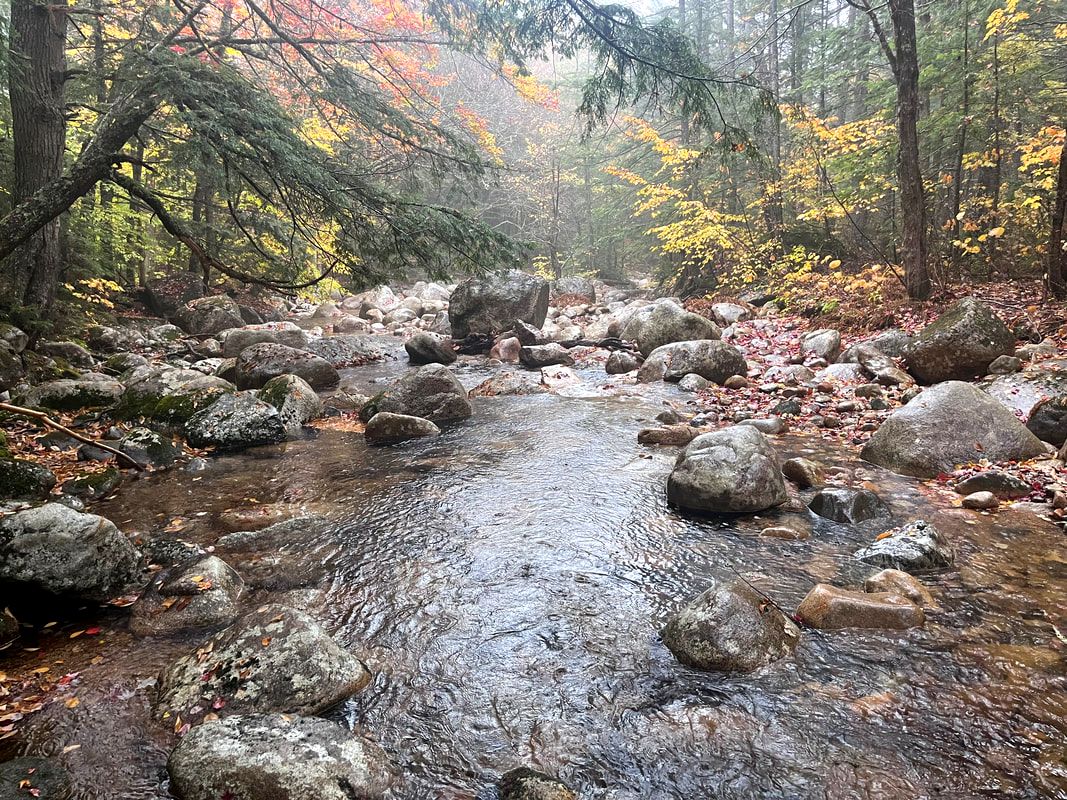 Oliverian Brook the next day.  More rain on the Oliverian Brook Trail. More rain on the Oliverian Brook Trail. The next day--after a climb of Mount Israel that will be the subject of another post--I hiked along the Oliverian Brook. I was curious what the space between the mountains looked like from below the ledges. While I was there, the ferocious rain stripped many of the trees clean. The leaves gathered in muddy puddles along the trail, becoming soil in real time. Peak foliage is over for another year, but this new landscape had its own beauty to observe. I sat under the roots of an old tree along the brook and watched the current, the rain, and this year's bright color turn to the browns and grays that the snow will later outline like a Palmer painting. The cycle of life continues. Creation never ceases. We are blessed to participate and witness. And one final video. This one is not about peak color--quite the opposite--but I did do a longer video about Hedgehog... 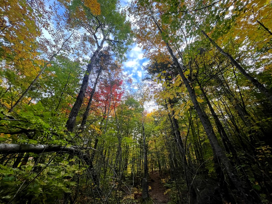 The Cross Rivendell Trail and the trees... Hiked On October 4, 2022 (via Cross Rivendell Trail) It is the first hike of October and the foliage situation is improving. Right now--at least on Mount Cube--it is all about orange and yellow with a few touches of red. When it isn't raining, the temperature is just about perfect. I am going to have to switch out from my summer pack to my regular pack this week. The number of layers I use in a day out is increasing. There is a gentle smell in the air of wetness and rot. It is a beautiful time for a sabbath walk. Also, there are fewer people out on the trails. Vacation is over and the peak season of outdoor activity is behind us now. In fact, it turns out that if you hike this mountain early in the morning on a Tuesday in October, you can have the place to yourself. I have never been so alone on a mountain. There were no cars at the trailhead. I saw nobody at the intersections with other trails. That was fine by me.  I took a break to check out these ferns. the picture doesn't do them justice.  Still, it felt a bit strange. When I hike by myself I am rarely alone. There are people around even if I don't see them or talk to them. On the days with rain and fog at the top--most recently Katahdin and Black (Benton)--there are still some hardy types. On Black it was just a couple people. On Katahdin there were plenty. I chose the mountain and the day with isolation in mind. In fact, I considered the Webster-Jackson loop--which would have been populated even on a weekday--and rejected the idea. Cube guaranteed silent-time with nature. I just didn't realize how much silent-time... For people who hike a great deal, seeking isolation is frequently part (or all) of the goal. It isn't all fun outings. We want to be anonymous for our own reasons. The trauma of the plague, at least, has given many folks the drive to get away. Each individual, though, has a motivation unique to them. They can be dark reasons or not, but they are still present in our hearts somewhere, possibly not yet fully realized. The mountains don't care who you are, after all. They can be good spots to work things out. There is positive power in sitting with only the vastness for company. Many times, no one will even bother you. I seem to be drawn to isolation myself, lately. There are times in one's life when a person wants to change things even if they are pretty social during everyday life. During this sabbatical season the fall in the air has prompted a desire to fade from view a bit. Anonymity is appealing. When someone is unknown, they can change how they dress, look, and act if that is what is desired. Time away helps with that. Time in a relatively undisturbed ecosystem--which is constantly emerging and reinventing itself--helps, too. For a moment we can slip into creation's rhythms and see ourselves as non-static beings. We are able to escape Society's wish to cast us permanently in our current outward role. In the wild we do not have to play the part of good or bad, strong or weak, foolish or wise that has been our assignment through the passing of years. We are observed, judged, and graded in life. These pressures strive to mold us. Sometimes they do so in inauthentic ways. Many of the people I meet out in the forest are seeking out the liminal space in offers. On the trail we are reminded that all is in flux; that there is death, life, and possibility in every new step. We do not have to be who we have become. We do not need to carry those burdens. That said, I didn't meet any of those adventurous changing people on Mount Cube. I was that alone.  Part of the view from South Peak. That is Smarts Mountain to the left.  I am remembering to make a photographic record of my lack of beard. I am remembering to make a photographic record of my lack of beard. Now practically speaking, on this particular walk, there were disadvantages to this isolation. First, I hadn't counted on being so tired at the beginning. My knees remembered the Katahdin hike differently from how my mind remembered it. It wasn't all about the beauty of the day or the companionship of the AT hikers. It was mostly pain, apparently. This creakiness came in part from having so few distractions. It takes a while to ease out of drive-mode into walk-mode. I could have used a person or two to facilitate the transition. Also, it isn't always great to be alone with your thoughts. One can have trouble settling down and putting aside whatever negative emotions have built up just from being alive and around people. The advantages, though, outweighed the burdens. The day was postcard-worthy. There was a mild breeze by mountain standards and the views were back. I encountered a couple view points on the way up; places where the rock ledges had overwhelmed any attempt the trees made to expand there. Then--as often happens--there was a scramble over exposed rock to the first of two peaks. The Cube's south peak is on the 52 With-A-View list. A wide valley can be seen with Smarts Mountain--only 4 miles away--dominating the landscape. The site of at least two plane crashes, it, too is on my list. 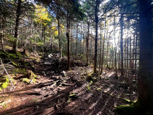 This is the least room-like spot on the ridge between peaks. This is the least room-like spot on the ridge between peaks. After spending some time there I progressed along a few hundred yards of the AT, which passed just below the peak, itself. This led to a side trail that brought me, eventually, to the north peak. The course here was relatively flat and narrow. The trees pressed close in in a way that made this part of the journey feel like exploring a room or a hallway. I don't know how else to describe the phenomenon. It happens occasionally close to the top of a mountain or along a ridge where the contours of the terrain and the tight network of plants break the wind. In those places it feels like all you would need is a roof to live there forever. The north peak had its own views. Moosilauke, Black (Benton), and Blueberry mountain were easy to identify. The first was noticeable for its size and the others for their ledges. Again, a valley stretched out between them and me. In this case the trees had given it an orange tint that was mesmerizing. I sat at the viewpoint for a while and then started back. 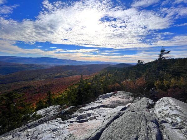 Last glimpses of sunrise on North Peak right where I lost the trail. Last glimpses of sunrise on North Peak right where I lost the trail. One of the problems with hiking alone is that there is only one brain to rely on when you get turned around. For this reason I took a bearing from the trailhead to make sure I could stumble down to the logging road where I left my car if need be. In this case it was more about retracing my steps along broad ledges that resist signs of foot traffic. Eventually I made back to the entrance of the tight corridor of trees and returned to South Peak. There I sat for a while. If you read my Watatic post you know I am trying to do more of that. My companion in this instance was a smallish tree situated near the same sort of 19th and early 20th century graffiti that graces many popular mountains in Massachusetts; old names of visitors carved deeply into ledge rock. At this point it was easy to remember that aloneness is not the same as loneliness, that we aren't really alone anyway, and that our thoughts--or non-thoughts--can be good companions. 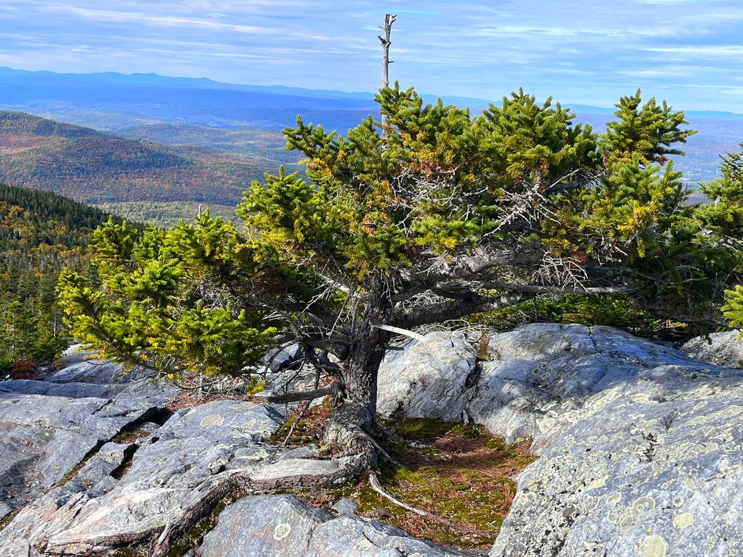 My tree friend on South Peak on the way back. I pointed my feet toward the car. Trails always look a little different heading in the other direction. I noticed small paths to secret campsites along with some glimpses through the trees that I had previously missed. The challenge of the end of the hike is that--in the returning--all the pressures of life return as well. It starts with figuring out a route home and then cascades from there. Mindfulness can keep these worries at bay for a while, but not forever. About a fifth of a mile from the trailhead I encountered two women heading up. I said hello and kept on moving. It was like a shift change. It was their turn to have Mount Cube to themselves. 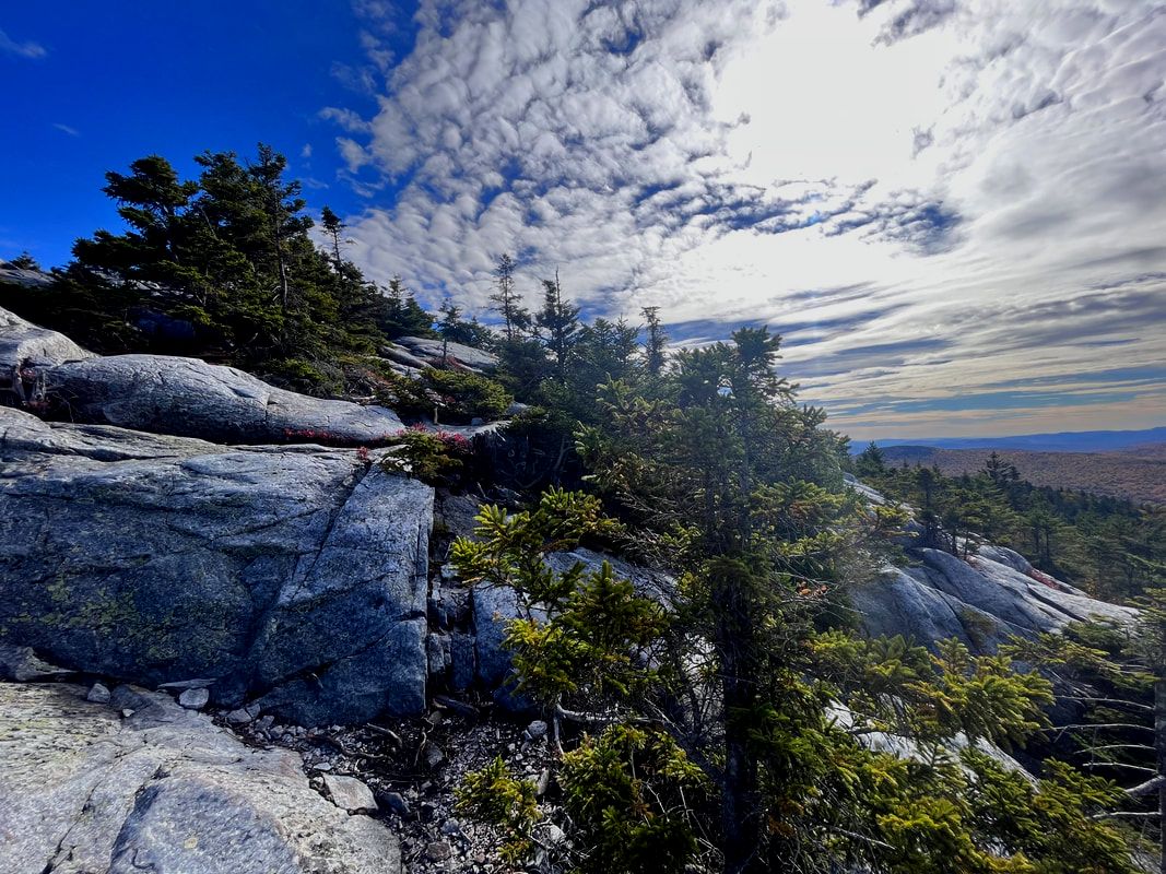 Just below South Peak either when saying hello or goodbye.  The view from a ledge. The clouds were with me almost the whole morning. However, it didn't really detract much from the experience.  Everything was wet. Everything was wet. HIKED ON; September 21, 2022 Anyone who has ever made their hobby or passion into a job will know that it changes the relationship. I first did this with preaching. I have always been a performer. When I was in high school I was a theater kid. Somewhere in the back of my mind has always been the thought that I was most myself holding forth on stage and at the lunch table back in my senior and junior years. Now I am a pastor and there are lots of different parts of that job that have nothing to do with performance. Still, when I am in the pulpit I am happy. It is where I should be. However, this type of performance is a job now. I have to take all kinds of things into account when preparing my worship services. I think about the people I see in church every week. How are they doing? What are they thinking about? I think about the seasons of the town and of the church. Are the kids in school? Is there a holiday or liturgical element I need to think about like water gathering, baptism, or communion? Now it is sabbatical and I find that I am being rather businesslike in my approach to hiking as well. What is my schedule of mountains? What does each require? How is my body feeling, not for this one hike but for the next and the next? What do I hope to get out if it? Gone for now are the days of spontaneously hitting the trail, understanding that I can take all the time in the world until I do it again. This temporary change in relationship isn't bad...but it is different.  One of my phone camera experiments. One of my phone camera experiments. This was something of a pragmatic hike. I chose "Black of Benton" for a number of reasons. Partly it was because it is beyond the area I plan on exploring closely in October. The geographical diversity seemed desirable for right now. Partly it was because I wanted a moderate hike. I haven't climbed anything other than a flight of stairs since Mount Washington and need to stay in shape for larger hikes coming up. I also must make sure I don't injure myself. Black Mountain--a 52WAV mountain--fits the bill with an out-and-back trail of just under four miles and an elevation gain of just over 1,600 feet. I can be challenged and still recover in time for the next one. Finally, there is an apple picking place just a few miles away. Not all outdoor time needs to be strenuous! My plan was to get a good workout with a full day pack, catch some views, and eat some apples without straining or pulling anything that would inhibit the next battery of hikes.  The trees are still green for the most part. The mountain was mostly evergreen anyway. However the bushes were exploding with different colors. The trees are still green for the most part. The mountain was mostly evergreen anyway. However the bushes were exploding with different colors. Another result of the temporary relationship change is that each hike feels a little bit like an appointment and obligation. There are days--I assume we have all had them--that contain an abundance of entropy. This was one of those days. Careening out of the parsonage at 5am I managed to lock myself out. Later, with that sorted, my car let me know that I was losing tire pressure. When I was figuring out what to do about that, I discovered that one of my water bottles had leaked all over my bag, my dry layers, and the maps and guidebooks I brought in the car with me. Somehow, though, I managed to hit the trailhead at 8:30, only an hour after my target time. I am not sure I would have persevered to that point if I didn't feel some responsibility. Apparently I have a schedule to keep. This "hiking like its work" element had invaded my psyche. I have to admit that on this day in Benton I started way too fast. Maybe some of the stress of the morning influenced my mood. In any case it took me a while to figure out the office mentality I had brought to the trail. I specifically chose this mountain because it would be challenging but not exhausting. Yet there I was 30 minutes in...trucking right along and wearing myself out. A socked-in scenic overlook--the views never really materialized--helped to slow me down. I waited for a minute to see if the clouds would blow away and then I turned around to see the remarkable stand of trees I was about to walk through. In the pause I was able to refocus. 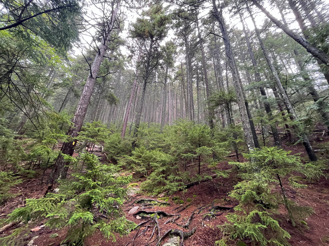 This stand of forest lasted for about a mile. You can see the trail in the foreground heading off to the left. 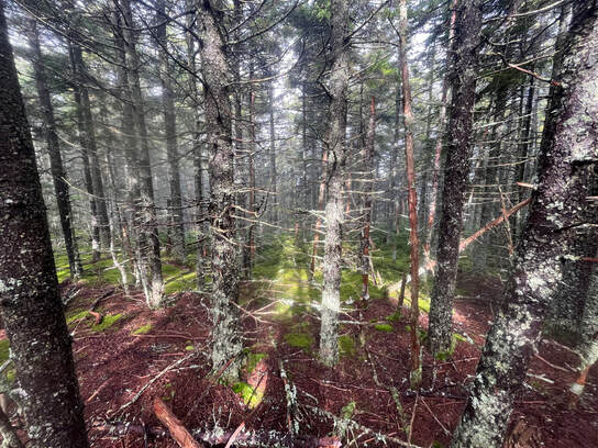 More of those trees! This time closer to the peak. More of those trees! This time closer to the peak. If you are a mountain, you get to be called "Black" for one of two reasons. Either somebody with that surname lived on or near you for a while in the 18th or 19th century, or the trees that grow upon you are among the many varieties of dark-shaded conifers that grace our landscape. This Black Mountain--like most--falls into the latter category. Black mountain is full of tall old trees that from afar give it a gloomy appearance. On a rainy day in September, though, to be in among those dark trees is downright mystical. This slowed me down. How could I be missing the scene around me? Still, there was that feeling of work. The hike was still partly a task. I told people I was going to climb a bunch of mountains, after all. One thing that I do in overly-businesslike situations is to actually add a fun and perhaps frivolous task that I can rationalize into being part of the project at hand. Enter photography. I had always wanted to do more with pictures. I was also a photographer in high school. I dressed all in black and did extensive studies of local gravestones. In my senior year I could be found either in the darkroom or near the stage. Just like hiking regularly, taking pictures slipped onto the back burner with the rise of work and children. To slow myself down on Black mountain I decided to try to figure out what capabilities my cellphone camera has. I always meant to, but there was the perpetual issue of something else going on. 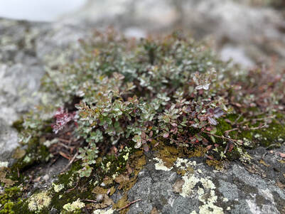 To take a good picture--or even a "just okay" picture--one needs to slow down and observe the context. This is what I did. The 19th century nature writer John Burroughs tells us that "There is nothing in which people differ more than in their powers of observation. Some are only half alive to what is going on around them. Others, again, are keenly alive; their intelligence, their powers of recognition, are in full force in eye and ear at all times."* Observation is one of the key steps to creation and creativity. That can be a sermon or a story we are making. It can be a picture, or a sabbath walk, or any number of other creations. Burroughs--writing in a shack in the middle of his vineyard--made a practice of observation. We should too. Sometimes I need to trick myself into thinking it is part of work...albeit a happy part. Maybe we all need to find ways to think of it as part of our being. 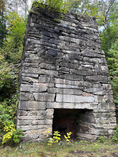 In the end I had a great time noticing the striations on the rocks and the emerging fall colors. At the top of the mountain I set a timer for 40 minutes to sit and experience the space I was in. After about 20 minutes a very chatty woman and her dog came up off the trail. We sat their talking and--unsuccessfully--waiting for the clouds to part for about 40 minutes. Then we hiked down. I left my new friend to go check out the old lime kilns at the foot of the mountain. Limestone is relatively rare in New Hampshire but this operation was quite large. They would heat the stone in these massive structures and the resulting lime would be used in agriculture and construction. The kilns were built in 1838 and 1842, operated for 50 years, and then were restored as a WPA project. I would have stayed longer there if it weren't for the presence of friendly-but-barely-controlled dog. It was full-fantasy mode. After a few more pictures I went back to the car and life...or whatever. I did go apple-picking. That, however is a different post... 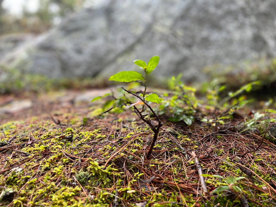 ...and this little guy. * Burroughs may be worth checking out. This quote is from his essay "The Art of Seeing Things"
Dear Folks, I am in the process of catching people up with some early hikes and other encounters with nature that I thought people might find interesting as part of a "How It Began" (HIB) series. Mostly this will describe specific hikes and perhaps some lessons learned along the way...if there are any. They are meant to be short and, perhaps helpful in some way to other hikers or fellow-travelers. I will post the dates of when I hiked a specific mountain since the ones in this series are NOT posted at or near the date I actually hiked them. To add further confusion, I am not doing them in order! Here is a post about a winter hike. We did so many and have posted so few... 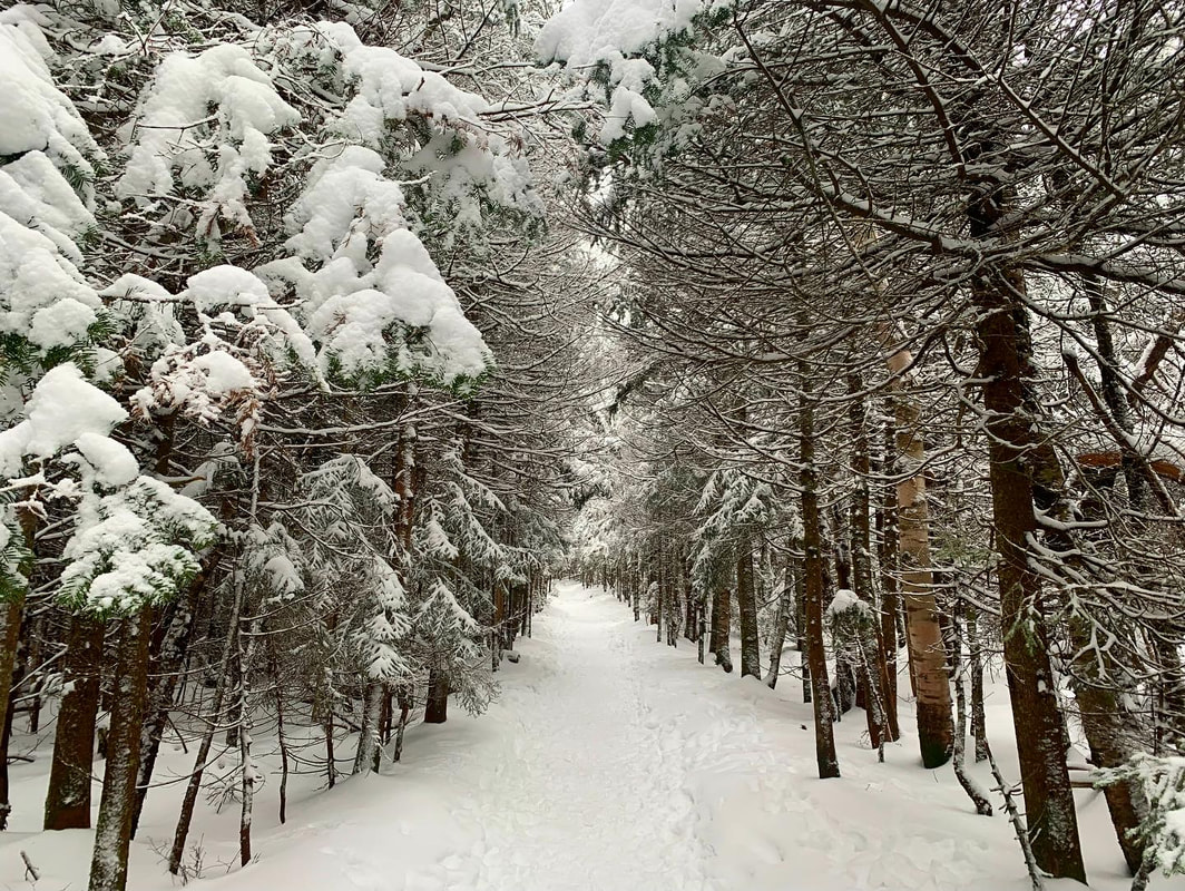 The Approach to Willard.  Today is the second day of my sabbatical and I am getting restless. Yesterday was all indoor work to prepare for various events to come. I arranged hiking companions and started on a schedule. Today it is raining off and on and I wish I was somewhere other than my living room. Oh well...I do have a pile of used books for the sabbatical and I can start breaking in to them. To keep the content flowing I have a couple of relatively easy hikes that we did in the winter. Winter hiking is its own thing, with special equipment and special rules to follow. It is not like downhill skiing. Winter climbing requires a trudge uphill, after all--causing wide fluctuations in body temperature if one is not careful--and there isn't a lodge nearby most of the time. Some people--including my wife Allison--claim it is easier to hike in the winter. The dips between roots and rocks are often filled in and there is the ease of butt-sliding down the larger peaks. I am not sure that matters in the total summation, though. The packs are heavier. We are heavier. Also, with the cold and ice we have a whole new way to mess ourselves up. Still, the views are something else. There is a whole winter-wonderland vibe that is different on the trail. Also, the trails are quieter. Many hikers hunker down for the winter. Others ski or sled. There are still people on the weekend but--as always--if you get out on the trail early or during the week, you can have plenty of space. Anyway, the two hikes. They are relatively close to each other and both sport some of the best views-for-effort in New Hampshire. In the regular hiking season there are generally thought of as the easiest of the 52 With-A-View list. Whether you will find them easy is subjective, obviously, so be advised! 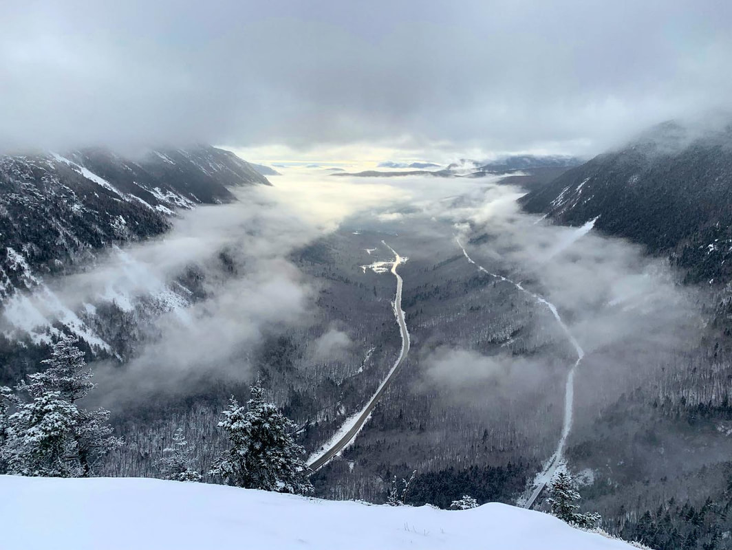 The view of Crawford Notch from Willard as the clouds finally clear. 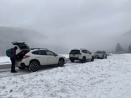 It was not a very hospitable day It was not a very hospitable day Mount Willard: Hiked on December 30, 2021 After our first hike up North Kinsman--which was less than ideal--we decided to get some more winter experience on smaller mountains. Willard shares a trailhead with Mount Avalon, one of my favorite mountains. We had hiked that after a long day of peak bagging in the fall. We knew that whatever Willard had to offer would be equally stunning...and include snow. It was misting a bit ("spitting" is the term I grew up with) and we moved on up with some trepidation concerning the weather. That said, the fog hanging over the snow was pretty special. The trail was mostly straight. It just went up, and then up more steeply. However, true to the conventional wisdom, it wasn't so bad! The snow had indeed rounded out many of the edges. We shed layers as our bodies warmed up and then added them back on for breaks. Layering is a key element of the whole winter hiking experience. We need to pay even more attention to our bodies with this new weather development. Snacking is pretty key as well. It is a good idea to eat something (a protein bar or a handful of GORP) right before starting. It will give your body something to do at the beginning and the energy is helpful as well. I also found myself sucking on hard candies most of the time. That may have been for morale reasons. After a while we hit the top and the clouds began to part. The only others up there that day were fellow peak-baggers testing out their Christmas gifts. In the clear winter air we were treated to highly technical conversations about hats, gloves, backpacks, and snowshoes. No doubt they were treated to ours. We actually packed snowshoes for this trip but did not put them on. That said, we wore micro spikes the whole way. For some other hikes snowshoes were essential. We want them when the trail isn't quite as broken out or if the wind has caused drifts. However, the spikes were always on otherwise. They are essential kit. Don't do serious winter hiking without them in your pack or on your feet. One great feature of this climb was that the clouds had begun to part and the sun warmed the top. It was rather relaxing to plop down on the snow in our winter gear and take a break to soak in the view. Finally, though, we turned to head down. Honestly with was a lovely half-day hike for us, which helped me, at least, feel like winter hiking was something I would be able to do. The trail is 3.2 miles round trip with only 900 feet of elevation gain. The reward is a fantastic look straight down Crawford Notch.  Pemigewasset View of Franconia Notch  The trail up Pemigewassett The trail up Pemigewassett Mount Pemigewasset Hiked on January 8, 2022 This was very similar to the hike of Willard in most respects. The view in this case was of Franconia Notch. The folks at the peak were more 52 WAV peak baggers and the whole vibe was very relaxed. It was a touch longer (3.8 miles) and quite a bit steeper (1,250 feet of elevation gain). Also, it was a cold, clear day which brought with it different challenges but, of course, a view untroubled by clouds. This hike was not without its challenges. The steepness got to us and our post-holiday bodies so we needed to stop a couple times to catch our breath. Some of our water froze as well and we needed to re-pack a bit. The trail was icy in places which gave our micro spikes a work out on the way up and the way back. I do not love winter gear...but it is necessary. There was one incident that reminded me of the importance of layering and of modifying your layers. The temptation is just to keep on hauling but, really, that can be a bad idea. On our way down we passed numerous groups heading up. Like I said, it is considered an easy mountain and--unlike our Willard walk--it was a beautiful day. It was also a big vacation time in the Whites and a number of people who probably had spent part of the week skiing decided to take a hike, instead. Most of them were fine. However, there were a number of groups with children who were way too bundled up. Steam was rising from the open spaces in their heavy jackets and they were screaming bloody murder trying to tear them off while their adults were forcing all that gear back on. A few adults were in the same situation as the kids. They all looked like old fashioned cars with burst radiators still trying to move forward. It is important not to be afraid of removing layers as well as adding them. We all know from sitting in our driveways during the pandemic that if you are staying still outside, the goal is to be as warm as you can be. However, with something a physically trying as climbing a mountain, it is more important to maintain a safe and comfortable average temperature. This requires using that big pack to take off and don clothing throughout the day. It is annoying and slows you down, but it is really for the best. I always start a little cold, knowing that I will warm right up when I move. Al always puts on a warm (but packable and lightweight) jacket for the first ten minutes then stops to take it off. Either way we are often bundled at the top where the wind chill requires it and we always wear hats and wool socks...and carry spares. Anyway, the drama of the descent aside, this was another fantastic hike that is probably doable for a lot of people who want to try winter hiking. I would suggest starting with Willard or Watatic as a shakedown. Then Pemigewassett and bigger peaks await. Actually we finished early enough from our Pemigewassett hike that we did another and explored Flume Gorge... 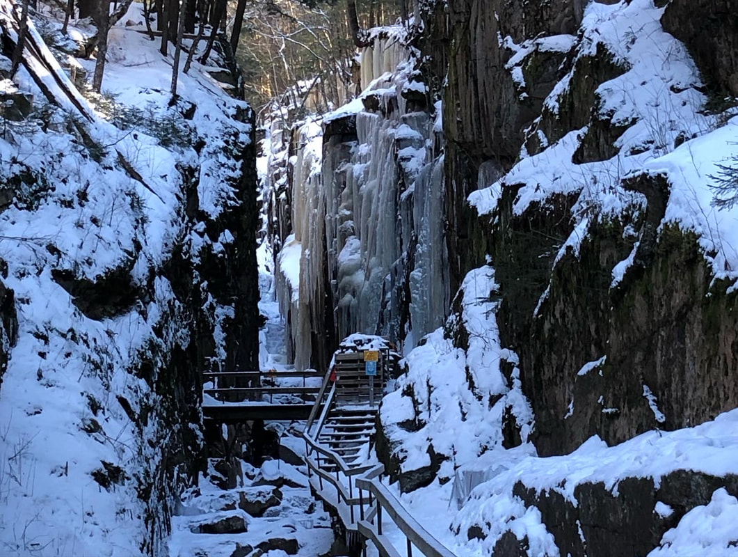 Flume Gorge, which is in the "Bonus Hikes" post.  We weren't entirely without views. This was what greeted us from Bunnell Ridge early in the day. 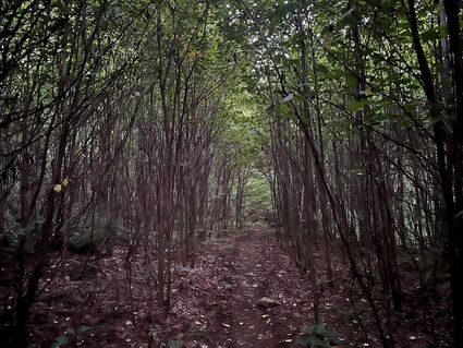 The flat part of the beginning right around 6am. The flat part of the beginning right around 6am. HIKED ON: September 4, 2022 Not every hike goes exactly as planned. However, sometimes all your planning means you hike the hike anyway. The Mount Cabot loop is just outside of Berlin, NH and required an overnight stay. While Cabot, itself, is one of the shorter of New Hampshire's 4,000 footers (4,160 ft) the prominence--or the amount if climbing you have to do--is substantial. Also, I wanted to hike to the Horn, a slightly shorter peak that resides on the 52 With-A-View list. I will write up a post at some point about the two lists I am hiking. Until then, you can find which mountain is on which list in the "Categories" section on this weblog. I will also post link to to more information at the bottom. What is worth knowing for this hike is that in order to take in both Cabot and the Horn, we needed to form a loop, crossing one more peak--the Bulge--in the process. Normally the best view--not surprisingly considering the list it is on--is the Horn. This trip, however, epic views were hard to come by. Anyway, we woke up at 5 and drove about 30 minutes to the parking lot. Our starting time was a little before 6am. The "Cabot Loop" starts on Bunnell Notch Trail, hits Kilkenny Ridge trail, and then heads down on Unknown Pond Trail for a total of about 11.5 miles. It is not a technically difficult but...it is long and there is climbing involved so we felt like an early start was in order so that potentially, at least, we could drive home when we were done. What we couldn't count on was the weather, of course. The peaks during this hike were socked in with fog. The whole day was humid and hot. Still, we were there as we planned...so we did it anyway. 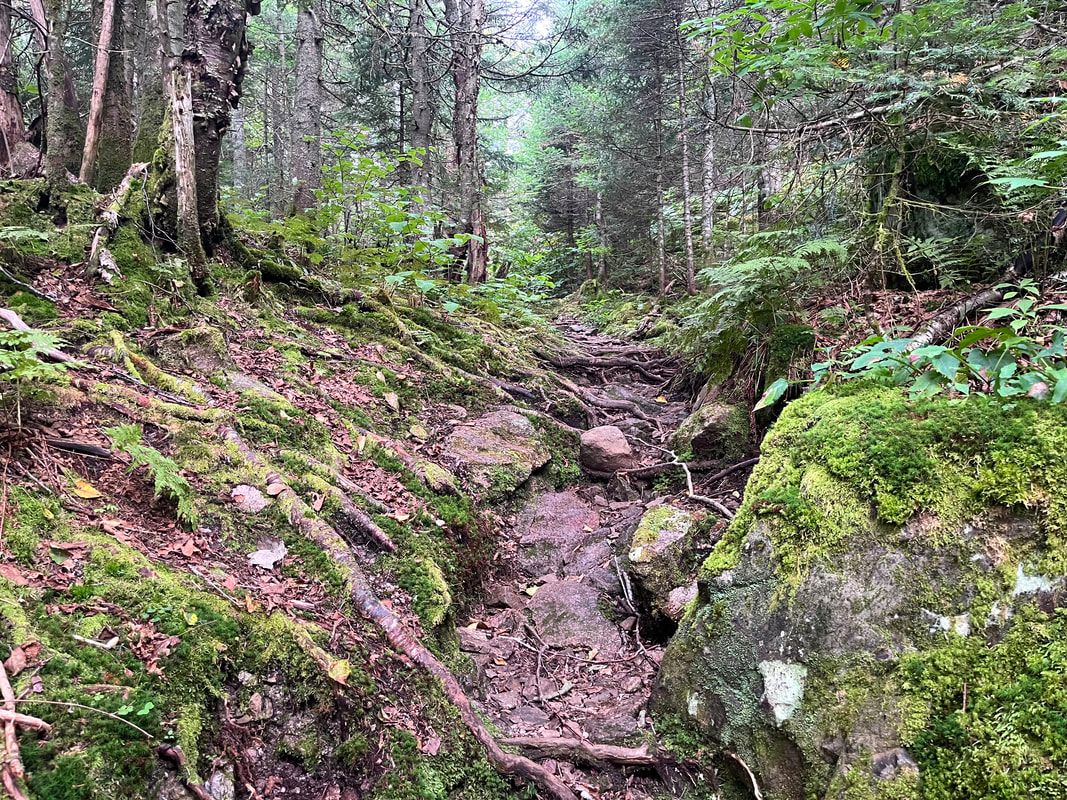 A typical piece of trail on the way up Cabot. Both the way up and the way down had an abundance of those head-sized boulders that can trip you up. 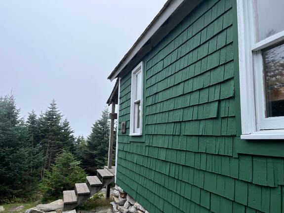 The hut and the non-view beyond. The hut and the non-view beyond. The loop was pretty straightforward, actually. The first mile (as often happens) was flat and then we climbed. This trail did not have much in the way of rocky parts. It was just a case of putting one foot in front of the other and avoiding the random trail hazards; small boulders, roots, and mud. The loop is not maintained at the same level as some but that was a plus after hiking the groomed trails and back roads of Scotland on the Great Glen Way. The soft earth was more hospitable by far! Our experience on the Way certainly helped with this one. Partly that was because of the differences. It was so very nice to be climbing! We could feel certain muscle groups that were underutilized as of late. The relative ease of the footing will help to get us back in practice for whatever we climb next.  Near the top of Cabot, there is a hut and--the best of all blessings--an outhouse. We hung out there for a while and chose to continue even though the views were non-existent. Here our time in Scotland was useful. During that hike (you can check out the posts under "Great Glen Way" for more info) we had to focus much of the time on small things. In this case it had nothing to do with the elevation, just fog. In theory we should have seen something. Still, as we went along we noticed the diversity in the trees, the moss, and the prolific undergrowth. Mushrooms of various kinds were also in abundance. At one point I think we could smell them. 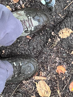 Also, there was mud. I haven't seen mud in months. Normally I am annoyed by how it sucks my boots in and forces me to alter my pace by jumping from dryish spot to dryings spot. This, though, was spectacular. The dryness has bothered everyone. It was great to see it again. This summer it has felt like mud is endangered too. There is power in the details sometimes. This walk forced us to connect to the moment we were actually in. There was no spectacular aesthetic payoff at the end to work toward and then savor on the way back. The challenge on a day like this is to find joy in spite of the weather, the strain, and the discomfort. I think we did a pretty good job.  Another non-view Another non-view Once we got to The Horn we didn't even bother to take a picture of yet another bank of clouds. Instead we settled in to eat our snacks (GORP and power bars). We also passed the time with the others on the top. There was a family with young kids who camped at Unknown Pond the night before. They were fun. We talked to the parents as the kids scrambled around on the bald rock that marks the peak. We had a lot of the same interests. It was good to pass the time with people who were also enjoying themselves. Then we chatted with a woman who was waiting for her family to come back from Cabot. They were all doing a an out-and-back. However, she didn't feel the need to bag the 4,000 footer as she had been there before. Besides, it was totally worthwhile to sit on The Horn and soak in the atmosphere. Everybody we met--and everyone I just mentioned was pretty much everybody, a rarity on Labor Day weekend--was in the mood for a walk in the fog. Everybody also found a way to experience and value the sounds, smells, and beauty of this off-weather day. Will I hike Cabot again? I don't know. I may hit The Horn on a clear day when I go up Roger's Ledges nearby. Honestly though. It was a good day, sufficient in itself. 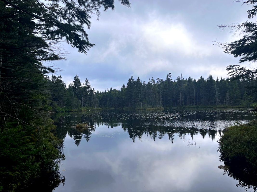 OK, Unknown Pond was darned pretty on our way out. Like I said earlier, I do plan--there is that word again--to write something up about the two lists I am doing in NH. Most of the hikers I know are picking away at both but show a preference for one or the other. We are a divided family on that point. Al likes the 48 4,000 Footer list more. I lean toward the 52 With a View list because I like a view. Usually when I can hike with my wife we do the 48 list. This was fun because we knocked off one of each! Cabot was 26/48 for me. The Horn was 13/52.
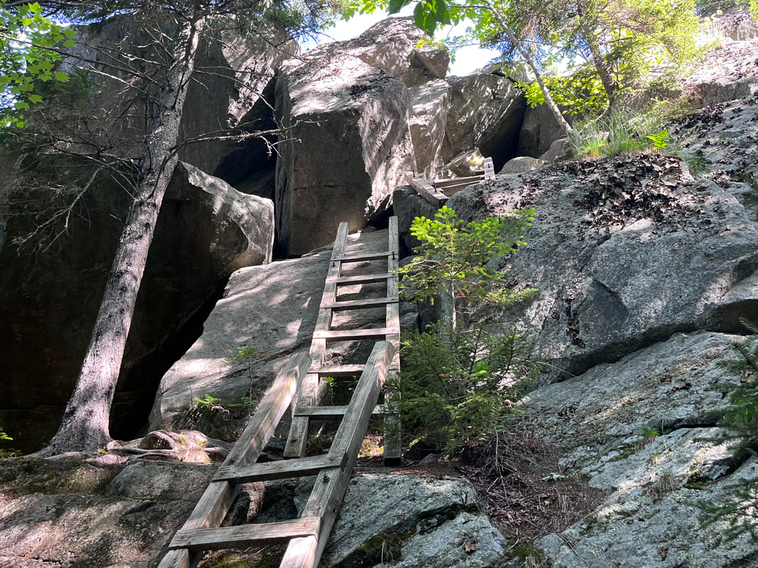 The crazy ladders to the tiny cave up Mount Morgan. It has been a crazy time here at the parsonage. The kids--some in their early 20's and one in his late teens--all have chaotic summer plans. Al and I have chaotic plans as well. The world seems to be on fire, too, adding to the general stress. Also the church--which needs to be essentially shut down for summer and reopened after Labor Day--has many complicated demands this time of year that are different from the ones at any other time. The last month has been a whirlwind and--I suspect--it will continue to be for the foreseeable future. It has put me behind on most things but...what can you do, right? We just plug away hoping to keep it all together. So let me tell you about a day of hiking that I took a while ago on June 15. Things had already gotten crazy. I had missed my usual weekend hike because I was officiating a burial service. Allison went without me up to Mount Carrigain. By Wednesday (the aforementioned 15th) I was toast. So when I couldn't sleep, I got up and drove to New Hampshire to get an early start on Mount Morgan and Mount Percival in New Hampshire. These are the two shortest peaks on the "52 With a View" list. In fact, before these the list had a height range of 2,500 to 3,999 feet. However, a recent exception was made when some other mountains lost their views. I should say, though, that this hike--they are usually done together--is not the shortest hike on the list. Nor is it the easiest hike. In fact, going up and down you even have options to make it even harder on yourself. As I chose to go up Morgan and down Percival, I opted for the scary ladder option on Morgan. I like my challenging parts when I am fighting gravity. In the end, it made for an interesting set of problems, including one very tight squeeze. Up until that point, this had been a total rage-hike. I had so much stress built up from long days and many, many meetings that I basically marched the first few miles, muttering to myself. The pause to figure out how not to tumble down a cliff helped to center me and once I came out on to the peak, I was ready for the spectacular view. 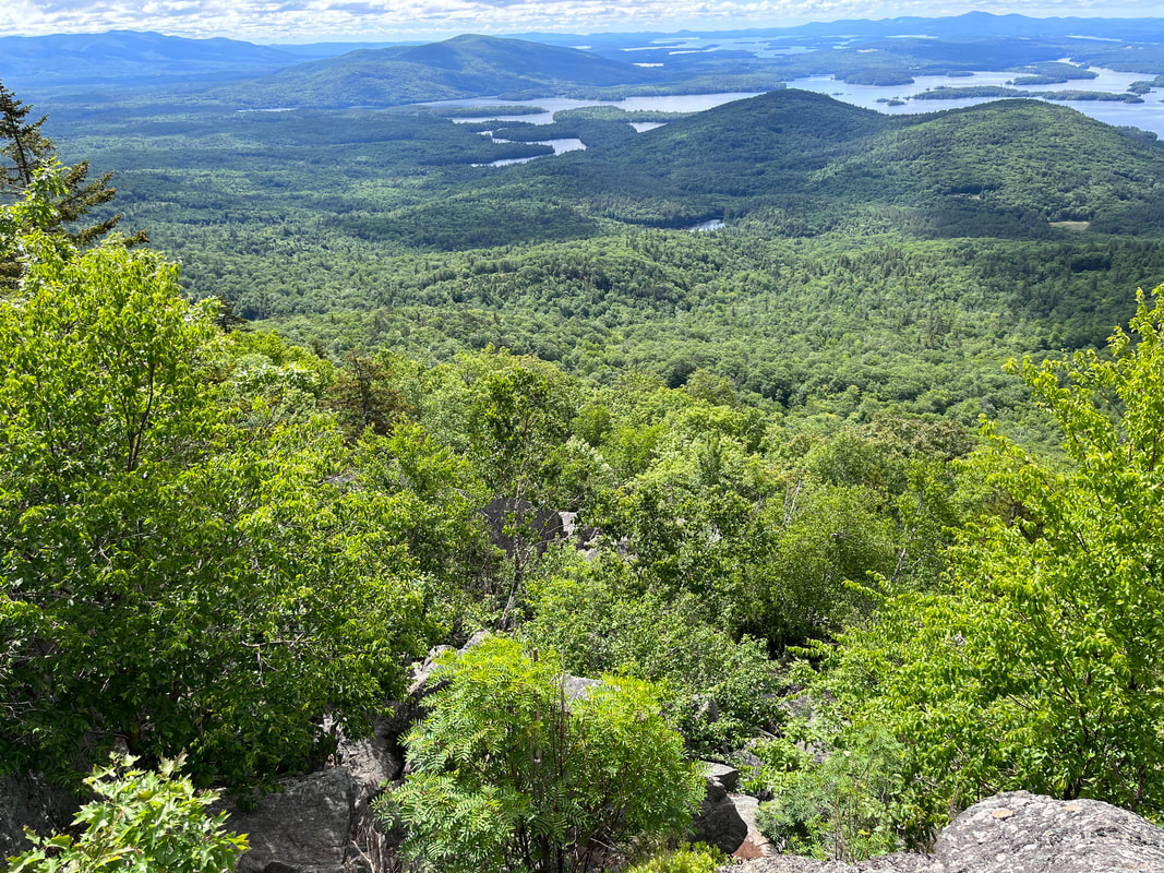 The view from Morgan
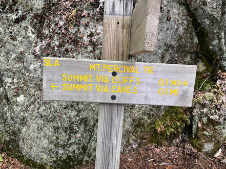 After the peak I started down again, careful to avoid the "caves" for the somewhat easier "cliffs." The cliffs were hard enough for me. Once that was over I began rage-hiking again. I knew my trip was over and I was headed back, ultimately to the cacophony of words. There were the spoken ones, of course, but emails and podcasts and videos too. At this point in the world there is so much to take us out of ourselves. Sometimes this is good. Justice work can do that. More frequently though, they can be words of futility and despair. Watch out for those! They are designed to run us down and put us out of sorts. They are designed to let "the man" get what "the man" wants; docility. 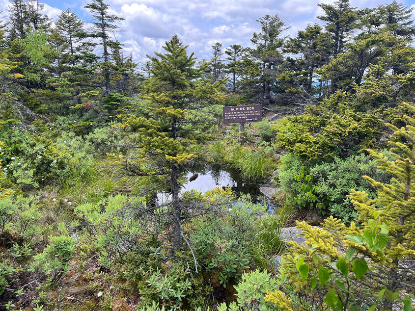 Yet another fragile alpine ecosystem, this one on Kearsarge South Yet another fragile alpine ecosystem, this one on Kearsarge South Right...hiking. I was talking about hiking... Long story short, I took a hard right halfway home. I didn't really mean to but I did. I wanted to get away from the noise just a little longer. This is how I ended up at Mount Kearsarge. Sometimes it is called "Kearsarge South" because there is another one (also on the 52 list) farther up. This mountain has one of the shortest hikes of the list but...it also isn't the easiest. The trail up is basically 1.1 miles up over rocky ground. Feeling a little bad about this unscheduled bonus walk I pounded up the trail. People coming down stopped me to chat--a normal occurrence--but I was determined to get up and down and back on the road. Once I reached the top, though...I relaxed a bit. The wind was back. So was the gentle whisper. The view was epic. I sat there for a short time and then headed down more slowly by another, gentler, route with a number of vistas that revealed themselves along the way and a few alpine bogs that made me stop for a while to take them in. It made me wish I was an ecologist rather than a pastor. Maybe I should have found a place working out in the field cataloging the abundance of life that survives in inhospitable locations. Anyway, that last hike did the trick. Maybe it was exhaustion from so much walking or maybe is was something more inspirational, but by the time I got back to the car I was ready to head home...with the radio off. Update: I feel like this post has more about me rage-hiking than it does about the mountains I climbed. I cannot remedy the entire situation right now, but I recently hiked up Kearsarge once again and made a video... |
Adam Tierney-EliotI am a full-time pastor in a small, progressive church in Massachusetts. This blog is about the non-church things I do to find spiritual sustenance. Archives
March 2024
Categories
All
|
 RSS Feed