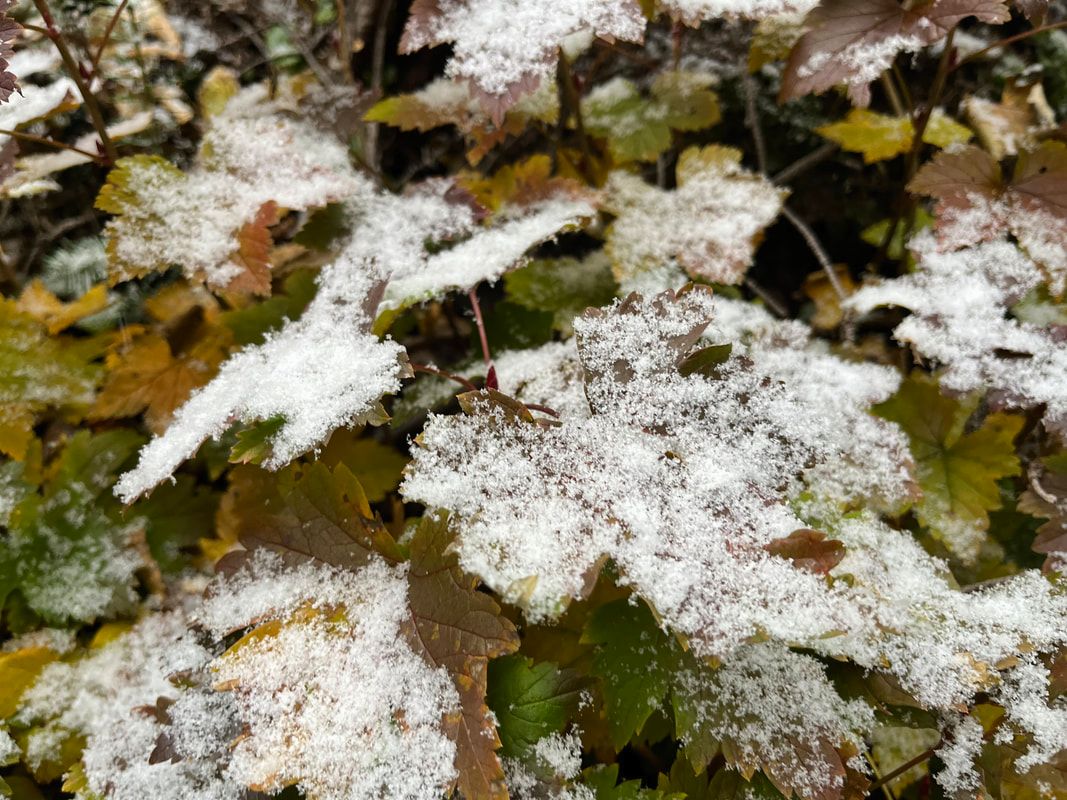
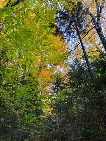
  It was all fall at the beginning. It was all fall at the beginning. Hiked on October 9, 2022 Snow changes everything. Obviously there are actual physical changes. Climbing in the snow--even a little bit--can alter one's approach. The rocks get slippery, for instance. Footing gets weird. If it snows early in the season there can be personal thermostat challenges, with layers going on and off in rapid succession. However, there are also aesthetic and spiritual changes. The white flakes create sharp outlines where previously there were none. The fall of snow, itself, helps us remember previous snows for better or for worse. The sound is altered, too. Even a little snow has the ability to muffle the incidental noises of the forest. Also, many creatures--human and otherwise--become silent, hiding away until the squall passes on. An early October snowfall starting somewhere above 3,000 feet changed this hike across South Carter, Middle Carter, and oft-forgotten Mount Lethe. We had climbed Carter Dome a couple weeks before. Two weeks--and the snow--made all the difference. When we were on the Carter-Moriah Trail (also part of the AT) in September the place was a seething mass of humanity. Thru-hikers were hustling along their way in hopes of making it to Baxter State Park before it closed for the season. Day hikers were everywhere. On the top of Carter Dome--as I mentioned before--a group had decided to have a picnic and blast their tunes for the rest of us to hear. On this trip it was all silence. It is too late for all that rushing about and too cold for picnics. From now until May there is a seriousness to this endeavor that doesn't empty the big mountains of people so much as put more space between them. 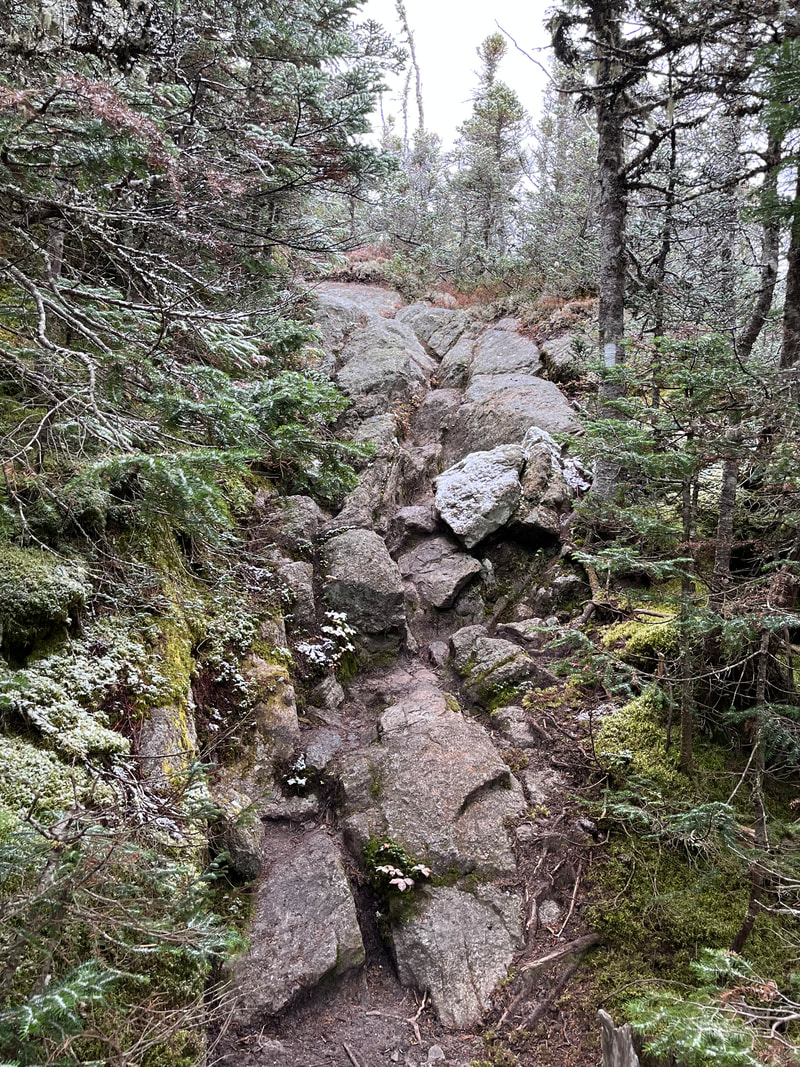 The steepest section of the trail. To get to the Carter-Moriah trail--the one that takes us over the peaks--we opted for a steep climb up 19 Mile Brook Trail. The pitch became steeper as went along. When we approached Carter Dome we were on the other side of the ridge. We stopped at Carter Notch and climbed to the peak from there. In this case--on the "front" side--the trail split, with 19-Mile Brook heading toward the hut. The other path--called the Carter Dome Trail though we departed it before the Dome--veers left and heads up toward South Carter. The plans of the few people we saw seemed to involve the hut. Once we turned we had the trail even more to ourselves. Shortly after this was when the snow started. I am not fond of winter or winter hiking. Snow, however, I like if it is ridiculously early in the season. It reminds me of Thanksgiving and Christmas. Also, it doesn't get deep enough to be a problem--other than the slickness--for our footing. We had the micro spikes in our bag just in case, but we didn't need them. I stayed in a T-shirt for quite a while, waiting for the snow to pick up. I heat up quickly and was mindful of what the drop in temperature could do if I soaked through too many outer layers. It was a strange feeling with the colored leaves still on the trees, but it wasn't an unpleasant one. The wind had died down, which helped a great deal as well. All the weather activity gave us something to think about as we moved higher and higher. In a previous post I made reference to a phenomenon that occurs sometimes on mountain hikes where the trail begins to feel safe and secure, like a comfortable room in a house or a welcoming hallway connecting two points. At least that is how I experience it sometimes. This hike had a great deal of this sort of action, particularly after the climb up. When we emerged onto the relatively broad intersection of our trail with Carter-Moriah, the room effect was very much in force. Again, two weeks earlier this spot would have been insane with hikers. Now Al and I were alone in the quiet with the snow gently settling around us. 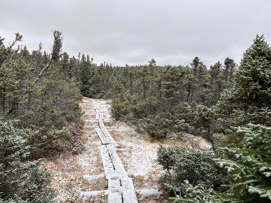 Flat, snowy wetland along the ridge as the snow stopped falling and the temperature dropped. Flat, snowy wetland along the ridge as the snow stopped falling and the temperature dropped. We may not have been in a true winter wonderland, but it was a wonderland nonetheless. That feeling stuck with us for the long walk along the ridge. We had selected this loop to get away from the crowds. Now on the main trail, we did see a few people enjoying the strangeness of the day. That said, the population was very manageable. We weren't sure it would be that way. The weekend of Indigenous People's Day is one of the busiest in the Whites. The foliage is usually full throttle. You cannot find a place to stay. Many of the best-known trails and mountains are packed with muggles looking for a fabulous view. We were under the impression that there wasn't much in the view department on the Carters. This was why we picked it. We wanted to hike. The snow had made the forest even more beautiful so we didn't mind terribly anyway. Funny thing, though. We were wrong about the views. After a long, long, time in the forest the snow started to abate. Through the trees and on various outlooks we were all able to cast our eyes on the fall landscape from our wintry perches. The juxtaposition of our landscape with the one far below was the sort of thing we hope for after putting in so much effort. It felt like a gift. 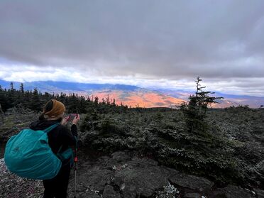 A fabulous early view once we got settled on the ridge. A fabulous early view once we got settled on the ridge. At this point the temperatures had dropped substantially. Bundled up in our winter jackets we took a moment for snacks and water before heading just below the peak of Mount Lethe. Then we turned on the North Carter Trail toward the Imp Trail for our descent. The rest of the hike was less interesting. We had a few more brilliant views before dropping under the canopy of trees. We had been talking about heading over the Imp Face--one of the 52 WAV mountains--but we were really done. I was especially finished. I had decided to wear my "backup" hiking boots that I used on the Great Glen Way. This was a mistake. I was trying to save money by nursing along my favorite pair, saving them for other hikes. I paid for my cheapness with pain. I don't think I can do that much longer. It is worth it to use the right gear for the right job. The best boots one can get are the best boots to have, it turns out. Limping down to the bottom of the North Carter/Imp trails I welcomed the short road walk back to our car to complete the loop. 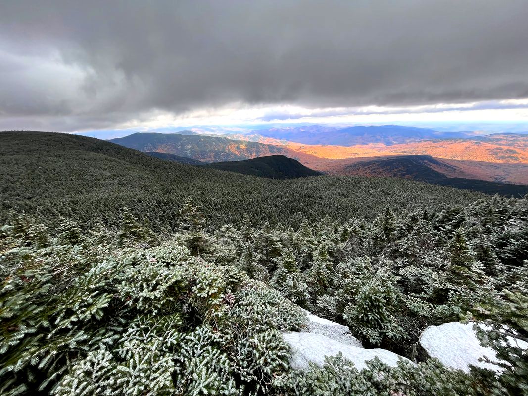 Winter stretched out to meet fall before we began our descent. Sometimes there is no great theme to a walk. On days like this it is best not to look too hard for meaning. Instead we favor the day we have been given with our attention. The snow, the pretty trail, the surprise views, and even the sore feet contributed to the experience. We were open to the wonder and were rewarded for it.
0 Comments
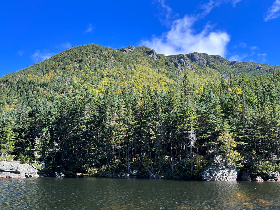 The massive bulk of Carter Dome from the notch about halfway up. 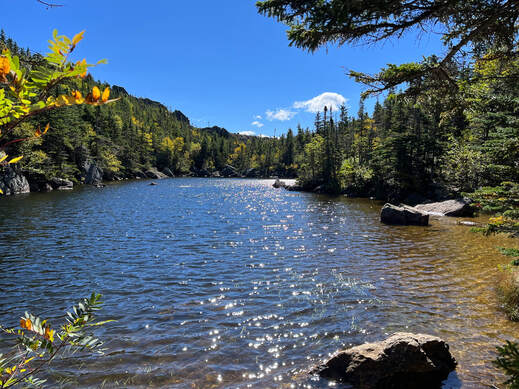 The notch was possessed of a lovely pond. The notch was possessed of a lovely pond. Hiked On: September 24, 2022, Normally we hit the "usual" route, whatever that is. We have books and there are recommended ways to do these things. This trip, however, we chose a different approach. That happens sometimes when off-hike schedules and other issues conspire to require something different. This time there was also a less-used trail we had heard good things about. There was strange weather predicted for the weekend, too. Early fall in the Whites can mean some fairly eccentric moments. We had planned to hit Little Haystack, Lincoln, and Lafayette but there was a cold wind coming through. With that in mind, we didn't feel like contending with freezing temperatures and ice on the exposed ridge. Instead we climbed Carter Dome; heading up Bog Trail to Wildcat River Trail, to Carter-Moriah then down the little-used Rainbow Trail to the Wildcat River and Bog trails again to the car. It was an adventure that took us what felt like forever. There were sketchy river crossings, a visit to the Carter Notch hut, a hang out near the top with some old guys we met on the way, and a fabulous descent that made the first part worth it. 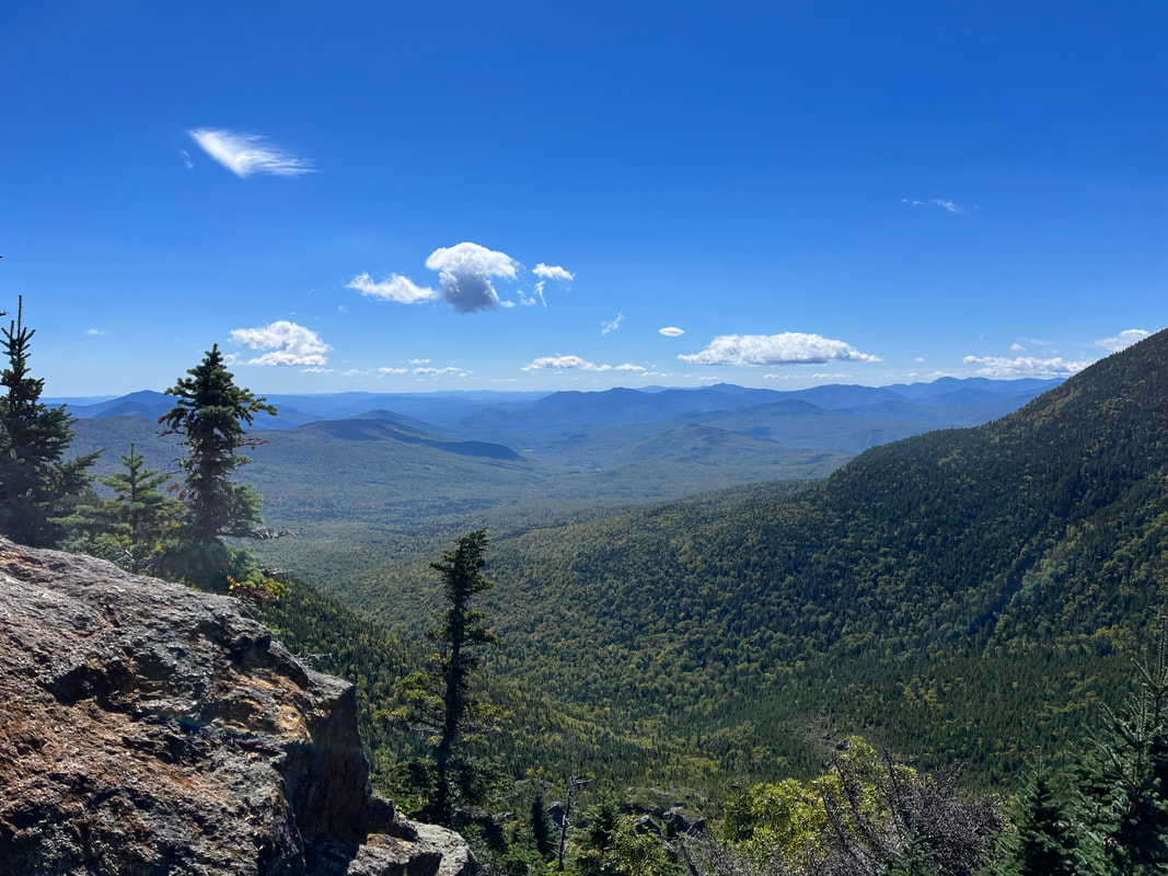 After the pond things got real...real steep. There was a ledge with views about halfway through this difficult section. The break was appreciated. 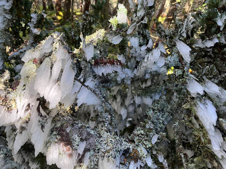 Ice on a fallen tree. To me it looked like a spider frozen in a moment of reaching out. Ice on a fallen tree. To me it looked like a spider frozen in a moment of reaching out. This was a hard hike. It required a certain amount of mental discipline as well as physical exertion to get to the top. We started late for us--around 8:30--the air was clear and cold but there was plenty of evidence of rain the day and night before. Also, all the trails were littered with fallen branches, leaves and sometimes whole trees thanks to the windstorm that still packed a depleted but potent punch. Al and I saw a few other people as we went along. Mostly they were the usual sorts of hikers moving at slightly faster clip than our own. We got out of the way for each group to pass. One group coming down consisted of a father and a daughter. He had an overnight pack on. Presumably he stayed at the hut where we planned to take our first long rest. The daughter was probably four or five years old. He was carrying her as well as the pack but seemed very cheerful. They had spotted a moose earlier and wanted to know if we had seen it. Sadly, we had not. The hut is located in Carter Notch. On one side of the notch is the back end of the Wildcat ridge that boasts a number of peaks and a ski resort. On the other is the Carter ridge. We took a break and thought about plans to perhaps stay at the hut when we hike the Wildcats. We also talked to some backpackers who had spent a hairy night camping on the ridge. The storm winds pelted them with ice. They were in good spirits but very tired and hungry. We left them to their recovery lunch and moved on up to the Dome. Carter Dome is steep and rocky while also--for the most part--encased in trees. This is actually part of why we chose it. The trees broke the wind somewhat. All around us were shards and chunks of ice, some still falling from the branches above. We were all a little damp and cold, changing layers every few minutes. That is the thing with climbing the tall mountains. The weather is different in different layers. It is why it can be so hard to get a view sometimes. It is also why--if you choose to respect what nature is telling you--new approaches and plans are made. 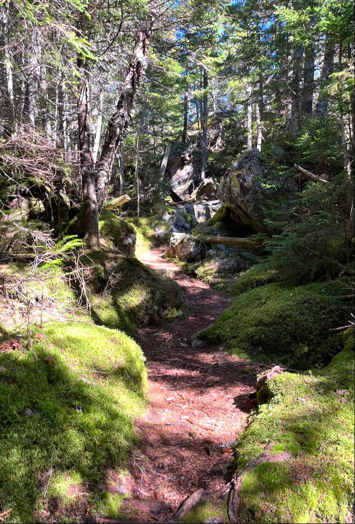 One of the many beautiful trails. 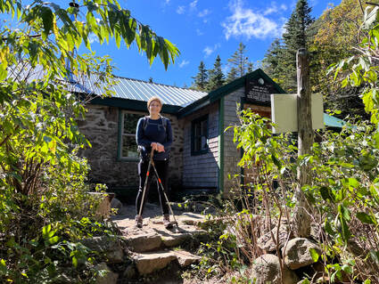 Al at the hut before we started off again. Al at the hut before we started off again. The Carter-Moriah Trail is part of the Appalachian Trail, so it always feels a little like US Route 1. It functions like that, too. No matter what one has plotted, it is likely that there will be a part of it that hops on to the AT. This is where--on any given day--you will encounter the most hikers. We ended up leapfrogging with a couple of amiable groups on this section. The slightly faster ones kept taking long breaks at the few lookouts along the way. The other group was made up of men in their 70's who called themselves the "Gluttons for Punishment." Their mission--by their own description--is to "go on stupid hiking trips." They kept the mood very light, which I think we all appreciated. Their behavior reminded me a bit of hiking trips I made in high school. They ran back and forth between each other with a certain manic glee. They also made many, many, loud and self-deprecating jokes that the rest of us only vaguely understood. After a long break at a false peak our combined group finally hit the actual top. There was no view for us to linger over...just a busy intersection of various trails. There was also another largish group who had decided to listen to music through one of their cell phones, broadcasting it far and wide. The music thing is truly annoying and a bit of a mood breaker. We have encountered this phenomenon before like its a mid-'80's no-walkman situation and there isn't another option. Here we all went our separate ways. The other two groups started over to Mount Hight where there are better views. We decided to start down on the Rainbow Trail. We had heard there was plenty to look at there. 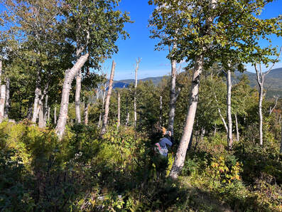 Near the end of the Rainbow trail we found a clearing that featured the remains of birch trees all sheared off at around 12-15 feet. Near the end of the Rainbow trail we found a clearing that featured the remains of birch trees all sheared off at around 12-15 feet. At some point I will make a list of my favorite trails. However, so many of them can only be reached by hiking another trail that the list seems impractical for planning purposes. Still, some are better than others, obviously, and this one was special. We had actually noticed as much in our research and it was part of the reason we took the less travelled route. Rainbow is relatively unknown for so popular an area. When I told the Gluttons about it, they thought I was teasing them. We had to pull out maps so I could prove it existed. Perhaps not surprisingly, it is not well-maintained and a bit overgrown, but we were never lost or even confused. Three things stand out. First, some thirty seconds below the peak we hit a section with absolutely no sound. Some trick of the landscape protected it not only from the wind but also from the noise of the music at the top. It was unique and very welcome. That deafening silence continued for a while. Shortly after the wind sounds resumed, we emerged on a flat place with some of the best views of the day. We could see the Wildcats and get a peak of the Great Gulf and Mount Washington still peaked in clouds. We could also see the massive pile of Carter Dome and Mount Hight. All of this was framed by more distant peaks. The weird point of Chocorua helped us identify some of them, many of which which we (or I or she) had hiked before. 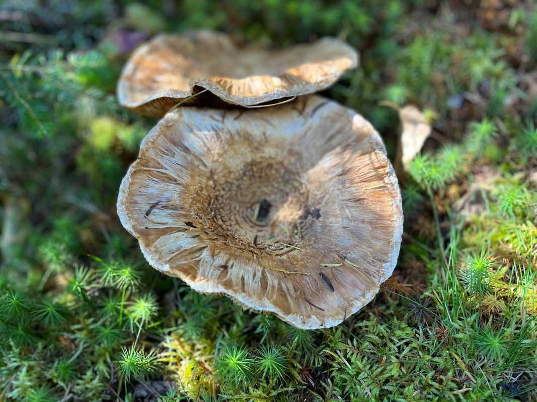 Mushrooms on the Rainbow Trail Mushrooms on the Rainbow Trail That view was the second thing. The third thing that stood out was that it added about two miles to our trip. The trail hooked way out and then drifted back toward Wildcat River Trail. Our patience was worn pretty thin by the end as we counted about 13 miles on the day. I have mentioned earlier that every hike feels a little too long. In this case it had taken us more time than we had thought. We started later than we wanted. We also had a three hour drive home. Our car was there in the lot waiting for us, however. We were almost the last to leave.  Here we are at the official top after saying goodbye to our extended party. Rainbow trail is behind us. Also, I shaved my beard for the first time since 1994. I am growing it right back. Wandering on through the notches which the streams had made, we at length crossed on prostrate trees over the Amonoosuc and breathed the free air of Unappropriated Land. --Henry David Thoreau 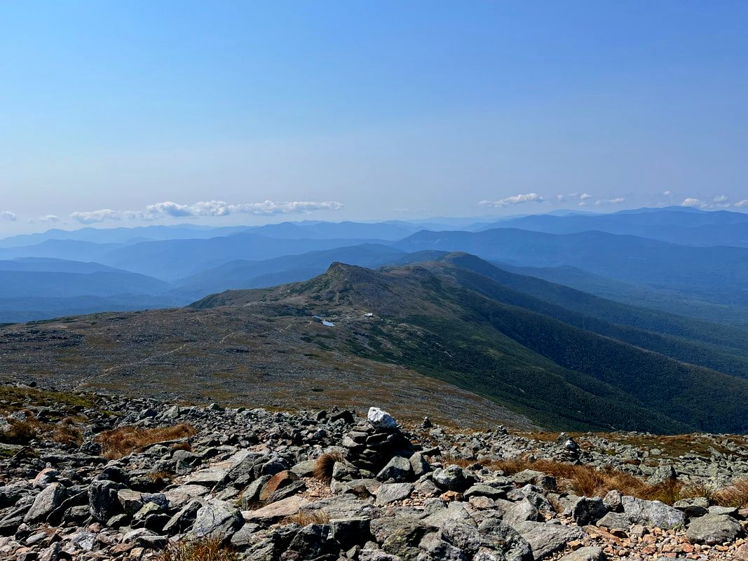 This photo shows our route pretty well. You can see our path up to the Ammonoosuc Hut through the trees on the right. The hut and the pond are just visible. That pointy rock in the middle behind the hut is Mount Monroe. The trail to Washington is clearly visible across the ridge and up to the cairns in the foreground. 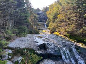 There was a sub-story about water in the way up. The Amonoosuc ran next to us on our left for much of the time and we met it again at the end of our hike. There was a sub-story about water in the way up. The Amonoosuc ran next to us on our left for much of the time and we met it again at the end of our hike. Hiked on September 10, 2022 Remember in my last post when I talked about why I hike? There were five reasons listed in descending order. First, I hike because of the spiritual connection it provides as I find ways to become part of "creation". Second, it is an aesthetic experience, witnessing the beauty and the "silence," though the silence is often quite noisy with wind and critters. Third, I can escape the suburbs, their dense population, and skewed values. All three of these were the primary motivators for that hike up Watatic in Massachusetts a day before attempting Monroe and Washington in New Hampshire. If these were the only reasons I did what I will describe now, it would have been pretty disappointing. The good news is that there are two other motivators for me. In fourth place is the mental challenge of a hard climb. At fifth place is the physical challenge. This was a day to practice perseverance in the face of mental and physical challenges. It was a day to do a hard thing and become stronger. Mount Washington, in particular, looms quite literally over its landscape. We have seen it from many tall peaks and--still looking up--wondered how one goes about tackling such a prominence. Frankly it put me out of sorts a bit and I had to find ways to not become overwhelmed. Also, it was a climb. Even the "easy" way up Ammonoosuc trail to the hut, over to Monroe, back to the hut, across Crawford trail to Washington, then down Jewell is demanding. What people don't realize about these mountains until they climb them is that height is only one measure of difficulty. There is also the length of the trail and its condition. The Whites are basically gigantic rock piles. You cannot stroll so much as pound and scramble much of the time. There was a lot of that, plus the heat of the sun. 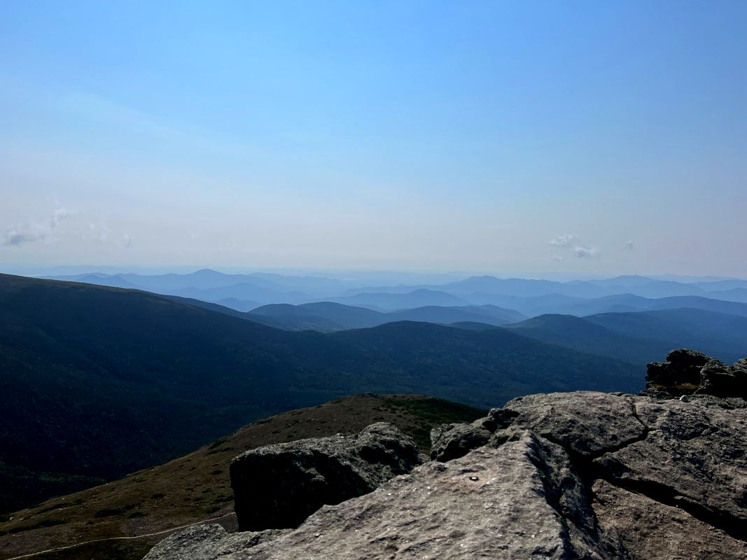 Mount Monroe was no slouch in the view department and basically more enjoyable in every way. 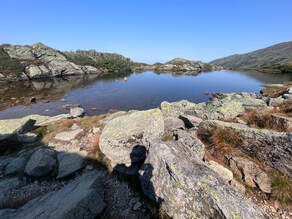 A cute pond next to the hut on the ridge and a shadow of the author. A cute pond next to the hut on the ridge and a shadow of the author. We parked at the base station for the cog rail that goes up Washington. There was, of course, a bathroom and a snack bar here as well as a train. In fact, this loop probably has the most amenities of any hike I have ever been on. Needless to say I was way too wired for this. After a couple of awkward encounters with folks in the parking lot (nothing bad, really, just that my enthusiasm was a bit much) I managed to calm down enough to get going. The walking, itself was pretty straightforward. Ammonoosuc (also called "Ammo") made a relatively straight--and very steep--line for miles toward a hut on the ridge between Washington and Monroe. It was a crowded day on the trail. Conventional wisdom among NH peak baggers dictates that if you are guaranteed good weather for Washington, you drop your other plans and nab it. I had wanted to do the Wildcats. Al wanted to climb Lincoln and Lafayette. The promise of a clear day on the biggest mountain, though, was impossible to resist for us and for a ton of other people. 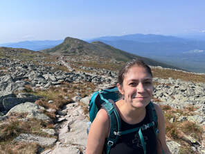 Right behind Al is another shot of Mount Monroe. This was taken probably had the hardest part as far as bodies were concerned. Right behind Al is another shot of Mount Monroe. This was taken probably had the hardest part as far as bodies were concerned. It was good company, however, and their presence made the walk go easier. Some of them were up for conversation after all. This is key to my hiking experience. Talking--either to myself or someone else--gets me through the hardest of days. All along the way we would encounter knots of slower moving people taking breaks. We were passed as well. As happens, however, after about an hour we fell in with about three different groups leapfrogging each other to the ridge. It was nice to encourage and be encouraged by strangers as we struggle together over the hard parts. However, it was anything but isolated. At the hut--more bathrooms, a snack bar, beds, and a water filling station--we turned right and climbed Mount Monroe. This was the high point of the trip. The peak rises steeply from the ridge and we found ourselves on all fours reaching out to grab the side of the mountain for stability. The top was relatively unpopulated. Apparently most of our new friends had not planned to hit Monroe. This was a plus. We weren't alone. However, it was a respectful crowd looking for the same thing. It was as close to reasons 1-3 as I got all day. I did a little recording for the church reminding them to go to worship the next day but avoided my usual panoramic video. The vibe among the groups wasn't right for that. 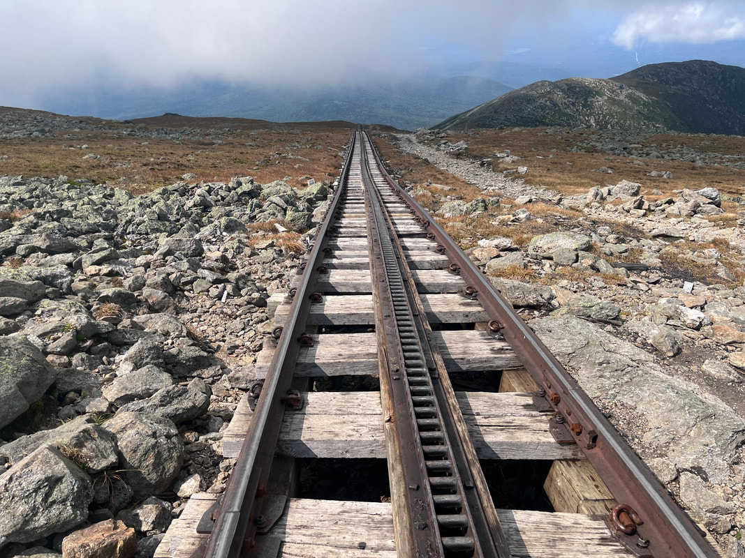 The cog rail tracks looking down. Our path is off to the right but beyond the frame of the photo. The trail next to the cog is for servicing the rails and is sometimes used to climb in winter when the train isn't there to belch smoke. 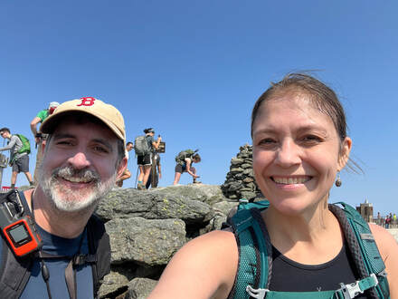 The peak selfie and a glimpse of the line behind. The peak selfie and a glimpse of the line behind. After that glorious climb we went back to the hut and started up to Washington. Here is where the physical challenge really began for me. We had already done most of the elevation for the day. Washington at this point was not as steep as the climb to the hut had been. Still, I had just gone up a 5,372 foot mountain and was attempting a 6,288 foot one. Mentally, too, I was tired and...there were so many people! The views, however, were fantastic. As I wrote about Mount Jefferson, pictures don't really do the landscape justice. Even the unrelenting rocks were pleasant to look at. Scenery, plenty of water, positive self-talk, and good use of hiking poles got us the rest of the way. Here is the thing about Washington, though. On tiny little Watatic I had the place to myself. Yes there was a slight hum from the road but there was no one there except wild animals and the wind in the trees. On Washington this was not the case. The large number of hikers were augmented by even larger numbers who had used either the road--yup road hum here too--or the train to get there. Hello suburbs! In 1858, when Henry David Thoreau climbed it for the second time, he encountered a hotel at the top called the "Tip-Top House". It is still there as an oddity next to the more modern gift shop, snack bar, bathroom arrangement that we were prepared to expect. Thoreau didn't stay long at the peak, disappointed by the encroachment. I will confess to having similar emotions. The "Unappropriated Land" of his first visit in 1839 is nowhere to be found now. 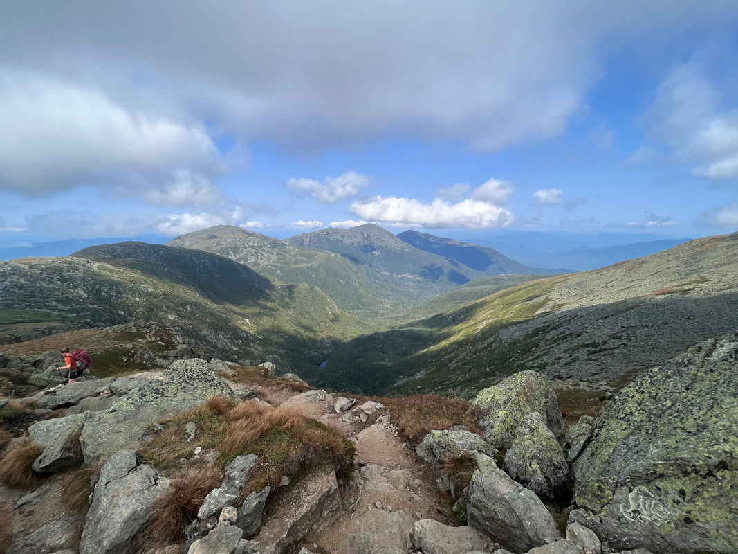 The Great Gulf and the northern presidents on the way down. The trip down Jewell took a while. I was glad to be away from the top, though. There was a period where we marched single-file in a long line of fellow humans but--away from the cog rail--some modicum of tired camaraderie returned. The views continued to be spectacular and our spirits lifted at least until the tree line. For me every hike is about two miles too long. My feet hurt and I am tired of foliage. This was no different. When we saw (and heard and smelled) the cog rail and its base station, we were happy to be done. It had been quite a day. I am glad I climbed Mount Washington--proud in fact! It was quite an accomplishment in many ways and I still kinda wish I bought a T-shirt. I doubt I would have been able to do it back when I managed to get to the top of Mount Roberts in July of 2021. If I had tried, it all would have ended in despair somewhere on Ammo. It is great to have that under our belts. Even though there are harder climbs to come, none of them are as symbolically important. That said, I am not sure I would do it again without a specific reason. Monroe was beautiful and I may head up there then turn south over the southern presidentials. I am sure I will go up Jefferson again which is to the north on the other side. Washington is massive and inspiring. However, my step counter--not a good one, just an app on my phone--says that I worked about as hard as I did to climb Cabot and the Horn. It seems like I can get the challenges I require in places where the spiritual requirements are more likely to be obtained as well. That said, if you haven't gone and you want a tough hike that people will recognize, get on up there when you are ready. You will be glad you did. 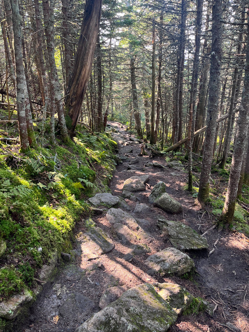 Part of the long slog to the car. 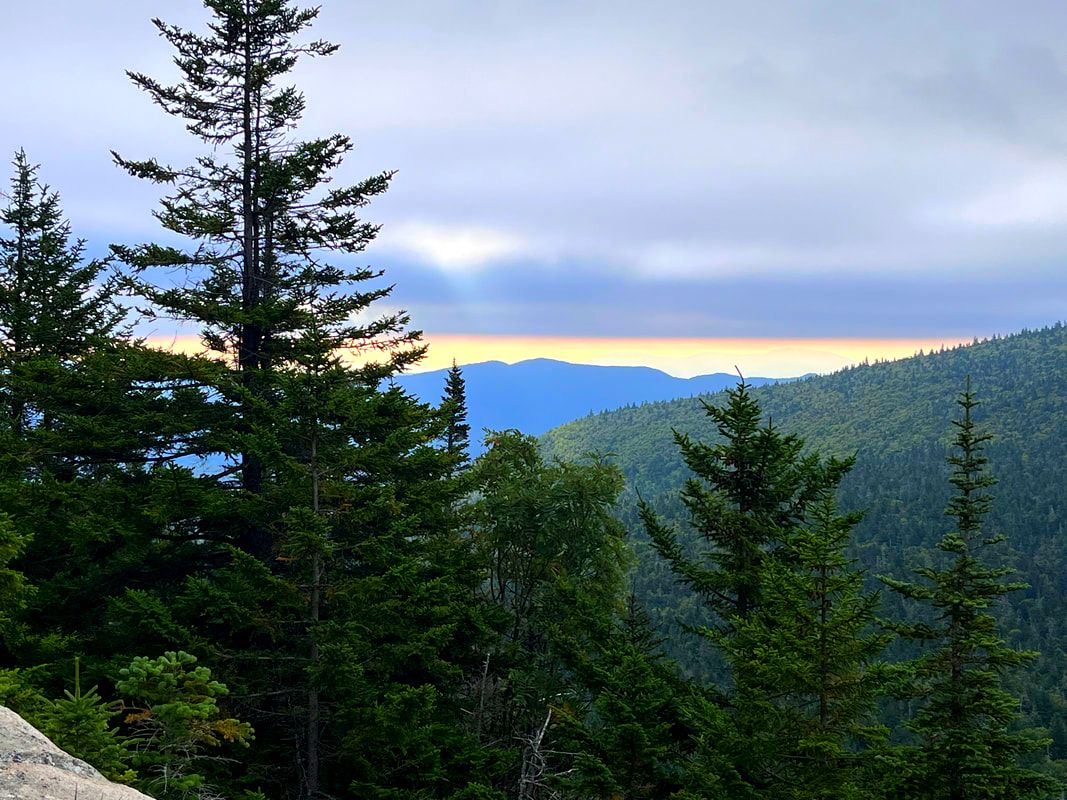 We weren't entirely without views. This was what greeted us from Bunnell Ridge early in the day.  The flat part of the beginning right around 6am. The flat part of the beginning right around 6am. HIKED ON: September 4, 2022 Not every hike goes exactly as planned. However, sometimes all your planning means you hike the hike anyway. The Mount Cabot loop is just outside of Berlin, NH and required an overnight stay. While Cabot, itself, is one of the shorter of New Hampshire's 4,000 footers (4,160 ft) the prominence--or the amount if climbing you have to do--is substantial. Also, I wanted to hike to the Horn, a slightly shorter peak that resides on the 52 With-A-View list. I will write up a post at some point about the two lists I am hiking. Until then, you can find which mountain is on which list in the "Categories" section on this weblog. I will also post link to to more information at the bottom. What is worth knowing for this hike is that in order to take in both Cabot and the Horn, we needed to form a loop, crossing one more peak--the Bulge--in the process. Normally the best view--not surprisingly considering the list it is on--is the Horn. This trip, however, epic views were hard to come by. Anyway, we woke up at 5 and drove about 30 minutes to the parking lot. Our starting time was a little before 6am. The "Cabot Loop" starts on Bunnell Notch Trail, hits Kilkenny Ridge trail, and then heads down on Unknown Pond Trail for a total of about 11.5 miles. It is not a technically difficult but...it is long and there is climbing involved so we felt like an early start was in order so that potentially, at least, we could drive home when we were done. What we couldn't count on was the weather, of course. The peaks during this hike were socked in with fog. The whole day was humid and hot. Still, we were there as we planned...so we did it anyway.  A typical piece of trail on the way up Cabot. Both the way up and the way down had an abundance of those head-sized boulders that can trip you up. 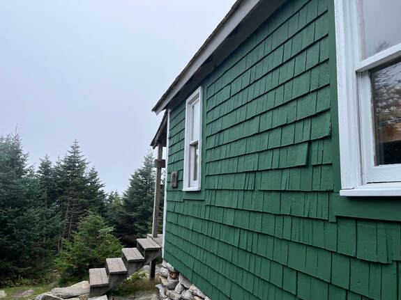 The hut and the non-view beyond. The hut and the non-view beyond. The loop was pretty straightforward, actually. The first mile (as often happens) was flat and then we climbed. This trail did not have much in the way of rocky parts. It was just a case of putting one foot in front of the other and avoiding the random trail hazards; small boulders, roots, and mud. The loop is not maintained at the same level as some but that was a plus after hiking the groomed trails and back roads of Scotland on the Great Glen Way. The soft earth was more hospitable by far! Our experience on the Way certainly helped with this one. Partly that was because of the differences. It was so very nice to be climbing! We could feel certain muscle groups that were underutilized as of late. The relative ease of the footing will help to get us back in practice for whatever we climb next.  Near the top of Cabot, there is a hut and--the best of all blessings--an outhouse. We hung out there for a while and chose to continue even though the views were non-existent. Here our time in Scotland was useful. During that hike (you can check out the posts under "Great Glen Way" for more info) we had to focus much of the time on small things. In this case it had nothing to do with the elevation, just fog. In theory we should have seen something. Still, as we went along we noticed the diversity in the trees, the moss, and the prolific undergrowth. Mushrooms of various kinds were also in abundance. At one point I think we could smell them. 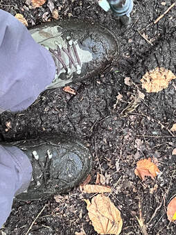 Also, there was mud. I haven't seen mud in months. Normally I am annoyed by how it sucks my boots in and forces me to alter my pace by jumping from dryish spot to dryings spot. This, though, was spectacular. The dryness has bothered everyone. It was great to see it again. This summer it has felt like mud is endangered too. There is power in the details sometimes. This walk forced us to connect to the moment we were actually in. There was no spectacular aesthetic payoff at the end to work toward and then savor on the way back. The challenge on a day like this is to find joy in spite of the weather, the strain, and the discomfort. I think we did a pretty good job.  Another non-view Another non-view Once we got to The Horn we didn't even bother to take a picture of yet another bank of clouds. Instead we settled in to eat our snacks (GORP and power bars). We also passed the time with the others on the top. There was a family with young kids who camped at Unknown Pond the night before. They were fun. We talked to the parents as the kids scrambled around on the bald rock that marks the peak. We had a lot of the same interests. It was good to pass the time with people who were also enjoying themselves. Then we chatted with a woman who was waiting for her family to come back from Cabot. They were all doing a an out-and-back. However, she didn't feel the need to bag the 4,000 footer as she had been there before. Besides, it was totally worthwhile to sit on The Horn and soak in the atmosphere. Everybody we met--and everyone I just mentioned was pretty much everybody, a rarity on Labor Day weekend--was in the mood for a walk in the fog. Everybody also found a way to experience and value the sounds, smells, and beauty of this off-weather day. Will I hike Cabot again? I don't know. I may hit The Horn on a clear day when I go up Roger's Ledges nearby. Honestly though. It was a good day, sufficient in itself. 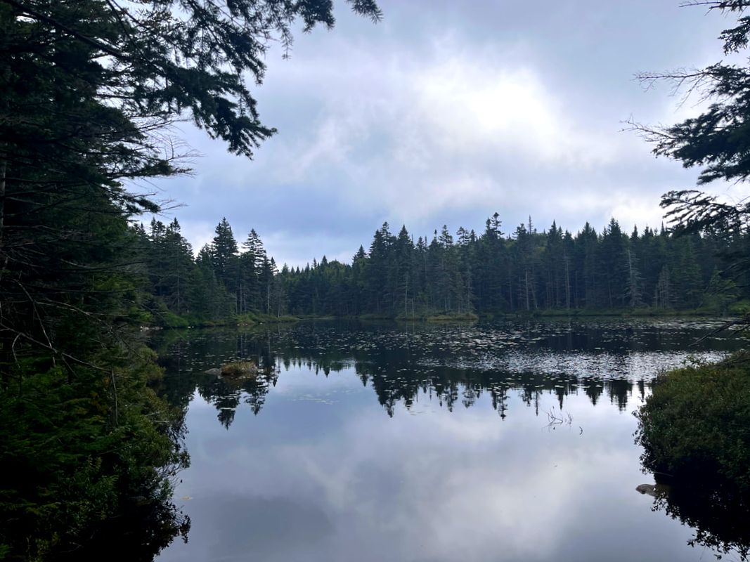 OK, Unknown Pond was darned pretty on our way out. Like I said earlier, I do plan--there is that word again--to write something up about the two lists I am doing in NH. Most of the hikers I know are picking away at both but show a preference for one or the other. We are a divided family on that point. Al likes the 48 4,000 Footer list more. I lean toward the 52 With a View list because I like a view. Usually when I can hike with my wife we do the 48 list. This was fun because we knocked off one of each! Cabot was 26/48 for me. The Horn was 13/52.
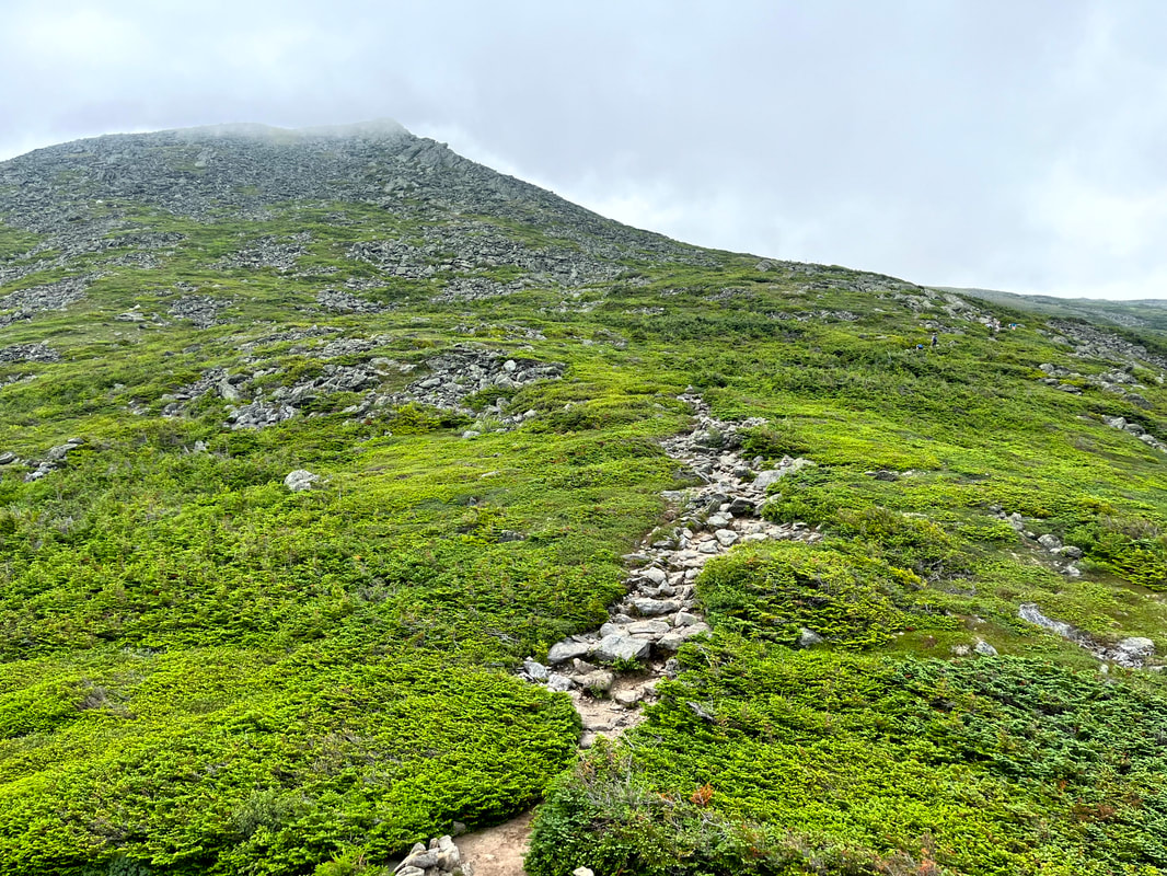 A brief relatively easy stretch after some serious scrambling, The peak is up in the clouds, which burned off in the epic heat well before we got there. 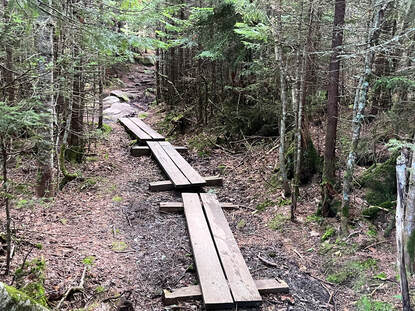 The trailhead started so innocently... The trailhead started so innocently... HIKED ON JULY 23, 2022 Pictures cannot tell the story. Words absolutely fail. This...was quite a hike. To celebrate the weekend of the first anniversary of my climb up Mount Roberts we hiked Mount Jefferson. The out-and-back on this 5,712 foot mountain (third tallest in NH) via the Caps Ridge trail was about 5 miles. We ended up exploring a bit, making the total hike around 7 miles. This now technically counts as a short hike for us. That said, there was a lot of crawling and clambering over rocks. It was quite the workout in ways that are not usual for many of our walks. It was also absolutely beautiful, with most of the trail unobscured by trees. However, if we were to do it again, I don't think we would take Caps Ridge down. That messed us up a bit. The trail does start in the woods, at the highest parking spot in the White Mountains. For the first few yards it is relatively flat. Then...it climbs and keeps on climbing up out of the trees and on to a number of false peaks and rocky outcroppings that require your full attention. Caps Ridge in on a list of trails known as the "Terrifying 25" for a reason! The views were very distracting, though. 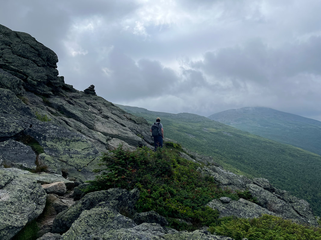 The trail led us up, over, and around many picturesque outcroppings and ridges.  The final push. The final push. We had plenty of company, of course. This is a popular hike and since we could see for miles, we could easily see each other. There were a number of small groups that we leapfrogged with on the way up. As usual, everyone was friendly, some were making good progress in good time. Others seemed to be willing to take breaks and worry less about their ultimate destination. It was all good.  Al in the foreground. Clay and then Washington behind. Al in the foreground. Clay and then Washington behind. The final push was like the House of the Holy Album cover. There were lots of tippy boulders and--with our poles long ago strapped onto our packs--we scrambled to the peak. It was striking...and crowded! There was one of those groups that decided to gather around the very top and obstruct anyone trying to get there as well. We let them be. the view was pretty much the same the whole way around and we planned to do a little wandering anyway. 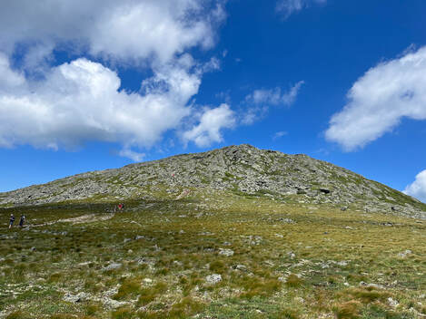 Looking at Jefferson from the Great Gulf Trail. Looking at Jefferson from the Great Gulf Trail. The "Presidents" are connected by a ridge that is relatively level, so once one works hard to get up there, it only makes sense to explore. I cannot recommend this enough! The various side trails--if you are adequately prepared--get you away from the parade of humans a bit and into something that feels more like isolation. There is plenty of nature to go around, of course, so even in a crowd you cannot help but experience the awe of being so high up in an area that doesn't really feel tamable. In fact, the biggest challenge to that vibe is the presence of Mount Washington. From Jefferson one gets a good view of the car road to its peak and of course the buildings at the top. The cog rail whistle--when the wind dies down--is also a thing. 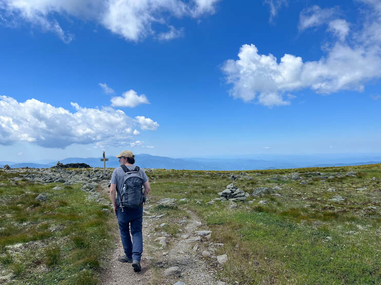 Right before we crossed over the big trail. The view of Jefferson peak (above) is off to my right. Right before we crossed over the big trail. The view of Jefferson peak (above) is off to my right. That said, Mount Adams and Mount Clay make up for Washington's "urban" feel. Also, our wanderings took us onto the Great Gulf Trail (and the AT) for a little while. The massive gap between Adams and Washington may have been the highlight of the trip! We passed a couple of through-hikers heading the other way and then found ourselves back onto the main trail before ducking off it again to a side trail that would bring us back to Caps Ridge. A little before we returned to Caps Ridge we encountered a family who we had seen before on the trail. Experienced hikers and climbers, they had brought their small children up the way we came to get some experience on the rock scrambles and cliffs. "Of course we couldn't go down that way" they said matter-of-factly. This stuck in the back of our minds as we said goodbye and proceeded to do just that. They seemed downright prophetic an hour or so later when I lost my footing on the last of the nasty cliff-things and fell, bouncing a bit before I caught myself by stiff-arming a large boulder. I am glad I did. It was a long way down. Man though, My wrist and shoulder still hurt two days later. No mandolin for me for a while... Still, this was an absolutely great day and a great climb. There is risk in what we do every day whatever it is that we do. The trick is to understand the undertaking and reduce the potential for disaster while enjoying the journey. As I slowly stretch and bend myself back to health this week I will remember the fall, but I will also remember the journey and be thankful I had the chance to take it. 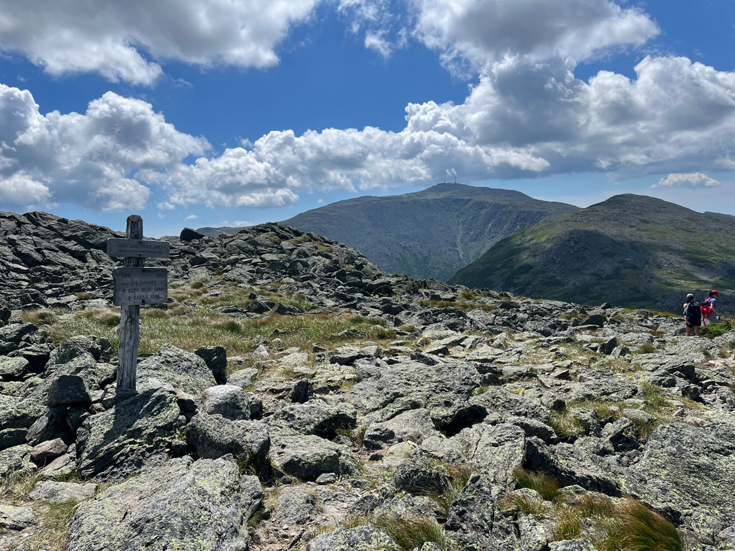 That is Mount Adams looking enticing from the crossroads of a number of trails right off the peak of Jefferson. 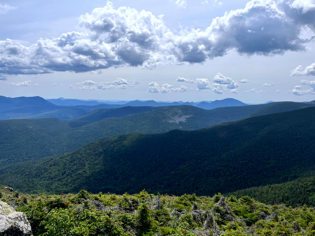 I forget but...I think this is one of the spectacular views off the first overlook on North Twin. That would be the shoulder of South Twin on your right. 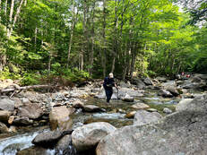 Wading through the second-widest of the crossings on the way down. My feet were so happy! Wading through the second-widest of the crossings on the way down. My feet were so happy! HIKED ON JULY 16, 2022 Man my legs hurt... This hike over the Twins was quite an undertaking. It was a twelve-miles total out-and-back over North Twin (4,760 feet) to South Twin (4,902 feet) then back over North and on down the way we came. We got off fairly early--a little before 5am--and were at the trailhead by 8. The parking lot was already full and we were among the many who found a parking spot by the side of the road. It wasn't the most crowded trail we've encountered--that would be our fall hike up Zealand--but it was still much more than we have seen at other times. It is a summer weekend in the Whites! This is what it looks like. Fortunately the crowd was one of the friendliest we have encountered. Occasionally you get grumpy people who are unhappy to see you. I believe I mentioned that in my Moriah post. Not on this day, though. I will spare you most of the details but there was a lot of shared picture-taking, friendly chit chat, and general encouragement both given and received. The hike up is different in a couple of ways worth mentioning. First, there are a number of somewhat challenging river crossings. This trail is not recommended during the spring runoff, in fact, when the crossings can be downright dangerous. There is also an unofficial "bushwhack" that helps folks get around them. However, we opted to ford them as the levels had gone down substantially and, well...it was fun. That said, instead of jumping from rock to rock, we bought our sandals and waded through. Taking the risks of an errant stick on the trail, we kept our sandals on until we crossed the last big stream. With boots back on--already a few miles in--we started our climb in earnest.  This is not the nasty gravel part, but part of the trail on the absolutely gorgeous ridge between the peaks. 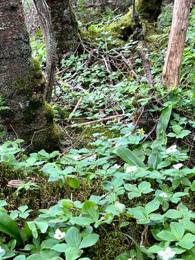 The next big problem we encountered was the condition of the trail. People have been hiking the Twins for a very very long time and the trail has been worn down over the years. Often when this happens (and on some parts of this hike) that means smooth and sometimes-slippery ledge. In this case, however, there were large stretches of small, loose rock that shifted underfoot. It wasn't a game changer by any means, but it was annoying. It would have been nice to gain some firmer footing. Our slow progress, however, gave us a chance to check out the foliage. This hike has incomparable ground cover with plentiful and diverse flowers and moss to examine during water breaks. I found it to be a nice consolation for the upward slog. On the way up North Twin we encountered a number of people going our way. We leapfrogged each other from time-to-time, talking each other through the river crossings in one case and celebrating the "first 4,000 footer" of a confused puppy in another. There really is a bit of a community among the people who do this frequently. Peak baggers belong to the same Facebook groups and follow the same folks on Instagram. My eldest son is hiking the Appalachian Trail and it isn't as intense as that--we don't camp together every night for months at a time--but we do occasionally see the same faces and we know we have the same hobby. On this day everyone was in a talkative mood, which helped in the darker moments of the climb. 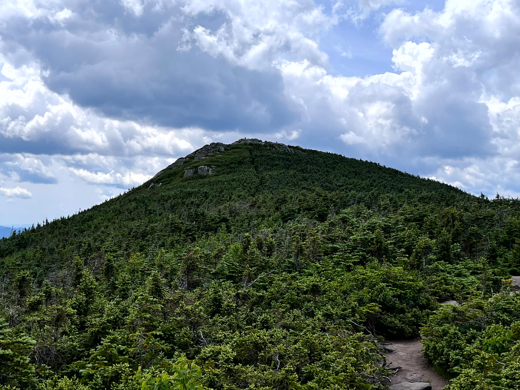 The peak of South Twin from the ridge. The peak of South Twin from the ridge. 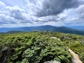 I have to admit there were moments when I was pretty close to despair on the way up, but once we reached the first overlook (and celebrated the puppy) things improved immensely. North Twin featured a couple of beautiful spots for a rest and a snack. Then we had the opportunity to hike across the ridge to the peak of South Twin. I have mentioned before that I love a good ridge trail. This one was special. Also, it was super-easy! I think I enjoyed it more than the peaks, themselves. On this hike, if you do all the work to climb the first mountain it is worth taking the time to bag the second. After all, the work is done! The 1.3 mile walk to South Twin was a great recovery opportunity with semi-obscured views and more of that diverse alpine ecosystem to enjoy. Once we made it to the summit, we were blessed with 360-degree views. I did not take a video because we were also surrounded by lots of fellow humans. Still, even with the crowd, it was quite a sight. Here on South we met a number of high schoolers, one of whom waxed lyrical about the mountain we were on and the mountains we could see. We had an excellent view of the "Presidents." Washington--with its towers and cog rail--was the most obvious, of course. However, the shear number of mountains within view rivaled the top of Liberty and seemed to stretch on forever. 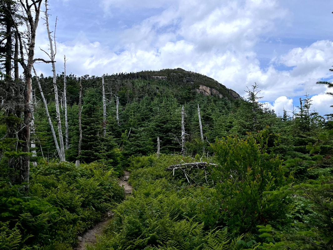 This is North Twin from the ridge. It was a bit more of a scramble back up. Turning around and crossing the ridge we once again approached the north peak. It was a bit of a struggle to climb back up the scrambles we had already climbed down but, really, it wasn't so bad. We stopped at both the outlooks on North once more and then proceeded to our cars. We crossed the river again, and again, and again. we leapt from rock to rock for the first one then I switched to sandals. Al jumped one too many rocks and got her feet wet so switched to sandals for the last crossing and hiked out that way. I will do this hike again sometime. It probably won't be too soon, though. South Twin was #24 for me on the NH 48 list which is exactly halfway. Also, I am at # 11 of the 52WAV. I would like to get back to those. Still, what a day... 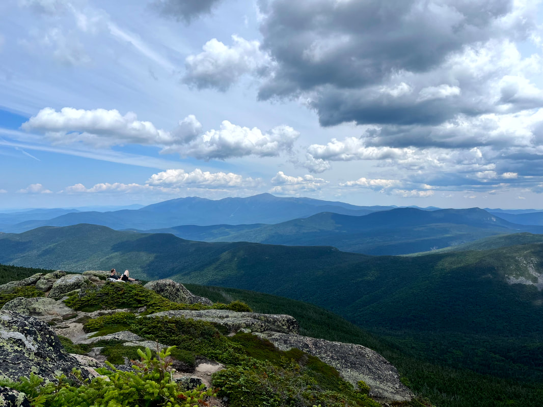 Part of the scene on South Twin. We all envied that guy and his sitting spot...but we did OK. Dear Folks, I am in the process of catching people up with some early hikes and other encounters with nature that I thought people might find interesting as part of a "How It Began" (HIB) series. Mostly this will describe specific hikes and perhaps some lessons learned along the way...if there are any. They are meant to be short and, perhaps helpful in some way to other hikers or fellow-travelers. I will post the dates of when I hiked a specific mountain since the ones in this series are NOT posted at or near the date I actually hiked them. To add further confusion, I am not doing them in order! Here is a post about a winter hike. We did so many and have posted so few...  Hiked On: January 16, 2022 In the back of my mind during this whole hike was the idea that I might have done something very stupid. It was 15 degrees below zero at the trailhead when we started up Mount Liberty. The socials that we follow were filled with dire warnings about climbing on that day. Mount Liberty is 4,459 feet tall. The out-and-back we had selected was a little over 7 miles, which means it was steep. Other than the temperature (and the abundant snow and ice) this wasn't our hardest climb. The snow and ice do make a difference, though. The freezing temps make a difference too. Our packs were heavy with snow shoes, spikes, emergency equipment and layers. Still, there we were at 7am ready to go. So, again, I couldn't help but think I made a mistake and should have done something else with my day.  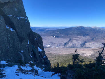 As a hike, it is fairly straightforward. It starts on a multi-use trail that we had been on before as there are a number of other climbs--for us winter climbs--that can be reached from that path as well. Then, we got a long period of relative flat before climbing...and climbing steeply all the way to the top. While on that flattish part, I started to have temperature regulation problems. As anyone who has spent time outdoors in the cold can tell you, there are moments when one's internal thermostat goes crazy. If you don't figure it out then hypothermia will set in. It took me a while to figure out what to do and we gave serious thought to turning back. Finally--after experimentation--I realized that I was running too hot for the amount of clothing I was wearing. This was the first lesson. I recalled going down Mount Willard a couple weeks before and witnessing a number of children on their way up desperately trying the shed layers while their parents just as desperately tried to make them keep the layers on. The kids were crying loudly, steam rising up out of their jackets. I remember thinking to myself that the kids needed to cool down to warm up--you don't have to wear all your layers all the time--and I realized I was doing the same thing. My concern over the temps had caused me to overdress for climbing. I was being just like those parents re-zipping jackets and cramming hats back on to sweaty heads. Since my parents were nowhere nearby I shed some layers and after a while things leveled out. I kept the hat, though, a hunter-orange number, and my gloves. Extremities are the first to go, my friends. Still, despair--my constant companion--was a problem. I have this issue below the tree line, particularly in winter. The trail, you see, just goes on and on and...I hate snow. The walk was slow and the struggle was real. We took many rests but the rests weren't that satisfying either. After all, I was cold. Finally we broke out onto a ridge and while there was still plenty of up to go, at least I could see out and around me to the winter landscape. Also I could see where I was going. Liberty is famous for its gigantic rock near the peak. We knew to point ourselves toward it and keep on keeping on. Also, the sun was out and that exposure warmed us up a bit after the shady trails below. As I have experienced in all seasons, a good ridge lifts the spirits immensely.  We finally broke out on the top and could see for miles all the way around. A small group had gathered there. Some were people we had been walking adjacent to for hours. Others had come over from Mount Flume, which we had done before the snow. About a third of them were carrying small sleds. I had done a bit of butt-sliding by this point but I had never imagined bringing a sled and treating a 4,000 footer as a personal sledding hill. It looked like fun. Butt-sliding is somewhat controversial in the Whites. Some love it. Some hate to hike down the shear track that they leave. I am a moderate on the issue. It is pretty convenient, though, and sometimes necessary of there have been a lot of sledders before you. We slid down a good chunk of this mountain ourselves using our snow pants, but I have to say...we never caught up to the actual sledders. In the end this was an important hike for me. It started rough and got dark (emotionally not meteorologically) a few times. In the end, though, I made it. I learned I could do something like this. I also learned that when people start saying "stay home unless you know what you are doing" sometimes at least...I do know what I am doing. Of course I have modified a number of hikes since because I knew what I was doing and didn't want to do a thing. After this hike, though, I learned to trust my judgement a bit more. I remembered that I had the authority to adapt to what my body was telling me. I also learned that even though I do not like snow...there are reasons to be outdoors in January.  That is Passaconaway on the left. The high point in the distace on the right is Chocorua and right in front of it is Paugus.  HIKED ON JULY 10, 2022 Hiking out of the parking lot on our way to the Blueberry Ridge trailhead we passed the time of day with another hiker who said two things that have proven pretty much true. One was that a person would have to look pretty hard to find a place as beautiful as the Sandwich Wilderness Area and the other was that--given the weather--there was no way that our various hikes would be any thing other than epic. We could only agree. The first we had already experienced. We have both hiked--alone and together--a number of trails in this area and each time we were struck by the foliage, views, and landscape. The second had special meaning. The last time we parked in that lot was to hike Passaconaway a couple of weeks ago on a day when the weather was definitely more dangerous. That story can be found in my Passaconaway post. This one is about a different day. 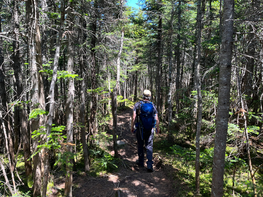 On the Ridge. 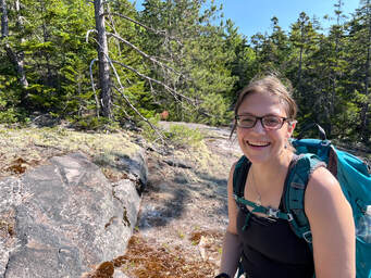 After that other hike we decided to make our return a priority, to climb up it's neighbor, Mount Whiteface. If we had enough in the tank we also thought we would hike the ridge--on the Rollins Trail--between the two mountains and peer into "the bowl". The space made by the two peaks and the ridge has never (at least during recorded history) been logged or experienced a fire. This, honestly, interested me more than the climb. The trail at first was just like Passaconaway, which is to say it was a road. You can check the other post for a further description. Then we turned into the woods and started to head up. Whiteface gets its name from the prominent stone cliff that can be seen from ground-level, so the trail--after a gradual start--became quite steep with a number of potentially-dangerous rock scrambles. We congratulated ourselves on waiting for a dry day for this. There were a number of ledges along the way, each with a similar, fabulous view of the wilderness area, some with Lakes Winnipesauke and Squam in the distance. We could see mountains we had already hiked and a number that we had yet to hike. Of course, we could also see into that bowl, which was breathtaking as well. I will say that the scrambles were a challenge. We stowed our hiking poles in order to use our hands to get better purchase. As we went up, we encountered a couple and their dog attempting a barely controlled descent. A few people we talked to over the course of the day decided to hike the ridge to Passaconaway instead out of concern for the potential for injury going back down the ledges. Al and I were not that worried, but we did end up on the Rollins Trail. The "true" peak of Whiteface is just a spot on the woods past all the cool stuff so we passed the point of no return in search of it. 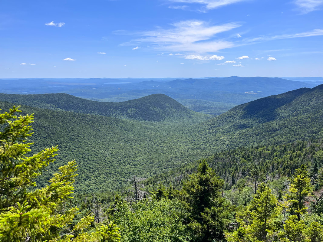 Looking down into the Bowl Research Area from the ridge.  I have always loved a square bale. I have always loved a square bale. I have to say... the trail between the peaks was my favorite part. The relatively untouched nature of the ecosystem gave the whole area on the ridge a sort of elfy vibe. There were plenty of thin, straight trees and a diversity of species that changed every few yards. The abundance of rotting wood that supported this system was covered in various mosses. There was a breeze and every once in a while...a view into that bowl again. Also, this part was pretty flat, which was a nice change from the boulder climbing and the inevitable climb down Dicey's Mill Trail. After that experience, we turn right at the intersection of the spur to the peak of Passaconaway. The left would have taken us to the top and a loop with some limited views. However, we had just been there. Honestly, as an attraction on this journey, it came in a distant third anyway. I mean, it was worth climbing when we climbed it, but it will be a while before we feel moved to do it again. We walked down Passaconaway's side back to the road and then to the car, set in a hay field. This very hike I would do again in pretty much the same way. Both the ridge and the ledges of Whiteface lived up to the hype. It is a steep and rough climb in places, though. Also, it was a touch over 10 miles. If you decide to do this one, pick a clear day and take your time. Frankly you will want to because there is so much to see. 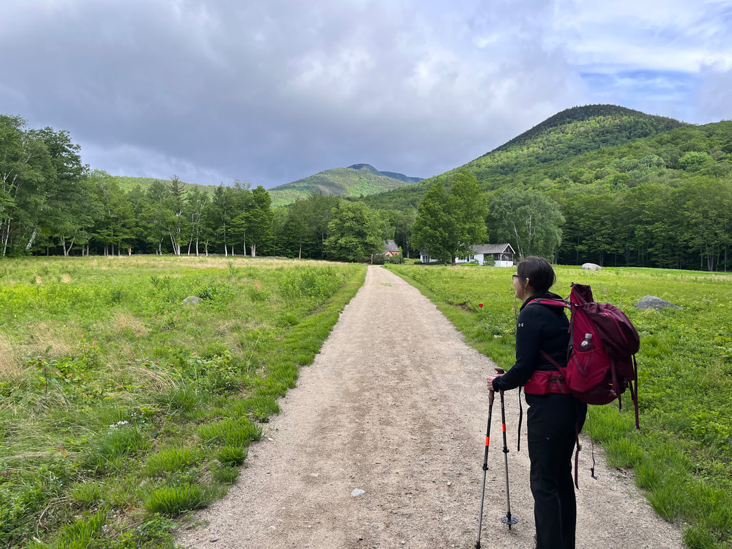 This hike was on our 28th wedding anniversary. Things have been so chaotic it was nice to just do the thing we do together. It almost didn't happen, though. While the weather below 3,500 feet was fine, if a bit windy and cold. Above 4,000 feet was downright wintery. The socials we subscribe to were ominous. We had previously planned for Jefferson, which is way past 4,000 feet--5,712 actually--so we opted for the 4,043 foot Passaconaway instead. Over the course of the day we considered a modified out-and-back to Whiteface next door...but in the end chose not to. What we did do was pack for colder weather before we started. Al and I both tend toward the heavy end of the packing spectrum. It is a comfort issue as much as anything else. We like water and snacks. We want the various layers that can get us through fluctuations in temperature both while walking and while resting. Who can argue with that, right? There are actually plenty of folks who would, preferring a lighter load that gets them up and down with greater ease. This hike, however, most of the people in the lot were playing it safe and adding a few items for comfort and safety. 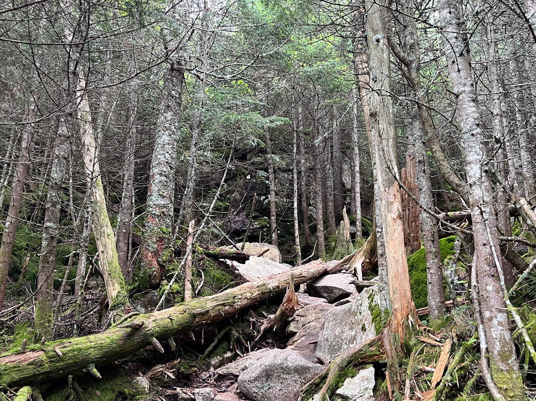 Most of the trail was long but relatively gentle. I had climbed three shorter mountains earlier in the week and the trail was longer but comparable to the combination of those. In fact the round trip comparisons for mileage and elevation for the two days were about the same. On Passaconaway, the big challenge occurred after the turn off for the ridge trail to Whiteface. Things got steep, cold, and wet about then. We started the ritual of adding and subtracting hats and jackets as the situation required. We even got as far as putting on our gloves! We passed a few people on the trail, all of whom were doing the same thing. Some had warnings for us. No one suggested we turn around, but they wanted us to know the conditions at the top. 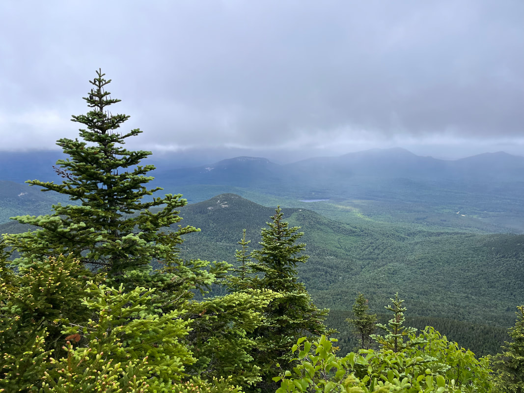 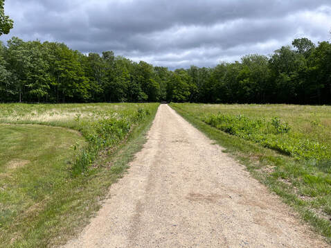 The conditions were...not ideal. They also were nowhere near as bad as what we encountered in the fall and winter. It was just a little unexpected given the lovely day at ground level. After the summit, we naturally struggled a bit with the possibility of hitting Whiteface. In the end--as I mentioned earlier--we chose not to. We were tired and wet and our plan would have just taken way too long. Still, it was a good hike on a good, if challenging day. I think it is probably worth noting that another hiker--an experienced and knowledgeable one--died that day while attempting a presidential traverse. The traverse involves hiking across a ridge of much higher mountains that are named after presidents. This includes Mount Washington--the tallest peak--and Mount Jefferson--which we expressly avoided--among others. We could not help but feel it. His family will miss him and, as fellow hikers, it is hard not to feel like we knew him a little bit. This tragedy put a bit of a damper on the day and reminded us of the need to respect the weather and understand our abilities, not just in general but on any specific day. There are times when we are strong and times when we are not. This is true no matter how good a condition we are in and how skilled we are at a particular task. Respecting nature means knowing when not to engage. The mountains do not care if you are ready for your attempt or not. Hiking, like many hobbies, comes with plenty of risk. This risk is part of what attracts people. When you climb a big mountain in the woods you come face to face with the vastness of the wilderness around you. You feel small and--perhaps conversely--in that smallness you feel empowered as part of something much, much larger. There is a spiritual element that is outward-facing. Yes, people go on these trips to challenge themselves, but that isn't all that is going on. Otherwise we could save a lot of time by hitting the treadmill or peloton. There is an attraction toward that smallness and the return to Creation that it represents. Still, it is good to know when to turn around or just stay home. We did not stay home and I am glad we didn't. However, we did change our plans and then we did turn around when we realized our tanks were close to empty. This was good too. I guess the lesson is to walk with humility and to not let the quest for perfection conquer the good before us. Dear Folks, I am in the process of catching people up with some early hikes and other encounters with nature that I thought people might find interesting as part of a "How It Began" (HIB) series. Mostly this will describe specific hikes and perhaps some lessons learned along the way...if there are any. They are meant to be short and, perhaps helpful in some way to other hikers or fellow-travelers. I will post the dates of when I hiked a specific mountain since the ones in this series are NOT posted at or near the date I actually hiked them. 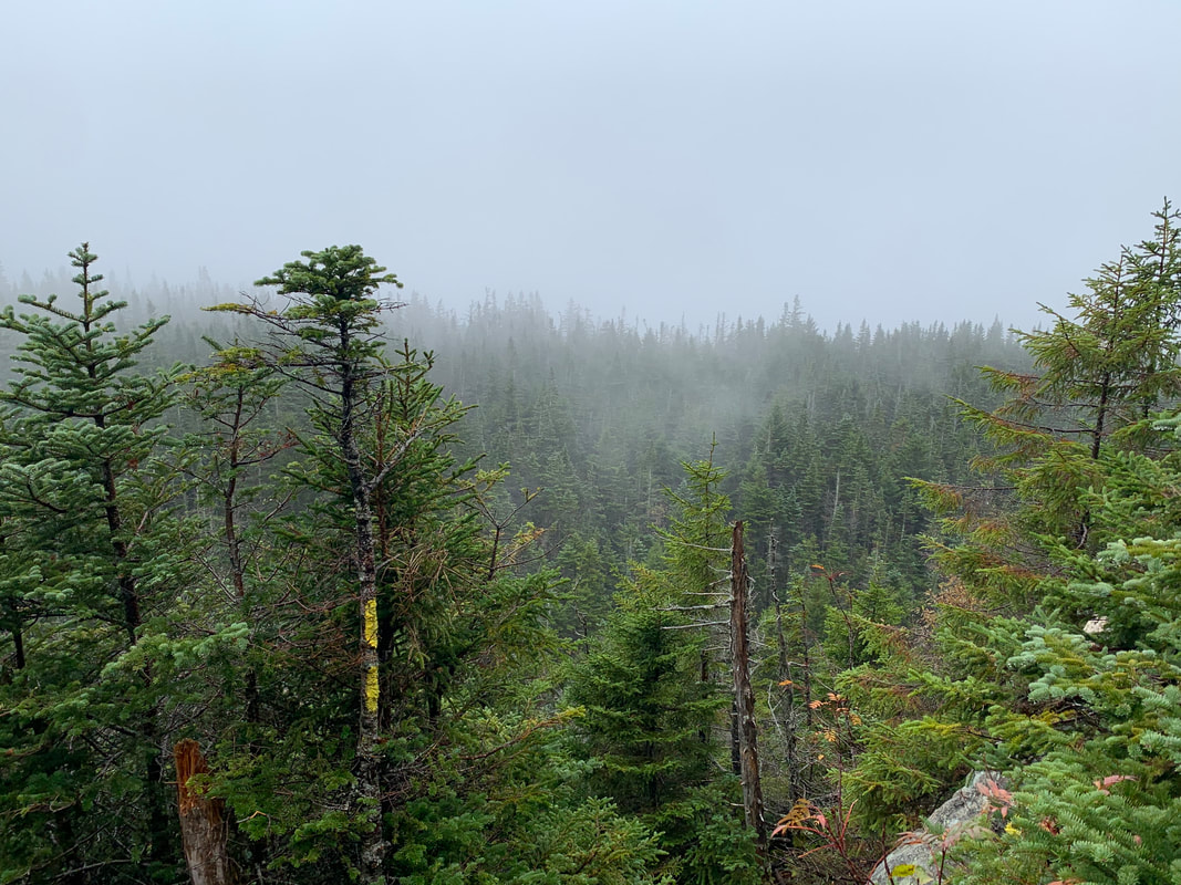 OCTOBER 4, 2021 This trip I completed with my brother Dan. Dan is the real hiker in the family. Many years ago after they graduated from high school, Dan and his twin brother (also my brother but we aren't twins) Matt decided to hike the Appalachian Trail north-to-south. Some of my own most ambitious hikes came from tagging along after them on various practice runs. I am a few years older than they are, however, and that window for a months-long adventure had closed for me. Anyway, they got pretty far over some of the hardest parts, but eventually they took a break and joined me working in the retail hub of Freeport, ME. Good times. Dan has kept on picking away at the AT, though. More recently than this hike, he actually joined my son on the AT for ten days going south-to-north through the Great Smoky Mountains. This particular day was wet and cold when we started. This is not an unusual state of being for New Hampshire in October and we planned accordingly. Our goal was to climb up Mount Osceola and over the ridge to East Osceola and then back, crossing Osceola again upon our return. We got a slightly later than usual start because we misjudged the time to get there. However, once we got underway things went smoothly for a while. On the way up there weren't any stunning views, nor were there any at the top. Fog will do that to you. Still, the foliage was wonderful and the company was fine. 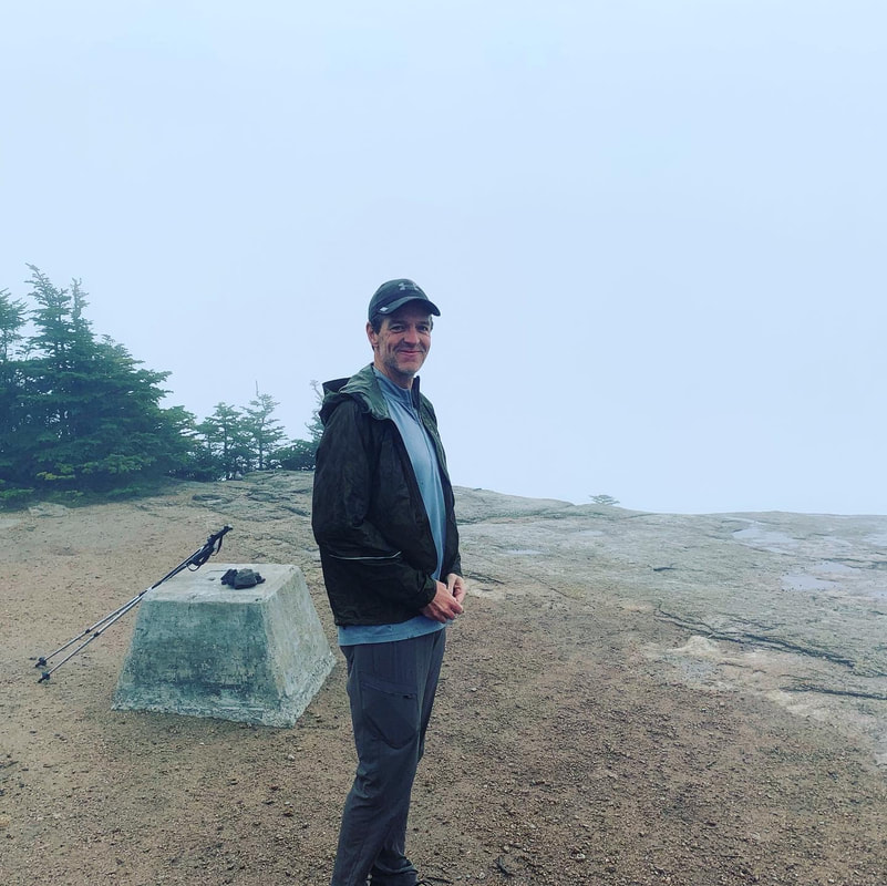  Actually, it was more than fine. Thanks to the plague most of our interactions for the year had been over zoom, which is not ideal. Being outdoors meant being able to interact like normal humans. A lot of the time was spent catching up. We talked about our families, kids, parents, siblings, and so forth so the time flew by. Another great perk of hiking with Dan is that he knows a huge amount about the outdoors. Dan is a wildlife biologist for NOAA and I appreciated the "enhanced video" aspect of having an expert with me. Since he also walks quite a bit faster, I also appreciated the fact that mushrooms and birds distract him. Most serious hikers--my wife and brother included--seem to think of hiking as an isolated activity. It is just the lone walker in the natural world. I am in that minority who thinks of it as social. You can identify the social types pretty easily out on the trail because--whether we are solo or not--we begin talking to strangers the moment they come into view and then continue talking until well after we pass them. We take seriously the idea of a "hiking community" but...we also make a bunch of noise with our mouths. Thankfully both Dan and Al tolerate this behavior in me. Maybe that is why it is so great to have them. The first socked-in peak over, we proceeded to cross to East Osceola. This ridge is a bit of a challenge. It is hiked less often than the rest because there isn't actually much of a view off of East and there is the issue of a fairly substantial scramble called the Chimney which one must first go down and go up on the return trip. Theoretically there is an easier way around it...but I didn't notice. 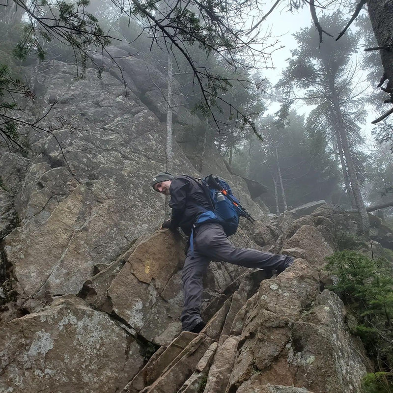 Or...if this was the way around...it wasn't much different.  We continued to East and then headed back. It was still wet and cold but the mushrooms were off the handle and we were enjoying the challenge. The Chimney was actually a bit easier--straight up--on the way back. I mentioned this same phenomenon on the Garfield Ridge. Climbing is just easier than descending when it comes to cliffs. When we emerged onto Osceola for the second time the clouds finally parted and we got one of those classic White Mountain views. I would say it was worth the trip but the trip had been pretty cool up to that point. Still, it was nice to see. On the way home I wiped out on some wet ledge rock, tangled myself in a tree, and broke my hiking pole. At this point I was still not entirely rehabilitated from my back surgery so I opted for the spectacular spill instead of twisting something to maintain my balance. Dan sorted me out. That is another good reason to hike with somebody. I felt the fall for a while though. In the end the trip was 8.5 miles and about 3,200 feet of elevation. It was quite a day.  |
Adam Tierney-EliotI am a full-time pastor in a small, progressive church in Massachusetts. This blog is about the non-church things I do to find spiritual sustenance. Archives
March 2024
Categories
All
|
 RSS Feed