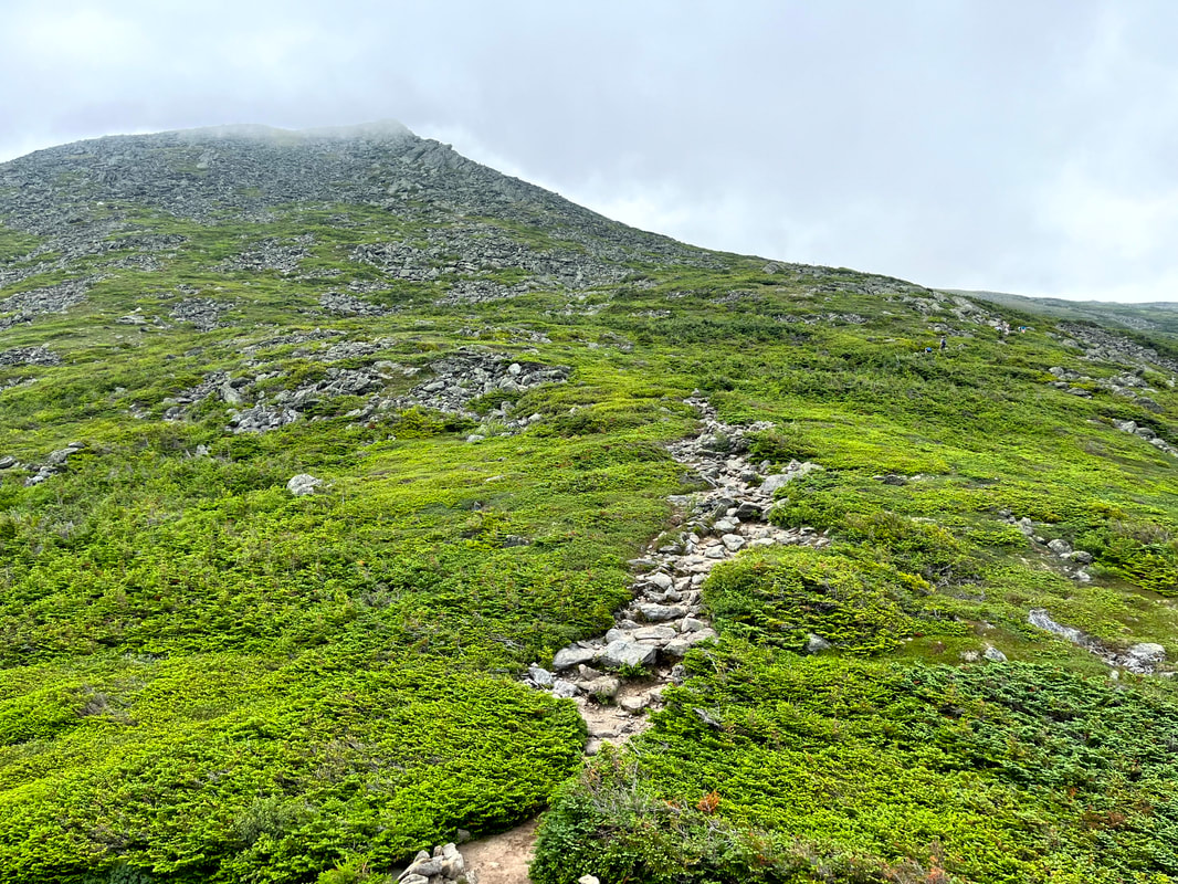
 A brief relatively easy stretch after some serious scrambling, The peak is up in the clouds, which burned off in the epic heat well before we got there. 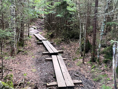 The trailhead started so innocently... The trailhead started so innocently... HIKED ON JULY 23, 2022 Pictures cannot tell the story. Words absolutely fail. This...was quite a hike. To celebrate the weekend of the first anniversary of my climb up Mount Roberts we hiked Mount Jefferson. The out-and-back on this 5,712 foot mountain (third tallest in NH) via the Caps Ridge trail was about 5 miles. We ended up exploring a bit, making the total hike around 7 miles. This now technically counts as a short hike for us. That said, there was a lot of crawling and clambering over rocks. It was quite the workout in ways that are not usual for many of our walks. It was also absolutely beautiful, with most of the trail unobscured by trees. However, if we were to do it again, I don't think we would take Caps Ridge down. That messed us up a bit. The trail does start in the woods, at the highest parking spot in the White Mountains. For the first few yards it is relatively flat. Then...it climbs and keeps on climbing up out of the trees and on to a number of false peaks and rocky outcroppings that require your full attention. Caps Ridge in on a list of trails known as the "Terrifying 25" for a reason! The views were very distracting, though. 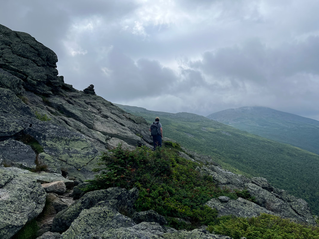 The trail led us up, over, and around many picturesque outcroppings and ridges. 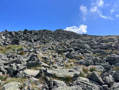 The final push. The final push. We had plenty of company, of course. This is a popular hike and since we could see for miles, we could easily see each other. There were a number of small groups that we leapfrogged with on the way up. As usual, everyone was friendly, some were making good progress in good time. Others seemed to be willing to take breaks and worry less about their ultimate destination. It was all good. 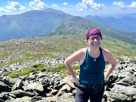 Al in the foreground. Clay and then Washington behind. Al in the foreground. Clay and then Washington behind. The final push was like the House of the Holy Album cover. There were lots of tippy boulders and--with our poles long ago strapped onto our packs--we scrambled to the peak. It was striking...and crowded! There was one of those groups that decided to gather around the very top and obstruct anyone trying to get there as well. We let them be. the view was pretty much the same the whole way around and we planned to do a little wandering anyway. 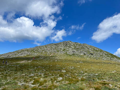 Looking at Jefferson from the Great Gulf Trail. Looking at Jefferson from the Great Gulf Trail. The "Presidents" are connected by a ridge that is relatively level, so once one works hard to get up there, it only makes sense to explore. I cannot recommend this enough! The various side trails--if you are adequately prepared--get you away from the parade of humans a bit and into something that feels more like isolation. There is plenty of nature to go around, of course, so even in a crowd you cannot help but experience the awe of being so high up in an area that doesn't really feel tamable. In fact, the biggest challenge to that vibe is the presence of Mount Washington. From Jefferson one gets a good view of the car road to its peak and of course the buildings at the top. The cog rail whistle--when the wind dies down--is also a thing. 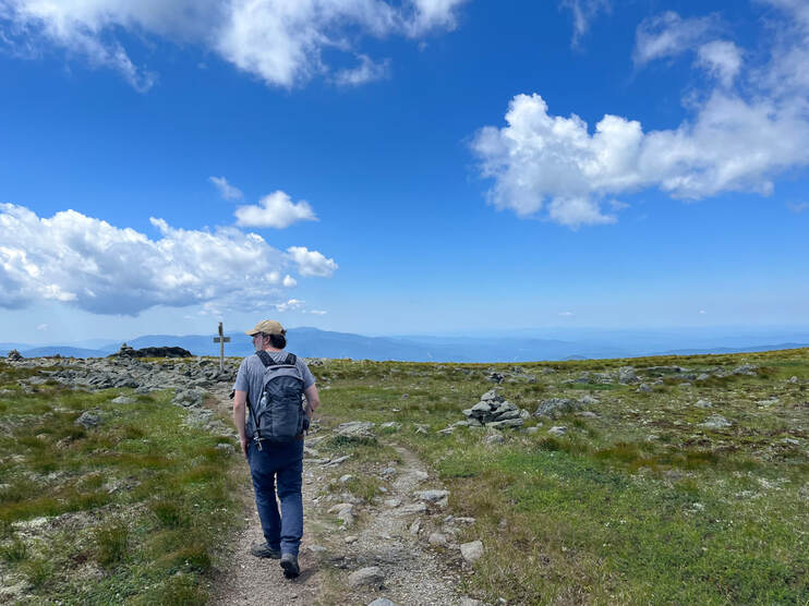 Right before we crossed over the big trail. The view of Jefferson peak (above) is off to my right. Right before we crossed over the big trail. The view of Jefferson peak (above) is off to my right. That said, Mount Adams and Mount Clay make up for Washington's "urban" feel. Also, our wanderings took us onto the Great Gulf Trail (and the AT) for a little while. The massive gap between Adams and Washington may have been the highlight of the trip! We passed a couple of through-hikers heading the other way and then found ourselves back onto the main trail before ducking off it again to a side trail that would bring us back to Caps Ridge. A little before we returned to Caps Ridge we encountered a family who we had seen before on the trail. Experienced hikers and climbers, they had brought their small children up the way we came to get some experience on the rock scrambles and cliffs. "Of course we couldn't go down that way" they said matter-of-factly. This stuck in the back of our minds as we said goodbye and proceeded to do just that. They seemed downright prophetic an hour or so later when I lost my footing on the last of the nasty cliff-things and fell, bouncing a bit before I caught myself by stiff-arming a large boulder. I am glad I did. It was a long way down. Man though, My wrist and shoulder still hurt two days later. No mandolin for me for a while... Still, this was an absolutely great day and a great climb. There is risk in what we do every day whatever it is that we do. The trick is to understand the undertaking and reduce the potential for disaster while enjoying the journey. As I slowly stretch and bend myself back to health this week I will remember the fall, but I will also remember the journey and be thankful I had the chance to take it. 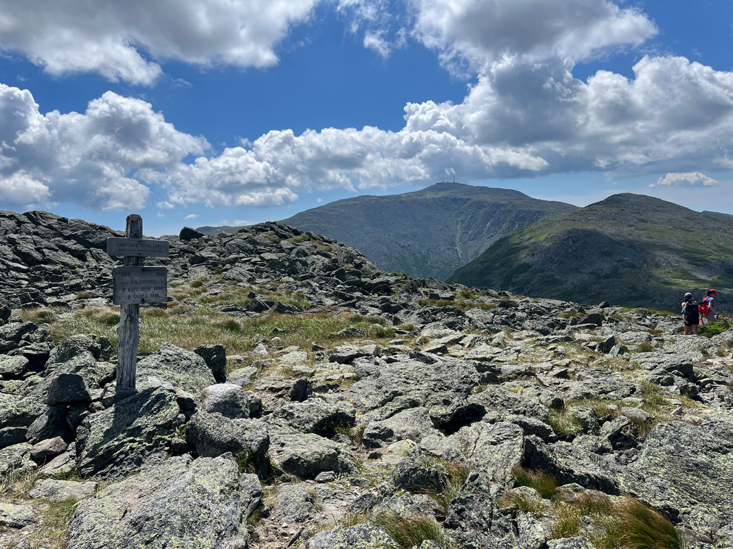 That is Mount Adams looking enticing from the crossroads of a number of trails right off the peak of Jefferson.
0 Comments
Leave a Reply. |
Adam Tierney-EliotI am a full-time pastor in a small, progressive church in Massachusetts. This blog is about the non-church things I do to find spiritual sustenance. Archives
March 2024
Categories
All
|
 RSS Feed