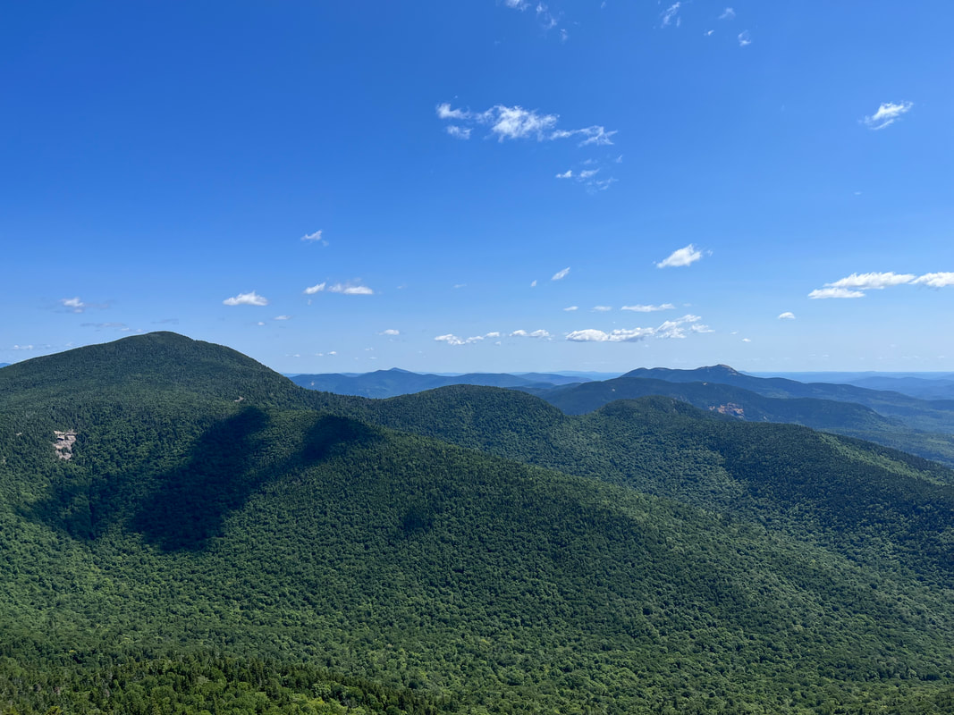
 That is Passaconaway on the left. The high point in the distace on the right is Chocorua and right in front of it is Paugus. 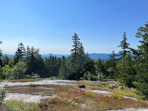 HIKED ON JULY 10, 2022 Hiking out of the parking lot on our way to the Blueberry Ridge trailhead we passed the time of day with another hiker who said two things that have proven pretty much true. One was that a person would have to look pretty hard to find a place as beautiful as the Sandwich Wilderness Area and the other was that--given the weather--there was no way that our various hikes would be any thing other than epic. We could only agree. The first we had already experienced. We have both hiked--alone and together--a number of trails in this area and each time we were struck by the foliage, views, and landscape. The second had special meaning. The last time we parked in that lot was to hike Passaconaway a couple of weeks ago on a day when the weather was definitely more dangerous. That story can be found in my Passaconaway post. This one is about a different day. 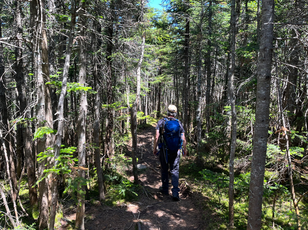 On the Ridge. 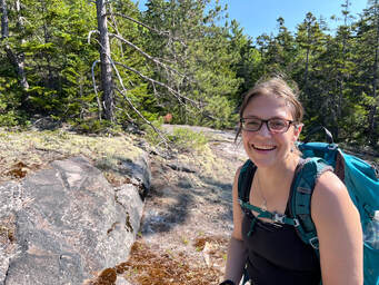 After that other hike we decided to make our return a priority, to climb up it's neighbor, Mount Whiteface. If we had enough in the tank we also thought we would hike the ridge--on the Rollins Trail--between the two mountains and peer into "the bowl". The space made by the two peaks and the ridge has never (at least during recorded history) been logged or experienced a fire. This, honestly, interested me more than the climb. The trail at first was just like Passaconaway, which is to say it was a road. You can check the other post for a further description. Then we turned into the woods and started to head up. Whiteface gets its name from the prominent stone cliff that can be seen from ground-level, so the trail--after a gradual start--became quite steep with a number of potentially-dangerous rock scrambles. We congratulated ourselves on waiting for a dry day for this. There were a number of ledges along the way, each with a similar, fabulous view of the wilderness area, some with Lakes Winnipesauke and Squam in the distance. We could see mountains we had already hiked and a number that we had yet to hike. Of course, we could also see into that bowl, which was breathtaking as well. I will say that the scrambles were a challenge. We stowed our hiking poles in order to use our hands to get better purchase. As we went up, we encountered a couple and their dog attempting a barely controlled descent. A few people we talked to over the course of the day decided to hike the ridge to Passaconaway instead out of concern for the potential for injury going back down the ledges. Al and I were not that worried, but we did end up on the Rollins Trail. The "true" peak of Whiteface is just a spot on the woods past all the cool stuff so we passed the point of no return in search of it. 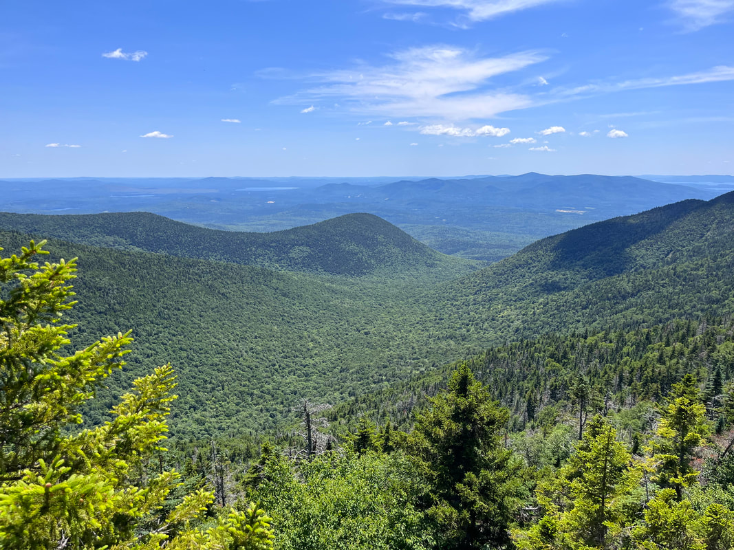 Looking down into the Bowl Research Area from the ridge. 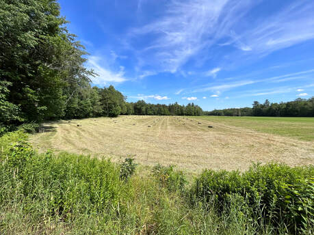 I have always loved a square bale. I have always loved a square bale. I have to say... the trail between the peaks was my favorite part. The relatively untouched nature of the ecosystem gave the whole area on the ridge a sort of elfy vibe. There were plenty of thin, straight trees and a diversity of species that changed every few yards. The abundance of rotting wood that supported this system was covered in various mosses. There was a breeze and every once in a while...a view into that bowl again. Also, this part was pretty flat, which was a nice change from the boulder climbing and the inevitable climb down Dicey's Mill Trail. After that experience, we turn right at the intersection of the spur to the peak of Passaconaway. The left would have taken us to the top and a loop with some limited views. However, we had just been there. Honestly, as an attraction on this journey, it came in a distant third anyway. I mean, it was worth climbing when we climbed it, but it will be a while before we feel moved to do it again. We walked down Passaconaway's side back to the road and then to the car, set in a hay field. This very hike I would do again in pretty much the same way. Both the ridge and the ledges of Whiteface lived up to the hype. It is a steep and rough climb in places, though. Also, it was a touch over 10 miles. If you decide to do this one, pick a clear day and take your time. Frankly you will want to because there is so much to see.
0 Comments
Leave a Reply. |
Adam Tierney-EliotI am a full-time pastor in a small, progressive church in Massachusetts. This blog is about the non-church things I do to find spiritual sustenance. Archives
March 2024
Categories
All
|
 RSS Feed