|
Dear Folks, I am in the process of catching people up with some early hikes and other encounters with nature that I thought people might find interesting as part of a "How It Began" (HIB) series. Mostly this will describe specific hikes and perhaps some lessons learned along the way...if there are any. They are meant to be short and, perhaps helpful in some way to other hikers or fellow-travelers. I will post the dates of when I hiked a specific mountain since the ones in this series are NOT posted at or near the date I actually hiked them. 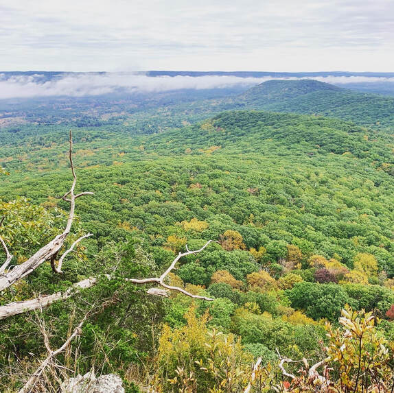 This is one of the views from Norwottuck. It reminds me a little of the view from the rebel base on Yavin 4. OCTOBER 8, 2021 History nerds will remember Shays' Rebellion, when a band of veterans from the Continental Army rose up to resist the entrenched interests of eastern Massachusetts and set off a series of events that ultimately culminated in the writing and ratification of the Constitution. If you don't remember, check it out. It was one of those iconic turning points in American history but in many schools you only get a day to digest the whole Articles of Confederation-to-US Constitution move and Daniel Shays gets merely a mention. These days folks with just enough information will try to shoehorn this second revolution into the mythology of today's "red v. blue" divide. It is a futile endeavor. They were protesting a number of issues, like not getting paid and being taxed without adequate representation. Underlying their oppression was the economic desires of the landed interests in Boston. The story is a Rorschach test for activists. You can make of it what you will. My suggestion is to just take it for what it is, on its own merits and in its own context. It is a moment in time, and a romantic one in its own way. The actors in their story are the closest we get to the legends of Robin Hood or Rob Roy MacGregor. I bring up this historical tidbit because you can check out Shays' old stomping grounds without too much difficulty. The Pioneer Valley--where the rebels were primarily from--creates a defensive bowl of ridges and rocks where Shays and Co. could hide out when the heat was on. I already mentioned the Seven Sisters hike. There are more to come, but this post is about Norwottuck, the site of their final stand. 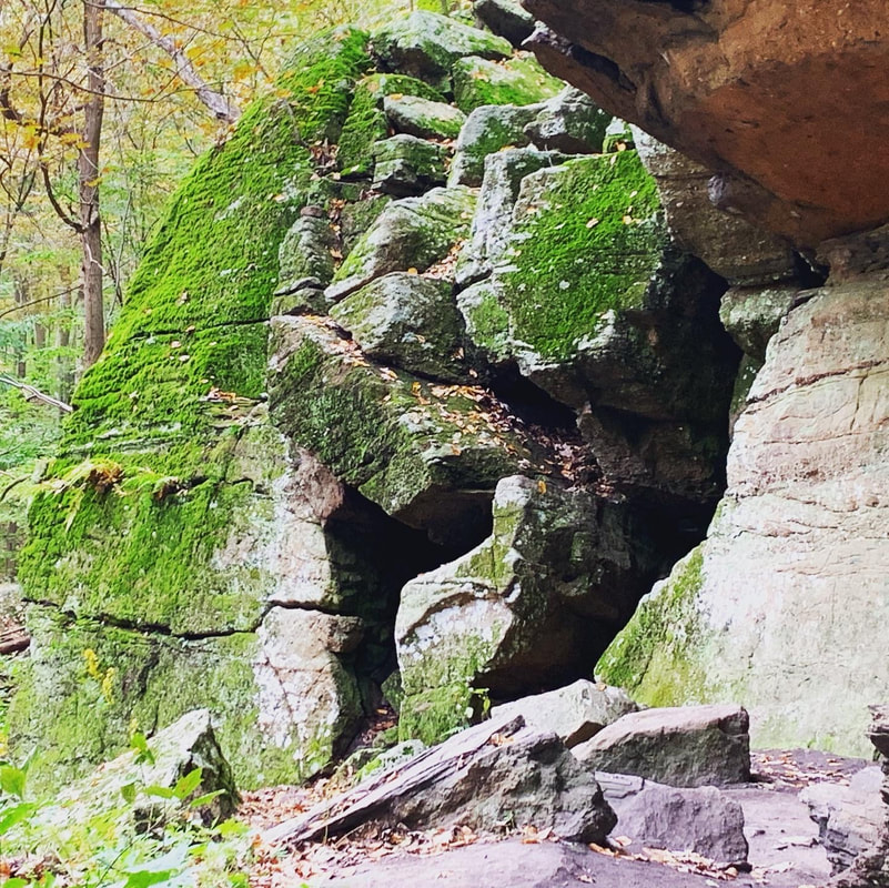 The legendary Horse Caves. 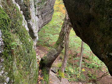 The view from one of the hike's many fun rocky challenges. This one enters into the theoretical final encampment of Shays' army. The view from one of the hike's many fun rocky challenges. This one enters into the theoretical final encampment of Shays' army. The hike, itself, isn't that long. Also, the elevation isn't very high. You don't have to go too far up to get a commanding view when the land around you is flat as a pancake. From the parking lot I head into the woods and then passed an active quarry to my right. After a bit of confusion, I managed to locate the trail I was looking for and found the footing easy for a while. Then it became ledgey and more difficult. The total walk was four miles round trip. It included the sort of rolling hills that I now know as a key part of hikes in the region. There are some steep parts up toward the peak and then down the other side. After a short scramble up the ledge to the top. I found numerous perches from which one could look out over the valley. That tacked on some time as I sampled many of them. I was working on a sermon, after all, and could use the inspiration. Even though they were farmers by trade, Shays' army had already fought one revolution. They knew how to choose the terrain. In addition to those many lookouts, the land is rough and rocky, with many places to hide and take cover. I had no trouble imagining a musket or two peaking around the corner. It would be an unsettling place to try to attack if you knew it was defended by locals. Dropping down from the top I eventually hit a flat area known as the "Horse Caves." Legend has it that Shays hid horses in holes in the cliff. If this is the case they must have very tiny horses! I would say there was room for maybe three goats. Still, it was a very cool spot to be. The flat area seemed like a likely location for their final encampment and it wasn't hard to imagine them there, waiting to face the militia from Boston. In the end, though, they surrendered. The commanding officer of the Boston militia claimed in his reports to have surprised them and captured everyone involved. Strangely, Shays was nowhere to be found. Nor were the other officers whose capture would have resulted in their trial and death. My guess is that neither side had much interest in killing and--perhaps after some negotiation--the leaders were allowed to slip away. A little research will reveal what happened to everybody from that point on. It did, in fact, prompt some reading for me. The hike was relatively easy, but it is one of my favorites. The story, the views, and the general vibe of the place got me going. I have tried to go back but it is also very popular with other folks and on the weekends it is hard to find a parking space.
0 Comments
 Al and I took a post-covid camp-and-hike yesterday. The goal was to test out some new equipment we got for eventual overnights and to get a little fresh air after surviving a little over a week as the coronavirus rolled through every member of our family. Though we are all fully-vaxxed we all got sick. I hate to think of what it would have been if we weren't vaccinated. We camped within our home county (MA Middlesex) at Pearl Hill State Park. We barreled in after work and were delighted by the tall, tall, trees and the relative quiet of our site. That night--after breaking a tent pole--we fell asleep to the sound of the wind in those massive trees. We will go there again, I think. It is relatively devoid of RV's as the lots are mostly set up for tenting. That said, many of the tent sites are pretty much right on top of each other. We were there on a low day. If you go during the weekend, take a good hard look at the map! 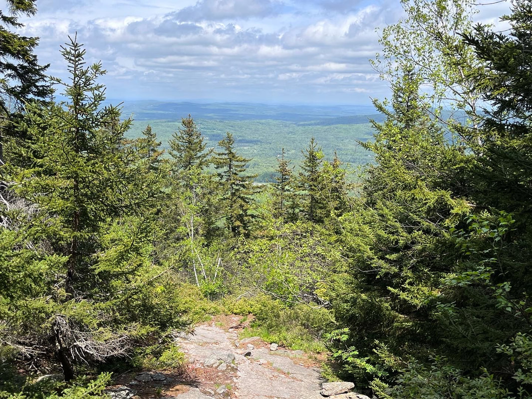 The next day we slipped over the border and hit a couple of our favorite mountains. Set slightly apart from Mount Monadnock are two smaller...er...monadnocks; Pack Monadnock and North Pack Monadnock. We decided to take a out-and-back route from North Pack to Pack and back over North to the car. This started, incidentally, at the northern terminus of the Wapack trail, a 21.5ish mile trail that starts on Mt Watatic--the "Wa" in Wapack and one of my very faves--in Massachusetts. Here is what I have to say about this hike. Don't do it in your first few days out of Covid isolation! The trail elevation was, in the end, comparable to a 4,000 footer and the length--about 9 miles--was too. In addition, we were carrying heavier packs than usual to test out the packability of our new gear. Today we are both stumbling around a bit coughing... That said, it was a pretty good hike. The clouds and occasional rain kept us good and wet for the first two-thirds of the trip but as we stumped back for our second time up North Pack, the sun came up and the views were finally cleared. In this case I cannot blame the mountains for my difficulties. I blame myself for trying to do too much too soon. It is important to listen to your body sometimes. The foliage was excellent. We saw some flowering blueberry bushes, a number of lady-slippers, and a wide variety of ferns still un-scrolling for the summer. The company was excellent, too, and we ended our hike at a small brewery in the old Grand Army of the Republic building in Peterborough New Hampshire. The GAR was an interesting group. They knew that, of course, they would eventually pass on but they built and maintained some beautiful halls and spaces for their community. On Memorial Day weekend, it seemed to be a good place to be. We were going to camp one more night but with our general condition and some heavy weather coming it we took a pass, went home, and watched the Celtics lose on TV. 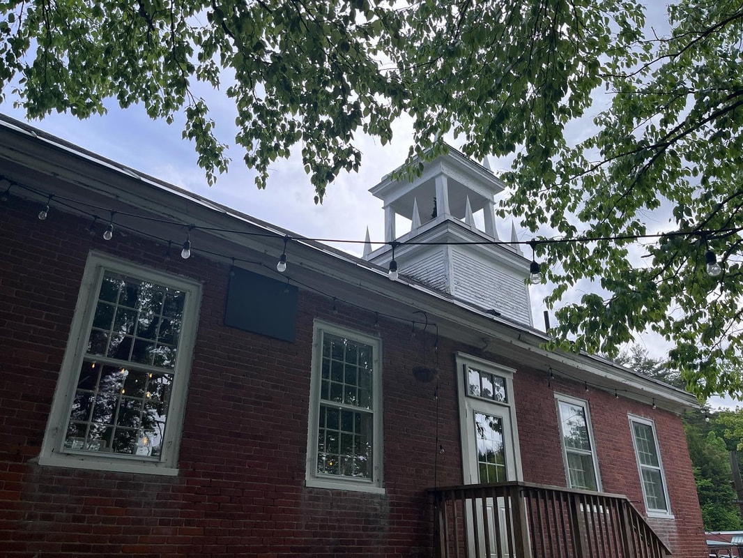 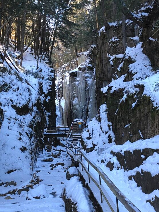 Flume Gorge in Winter Flume Gorge in Winter The experience reminded me to remind you--dear reader--that there are plenty of "non-list" hikes in NH worth doing. There are plenty of non-list hikes to do everywhere, but my MA hikes don't have a list other than my own and I will address those--like Watatic--in their own time. That said, in addition to the mountains on the Wapack Trail, here are some others I have enjoyed recently: Black Cap Mountain (and Cranmore): The top of Black Cap is the real draw on this short and relatively easy hike. We also hit "Mt Cranmore" which is really a lower spur of Black Cap and home to the Mt. Cranmore ski trails. Arethusa Falls: This is not a mountain but...it is a fantastic hike with a lovely waterfall at the end. It is, however, more of a hike than one might at first think. Eagle Mountain: There are probably a few mountains with the same name so I will be more specific. You access this trail from behind the Eagle Mountain Resort--a cool old hotel--in Jackson. It only take an hour or so to do but it is a fun hike if you have a short time window. The link is to the resort. You deserve it. Flume Gorge: We hiked this mid-winter so did not hike through the gorge. Instead we hiked above it and looked through. It was a fabulous hike with cool views. So there yah go! The next time you are in New Hampshire and don't want to spend your day bagging peaks but would like a cool view and a lovely walk, I recommend doing all or any of them. Just don't do it when you are sick. 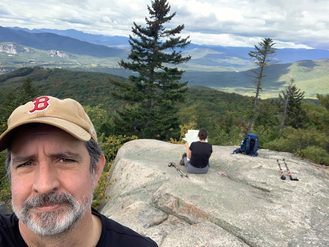 Hanging out on the top of Black Cap Mountain, N. Conway, NH Dear Folks, I am in the process of catching people up with some early hikes and other encounters with nature that I thought people might find interesting as part of a "How It Began" (HIB) series. Mostly this will describe specific hikes and perhaps some lessons learned along the way...if there are any. They are meant to be short and, perhaps helpful in some way to other hikers or fellow-travelers. I will post the dates of when I hiked a specific mountain since the ones in this series are NOT posted at or near the date hiked. 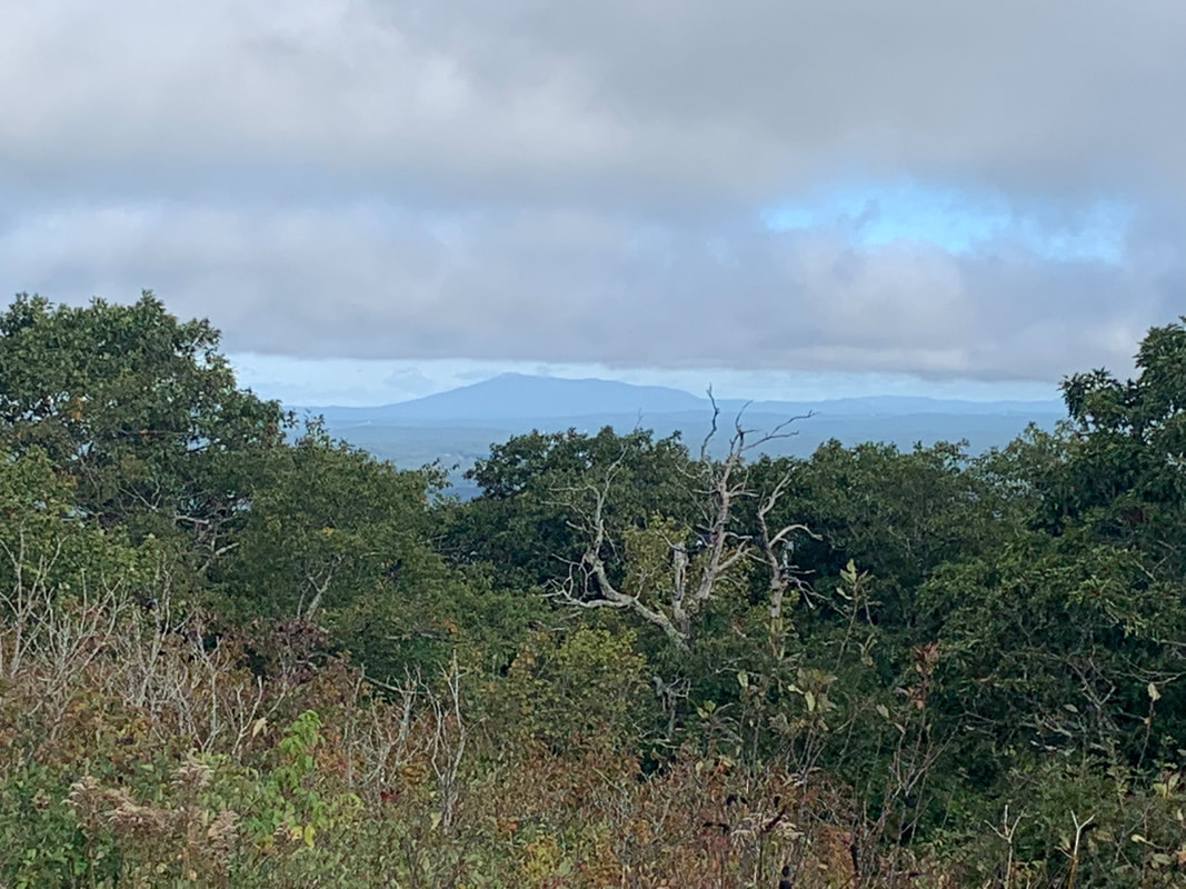 Wachusett's View of New Hampshire's Mount Monadnock in the distance 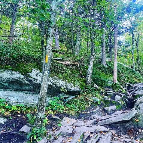 SEPTEMBER 21, 2021 But special I remember thee, Wachusett, who like me Standest alone without society. Thy far blue eye, A remnant of the sky, Seen through the clearing or the gorge, Or from the windows on the forge, Doth leaven all it passes by. Nothing is true, But stands 'tween me and you, Thou western pioneer, Who know'st not shame nor fear, By venturous spirit driven, Under the eaves of heaven, And can'st expand thee there, And breathe enough of air? Upholding heaven, holding down earth, Thy pastime from thy birth, Not steadied by the one, nor leaning on the other; May I approve myself thy worthy brother! from "A Walk to Wachusett" by Henry David Thoreau 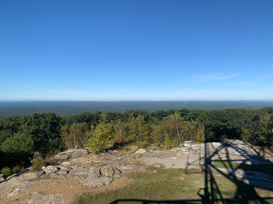 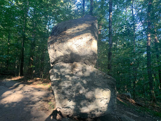 The less-photographed side of Balance Rock The less-photographed side of Balance Rock I don't really know where to start with this mountain. I have hiked it a number of times, sometimes with family and sometimes alone. This particular hike was a solo one on a fabulous fall day. I took some time at the top to work on a sermon before hiking back down to have coffee with a friend and colleague who lives and serves nearby. Wachusett is a monadnock, which is to say it "standeth alone without society" in Thoreau's words. Monadnocks rise up as a single hill in an otherwise lower landscape. There are a number of these in the area. Two of which--Watatic and Monadnock, itself--will be written up soon. This means that--much like the ridges of the Pioneer Valley--they have an unobstructed view in spite of the relative shortness of their peaks. My trip was about 4ish miles (give or take a mile). I started at Balance Rock Trail (because I am sucker for big rocks) and headed up Old Indian to Semuhenna to West Side Trail back to Old Indian Trail to the top. After exploring a bit, I settled on to the observation tower to do some work and to eavesdrop on a group of birdwatchers who were cataloguing raptors. My way down was even more of a ramble. Be sure to have a map with you. There are a bunch of trails leading to different locations and trailheads. Honestly it wasn't my favorite trail up. That would probably be Harrington/Mid-State Trail. However it worked for the day. 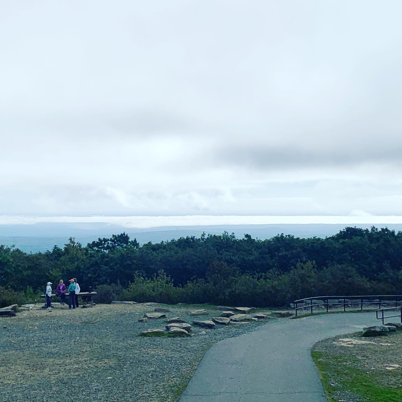  The one thing that is worth noting is that Wachusett is a ski mountain. In this case that means that there are many great views that would not otherwise be possible, thanks to ski trail clearings. On the other hand...it is not as remote or wild as Thoreau's time. It is an extremely accessible place, with both the good and the bad that go with that. Unlike even many ski mountains, it has a parking lot at the top. It can be a bit jarring walking off a secluded trail and encountering a scrum of humanity and their cars. This is still Henry's "Watchtower of Massachusetts" but now...it actually has a tower on it. I suggest weekdays in the morning. Then there are fewer people. That said, I do love this mountain. The walk up and down is always worthwhile. Both the views and the foliage are worth pausing and examining. Fall is best, but spring is nice too. Summer and winter can be a bit chaotic, but other people experiencing and loving nature isn't the worst thing, right? Update: I have been up Wachusett since I posted this and--in April of 2023--I made a short video of a slightly different hike from the one described here. I ended up on the same peak...but it was quite a bit longer. Here it is! Dear Folks, I am in the process of catching people up with some early hikes and other encounters with nature that I thought people might find interesting as part of a "How It Began" series. Mostly this will describe specific hikes and perhaps some lessons learned along the way...if there are any. They are meant to be short and, perhaps helpful in some way to other hikers or fellow-travelers. I will post the dates of when I hiked a specific mountain since these are NOT posted at or near the date hiked. 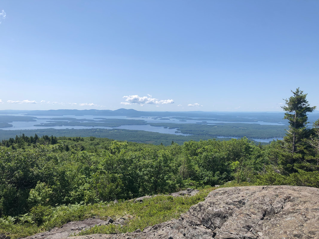 JULY 24, 2021 I hiked Mount Roberts to test my back a bit before going on to other things. Previously I had done smaller mountains on my way to rehab and things had held up OK. Roberts was the first of the "52 With a View" list, which served as a bit of a motivator as well. I had actually climbed a few of them before--like Monadnock and the Moats--but this was the first time I was aware of the list (and the first after surgery) so it was the first I actually counted. My wife had been (and still is) climbing the mountains on the slightly larger "New Hampshire 48" 4,000 footers list. I am too now, I guess, but in the beginning--and still--I was/am attracted to the somewhat more accessible but still challenging list of New Hampshire mountains under 4,000 feet that always promise a view. A rather popular mid-sized mountain for NH, Roberts is 5.2 miles round trip with about 1,400 feet of elevation gain. The actual mountain is 2,584 feet tall, so fairly substantial with some guaranteed (by the list) views. Parking is also easy, and can be found at "Castle in The Clouds" which is not a castle, but a park located in Moultonborough. The hike, itself, is fairly straightforward although finding the trailhead can be a bit of a challenge. We ended up starting on the way to Mount Shaw but were set right by a local. I remember the grade feeling steep but doable. I may not have found it so rough today but, as I said, it was the first relatively substantial hike I took for my rehab. There were a few views on the way and a nice ledgey area to sit for a while. I remember being pleased to get to the top but a bit deflated when I realized that the group coming up behind us also trucked along some lawn chairs for a picnic. Aspirations right? All told it was a good trip and I highly recommend it. The few other hikers were well behaved and we all gave each other space. The way up was manageable and the view was worthwhile. I had no profound revelations while I was up there but, still...worth doing again. 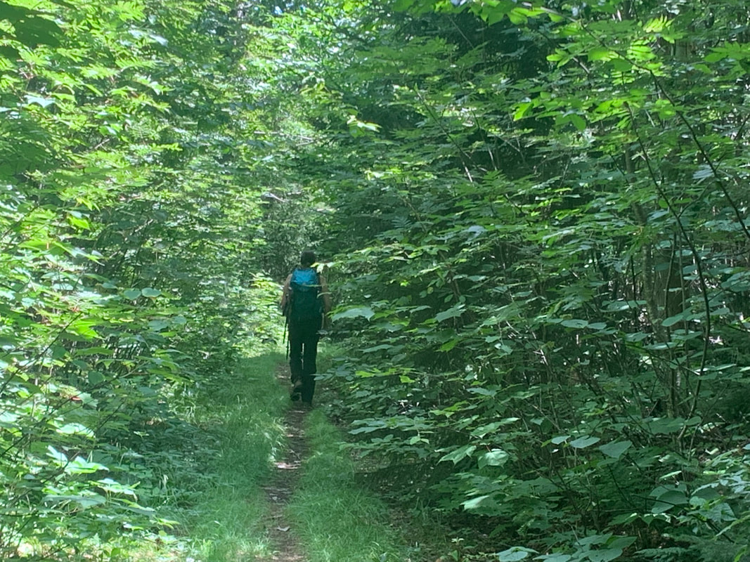 |
Adam Tierney-EliotI am a full-time pastor in a small, progressive church in Massachusetts. This blog is about the non-church things I do to find spiritual sustenance. Archives
March 2024
Categories
All
|
 RSS Feed