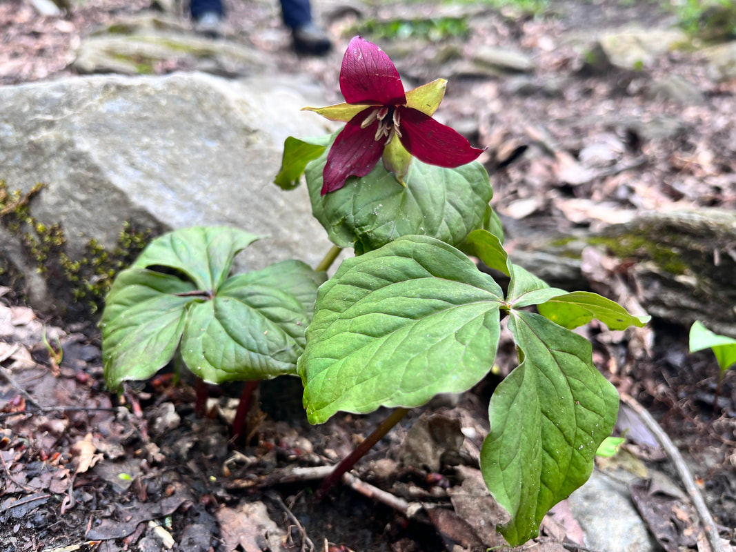
 Hiked on May 5, 2023 One of the ironies of our current hiking project is that I don't get out to western Massachusetts very often. Part of the reason is that it feels so far away from our home in the east. While it is closer to us than many of our New Hampshire hikes, it still feels farther. That said, we finally got out to hike the famous Mount Greylock. We had driven up--because that is a thing--but it was special take the slow route. I am glad we did it. Greylock is the tallest peak in the state and, while it doesn't break 4,000 feet, it has the atmosphere of something larger. Our primary reason for choosing this particular day had to do with flooding in the north. All these big mountains release massive amounts of melted snow this time of year. Greylock does too. However there had also been massive amount of rain in northern New England making both hiking and driving difficult. The southerly position of our hike today meant that not only did we not have much rain, we also were on a peak where the snowmelt had already occurred. So... here is our hike! I highly recommend it, particularly if you live in the Bay State. We have many pretty and impressive natural sights that sometimes get neglected for what is right above us on the map. We should be proud of what we have!
0 Comments
Hiked On 3/1/23 Anyone who has spent time in the Pioneer Valley in New England has seen the proliferation of long ridges that spring up from the otherwise relatively flat landscape. Most of these are good hiking. Over a week ago I was in a car traveling north and noticed a particular ridge that looked promising. Further examination revealed that it is the location of the "Poet's Seat" a castle-folly and the monument to the relatively forgotten 19th Century Romantic poet Frederick Goddard Tuckerman. A few days later--on an appropriately romantic and rainy day--I went out to walk and explore.  It really was snowing and raining for most of the time. However, the gray moodiness for this hike worked well. The trail along the long ridge undulated and the the snow shifted slightly under my feet. The rain and mist rising up from the warming snow was atmospheric, creating the sort of atmosphere that must have inspired a writer like Tuckerman. He preferred to keep to himself, after all. In 1860 when he published his first and only book--perhaps unimaginatively named "Poems"--he received a confused response. Many of his friends and acquaintances among the New England Literati didn't actually know he was a serious writer before their complimentary copies arrived. Tuckerman's book was only a mild commercial success. The response from his transcendentalist and romantic friends like RW Emerson, Jones Very and the Longfellows indicated that he had potential. However, only Nathaniel Hawthorn seems to have actually enjoyed it entirely. That said, most saw moments of brilliance, particularly in his collection of sonnets. They praised his close observation of nature. Later he would be described as a writer of herbariums. His focus on the minutia of the natural world could--when his writing was on point--create an immersive effect prized by readers of the day. His description of beans--in a poem ostensibly about coffee but really a story about some local characters--is typical of that work; "The bean, the garden bean I sing-- Lima, mazagan, late and early Bush, butter, black eye, pole and string Esculent, annual, planted yearly" He was also known to make up place names and allude to people he invented as if they were from the Bible or ancient literature. The dude could create a world, which is something that--as a gamer and reader of speculative fiction--is something I can get behind. 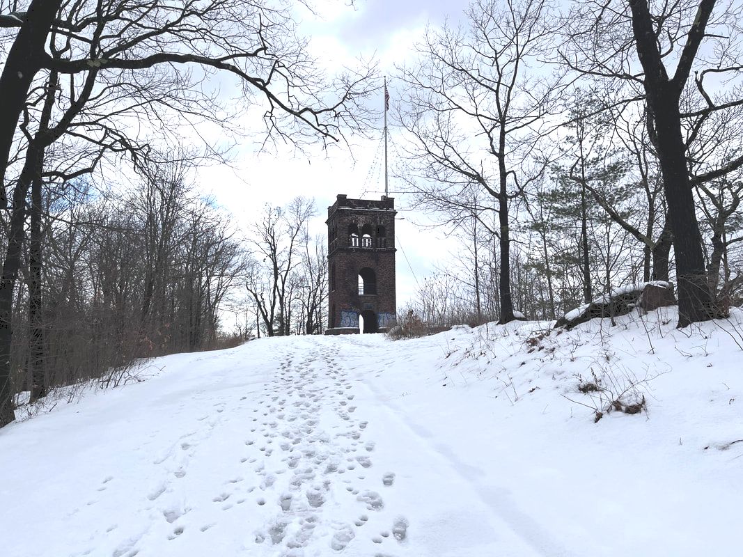 That said, not all was happy in his life. Most of his poetry is dark. His later poems--after the death of his wife--are even more gloomy. As a young man he retreated out to Deerfield to be away from society and from the many connections cultivated by his family. He was the brother of a famous botanist, Edward Tuckerman, and a composer, Samuel Tuckerman. Henry Tuckerman--another writer--was his cousin. Far from Boston, apparently, he could be his romantic self. In the early 20th Century, Tuckerman was rediscovered...or...in some ways discovered for the first time. But the discovery was brief. At least it got him a monument, right? Now you can find his work in some anthologies of poets from the era. However, the easiest way to read him is to get his one book for your e-reader. After all, it is free online. There is more about Tuckerman and about the hike in the video below. Also, I turned it into a podcast 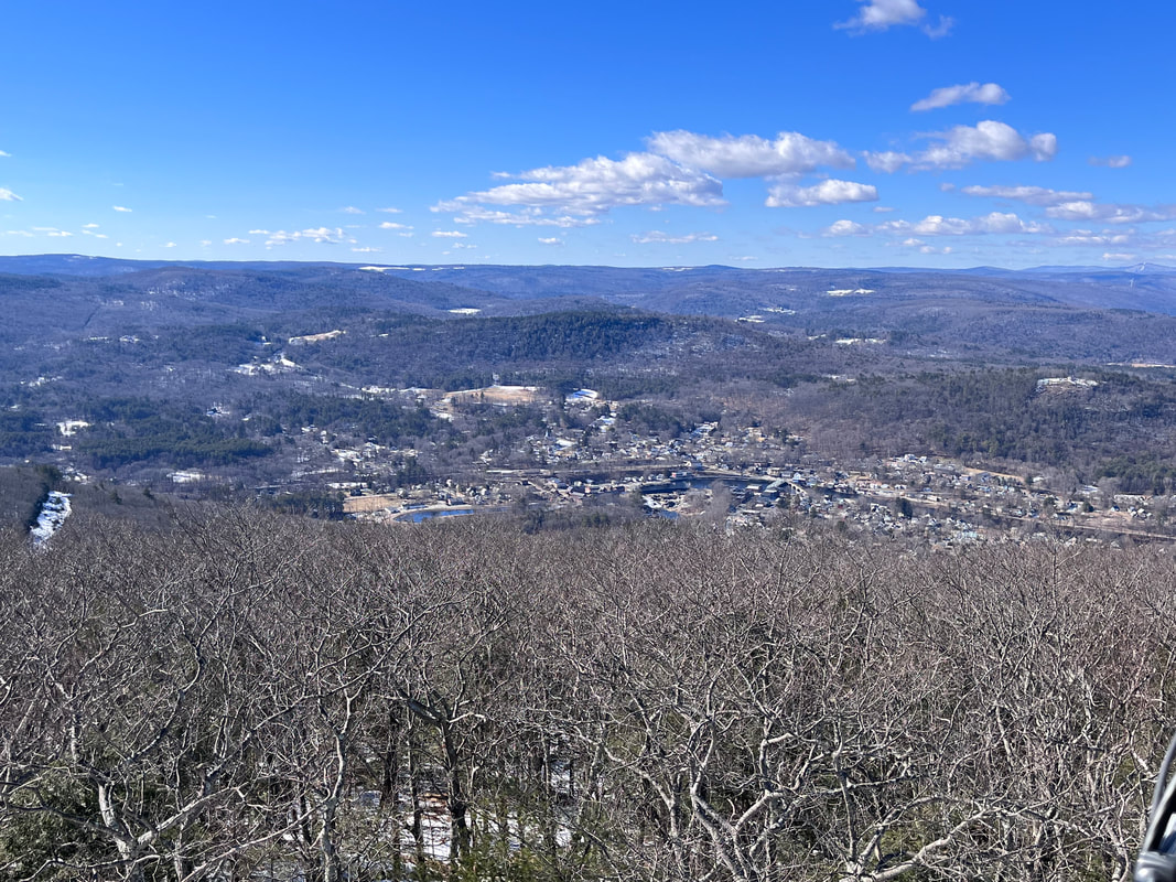 The view from the fire tower at the tiny Massaemett Mountain.  The hike over to Massaemett wasn't entirely covered in snow. There were areas where the sun had done its work! The hike over to Massaemett wasn't entirely covered in snow. There were areas where the sun had done its work! Hiked on February 14, 2023 This was a spontaneous hike. Thursday's weather looked hideous as usual and I wanted to see the sun! I decided, therefore, to hit Route 2 and head over to the High Ledges Audubon Wildlife Sanctuary on a Tuesday to catch the view. I had been saving it for a perfect day...and this was pretty close. The loop I chose was around 5 miles and featured an undulating landscape with a small mountain, a fire tower, a valley, and some hills. The snow was fairly compact to start and then it got loose as the air warmed it up. This made footing a bit of a challenge...and I brought out the micro spikes. I could use the workout though. There has been quite a bit going on. The church is wrestling with some big questions. Finally, I have a few weeks of sabbatical starting soon. I will give thought to the church's questions then and add in a few of my own....  I got turned around right about here. Very pretty though.  Another view from the fire tower. It looked a bit like a prison on the inside but to look out was fantastic... Another view from the fire tower. It looked a bit like a prison on the inside but to look out was fantastic... Lately I have been thinking about life-changing moments. Specifically those times when we make a decision to leap into the abyss and become a miniature or occasional "knight of faith" in the old formula of Kierkegaard. There are times when our lives change because of something that happened to us. However, when we are able to exercise of free will, our moments of decision change the trajectory of who we are, how we are perceived, and maybe who other people are around us. These decisions aren't always drastic. This is a good thing. People can wait their whole lives and miss the turning points if they believe that our choices only come in large sizes. Sometimes we hardly notice them at the time. Either way we make them, don't we? They are the beats of our lives. Looking back they are the decisions we mark to say that life was different afterward...in some way large or small. I remember deciding to become a minister at the foot of Doubletop Mountain in Maine when I was 19. It wasn't momentous at the time but there I was...and here I am. I just went for a walk in the evening and decided that--given my interests and my emerging skill set--the parish and I would be good for each other. My ministry outlived the campsite we stayed at. It seems to be a much bigger deal now. A short time later I met my future wife at a meeting of college activists. In an uncharacteristic fit of optimism, I thought I would like to get to know her better. Turns out I didn't make much of an impression on her at the time...but here we are three decades later. There are decisions that change our lives in smaller but still-lasting ways. I remember the first time I played the ukulele in the middle of a sermon. Everybody was surprised. These days--many music ministries later--it isn't a big deal anymore. The same can be said for Dungeons and Dragons Club and the "Snow Posse" (sidewalk shoveling) youth group events that grew into something for a few years then seemingly faded away. Those youth are grown up now and some keep in touch. I am always pathetically happy to see them when I can. Two of the gamers now help me teach their parents in "adult" D&D. Maybe it didn't fade after all. Each of these decisions and many others started small and even commonplace. What grew out of them was a life. I feel like there will be a few more decisions like that soon. Maybe I will make them. Maybe someone else will. Right now with the church it feels like many, many big decisions are coming down the line. However, it will be the small ones that lead to another and another that will determine our future.  Looking down from the tower toward the trail which runs by the telephone pole. Looking down from the tower toward the trail which runs by the telephone pole. I say all this now because hikes like this are a series of small decisions. This week on a Tuesday I decided to get up and get going. I decided where to go. There were all kinds of micro decisions that helped me to focus on the day. How would I get there? Would I do both the out-and-back to the tower or just the ledges themselves? Was this a good use of my time? How would I deal with the vagaries of weather? Also, on this trip, I decided to do some more extensive filming. It has been a while. Many of you are aware of my interest in 21st century communication. This weblog is part of that. My podcasts are as well. For a long time I was into making youtube videos of sermons, church news, meditations, music and--during the plague--entire worship services. Sometimes this meant collaboration. At other times I worked on them by myself. I got into it through a series of small decisions that brought me joy. A series of small decisions may bring me back...or maybe they come to nothing. It is too early to tell. If we use the model of "Sabbath Walks" that I write and talk about here and elsewhere, all of these endeavors--these choices made and sometime pursued--fall into the category or "frame" of dialogue or creativity. On this hike, for example, the choice to film meant stopping and starting; recording sections of trail, talking to the camera while imagining future viewers, editing after getting home while re-living the excursion, and improvising a soundtrack. I had to make decisions about equipment. If I keep doing this there will be more decisions to make as some things may need replacing. There are many little steps. After all to even get to the point of recording there was research. There were skills that could use some improvement through repetition. That said, I am learning. While this decision may not lead to anything more, it just might...probably in surprising ways. After all, nobody thought the skills I learned from my "hobby" would help hold online worship together during the early months of Covid. Ultimately we found somebody more skilled. Of course, nobody thought that the skilled person we found would be a beloved former member of the D&D Club and the Snow Posse who had moved away. Decisions keep on rippling out, don't they? Anyway, I have included the video. I think it is pretty good for a first attempt! I also started a Sabbath Walks YouTube page that you can subscribe to to get notifications. Just click on the video above and hit "subscribe." I may decide make more of these moving pictures. We shall see. Both I and the church are looking for ways to communicate. Perhaps this is the way. Here is to your decisions and dialogues. I hope you have found something to bring the sabbath "walk" to life regardless of what it is or how you go about it. Many blessings on your travels until next time. I will see you out on the trail. 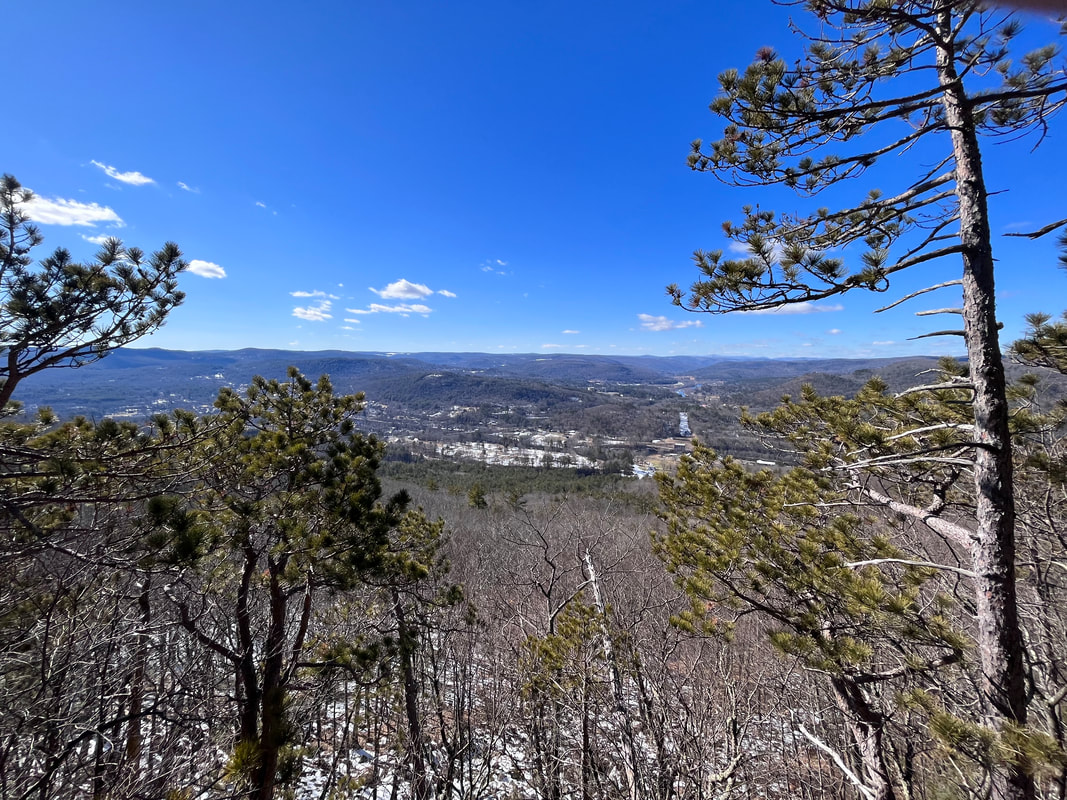 Finally, a still from the an out crop of the ledges themselves, where I took a break. There are better pictures in the video. 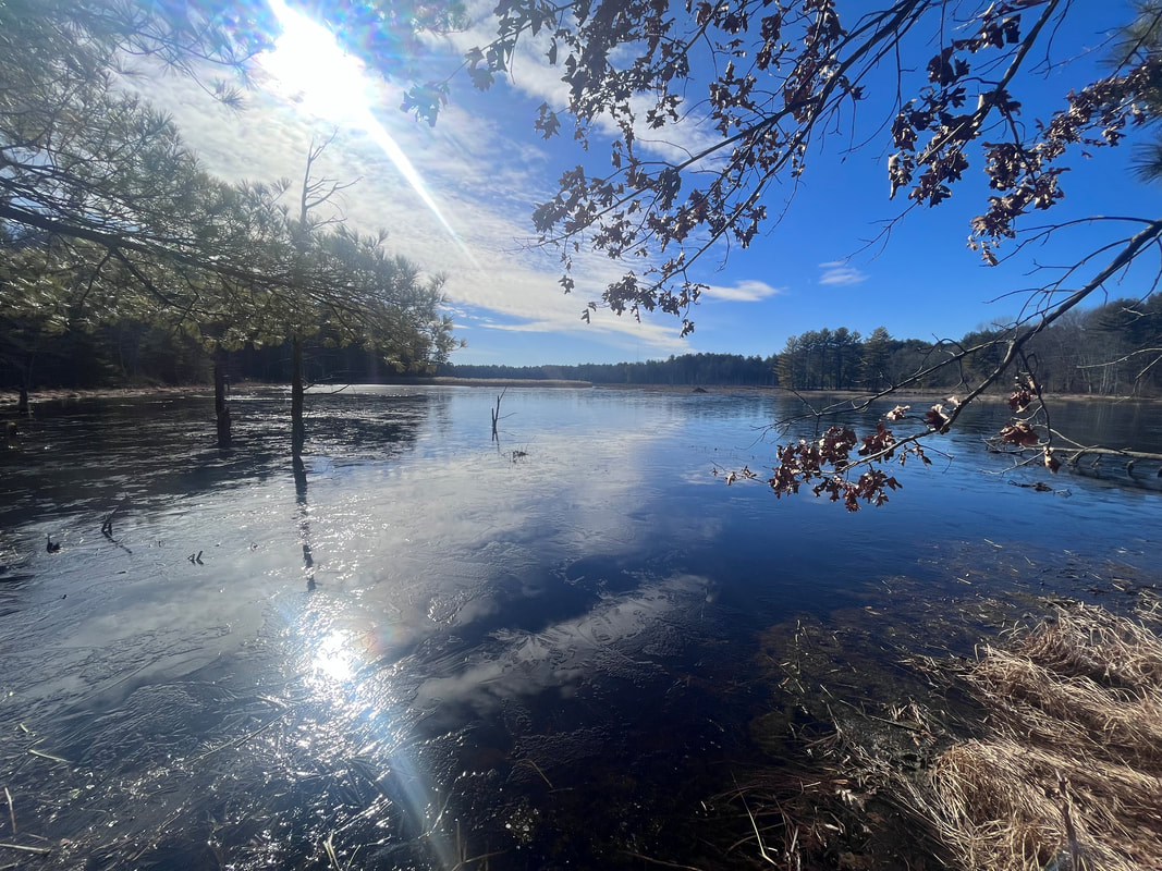 This is the first glorious view of my walk through the Assabet River Wildlife Refuge. It was lovely and might be an easy half-mile out and back for someone. Hiked on February 2, 2023 Somewhere along the way of this project, it appears that at least a few people got the impression that I am particularly rugged or outdoorsy. I am not of course. I am just a suburban dad transitioning to empty-nester with a bad back and sore knees. I prefer a room and a bed--preferably my own--to a tent or sleeping platform. It is just that I find the Transcendent in nature, and that helps get me through the week. I have been doing some workshops on Sabbath Walks. I have been pitching them as "mindful walking" workshops because the word "sabbath" appears to make some folk uncomfortable. Maybe it is because "sabbath" is a religion-word. I like it better, though, "mindful" is way too broad. Anyway, It is at these events--and the conversation around them--that I have noticed this disconnect. People will come up me to say it is all very interesting...but they cannot go on a big hike. Usually this is for physical reasons, which I totally get. The only issue is that I am not talking about hiking. I am talking about walking and even that has more to do with sitting. The process is all about perspective and intention. Are you paying attention to the world around you? Are you letting your experience influence your understanding through reflecting on your context? Then you are more than good. 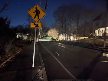 A glimpse of a night walk through my town. The whole place feels different in the dark. A glimpse of a night walk through my town. The whole place feels different in the dark. Actually I haven't gone on many big hikes lately. Work has gotten in the way. So has the weather. I do get out every week but all of my Sabbath Walks in 2023 have been in Massachusetts. It is a good thing that we have so many great opportunities to get out in nature here! Yes, it will be hard to cultivate "likes" in the same way when the views are less dramatic and the physical effort may also be. That said, I have enjoyed immersing myself in the land close to home. Some of the best hikes lately have been repeats. I trundled up Mount Watatic again and again. The Graces and the Crow Hill Ledges still stand out. One of the best walks I had was my usual four-mile round-trip stroll downtown...but at night. This made all the difference. What I really want to talk to you about though, is the Assabet River Wildlife Refuge. 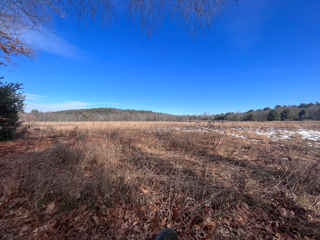 I took advantage of a bench to sit here for a while and have my lunch. It was quite the pretty spot. 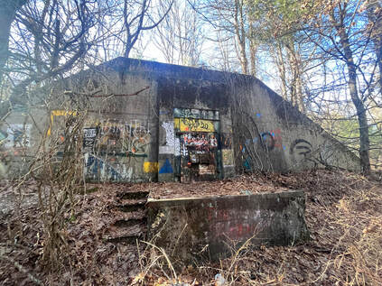 The bunkers off the main trail were covered in graffiti. Obviously they had been re-purposed as hangout spaces for people who wanted to get away. The bunkers off the main trail were covered in graffiti. Obviously they had been re-purposed as hangout spaces for people who wanted to get away. I have to say that I only recently really clued into its existence. I went over there because the weather in New Hampshire was turning dangerous and I also had the need to find something more accessible for a group Sabbath Walk in the spring. As I mentioned earlier, people think that these walks need to be challenging. They do not. I was--and am--searching for places where a person could walk a few feet to find a pretty place to sit. If they wished, they could move on for a more challenging workout...but they wouldn't have to. When you are in a group you need both "easyish" and "hardish" options, so everybody gets what they want or need. Now, on this hike I had expected to see wildlife...and I did. What was surprising, though, was the large amount of evidence of previous human habitation! Many of the trails were unusually wide and there were patches of old, cracked pavement in places. Also, right where I parked was the foundation of an old tavern dating back to 1700. However, the most remarkable thing was the proliferation of immense concrete bunkers tucked away in the forest. Each had a massive metal door that was barred and locked like some dystopian Hobbit hole. Since my trip I heard from friends who had been in one. The description seems to fit as they appear bigger on the inside. The one they visited was vast, cold, and oppressive. 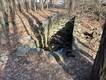 The foundation of the Rice Tavern. Erected in 1700, turned into a house later, and torn down in 1945. The foundation of the Rice Tavern. Erected in 1700, turned into a house later, and torn down in 1945. Now, I later learned that there were 50 of these bunkers in the park. Therein lies a story. First, of course, this land was wilderness. Then it was occupied by native Americans. Then, as Europeans came to this continent, it was a neighborhood for a long time. That is where the old tavern came in. Later Henry David Thoreau would pass through to visit friends. In fact, it stayed a agricultural community until 1942. Then, as the Second World War heated up, the land was seized by eminent domain. The people were moved. There were about 100 of them and they claim their compensation was 10 cents on the dollar. Their houses and the tavern were destroyed. In their place were those big bunkers, to store ammunition for Fort Devens. After a while this annex was sealed off and abandoned. Finally, in 2005, it was opened to the public. When I told this story in church and asked if anyone had been there only my eldest son raised his hand. His high school cross-country team ran there. Otherwise it is a new park to pretty much everyone I know. 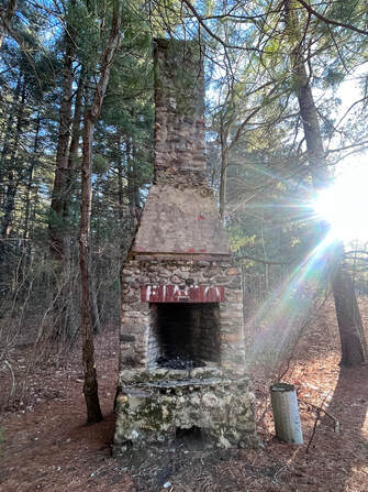 I found this near a fishing pier. I found this near a fishing pier. As you walk along its trails today there is all this evidence of the past. There are so many layers of humanity. Some of those layers tell peaceful stories of life lived in the usual ways. Others tell stories of fear, displacement, and violence. Now, the story of this refuge can be read as a parable. With any good parable we have choices to make about how we approach it and where we see ourselves in it. We can imagine ourselves in the position of The Native Americans, or the early colonists, or the neighborhood right before the war...all of them swept away. Perhaps instead we could see with the eyes of those massive bunkers stubbornly demanding our place in the midst of the wilderness. They are solid, powerful, obnoxious even…but largely irrelevant to the world moving around them. Or…we could see ourselves in the refuge, itself; adapting to our current context to serve current needs and connecting to the ecosystem that sustains us. Whatever we choose--and at times we have probably felt ourselves in all these categories with more besides--this walk reminds us of the fullness of time and the power of creation to alter our understanding of what "truth" is. It is a thoughtful place for a walk, or a sit, or a stand. I spent a couple of hours there. Then I went to a bar and wrote the beginnings of a sermon--here is the podcast version--with this story as its inspiration. That is what is supposed to happen on a sabbath walk. There should be a physical and mental challenge, then a new insight gained and a dialogue created. We make sense of our reality through reflection, after all. \My step counter says I walked 8.5 miles and there was much more to explore. I will definitely be back there soon. 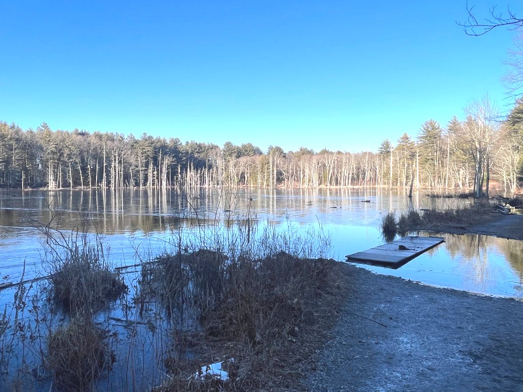 Near the end of my hike I had to do quite a bit of log-hopping to keep my feet dry. The Assabet River is mostly reeds and marsh at this point...and it floods a bit...  Thoreau actually wrote a poem about travelling though this area. The Old Marlborough Road exists as a road outside the preserve, but inside it continues as a perimeter road to the park. I hiked it. It was mostly quiet, with a few strollers and fat bikers. Anyway...here is the poem. It isn't necessarily one of his best, but it helps to give life to the people who used to live there. Also the page describes the area a bit. In my sermon I said the refuge is in Sudbury and Wayland. Of course it is actually in Sudbury and Maynard. After twenty years living here my geographical references are still those of a Mainer. By way of reparation, the link is to a Maynard historical site. Update: I finally got around to making a video of my most recent hike here. So if you are interested...here it is! 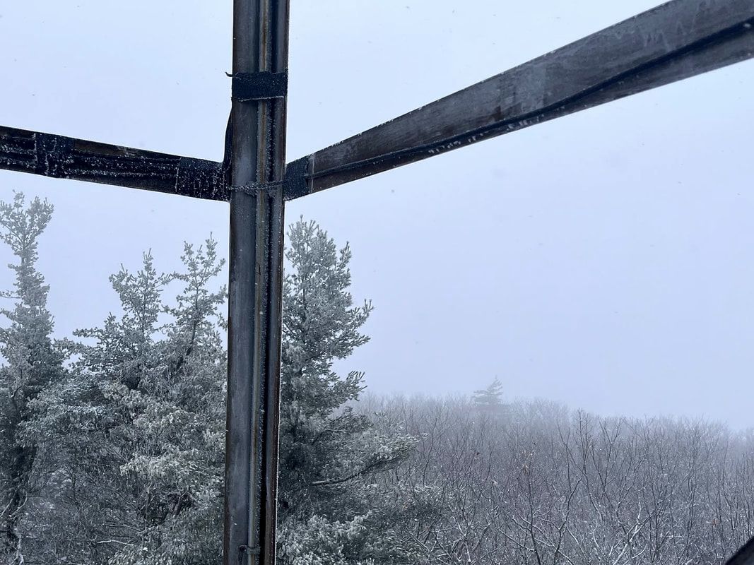 Other people's views from this point are spectacular...I promise. Hiked On January 12, 2023 One of my mentors in ministry told us that on his sabbath days he would put his canoe on top of his truck and drive it through the middle of town. Sometimes he would take his canoe fishing, which is what everyone assumed he was doing. Sometimes he would just paddle around and go home. Sometimes, though, he would drive his canoe to Bangor for a bagel and a coffee with friends...and maybe a trip to the seminary library. He told this story to convey four things. First, that the people of Maine are all pantheists at heart. As a Mainer born and raised I can confirm that this is true. Second, that people may not always respect your "off" time but will do their darndest to respect your sabbath time. Third--and this is where the canoe comes in--in a town of pantheists, a canoe on your truck means you are fishing...and fishing is sacred. Finally, the lesson was that you are best off leaving the parish come sabbath-time. That way folks will not be able to get in touch with you as easily. Also--more importantly--you will be away from the things that draw you back to your labors. 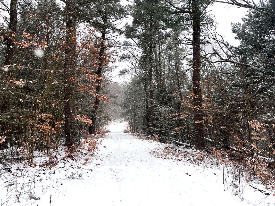 A bit of the early snow. It got more intense before finally trailing off for a while. 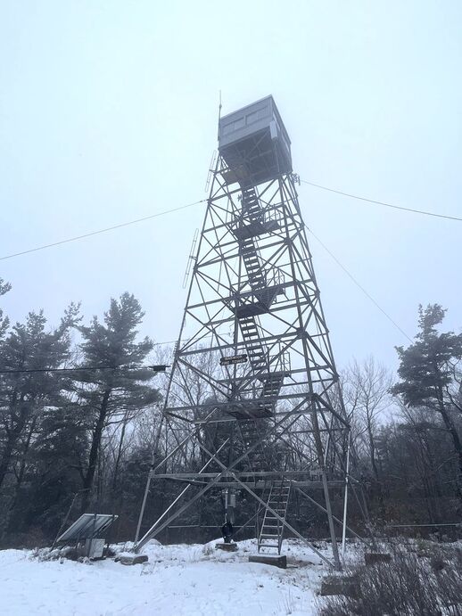 The peak of Mt. Grace The peak of Mt. Grace I thought about that yesterday as I tried my best to tie up loose ends in the morning and hustle out the door for my weekly sabbath hike. "Weekly" is a New Year's goal. Unfortunately, though, I was already on "Plan D" as plans A through C were left in tatters. Mostly the problem was weather up north, but the skies in the Bay State weren't looking so bright either. Little flakes of snow on my windshield indicated that perhaps the northern storm was going to make an appearance after all. Also, my hiking buddy, Andy, couldn't get out of a meeting. So I was left figuring out how far I wanted to travel to hike in the snow by myself. The solution was to leave New Hampshire and Maine well alone and to stay in my adopted commonwealth. A slick and wooly drive down Route 2 brought me to the somewhat obscure Mount Grace State Park and a snow-laden hike up its eponymous mountain, then over to Little Grace, and finally back to the lot. Mount Grace isn't a bad name, but it is a bit unusual. The legend says its name comes from King Philip's War when the daughter of Mary Rowlandson died after being captured by members of the Narragansett tribe. Theoretically the mountain is named after this daughter. It is a romantic notion and ties into one of the major historical moments in and around the Pioneer Valley where the mountain resides. However, there is one glaring problem. Mary's daughter was named Sarah...not Grace. So the name of the mountain remains a mystery. That said, it is a powerful idea to ascribe to this mid-sized monadnock. Somebody in some way found grace here. Maybe we still can. 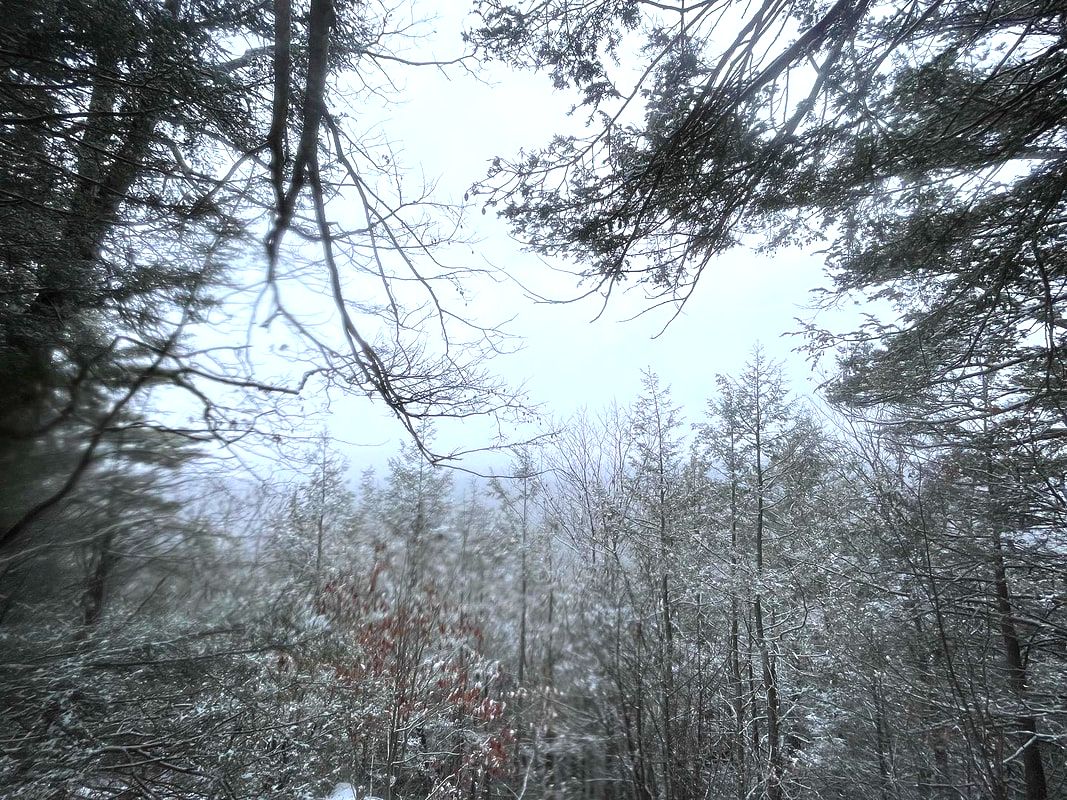 The water-damaged view from Little Grace. It was raining and snowing by now but I took some time, backtracked to check out some elusive views of farmhouses, then had a snack. 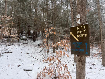 A sign for the New England Trail, a relatively short multi-day hike that I would like to do some day. A sign for the New England Trail, a relatively short multi-day hike that I would like to do some day. If you want to be alone in Massachusetts, drive west and go hiking in a snowstorm. There will be no people to bother you. The trail started out relatively flat but that changed quickly. It was quite a bit more elevation than what I experienced the week before. That, of course, was what I was looking for. It was the only part of Plan A that remained. Then the trail went on up along some power lines to the rather impressive fire tower. It was snowing heavily at this point so no view was to be had. Alas! Pictures indicate it is quite nice. I will need to come back some time. I did get startled a bit. When I turned around to descend the tower my long-suffering water bottle came loose and fell about 40 feet. It hit every available truss on the way down making a dramatic noise as it did so. After finding the water bottle that had submerged itself in the snow, I turned south along a row of power lines that marked the shoulder of Grace and continued on to the smaller peak. Little Grace also theoretically offers views. Every once in a while the snow would blow and eddy away. Then I could peer down into the valley where a number of farms were perched looking for all the world like landscape illustrations in the Saturday Evening Post. One thing worth noting is that--while this is indeed part of my "easyish" hiking list--there were a couple elements that made it challenging. First, there was that snow, which made both visibility and footing rather sketchy. This can be remedied by choosing a better day! However the next thing cannot be fixed so easily. The trails are arranged so that if you decide to climb both peaks and loop back to the parking lot, you will be climbing up pretty close to the end. On a traditional morning climb you go up and then down. This trail rolls up and down quite a bit, which might not be everybody's cup of tea. In the end--according to my imperfect calculations and because of some diversions I took--my total elevation for the day was around 1,500 feet. The feet came in installments across the miles instead of all in one massive climb, but that is more than a number of mountains on the 52 With a View list, including the "starter" peaks of Willard and Pemigewassett which I, at least, found easier than this. You can make it...but I confess to swearing a bit when I hit the last climb of consequence. The loop took me down the side of Little Grace and back around to the parking lot. It was a journey of small views, evocative precipitation, and unsure footing. However, I am glad I got out. Once again, for the second week in a row, I had the place to myself. I do not doubt that the pantheist in me appreciates this. I feel like I am keeping the spirits company on a cold, wet, lonely day. They certainly appear to be keeping mine. 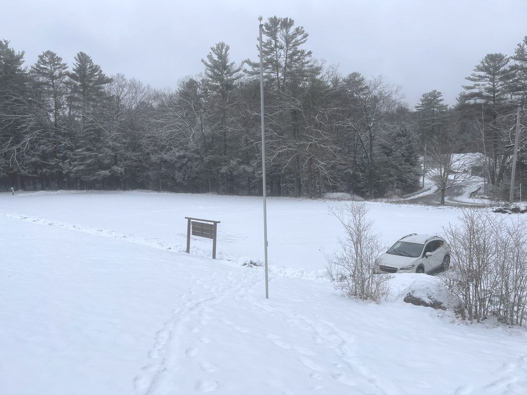 My car in the lot. Proof that the place was all mine for the day! The word "grace" has a number of meanings. In common usage we usually think of dancers or athletes, or people who are particularly well-spoken or well dressed. Perhaps those cues are why we tend to think of wealthy people as graceful even when we do not have much evidence to go on. Also, being gracious is what you try to do when someone else is being a boorish. These are all social, societal qualities. However, in the church where I spend my time, grace indicates the unmerited favor of the Divine. For Universalists--and I serve a congregation that is, among other things, Universalist--this grace is extended to everyone. The old-man funny, curmudgeonly, front-door thing to say now would be that grace was hard to feel on a day with heavy snow and no views. I certainly didn't feel graceful...but I won't go there theologically. There was plenty of grace to be found on these two mountains. In the dynamic display of nature going about its business all I saw was grace. Sure, I saw and felt a whole lot of nature, too. Yet the fact that both were present is not coincidental. I do not love winter hiking, but I love this grace that is sometimes hard to immediately locate in people and in the institutions people make. Yeah we all have it, or have access to it anyway. It is "freely given" and I don't mean in some reductive Christian sense. Grace is just present all the time for all of us. Mostly we don't experience this presence. It takes time and the cultivation of relationships to see and feel it around us. It takes the growing of love between each other and within ourselves. This wild morning reminds me of the blessing of grace. Maybe it will help provide the charge forward for another week. I suspect that on those trips to Bangor my old mentor also snuck some work in on his sabbath day. I get that too. After my hike I spent the afternoon wearing out my welcome in a number of warm dry places where I could write. The draft of this post was one thing. Another was the draft of my sermon for Martin Luther King weekend. The morning reminded me that finding grace in ourselves and each other is more than an attempt at personal wellness. It is instead an important attitude on the path toward justice. Grace leads to love and love to trust then on to community...or at least that is the direction the sermon went. May we all find ways to be this kind of graceful; not pretty and charming but bold and challenging as we expand and strengthen the web of connection--the world community--that surrounds us. 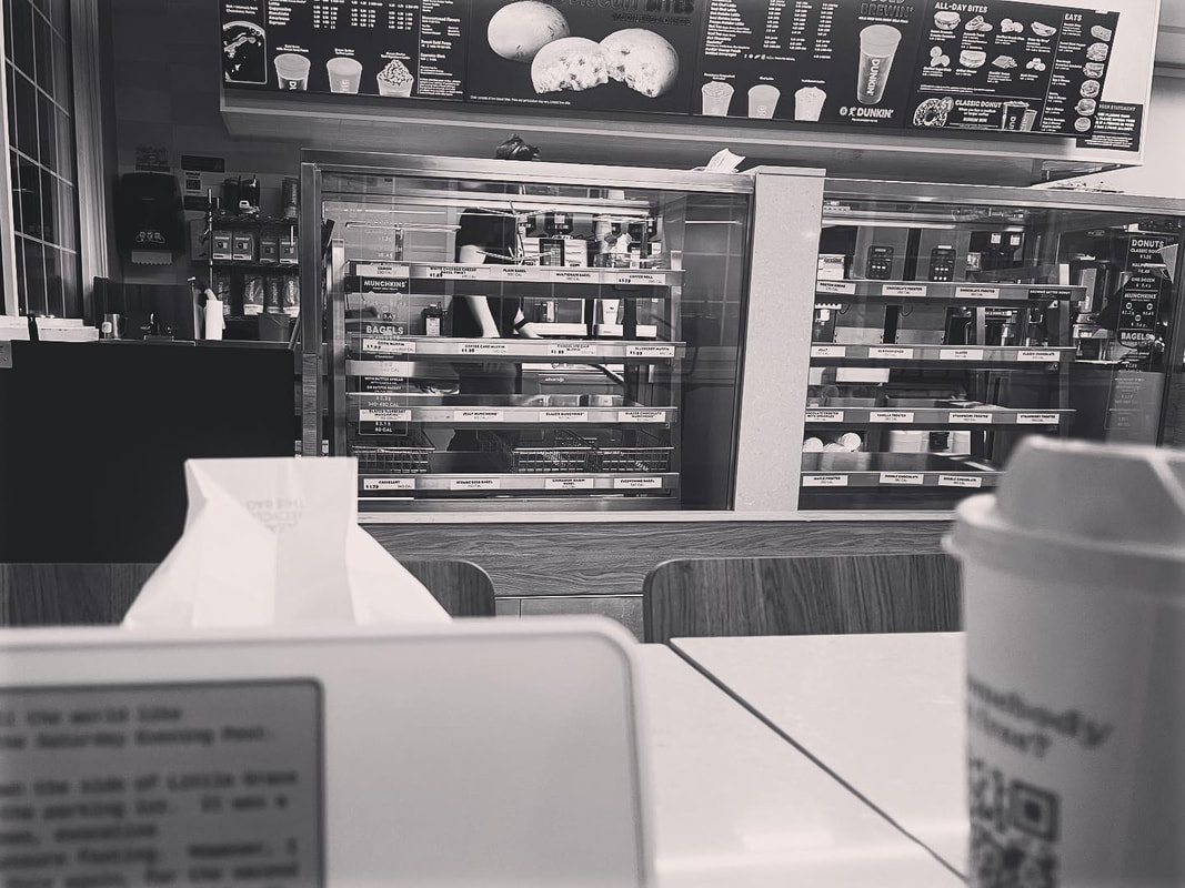 The last writing stop, where even the stale donuts were gone... 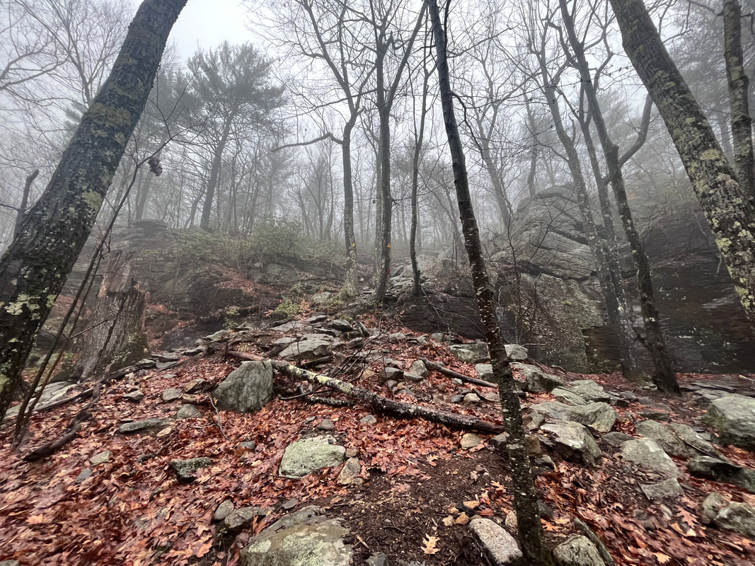 The whole trip had a soft mist or a gentle downpour. Very evocative...  Rock Tripe has a great name. It is edible, sorta, if you boil it enough to remove its flavor and "purgative properties" but it has indeed saved lives. Also, this one looks a bit like a dragon... Rock Tripe has a great name. It is edible, sorta, if you boil it enough to remove its flavor and "purgative properties" but it has indeed saved lives. Also, this one looks a bit like a dragon... Hiked On January 5, 2023 It is hard to get going sometimes, isn't it? Getting ready for church on Epiphany Sunday even my brain felt bloated and out of shape. Two Sundays went by without a service. How do I do this again? Why do I do this? In the end it was fun. I preached about beginnings and about not falling back into the same old ways of last year. After all, the old patterns may not be so hot. The band also did a pretty good job leading Good King Wenceslas. It is ostensibly a Boxing Day carol --"Good King Wenceslas looked out on the Feast of Stephen"--but really it's just cool folk tune about the legendary Duke Vaclav of Bohemia. Anyway, hiking is like that too...but worse. I mean, it has been over a month since I put in any really serious reps hiking. I have been to the gym a handful of times and did those Solstice Walks but sometimes I worry that I won't really get back up to climbing shape. This isn't my favorite time. You know this. I would rather hike in "shoulder season" in the spring. Winter is here, though, and getting out is important. 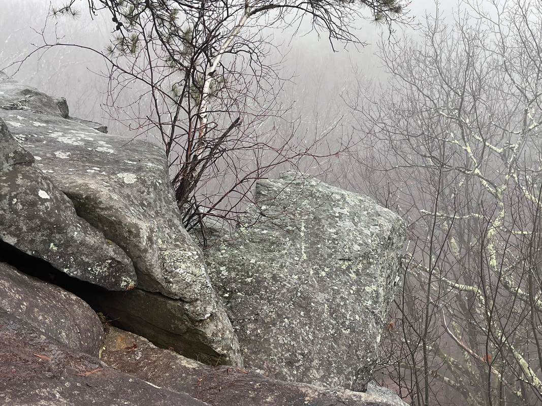 There was no view, really, from the ledges. However the fog accentuated the foreground nicely. 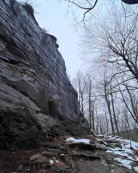 Near where the cliff climber was. Near where the cliff climber was. On Thursday I concluded that I could probably clear a few homiletical cobwebs as well as partially arrest my downward slide in health and fitness by taking a good walk. Maybe I could shock myself back into action! I put my heavy pack on and drove back out to the Leominster State Forest. There I continued the loop that I started a couple weeks earlier. The total hike was about 3.8 miles and 600ish feet of total elevation. So not a big climb. However, I am out of practice. My knees hurt at the end. The thing about this loop up the Crow Hill Ledges is that it features a short, steep section at the very beginning. I guess it could be at the end instead if one takes the loop the other way. I like to climb up rather than climb down, though. So I always choose the hard part first. After that things roll a bit along a long ledge. There are obscured views through the tree trunks that wouldn't be there the rest of the year. On this day, though, many of them were still socked in a bit by rain and fog. The crisp, clean wintery air had been replaced by, well...shoulder season weather. It felt like early spring. 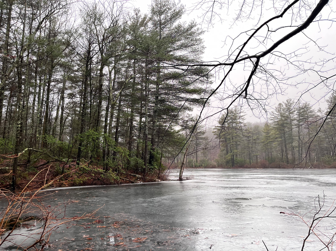 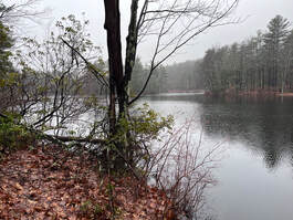 Still, it was more than nice to be out and about. Parks like this are very popular on nice days, so a little inclement weather meant that I had it to myself for the most part. There was a college kid scaling the massive cliffs and a couple different people walking their dogs on the flat. There was also the constant sound of traffic from Route 31. That aside, though, the fog added a mystical quality to the hike. The landscape--now wet with rain rather than covered with snow--looked very different from the last time I was there. Once again I wandered about a bit, exploring the side-trails and looping around the local swimming hole still holding on to a little ice in spite of the relatively warm winter weather. I felt like I could spend all day there. In the end I didn't spend the day. In fact, it was already pretty late when I arrived! Technically Thursday is my sabbath. However a variety of errands and tasks early in the week--start up stuff for the church mostly--had pushed quite a bit of work into the morning. Once again this made me late. Just like last time I found myself pulling out my headlamp on the way back. The rain had made the journey a perpetual dusk until the dark appeared. Then I drove to a Dunkin' Donuts for dinner and to write my sermon. Still, at least I achieved my goal. I got out and did a thing. I had a small adventure. I cleared my head enough to get the most creative parts of my job done. Maybe this trip will beat back the inertia. Maybe this year won't entirely be a slog after all. Update: I recently made a video of a hike that was similar to the one described...here it is! 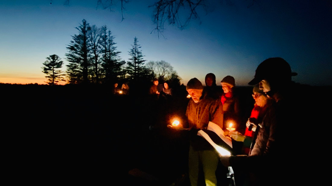 Singing on Pegan Hill in Natick, I love these people and I love singing. I think Tod Dimmick took the photo though, as I was playing the ukulele at the time... It was winter solstice Wednesday. Solstice is a holiday that flies under the radar in these parts, but not necessarily everywhere. In a way we all celebrate it. It is at the root of all the December holidays. When it does pass unnoticed, it may simply be because it is the rare holiday built on scientific fact. Thanks to the special relationship between the earth and the sun we have a "shortest day". No god in his chariot made this happen. The forces of ecology and personal biology make this a particularly difficult time for may of us. That is the real reason for the parties, the festivals, the light in the dark. Since the birth of the solar system--roughly--there has been the fact of winter. It is a fact that we sometimes grapple with. Often it is a fact that changes and molds us. It deserves a moment of our time, doesn't it? These layers of legend decorating winter solstice, as beautiful as they are, can otherwise obscure a primal element of human existence. The dark comes. So, too, does the cold, the ice, and the famine. Therefore, it is good to find a way to mark the moment when the darkness recedes, even though the winter is just beginning. Doing so helps us to understand our place as part of nature. It also reminds us that the sun--and spring and better days--will also return in their time. 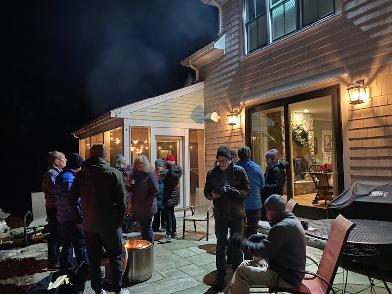 Tod again? I am in this one... For me, this year's observance of solstice came down to two walks. The first of these was on the solstice day, itself. Every year the church hosts some sort of walk to mark the occasion. It is a ritual, but it rests lightly on us. At our most hardcore--a few years ago--we would take a midnight stroll through the outdoor labyrinth at nearby Wellesley College. That was a hearty little group! Since the plague, however, we have erred on the side of--relative--accessibility. Even these days we feel the struggle to gather sometimes. Being outdoors is uncomfortable, but at least we know we can be together. With this in mind, we now hike up Pegan Hill right here in the neighborhood. Instead of midnight we chase the sunset around 4:30. Then we sing carols until it is too dark to see the lyric sheets even with our "vigil candles". Finally we hike down, grab refreshments at a nearby congregants' house, and move on to our own dinners. My job this year was to organize the thing and play the ukulele. The tension is always between formality or informality and we haven't quite figured it out. Is this an earth-centered worship service or a fun carol walk with friends? It is somewhere in the middle, which can make it tricky to plan. 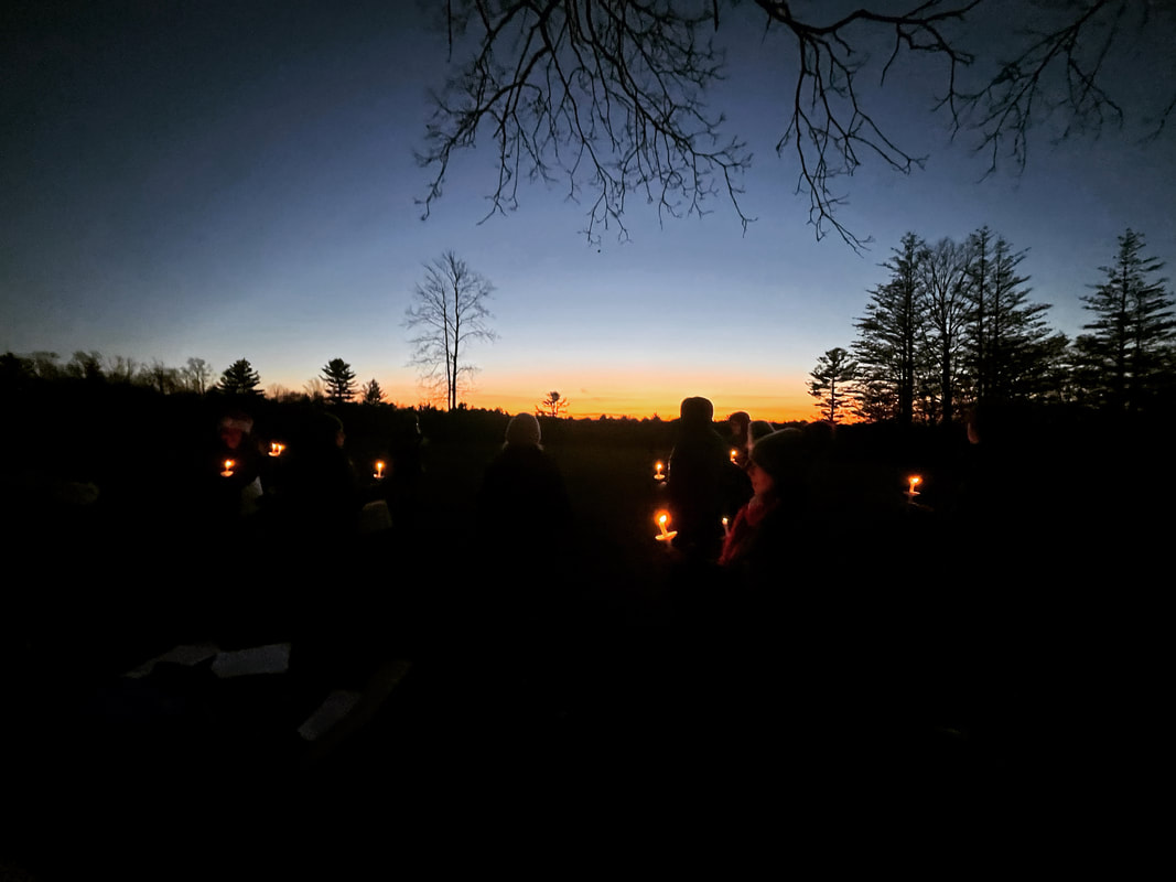 It has been a while since I have been up on Pegan Hill in the light of day. It is pretty then, but for me--thanks to these nocturnal gigs--it is usually perpetual twilight. On a clear day or evening one can see the Pack Monadnocks in New Hampshire. This is one of the benefits of Eastern Massachusetts's flatness. Any rise is prominent. At 410 feet, Pegan is the tallest rise in town. The name comes from a faction of the Natick Praying Indians who farmed it. Though the Praying Indians are still around and sometimes worship at our church--built on the spot of their original congregation--we do not know what happened specifically to the Pegan group. I thought of them Wednesday as I do whenever I am up there. There is so much we miss in history and relationships that we can only speculate at now. The human history that this hill represents is complicated. It is important to recognize humanity at its worst so maybe, as the earth turns again, we can do a better job. 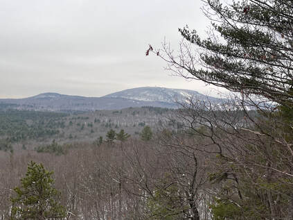 Wachusett from the ledge... Wachusett from the ledge... The second hike was the next day. It ended up being a small, solo celebration of the promise of more light. After my work was mostly done I drove an hour to the Leominster State Forest and climbed up to the Crow Hill Ledges that look out toward Mount Wachusett. There was snow for this one. It felt like winter, which of course was the point...and also a bit of an obstacle. Micro spikes were necessary and some of the rock faces were quite slick. Still, I took my time even though I knew the dark wasn't far away. Of course the extra light on Thursday as compared to Wednesday was not much. It won't be for some time. That said, it was still a hint and a promise. Snow and ice get pretty old pretty fast for me. In a couple of weeks my animal brain will be living for spring. There is nothing I can do about this; just push forward and find joy where I can. I lingered for a while under the massive cliffs, which were more impressive than the view. Then I put my headlamp on and got back to the car in time to grab some food and go play TTRPG's with friends. Then I drove home from Worcester in the rain.   These cliffs were massive. These cliffs were massive. If you want to replicate these hikes, neither is terribly strenuous. Pegan Hill is probably about a mile round trip and--if you don't go exploring down random trails like I did--Crow Hill Ledges is about the same. The footing on Pegan is solid for a suburban hike. There was some sketchy scrambling on the ledges, though. It would be worth considering before heading out. Leominster State Forest--where the ledges are--seems worth exploring. So you can expect more posts from there in the future! I hope you are all having a blessed holiday and you are getting what you want and need from this time. As I write this the power is out and my tasks are becoming unmoored! Oh well, nature has its say apparently. There are things that just won't get done. 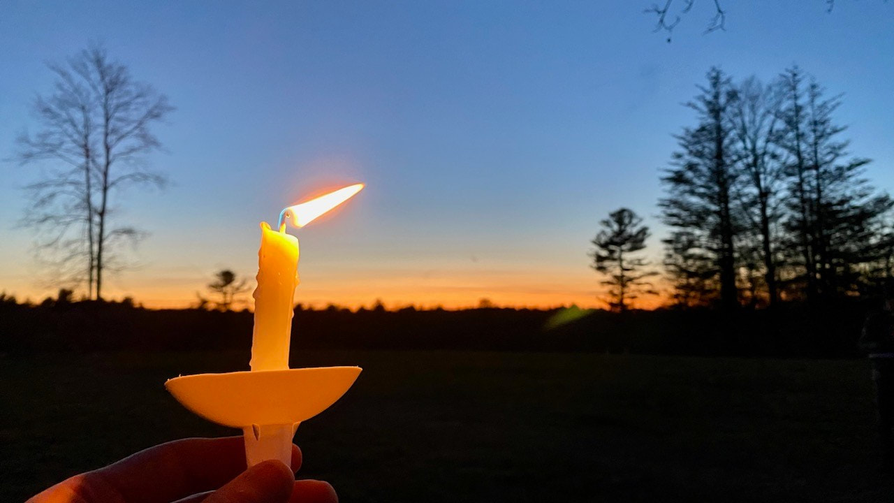 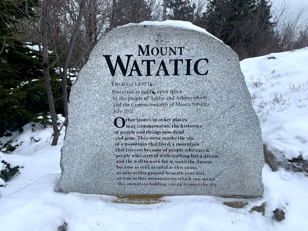 A stone on Mount Watatic in honor of when it became a local park. "Other stones in other places may commemorate the histories of people and things now dead and gone. This stone marks the site of a mountain that lived, a mountain that lives on because of people who cared, people who started with nothing but a dream and the will to work for it, until the dream became as real, as solid as this stone, as sure as this ground beneath your feet, as true as this mountain on which you stand, this mountain holding you up to meet the sky." 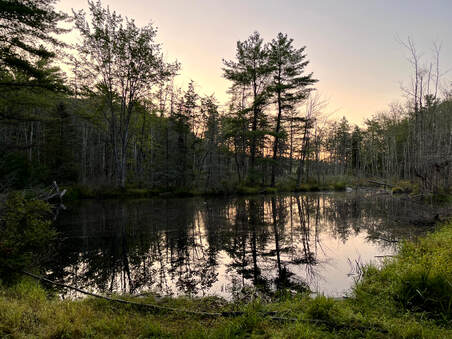 A lovely pond at the beginning of the trail. A lovely pond at the beginning of the trail. Hiked Most Recently on September 9, 2022 Most people I know--be they casual walkers or intense backpackers and peak baggers--have a favorite hike or walk. For some people it is the longest (or most difficult) trip they had. Maybe it is the hardest (or tallest) mountain. For others convenience and accessibility are key. Maybe there is a pretty spot involved. Sometimes it is a place where an important personal event occurred. As with most heart-centered choices, the reasons vary. For me, the decision really comes down to how it makes me feel. What I want to talk to you about today has to do with the internal dimensions of hiking. We live in an anxious world. Some of us internalize that anxiety as we move through an era that tries its best to push us away from our center. Make no mistake, this is intentional. Anxiety (along with a number of negative emotions) makes us feel empty and unworthy. It also makes us buy stuff to fill the emptiness. The Man gets rich off our unhappiness. I know this feeling very well. I start worrying before I get out of bed in the morning. I worry all day. Sometimes I worry in my sleep. Every moment of every day, even when I am doing or thinking about something else, I am anxious about something. What that thing is doesn't really matter. It can be big or small...but it is always there. So when I think about what I need in a hike, the "challenge rating" is not foremost in my mind. Availability is. Remoteness is. Primarily, though, I am looking for a chance to transcend that worry. I want to be away from everything. I want to be insignificant in the face of the vastness of the universe. I want to sink into my surroundings until I know that whatever personal failing or foible that is concerning me is insignificant, too. This technique is different from things like positive self-talk designed to build ourselves up. I am a believer in that too. However, when I hike (or walk or whatever) I am trying to find my way to a positive connection with the Divine. I am trying to be part of a whole that will lift me up as I swim in its current. I want to snicker at the trippy prose of transcendentalist philosopher Ralph Waldo Emerson when he writes in his book Nature, "Standing on the bare ground, — my head bathed by the blithe air, and uplifted into infinite spaces, — all mean egotism vanishes. I become a transparent eye-ball; I am nothing; I see all; the currents of the Universal Being circulate through me; I am part or particle of God." I can't though. Not really. After all--when I am out in the world trying to feel the wind in the air and the rock beneath my feet--what the heck am I doing if not stumbling toward the same thing? 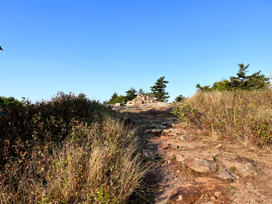 The peak in summer. This brings me to my current favorite mountain. A couple of posts ago I included a picture of Bradbury Mountain near where I grew up. It is where I learned to connect with the natural world and where I learned a certain sort of nature-spirituality that stays with me even here in the suburbs where I live now. These days Bradbury is too far away to really be my current favorite. That said, it is a good indicator of what I am looking for. It needs to be near enough so I can visit when I need to. It needs to be far enough that I have the process of physical as well as spiritual journeying. It also needs to be challenging enough that not everyone uses it for this purpose. It doesn't need to be--in fact it shouldn't be--risky. It just needs to be inconvenient. When I manage to strategically select my time, I want the place to myself or, at least, to be in the company of other people seeking the same isolation. I climb plenty of mountains and hike around a large number of lakes. If there are too many people--and I love people--then it is a different sort of walk. 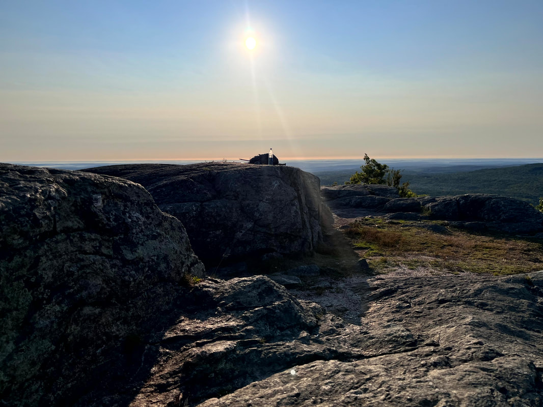 My sitting spot on my last trip. 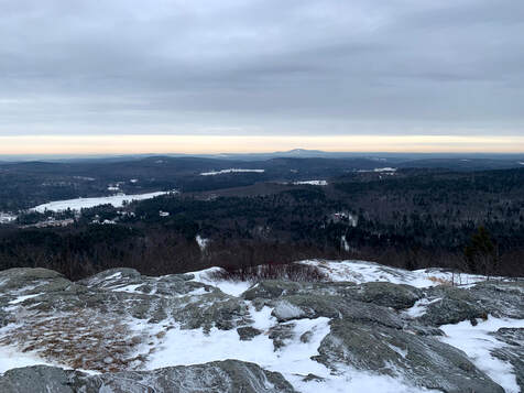 A winter view from approximately my summer sitting spot. That is Mount Wachusett in the distance. A winter view from approximately my summer sitting spot. That is Mount Wachusett in the distance. So when I need to clear my head, Mount Watatic gets the nod these days. It is right of Route 119 (in Ashby and Ashburnham) and a little over an hour from my house. The climb can easily be made into a 4 mile loop by including Nutting Hill and heading over to the New Hampshire border at the end. It gets busy on the weekends and on many weekdays too. However, if you get up early, you can have the place to yourself. This is what I did on Friday. I left the house at 4:45 and arrived a bit after official sunrise. I walked to the top--getting turned around a couple of times--and made it to the ledge just below the peak where I sat alone for an hour. Watatic is a Monadnock which--as I have mentioned numerous times--means that it juts out alone over an otherwise flat landscape. Wachusett is easily visible. That is another great hike. To the north one can see a number of larger peaks across the NH border. It also serves as a trail end for the Wapack trail that heads up the Pack Monadnocks to the north. It is also the northern end of the Mid-State trail that heads south across Massachusetts. Or, at least, the NH border just beyond it is. Anyway, on Friday I spent the hour at the ledge not thinking very hard. There is plenty going on in my life right now, which is typical for most everyone. We need to slow down and shake off some of that burden when we can. As often happens, this became a theme in my sermon Sunday. It was already a theme for sabbatical just around the corner. It took a while to get in the mood. I put my bag down, had a snack, and wandered around the ledge trying to decipher the 19th century graffiti scratched into the rock. Finally, though, I settled in. After that there isn't much to say. I didn't make it to "transparent eyeball" status by a long shot. However, there was a moment when my brain stopped sprinting toward numerous finish lines. That was the longest period of not worrying I have had for a long time. Both my body and my mind were grateful for the break. When I think about what attracts me to walking and what makes a "good hike" I can make a list. I take sabbath walks because... 1) I can connect to nature, "creation," and God 2) I can to witness the beauty and the silence 3) I can escape the suburbs and the often-mindless busyness they represent 4) I can experience the mental challenge of doing something difficult 5) I can experience the physical challenge, too All of these are spiritual reasons. They are good Watatic-climbing reasons, too. Does this activity constitute a "church"? No of course it doesn't. Churches are communities first and foremost. They have a call and a hold on a person. On the face of it, these are potentially solitary reasons even when they are shared among others. Still, they do form a framework for a discipline, or a prayer. They make a walk a "walk"--both literal and metaphorical--which gives me strength to head out into the world. This may not be your bag. If so, what is? What do you love doing? Can you make a list like this one as to why? What is your "walk"? I would love to know.
Update: I hiked Mount Watatic after a big snow storm in 2023 so I have added the video ove recording the trip! Dear Folks, I am in the process of catching people up with some early hikes and other encounters with nature that I thought people might find interesting as part of a "How It Began" (HIB) series. Mostly this will describe specific hikes and perhaps some lessons learned along the way...if there are any. They are meant to be short and, perhaps helpful in some way to other hikers or fellow-travelers. I will post the dates of when I hiked a specific mountain since the ones in this series are NOT posted at or near the date I actually hiked them. 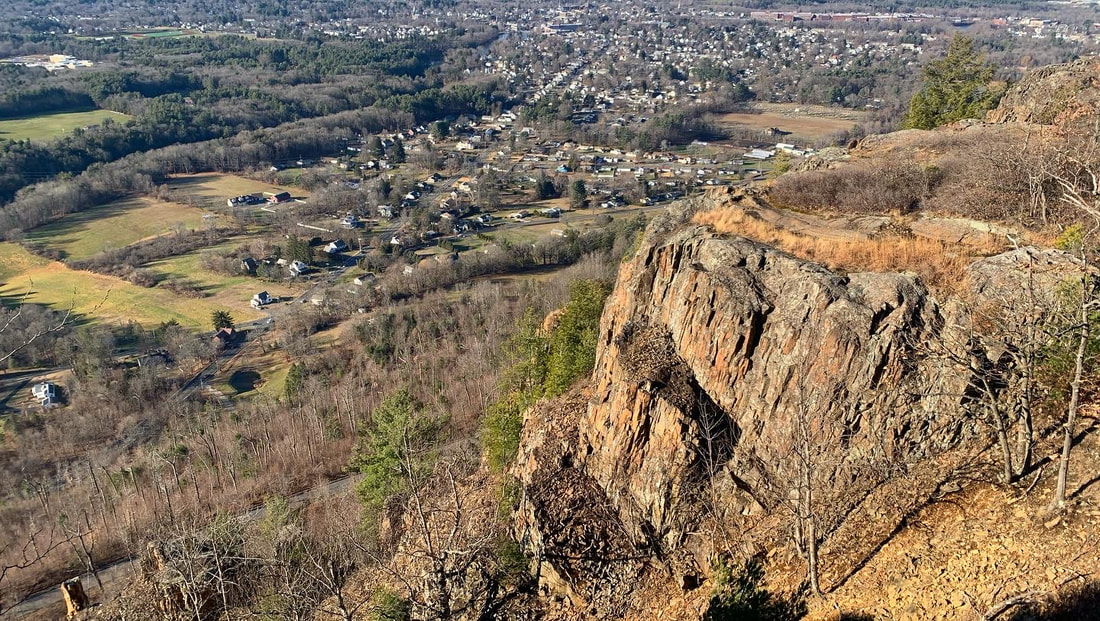 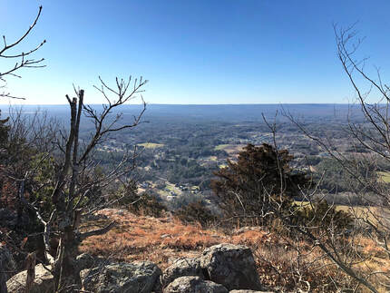 DECEMBER 14, 2021 Sometimes there are good things on even the least promising of days. This was a busy day for me. Holiday prep was in full swing. We had family things and church business going on. My post-surgery back had taken a turn in the wrong direction. There were other tragedies--not my story to share and therefore not discussed here--that occurred even as we took this walk. It is hard sometimes to separate all that from the trip up to Mount Tom by way of the Mount Tom Ledges, but I will. Somehow in the midst of all of the mess of life, this hike stands out as one of the best. Now, some of you may recall that the name "Mt. Tom" has already come up in my post about the Tom, Field, Willey, Avalon post about a loop over three 4,000 footers and one slightly shorter (and super-gorgeous) mountain in New Hampshire. This is not the same Mountain. Apparently "Tom" is an evocative name when it comes to these sorts of things. This hike occurs back in the Pioneer Valley, my old friend. It is yet another rocky ridge surrounded by flat plains enabling stunning views wherever the trees part, or are low enough. This hike was about seven miles out and back and featured around 1,200 feet of elevation. I really did not feel well. I was tired and distracted by a million things. We almost stopped at the first overlook (which was fabulous) but then--after a quick rest--we continued forward at first tentatively, then with purpose. I had to stop occasionally to answer emails and check messages which is something I never do on the trail. This really was a different time, though, so I made a couple exceptions. However, perhaps the chaos outside the moment made the time on the ledges that more special. 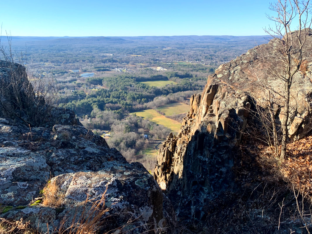  After that first overlook the landscape became rocky and rolling with constantly changing views into the farmland below. We covered a couple of smaller peaks and then moved along toward Mount Tom, itself. One of the big differences in hiking in Massachusetts is that there is much more evidence of humanity. With each view we could see houses and sometimes whole towns stretched out below us. We also passed cell towers, power lines, and windmills. There were decaying and somewhat-unidentifiable pieces of metal and glass sticking out from the bushes. There were service roads as well. Finally, on the very top of Tom there were a few industrial-looking buildings obviously there to maintain the radio towers that dominate the peak. Also on the peak was a massive metal and wood star with Christmas lights on it. It turns out that this star is a local tradition in Easthampton. I love Christmas lights. Somehow all this evidence of humanity worked. There wasn't any "litter" to speak of and I loved the industrial elements. They seemed to go with the gray and hardy rock that was everywhere. Yes there was evidence of people communicating, celebrating, and making the mountain a centerpiece of their lives. That--at least on this hike--made all the sense in the world. After a while we turned back around and experienced all the views again. I am tempted to hike this in every season eventually. I can only imagine that it has plenty more to give.  Dear Folks, I am in the process of catching people up with some early hikes and other encounters with nature that I thought people might find interesting as part of a "How It Began" (HIB) series. Mostly this will describe specific hikes and perhaps some lessons learned along the way...if there are any. They are meant to be short and, perhaps helpful in some way to other hikers or fellow-travelers. I will post the dates of when I hiked a specific mountain since the ones in this series are NOT posted at or near the date I actually hiked them.  This is one of the views from Norwottuck. It reminds me a little of the view from the rebel base on Yavin 4. OCTOBER 8, 2021 History nerds will remember Shays' Rebellion, when a band of veterans from the Continental Army rose up to resist the entrenched interests of eastern Massachusetts and set off a series of events that ultimately culminated in the writing and ratification of the Constitution. If you don't remember, check it out. It was one of those iconic turning points in American history but in many schools you only get a day to digest the whole Articles of Confederation-to-US Constitution move and Daniel Shays gets merely a mention. These days folks with just enough information will try to shoehorn this second revolution into the mythology of today's "red v. blue" divide. It is a futile endeavor. They were protesting a number of issues, like not getting paid and being taxed without adequate representation. Underlying their oppression was the economic desires of the landed interests in Boston. The story is a Rorschach test for activists. You can make of it what you will. My suggestion is to just take it for what it is, on its own merits and in its own context. It is a moment in time, and a romantic one in its own way. The actors in their story are the closest we get to the legends of Robin Hood or Rob Roy MacGregor. I bring up this historical tidbit because you can check out Shays' old stomping grounds without too much difficulty. The Pioneer Valley--where the rebels were primarily from--creates a defensive bowl of ridges and rocks where Shays and Co. could hide out when the heat was on. I already mentioned the Seven Sisters hike. There are more to come, but this post is about Norwottuck, the site of their final stand.  The legendary Horse Caves.  The view from one of the hike's many fun rocky challenges. This one enters into the theoretical final encampment of Shays' army. The view from one of the hike's many fun rocky challenges. This one enters into the theoretical final encampment of Shays' army. The hike, itself, isn't that long. Also, the elevation isn't very high. You don't have to go too far up to get a commanding view when the land around you is flat as a pancake. From the parking lot I head into the woods and then passed an active quarry to my right. After a bit of confusion, I managed to locate the trail I was looking for and found the footing easy for a while. Then it became ledgey and more difficult. The total walk was four miles round trip. It included the sort of rolling hills that I now know as a key part of hikes in the region. There are some steep parts up toward the peak and then down the other side. After a short scramble up the ledge to the top. I found numerous perches from which one could look out over the valley. That tacked on some time as I sampled many of them. I was working on a sermon, after all, and could use the inspiration. Even though they were farmers by trade, Shays' army had already fought one revolution. They knew how to choose the terrain. In addition to those many lookouts, the land is rough and rocky, with many places to hide and take cover. I had no trouble imagining a musket or two peaking around the corner. It would be an unsettling place to try to attack if you knew it was defended by locals. Dropping down from the top I eventually hit a flat area known as the "Horse Caves." Legend has it that Shays hid horses in holes in the cliff. If this is the case they must have very tiny horses! I would say there was room for maybe three goats. Still, it was a very cool spot to be. The flat area seemed like a likely location for their final encampment and it wasn't hard to imagine them there, waiting to face the militia from Boston. In the end, though, they surrendered. The commanding officer of the Boston militia claimed in his reports to have surprised them and captured everyone involved. Strangely, Shays was nowhere to be found. Nor were the other officers whose capture would have resulted in their trial and death. My guess is that neither side had much interest in killing and--perhaps after some negotiation--the leaders were allowed to slip away. A little research will reveal what happened to everybody from that point on. It did, in fact, prompt some reading for me. The hike was relatively easy, but it is one of my favorites. The story, the views, and the general vibe of the place got me going. I have tried to go back but it is also very popular with other folks and on the weekends it is hard to find a parking space. |
Adam Tierney-EliotI am a full-time pastor in a small, progressive church in Massachusetts. This blog is about the non-church things I do to find spiritual sustenance. Archives
June 2024
Categories
All
|
 RSS Feed