|
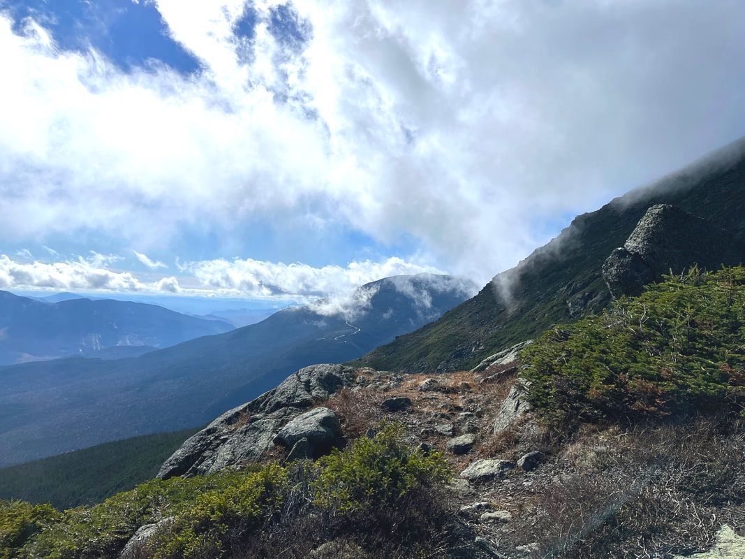
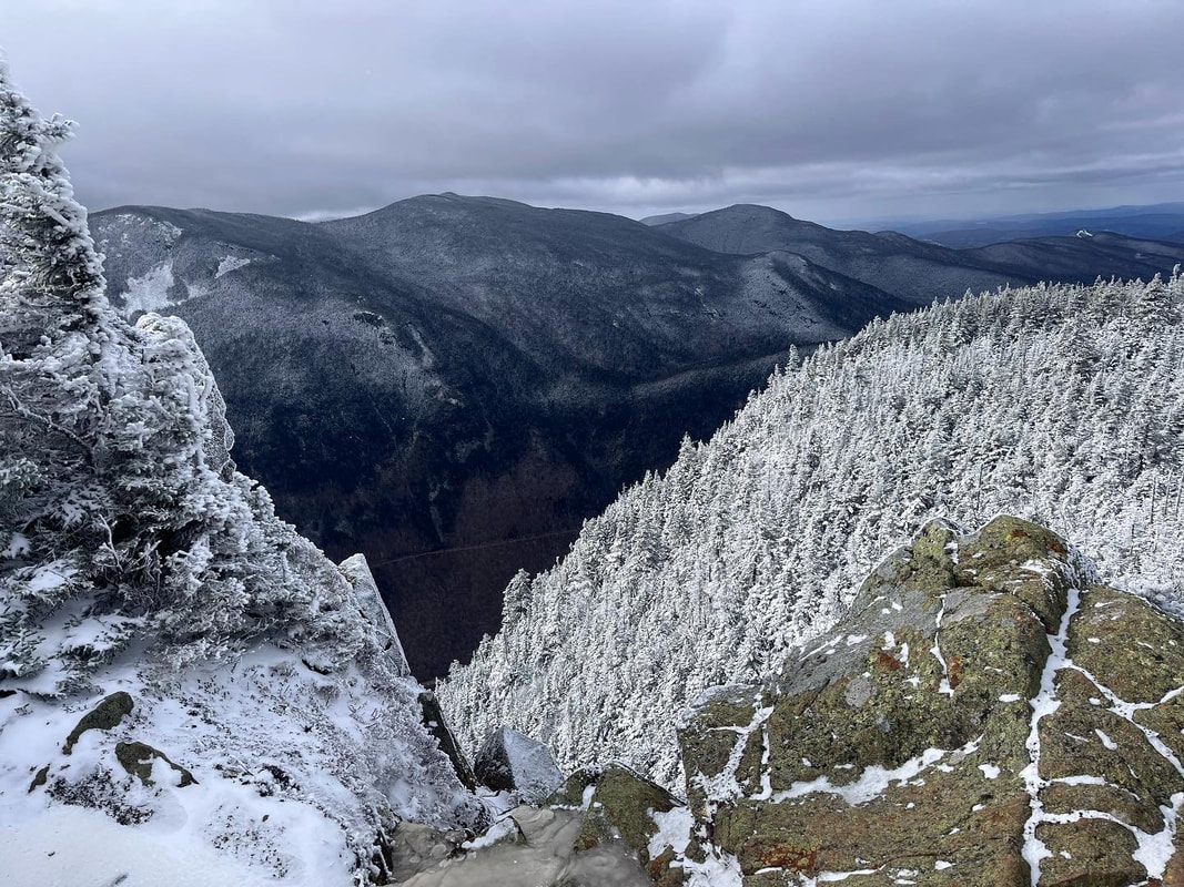
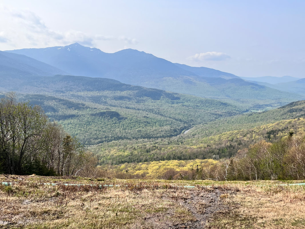 One of the many views from Wildcat I feel bad. I thought I had finished the wrap-up for the NH48 project months ago! Mostly I feel bad because I know that no one else really wants to hear about all these hikes. This is for me to remember. Still, I am storing them here. This final collection features the last push to the finish. Some of them were very difficult. Others less so. I sort of picked up in the middle of Allison's 48 list so had to go back to do the "easy" ones later. It was quite a time and quite an adventure. I am glad I did it. Anyway...if you are interested...here they are! 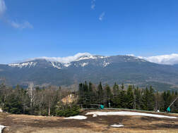 Another view of the Presidents from the ski trail. Another view of the Presidents from the ski trail. Wildcat D and Wildcat (A) #37 & #38 This was quite an undertaking! We decided to hike up one of the ski trails at the Wildcat ski resort. I suspect its presence on the slopes of Wildcat D is why the mountain has this strange alphabetized naming system. Actual Wildcat Mountain is sometimes referred to as Wildcat A. Anyway, there is a video you can watch if you wish. POST AND VIDEO  Early on there were a number of dark, flat, bodies of water. Early on there were a number of dark, flat, bodies of water. Owl's Head #39 One of our favorites, Owl's head has very little to offer on the face of things. It is an 18 mile round trip--the longest hike on the list. The trails up the mountain are not maintained. Finally, there is no view. However, the trip is beautiful. You just need to plan to be out there all day. If we were to do it again we would take two days and camp along the stream. It would be a nice place to sit and get away from everything for a while. There is a video for this one, too. Post and Video  You can't see it, but it is snowing... You can't see it, but it is snowing... Hale #40 Hale is the smallest of the mountains and generally thought to be the easiest hike. Frequently it ends up late in people's lists, saved for a rainy day like I did. Allison was with me but she had already hiked it. Since it is relatively straightforward, many people also get it done early when they are getting in shape for bigger things. This is what Allison did. It was a fun climb though. We were treated to a June snowstorm! Post 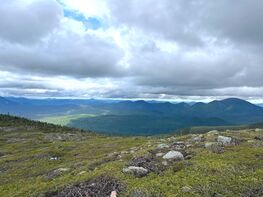 The view off Guyot, which is hard to get to, but maybe my favorite mountain in this project. The view off Guyot, which is hard to get to, but maybe my favorite mountain in this project. West Bond, Bond, and Bondcliff #41, #42, #43 In an ideal world we would have ended on this two-day traverse that took us over these three peaks as well as Zealand, which we had climbed earlier. We also climbed Guyot on our way to the bonds. We stayed at the Guyot campsite below the peak. This mountain was probably the best. Again, we have a post and a video...but this is nearly the last post and definitely the final vid... Post and Video  Al took this on her earlier hike. Al took this on her earlier hike. Waumbek #44 This mountain is also considered one of the easier ones. It, too, rather lacks a view. In order to get to it, however, one goes over Mount Starr King. Starr King is named after a minister and is referenced elsewhere, particularly in my Hedgehog post. He had a mountain named after him less for his contributions to American religion and more because he wrote "The White Hills," a proto-hiking manual that popularized the region. The hike, itself, was pretty straightforward. This--like Hale--was another one that Allison had already done. However, she had nothing better to do that day and accompanied me. 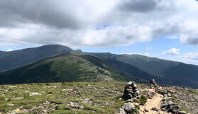 Looking off Eisenhower toward the bigger Presidents. Looking off Eisenhower toward the bigger Presidents. Pierce and Eisenhower #45 & #46 Al had also hiked these two before. You might recall that she started the list while I was rehabbing my back. When I hiked by myself, I frequently chose different mountains, which also put me behind. It was a somewhat crowded day when we went up. There had been warnings of thunderstorms--not a good mountain combo--but it became clear that if we got off early, we would be fine. Others had figured out the same thing. The climb up Pierce was straightforward and uneventful, though it did feel a bit more difficult that it should have. When we rested at the top, we met a number of people. One was from where we live. Another was an old guy filled with unsolicited advice. Old guys giving advice is a feature of the Whites. The one from around our part of the world joined up with us for the ascent of Eisenhower. He was a good talker. On the top of Eisenhower, we overheard an extensive debate about where to finish your 48. One side was pro-Isolation. The other was pro-Carrigain. We had already figured out that we were going to split the difference. On the way back to Pierce our companion got ahead of us. We are not fast, so we waved him on as he drifted from our sight. Anyway, it was a beautiful day on a hike that many people do much closer to the start of their NH48 adventure. I had wanted to get back up there this winter. However, I don't see that happening at this point.  More Presidents off Isolation More Presidents off Isolation Isolation #47 This hike was ridiculous. I don't know how else to describe it. It was long (about 15 miles) and wet. There is about a mile or so, in fact, that is a stream you wade up and down. That said, it was an adventure to remember. Allison finished on the top and there was much rejoicing. On the way back we switched to crocs and waded for a long chuck in the middle. We have many stories from this trip that no one who hasn't don that hike will understand... This is a very popular mountain to end on. However, I am not sure why. It does provide a unique view but not a spectacular one. That said, we will probably do it again some time in the next decade. 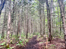 I could have had a more spectacular pic...but I loved this stand of trees. I could have had a more spectacular pic...but I loved this stand of trees. Carrigain #48
So we end on Mount Carrigain. I chose it by process of elimination. Al wanted to get hers over and done. She chose Isolation. Carrigain was what was left. At the time it seemed a bit anti-climactic for a hike, but it will always be special to me. It marked the end of the project and a turning to other things. I am a trifle annoyed, though. In order to receive the patch, I needed to write a narrative of my final hike. I posted the narrative here on the web page. It has been months of waiting now and I doubt that patch is ever going to arrive. Probably some confusion somewhere...oh well...I still did it right? I think of this mountain every day, mostly because we named our puppy after it. Of course, most people we know think we named her after Nancy Karrigan. That's OK. The mountain has grown on me. Whether it or the dog made that happen is immaterial at this point. It is a nice memorial to a time that I look back on with fondness... Post
0 Comments
 Hiking up Adams about to turn right for an extended boulder crawl. You can just see the road up Mount Washington straight ahead. Things have truly been hectic at church. However, I am enjoying looking back at old hikes as I plan new ones for the future. Truthfully, the way things are going it may be a while before I head up north again. Of course, the mountains will be there...and I will bring snowshoes! As with the previous hikes, some of these hikes have longer posts, which I have linked in the descriptions... 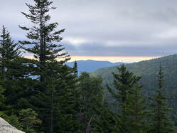 Mount Cabot #26 Longer Post We combined this hike with a trip along the ridge to The Bulge and The Horn. The Horn resides on the 52 With-A-View (52WAV) list, but there was no view to be had. By that time the clouds had rolled in and the rest of the hike veered between misty and rainy. We did have this one good view heading up. The longer post tells the tale. 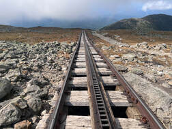 Looking down the cog rail on Mount Washington Looking down the cog rail on Mount Washington Monroe and Washington #27 & #28 Longer Post This trip combined one of my favorite mountains--Monroe--with one of my least favorite...Washington. This has nothing to do with the relative ease of the climb. Honestly, while Washington is indeed the tallest. It isn't much taller than its neighbors. All the Presidents are big piles of slag. The longer post tells a bit about why I would climb Monroe again...and just look at Washington from there. This trip helped me refine what I like and don't like about hiking. 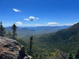 Carter Dome #29 Longer Post This hike was tough! There isn't much more to say that isn't in the longer post. That said, I would do it again. I might decide to climb up the Rainbow Trail, however as it became one of my favorites. The longer post has the details.  Middle Carter and South Carter #30 & #31 Longer Post We climbed this one on a day where it was fall at the bottom and winter at the top! What a great trip. If you are planning a hike on a three day weekend in the fall in NH, this may be the right one for you. All the tourists are heading to the Presidential and Franconia ranges. Do both yourself and the folks at Search and Rescue a favor and climb the Carters. They are plenty. 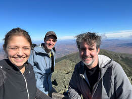 Group selfie on the top of Adams. That is Madison behind my head. Group selfie on the top of Adams. That is Madison behind my head. Madison and Adams #32 & #33 This was the hardest hike we did in the Whites. I have tried to write about it before but just haven't been able to grasp its weight. Adams is the second tallest mountain on the 48 list and Madison is the fifth tallest. For comparison, Washington is first, Jefferson is third, and Monroe is fourth. All of these are pretty much the same height if you are climbing them. They all hurt, too. What I do remember is a massive amount of exertion. I had been climbing every day that week--mostly 52WAV mountains--so I was in good shape, but also a bit tired. That said it was beautiful and I enjoyed the time spent in nature with my brother Dan and my wife Allison. I would do this again, but only climb one peak per trip. A few things happened on this hike that are worth mentioning. First, we were given stern warning at the base of the trail. This is an unreasonably difficult hike for its level of popularity. The rangers know this and want to make sure that the people going up know what they are doing. After that we encountered an entire dog-and-pony show of an influencer, her friends, and some poor guy who actually had to take the pictures. I think they thought we should know who they were...but we were too old. They were a bit much, so we got ahead of them as quickly as possible at one of their many stops. Finally, on the way down the mountain we passed a number of people who should have listened more closely to the rangers. They were struggling mightily. It was a good reminder that sometimes we think more highly of our abilities than we should. Humility is a must in the White Mountains. 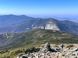 Looking toward the cliff of Mount Cannon from Lafayette. Looking toward the cliff of Mount Cannon from Lafayette. Lincoln and Lafayette #34 & #35 Mount Monadnock--on the 52 WAV list--may be the second most climbed mountain in the world (after Mt. Fuji) but I have to say that these two peaks have to be up there as well. They bookend a fabulous section of Franconia Ridge that features breathtaking views all around. As with Mount Washington, though, I found it too crowded for my taste. This may be why I did not write a longer post for this hike. I am glad I did it. However, there are mountains I would rather climb. The climb up Lincoln was typical New England. There we very few switchbacks, just a steep incline that got steeper with time. The hike goes over Little Haystack--"little" is a misnomer--then up to Lincoln. The views were indeed spectacular and there were certainly plenty of folks to share them with. Then came the walk across the ridge to Lafayette, hitting a couple smaller peaks on the way. The way down was less direct than the way up, presenting a number of different views forward and back before finally dipping into the trees. I think if I could have found a day just as pleasant with fewer people I would have been more into it. However, I don't think such a day exists. 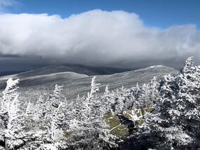 On Mount Webster looking back toward Mount Jackson On Mount Webster looking back toward Mount Jackson Jackson #36
Longer Post So right after putting down what is many people's favorite hike, I want to share my favorite with you. At least this was my favorite hike on the NH 48 list! I did run into some horrific weather and almost slid right off the peak. I would do it again, though. After Jackson I went over to Mount Webster (another 52WAV). I would love to replicate this whole day sometime. The longer post here covers it, I think. HIKED ON 6/19/23 and 6/20/23 Really, in a perfect world this would be our final hike of the NH 48 4,000 Footer list. That isn't how it worked out. However, it was beautiful. It was also the last of my hiking videos before life got in the way. That and recording got in the way of hiking (sigh). So, I am mostly just embedding that video here. It should be noted that we crossed of Mount Zealand for the second time and experienced the revelation of beautiful Mount Guyot, which isn't on anybody's list. It may be my favorite mountain. It took quite a bit of effort to get there but the reward was great. 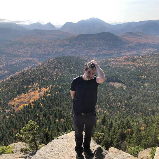 Zealand hike the first time. It made me so happy! So here is the second group of hikes for my New Hampshire 48 4,000 footers. As I mentioned in the first installment, I started the project before I should have. These hikes, however, mark the transition from rehab to hobby. I was getting stronger. I also was climbing many other mountains when I could. I took every opportunity I could get to head out on the trail in Massachusetts. Also, I would run up to New Hampshire or Maine to climb smaller things when time would allow. Many of those hikes are documented here in Sabbath Walks. Perhaps this information will help explain the growing gaps between 48ers. It also indicates something of my hiking style. Most of my other hikes were solo endeavors. On the 48 list, however, I usually had at least one companion. The mix worked out well, I think. As with last time I have linked to longer posts on specific hikes when possible and wrote a bit longer where I don't have any other supporting material. I couldn't always find the time to write, after all. Life has a way of being lived...  Brother Dan Brother Dan Osceola and East Osceola #11 & #12 (October 4, 2021) Longer Post I really loved this hike. My brother Dan joined me, which gave the whole thing the feel of a family reunion in the wake of Covid. I also wiped out and broke a pole by landing on it. The long post has the deets. 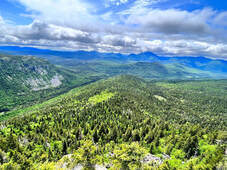 Zealand #13 (October 7, 2021) Video (ZBonds Traverse) This has to be among my favorite hikes. I have hiked it once since--the video link tells the story--but I can see myself heading up to the cliffs in the future just to take in the view. It was one of the first climbs I enjoyed for itself. The process of rehab was far enough along to drift into the background a bit. 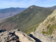 Flume looking toward Liberty Flume looking toward Liberty Flume #14 (November 11, 2021) I have no real documentary evidence of this hike up Osseo trail. This is strange as I really loved it. The climb was relatively gentle. Allison and I spent time at the top eating snacks and watching the world go by. On the way down we encountered the honor guard with an enormous American flag. Flags on the 48 usually has events on September 11. That year someone was doing something on November 11, too. They looked tired but determined to get to the top in time! Osseo Trail is the "easy" way up. There is also a slide. The thing about slides is that you get a fabulous and continuous view while raising the difficulty level a few notches. I was in no shape for Flume Slide and the hike was so pretty I would probably do it the same way again. 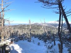 Can you see the dog? Can you see the dog? North Kinsman #15 (December 4, 2021) Longer Post The long post here actually records our second summit, which included South Kinsman. We failed to get to that mountain the first time. We started later than Al and I usually do and there wasn't really the time to make it out and back before dark. After hitting the peak of North, we decided to turn around. Hikers often remind ourselves that getting to the top is optional and getting back to the car is mandatory. Still...it was frustrating. The good news, though, is that the mountains don't go anywhere. 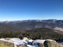 Liberty #16 (January 16, 2022) Longer Post It was dangerously cold that day. We got up early and I had trouble moderating my heat. That said, the hike was beautiful. There were some folks using the mountain as a massive sled run--buttsliding--which is controversial. However, after everything ices over it may be the only way down. This was my favorite hike of the winter. The long post explains it pretty well. 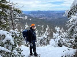 North and South Hancock #17 & #18 (February 11, 2022) Here is another hike without any documentation. In this case I know why. I was so depressed about the steep climb and the deep snow. A quick butt-slide off South Hancock cheered me up but...still... Also, we did this one morning during our annual church ski retreat. We probably weren't as well-rested as we could have been. Now I enjoy winter hiking and did quite a bit of it this past winter (2023). However, I like to keep my hikes a bit more manageable so I can enjoy the views and the weather while also getting home and warm. Those hikes can be found in other sections--and in the Tecumseh video--as the shorter, more local hikes in the snow fit the bill for me. Allison reminds me that the Hancocks are supposed to be easier in winter because the trail conditions aren't so great the rest of the year. Whatever... 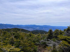 South Kinsman #19 (May 7, 2022) Longer Post This is the same long post as North Kinsman. I loved this second hike with South being one of my favorites. There was no sadness or defeat this time. We took the same route over North and then on from where we turned around before. 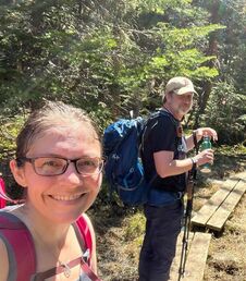 Moriah #20 (May 14, 2022) Longer Post Man were we tired during this hike. Also, there was snow in places and the tiny peak was packed! I still remember it very fondly even though we had forgotten our "means to treat" and ran out of water before reaching the car. We will never do that again. The long post only reflects some of the desperation. 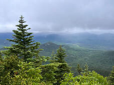 Passaconaway #21 (June 18, 2022) Longer Post This hike was made during one of those strange mountain storms that exist above 3,000 feet. We had actually decided on Passaconaway as a back-up hike instead of something taller. I am glad we did. There was a fatality not far from us that day. The lesson--much as with our first attempt up South Kinsman--is to respect the mountain. 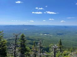 Whiteface #22 (July 10, 2022) Longer Post In some ways the Passaconaway hike was like the Kinsmans. At one point we had thought of doing both during the storm and even strolled out a short way toward Whiteface in the storm. Instead, we turned around and took it the next week, walking back to just below the peak of Passaconaway. It wasn't as depressing, however, because we were learning to be in touch with ourselves and with what was going on around us. Our reward was a fabulous day described in the long post. 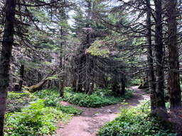 North and South Twin #23 & #24 (July 16, 2022) Longer Post I loved this hike. It made up for the strain of some of the earlier ones and reminded me to take time looking at the nature around the trail instead of just the views. that said, there were plenty of views from both peaks with South Twin performing brilliantly. I would climb South again by a different route instead of an out-and-back over North. North Twin was fine, but not as brilliant. Also, the weird small rocks on the trail made footing a bit painful at the end of the day. 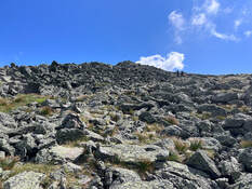 Jefferson #25 (July 23, 2022)
Longer Post This was a big deal of a hike for us. It was the first we did in the Presidentials! It is still my favorite mountain on that ridge. The long post covers it well. This was our final hike before taking time to hike the Great Glen Way in Scotland. The Highlands had something to live up to... 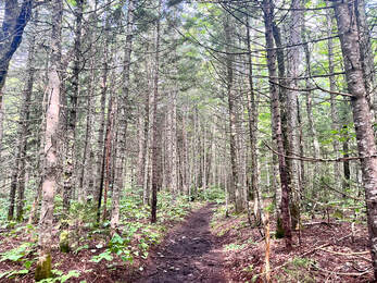 This bad boy starts out super-flat... This bad boy starts out super-flat... I have been out and about lately, as some of you know. Church is hopping. There have been crises large and small to deal with. Life just gets ahead of me sometimes, as it does for everyone. That said, I have also been hiking! This week, in fact, I made my way up Pamola Peak, down the Chimney, over South Peak along the Knife Edge, and on to Baxter Peak all on Mount Katahdin. I hope to post about that at some point. Many things went wrong but...the Knife Edge was a bucket list item for me. In my few spare moments, though, I have been filling out my application for the NH48 4,000 Footers Club. Yes, there is an application process to join. Obviously one can hike all the mountains, become a "48er" and never make it "official". That said, I think it would be fun. There is a dinner at some point...and a patch. Also, it is an accomplishment with a set beginning and a set ending. In a life and job where one thing just flows into another as Sundays and seasons roll right along, there is comfort that in this, at least, there is a piece of paper in a file somewhere that said I did a thing. The application includes lists of names and dates. It also includes a narrative. It seems like low-hanging fruit to post the narrative here...with slight enhancements since the actual report is rather dry.  ...then gets progressively rockier and steeper. Narrative: Mount Carrigain Hiked on 8/27/23 #48/48 I found this final mountain to be fairly straightforward when compared to the ones I had climbed most recently. Mount Isolation had been my 47th, for example and that turned into a bit of an adventure. That was fine, though, I was finally–after waiting about a month–able to find a reasonable day for an ascent. My companion on this hike was my wife, Allison Nelson-Eliot, who finished her 48 on that aforementioned Isolation hike. That was hard to schedule, too. The rain has been an epic reminder of the strain we have placed on this "dying" Earth. It is probably worth noting that I hiked most of my mountains with Allison but her application will contain some different dates from mine as she repeated some mountains with me after she did them the first time. As we waited for at least some of the water to run off Isolation she climbed with me. That meant second summit for her on Pierce, Eisenhower, Hale and others. I also introduced her to some of the "52 With a View" mountains that I love. We did this hike as an out-and-back via the Signal Ridge Trail. It took us about 8 hours including rests and a celebratory stop at the fire tower/viewing deck on the summit. The hike itself was a bit of a slog. An early commitment to flatness disappears to be replaced by a steady–sometimes steep–incline strewn with those awkward granite boulders so common in northern New England. We cursed the hike many times until we reached the actual Signal Ridge. As I noted, it had been a month since any serious climbing had occurred. Then–even though cloud cover obscured the view at times–our mood improved. There is something about seeing the end-point for so long that really gets you going! 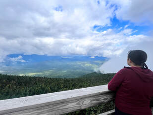 Al and the view. Al and the view. I am a people-person and–as with many hikes I have taken–I fell into conversation with a few of the folks around me. This trip we climbed with a couple of ADK 46’ers up for vacation and met a couple still in their single digits on the NH48. It was an amiable crowd to spend time with at the top. The view–as I mentioned–came and went, but we got some glimpses into Both the Pemi Wilderness and the White Mountain National Forest. For me it really is about the people you meet along the way. I am a talker. Most people, I think, hike for the silence. However, in any group there is usually somebody more interested in the story than the view. We make eye contact. We venture some quick comments and observations. Eventually we recognize a fellow-traveler and stay connected for as long as we leapfrog each other up and down. This was a good mountain for small-talk and hiker-chats. The way down was unremarkable except for how happy I was to have finished the list! This started as a way to spend time with my wife while rehabbing from a mid-Covid back injury that resulted in surgery. We hope to keep on climbing. Early in my rehab I got pretty far on the 52 WAV and we have begun picking away at the NE67. Who knows what we will get up to next? 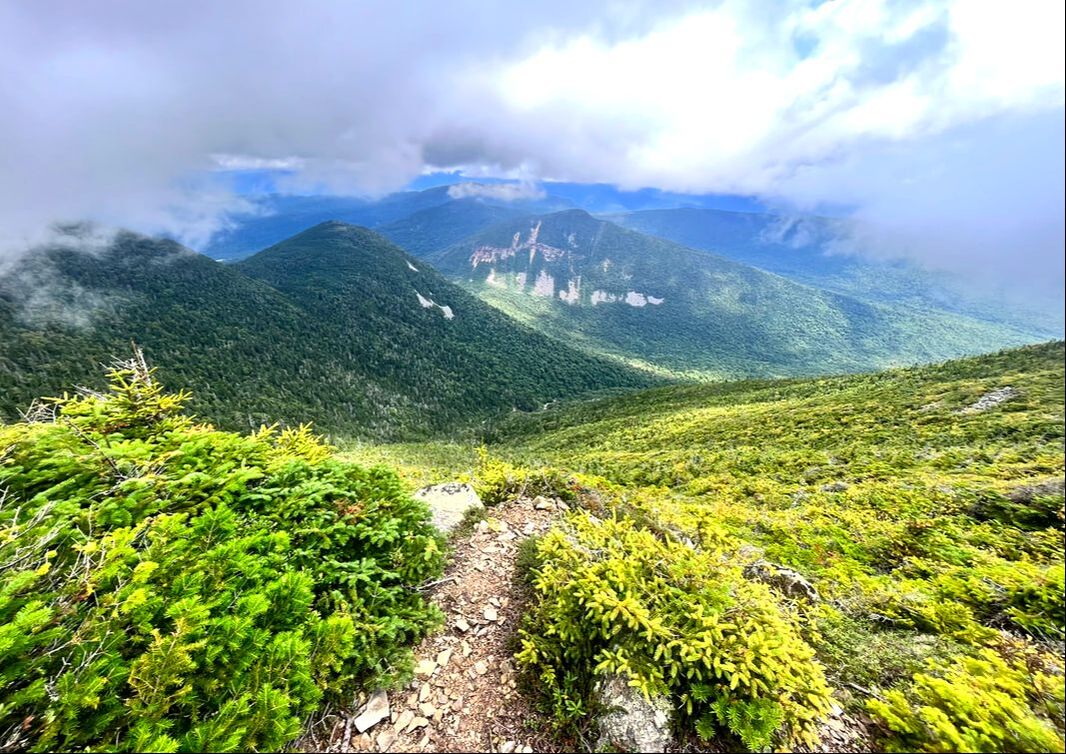 There are different kinds of walking pilgrimages. I certainly know many people who take them. The traditional Camino de Santiago--in all its variations--is popular among the Christians. Others--like the Muslim Haj--involve walking of another sort. That said there are other journeys that are less explicitly attached to a tradition but still carry a special meaning. For example, a year ago my son finished through-hiking the Appalachian Trail. The people who I know that have taken that journey describe it as spiritual and life-changing. The key element is that the walk tells a story with both external and internal elements. To the extent that it does this, it can be considered a pilgrimage of sorts. I wrote about this elsewhere so I will cease traipsing down that road. All I want to say is that--among other things--climbing the 48 4,000 footers of New Hampshire over the last two years (from August 21, 2021 to August 27, 2023) constitutes a pilgrimage for me. Yes, this project was shoehorned in among other challenges of life. Also, it accounted for only about half the hiking I did during that time. Still, it counts as a pilgrimage. There was intention in the undertaking that included a desire to get out in order to take part in Creation. I am listing the mountains in a series of posts in the order that I hiked them. In some cases there are specific articles or videos, which I will link to with minimal comment (the links are in "Longer Video" under the title of each section). Others I never got to writing about. They may get a paragraph or two more. Anyway, it is a record of a pilgrimage of sorts for people who might want to do the same or, at least, to know that it is done. At the very least I want to remember. This is the easiest way I can manage. 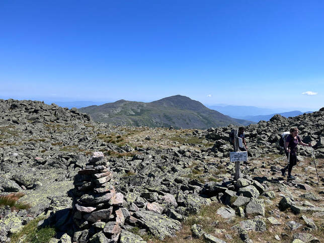 A view over to Adams and Madison from Jefferson...which are in a future post A Rough Beginning: One thing that joins this first batch of hikes together is the simple fact that I shouldn't have done them. Right before the pandemic I injured my back. As the plague wore on, the pain became so bad that I could not walk more than a few feet before curling up in a ball on the floor. Many people never noticed, of course. All the world was separated by a disease. Technology--like zoom and video worship--meant that no one had to witness anything other than what I curated for the public. Still--just like everyone else--there was a lot going on. Also I was depressed...but who wasn't. Anyway, eventually medical people could see me in person and it was decided that I should have surgery. I did this and it was a spectacular improvement! Having spent the previous year or so on my back watching YouTube hiking videos I was ready to go. However...rehab was slow. I was weak and there were stitches to worry about. I really should have taken my time. That said, Allison--my wife--had been climbing the 4,000 footers of New Hampshire and I wanted to spend time with her. FOMO is real, folks. So I began before I should have. All of these hikes were really difficult. Still...I made it didn't I? 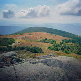 Moosilauke #1 (August 21, 2021) Longer Post This was a mess of a hike. I made it to the top OK but felt miserable on the descent. There is a long post if you want more details. I am told it is a great mountain and I remember the views being spectacular. I think it may be a while before I climb it again, however.  A cool view of the inside of the ski lift off Cannon A cool view of the inside of the ski lift off Cannon Mount Cannon #2 (August 27, 2021) Longer Post This hike felt arduous at the time. Mostly I remember the first time involving falling down more than I would like. This was true for all of these. I really couldn't twist because of the risk of damaging the surgical area and the still-healing part of my back and spine. This meant just letting gravity take me and hoping for the best. The results were--thankfully--mostly comical. What a sketchy thing to do though...  The Tripyramids #3 & #4 (September 6, 2021) Longer Post All I have to say about this is that I weirdly had a good time. I must have looked pretty pathetic--I basically crawled up the mountain in the rain--because after we were done Allison suggested that perhaps mountain climbing wasn't for me. However, it was the first post-surgery hike I enjoyed at all.  The view from Tecumseh is pretty bland except in winter. The trail is awesome, though. Check out the video in the longer post for the winter view. The view from Tecumseh is pretty bland except in winter. The trail is awesome, though. Check out the video in the longer post for the winter view. Mount Tecumseh #5 (September 10, 2021) Longer Post (including a later winter video) This was my first solo hike of the 48! Most of these hikes were with people. However about a third of my hiking is by myself. I am also working on the "52 With a View" list. I do plenty of climbing in Massachusetts and some in Maine. Many of those are weekday trips when I duck out on my "clergy sabbath". I LOVE Mount Techumseh. 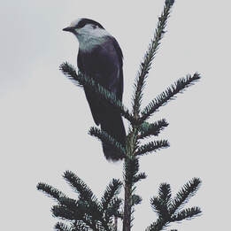 A controversial bird--the Gray Jay--looking for a handout on Mt. Tom. A controversial bird--the Gray Jay--looking for a handout on Mt. Tom. Mounts Tom, Field, Willey #6, #7, #8 (September 27, 2021) Longer Post This felt ambitious when we did it. It was a long loop with limited views. At the end we added Mount Avalon--a 52WAV mountain--which made the long hike beautiful. The hike still falls in the "shouldn't have done it" category, but I did feel like I was getting better.  The views off Garfield were spectacular...but the hike up was mostly moss The views off Garfield were spectacular...but the hike up was mostly moss Galehead and Garfield #9 & #10 (September 28, 2021)
Longer Post The "longer post" is pretty thorough. The day after Tom, Field, Willey, and Avalon, we went up Galehead, thinking that was it for the day. Instead we kept on going for a singularly long haul that ended in the dark. Garfield was beautiful. Galehead was a slog. After this hike--while I wasn't really physically up to snuff--I stopped worrying about whether I could make it up or down. Future hikes indicated this may have been a mistake. Still, this is the end of the "first phase". 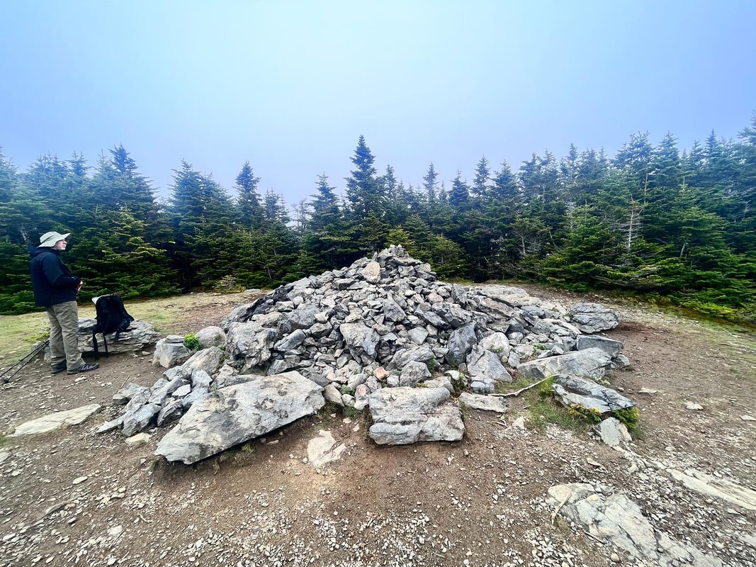 The pile of rocks near the top. People sometimes climb this to see if they can see anything. They cannot. The pile of rocks near the top. People sometimes climb this to see if they can see anything. They cannot. Hiked On: June 4, 2023 Edward Everett Hale was a Unitarian minister and 19th Century man of letters. He was most famous for his short story "Man Without a Country" that served as a teaching tool for American middle schoolers in the 1980's. It is just OK. I have gotten more joy out of his memoir "James Russell Lowell and His Friends." As one of those friends, Hale is able to breathe air into the period. He is nostalgic, intellectual, wry, and moving. This is more his speed than didactic tales of place and patriotism. Hale also loved the outdoors and the White Mountains in particular. He would travel up north every summer, leaving his family in Rhode Island to explore the wilds of New Hampshire. No doubt the landscape appealed to him. He had romantic, transcendental leanings after all. He also had a mistress living in Intervale, the not-coincidentally obscure Harriett Freeman. Freeman was a conservationist and botanist who made substantial contributions to Hale's work. She was an intellectual--like the already married Hale--and they hit it off first in the world of ideas. Both her collaborations with Hale and her own work were suppressed after Hale's death out of respect for his wife and children. Only recently have people begun to tease out her contributions. While she had attended Hale's church as a child--there is something to unpack--he was 62 when the affair started. Freeman was 37. Their relationship lasted for 25 years.  Very Elfy Trail 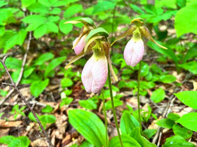 There were plenty of Lady Slippers near the path and we were careful not to tread on them. There were plenty of Lady Slippers near the path and we were careful not to tread on them. The free-thinking Hale was also a chauvinist. In my Sunday School curriculum about the Universalist minister and suffragist Olympia Brown I teach that Hale liked neither Universalists nor women clergy. He wrote to Freeman "1. I dislike Universalists. 2. I hate women preachers. 3. A Divinity student, who is a woman, is worse than a preacher proper. 4. A conceited person kills me." All this because he had to spend time on the train with someone who was definitely numbers 1 through 3. Whether she was also actually number 4 is lost to history. Like I said, Hale was a pig. I do not know Freeman's opinion, but it is probably safe to say she was at least sympathetic to Hale's position. Like many wealthy Bostonians--and wealthy Boston Unitarians--she had a number of blind spots herself. She was into eugenics in a big way. She belonged to the racist Immigration Restriction League. She took part in the anti-suffrage movement and also the DAR. These two weren't exactly the ideal couple for a costume-drama romance, which is probably why no one has attempted it. Anyway, that is plenty to think about when hiking Mount Hale, one of the 48 4,000 footers of New Hampshire and my 40th. As these hikes go, it is short and straightforward, which is why I didn't make a video. The 4.4 mile round trip is best saved for a rainy day. There is no view from the top. Our trip included a little June snow, which reminded us of the strange weather these mountains produce. Mostly, though, it was a pretty walk on a drizzly day with other peak-baggers who had the same idea. It would not have been like this for Edward and Hattie. They would have trudged up this mountain some time after the devastating forest fires of 1886. That year a passing train sparked and burned out the entire Zealand Valley. The place was still being described as a "desolate burnt wilderness" as late as 1907. It is entertaining to think of the two of them up there in their awkward 19th Century hiking clothes that look like party clothes to us. They would have had spectacular views of the many larger mountains around them, which they probably also hiked. For us, though, the way was lush and green. We looked down at the flowers and foliage near our feet. We paused by Hale Brook. In is interesting to think that the reason for the lack of view may be traced to Hale and Freeman themselves. After all, they were dedicated conservationists at the beginning of that movement. I liked it this way just fine. 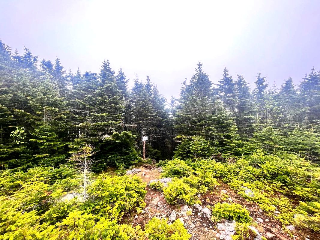 The bushes continue to encroach on the peak where the fire tower used to be. Would I recommend it? Absolutely I would. The forest it passes through is lovely. There is the brook that provides spots for reflection and a near-constant soundtrack. Then, when you are done, you have plenty of time for a leisurely lunch at one of the many good restaurants within driving distance. You can have a romantic chat about ideas if you wish, like a 19th Century thinker. You could also just talk about the hike and make plans for more. I have done both. If you are looking for a brew pub for this talk--and we frequently are--both Reklis and One Love fit that bill nicely. As you walk and later relax with whatever post-hike ritual suits you, also give a thought to the humans of the past that this mountain reminds us of. What a complicated bunch! You can also give a thought to the humans of today, too. We met many on this trail oblivious to the foul weather on a snowy summer day and fully alive in the midst of the abundant wild around them. 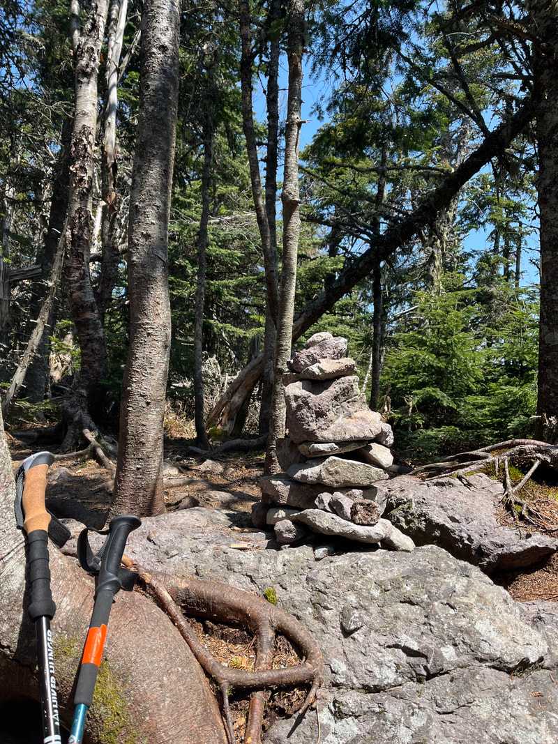 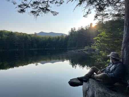 Hiked on May 28, 2023 We were dreading this one a bit. Owl's Head Mountain is on New Hampshire's "48 4,000 footers" list. To climb it you must walk nine miles into the forest and then turn back around. The views are scant. The footing is just OK. Also--since some of the trails are unmaintained--there is the possibility to get turned around or lost. It is an exercise in perseverance. It is a test of your physical endurance and your ability to move about in the forest. The reward is...well...you get to bag the peak. For me, this hike came at a moment of transition. I know I talk about this elsewhere, but I have a great deal going on. Much of it is life-stage stuff. Our eldest is in the process of moving out. Middle Son--who was the subject of many unschooling posts in my previous weblog--graduated from college the day before Owl's Head. Our youngest was in Kentucky competing in high school debate nationals. Also, there are vocational concerns for me. My rapidly-ending sabbatical has been about transitions. What will happen to the church in general? What will happen to the church I serve? In spite of plenty of thought and study...I don't know. 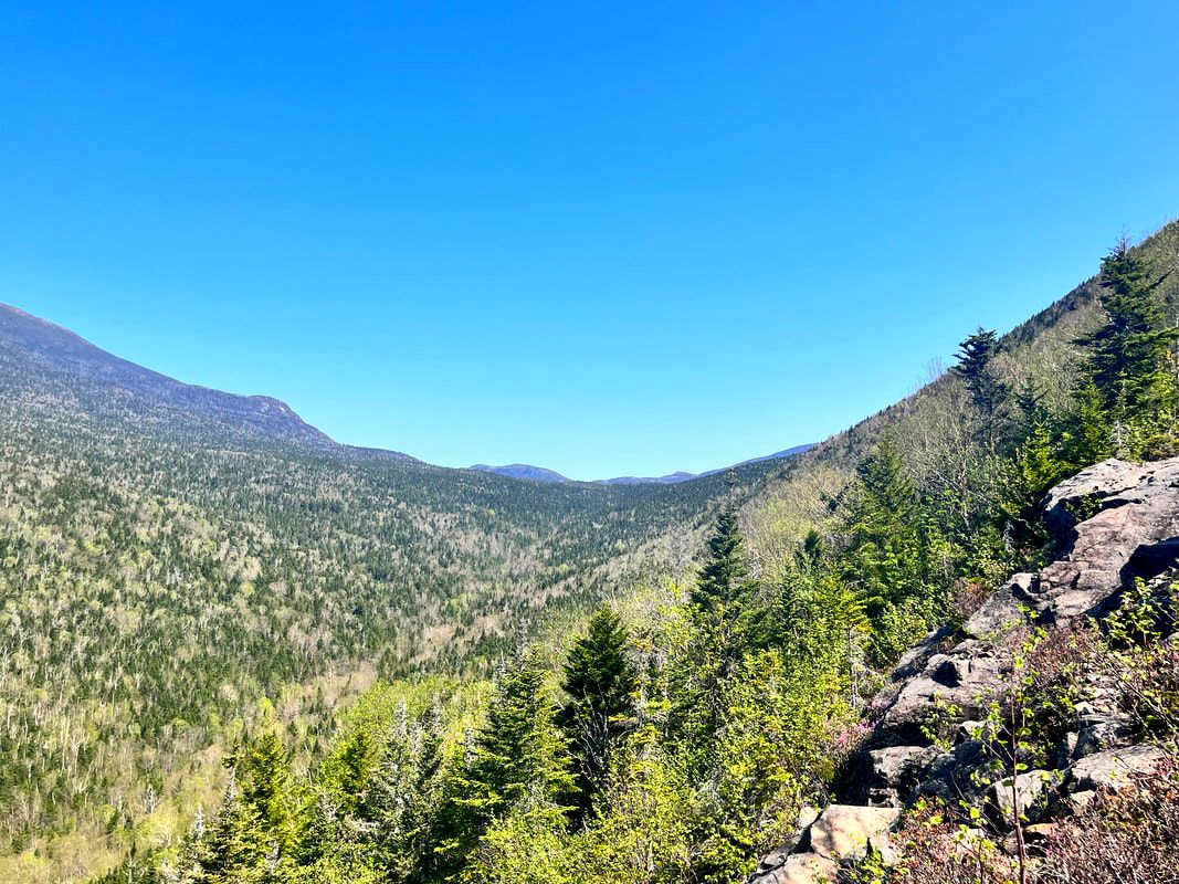 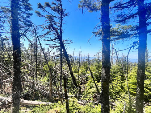 Anyway, what a great time for a walk in the woods. Nature, too, is in flux. Even without the brutal destruction of ecosystems. Change is in its nature when left alone. Out in the "wilderness" we can look around and see that living things grow, live their assigned cycle, and die. The natural world reminds us that we are a part of it. We are presented with the fact that the continuous transition we witness and experience comes from being part of a whole vast organism. Our failing is when we lose track of this organism and start believe that we--the constituent parts--are the beginning and the ending. This hike was hard. When we got back, my legs--relieved at having to walk no more--cramped up for a solid 30 minutes. Sometimes you choose a high degree of difficulty because the the challenge reminds you that you can do hard things. By doing these things in isolation--away from the high stakes areas of love and regular life--we can get the practice we need. We can develop the confidence that perseverance and problem solving bring. We can look back and recognize that--while no true mountain is the hardest mountain we climbed--we did the deed. We realize we can keep going on with hope even when we do not know the way. That was Owl's Head. It was a reminder that we are part of something much greater than ourselves. It was a reminder that--in this time or trail--I (we) can push on to whatever comes next. In the video we get lost and I lose track of time. However, I am glad we did it. I will be thinking about walking through that epic tree tunnel long after specific views on prettier, easier hikes are forgotten. 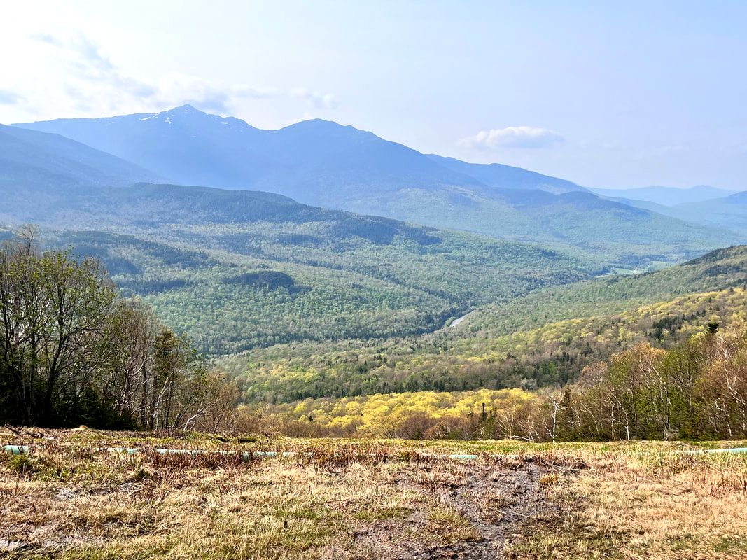 Lots of views of the Presidents off Polecat ski trail. Polecat seems to double a service road and is the required way to the top if you choose the slopes. Lots of views of the Presidents off Polecat ski trail. Polecat seems to double a service road and is the required way to the top if you choose the slopes. Hiked On May 21, 2023 I am an anxious hiker. Each big trip gets me worried about all the things that can go wrong. The list ranges from the practical and semi-preventable (like running out of water) to the possible (like an injury that requires immediate attention) to the statistically possible (bears). I worry about getting to the trailhead, getting actually lost (as opposed to just confused for a while), forgetting some item, or maybe a meeting back home. Anyway, these concerns are compounded when the hike is long or complicated. They are also compounded when the people "in the know" are also worried. Enter the Wildcats. Wildcat "A" and "D" are both 4,000 footers. They are connected by an undulating ridge with two more "named" peaks and a number of unnamed prominences. 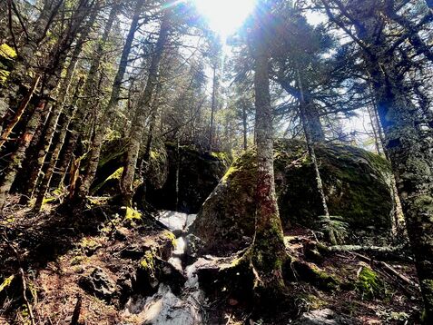 We worked our way up to this after the winter and...at least some worries were justified. Even though we took the smoother route up a ski trail, it was rough. There was a large, rapidly melting monorail of snow covering much of the ridge. There were patches of ice and water. Near the end--as we summitted "D" on our return--my surgically repaired back started to give out. I was not a happy camper. That said, it was beautiful up there. The trees did their "tunnel effect" I have written about on Cube. The views--when we had them--were top notch. Stretches and food got me back from the brink in the end. It was a hike to remember...but not in detail. If you watch the video you will note that I go on about the boring letter-based names and speculate as to why that might be. Later, it occurred to me that Wildcat Mountain isn't on Wildcat A, which is officially just named "Wildcat." Maybe that is why? Does the whole thing need to have the same name for marketing purposes? Anyway, just a final thought...
 Most of my best pictures were from Mount Webster because I wasn't busy falling down. HIKED ON NOVEMBER 14, 2022 Yesterday was "Thanksgiving Sunday" which is the Sunday before Thanksgiving. It was lovely and peaceful and--at least for me--quite moving. Today, however, I am on screech. Thursday is actual Thanksgiving, then Sunday is the beginning of Advent. There is so much to do. All I see is a long string of tasks stretched out until December 26. This is not unusual for any of us, particularly for clergy, so I am putting my head down and getting on with it... That said, I did hike Mount Jackson and Mount Webster a week ago in a freak snow situation. The weather--which was unseasonably warm--had turned on a dime. Al got sick. I had a reservation in New Hampshire. All this added up to a very beautiful, very cold, very slippery hike! 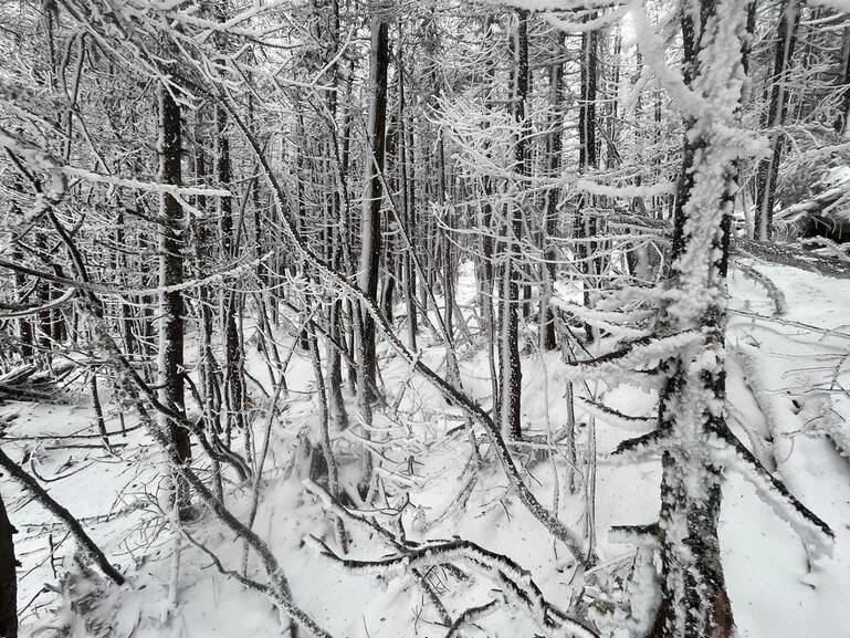 This stand of trees were on the ridge between Jackson and Webster in one of those quiet places you find even on the windiest days. 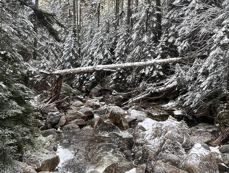 One of the many stream crossings that probably wouldn't be that difficult...except for the ice. One of the many stream crossings that probably wouldn't be that difficult...except for the ice. There are plenty of things that I would do differently. I would have perhaps not gone. I would have done better research (I was planning on a different I hike with Al). However, I did go. I do not love snow but I have done quite a few winter hikes at this point. I knew it would be gorgeous at the top and that the trails themselves would have a lot to offer. The only thing that gave me any pause was that I was by myself. With that in mind, I double checked my pack, put on my microspikes, and went on up. It turned out that--while I passed two people heading down Webster--I was the only one hitting Jackson on this particular day. It is a popular mountain. It is rare to have it to oneself. The sound of the high wind in the trees and the rush of water under (and over) the ice created the background music to my solo climb as I negotiated some deadfalls and, of course, the icy stream crossings. I was careful and took lots of breaks, too. 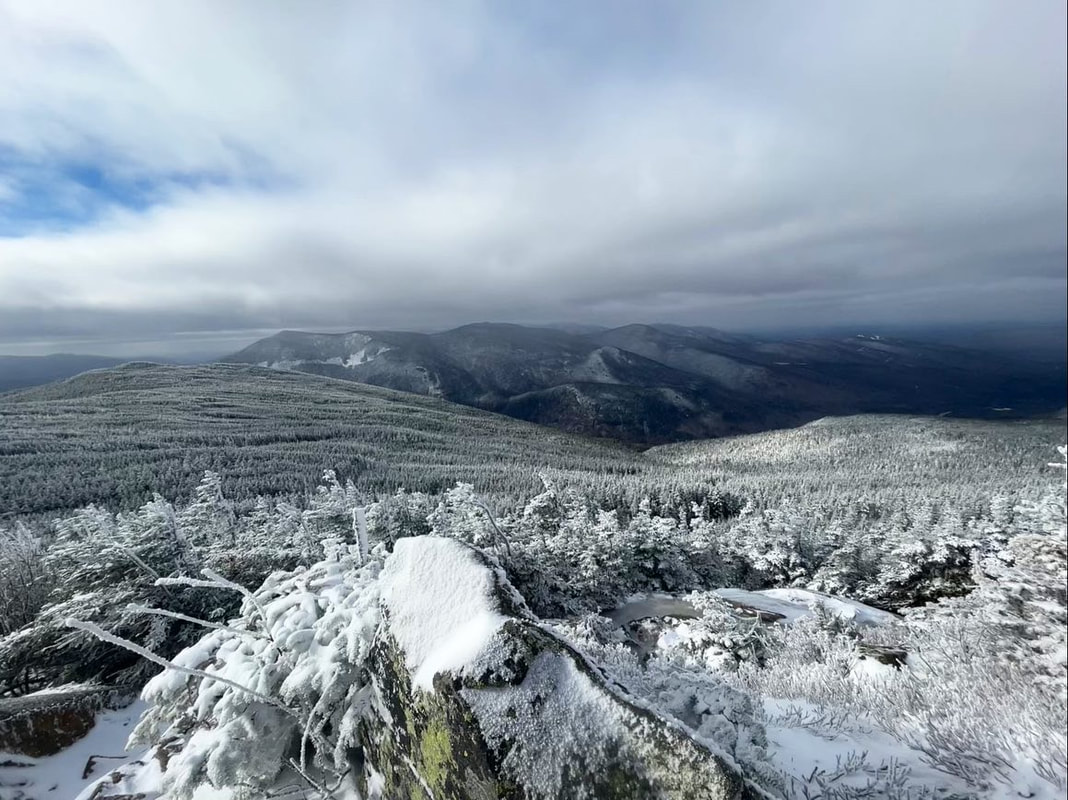 Taken near where I fell on Jackson. That flat-looking thing to the left is the ridge I took to Webster. Finally, I reached the tree line. What followed was a brief period of complete chaos! I was pushed around by the wind. I later learned that the wind chill put the temperature at -2 degrees Fahrenheit. My hat almost blew off. I got turned around and--most exciting--I fell and slid on the ice while trying to avoid the worst spot. It was dangerous but--thanks to the speed of falling and the need to figure out what to do so as not to freeze to death--I kept moving. In fairly short order I found my way to the peak and then started down toward Webster. Those few moments of free-fall, though, became my reflection for Sunday. Every once in a while I have the experience of a sermon or prayer coming to me in its whole form. This was one of those times. Collecting myself before trying to stand, the first few ideas came to my head. We humans are always grateful for the peace--in this case an extremely dramatic and windy peace--after a fall. Time stopped while I sat there on the edge of the earth. All I experienced was the smallness of me and the vastness of what was around me. Nature doesn't really care about you. Sometimes that is properly frightening. Sometimes it is liberating. 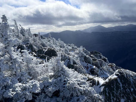 The ledges on Webster The ledges on Webster There are a lot of different ways to fall. Each time we are saved we crave welcome and assurance. We are grateful for how we made it through the crisis or the climb. We give thanks and praise the acts of kindness and love--from ourselves and others--that we experienced in the darkness. After taking that moment where I fell, the rest of the hike unfolded before me. What a blessing to be alive on this dynamic planet! I slowly brushed myself off and continued on to Mount Webster. 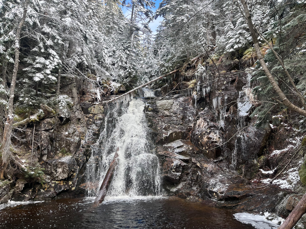 In a way there isn't much to say, except that the ridge between peaks was spectacular. So, too, was the view--from a much more secure perch--off Mount Webster. On the way down I passed a few more people sensibly just doing the smaller mountain. None of them were by themselves. I also witnessed a beautiful waterfall on the way down. Snow really does its job on the landscape, making it feel other-worldly. This is our world, though. That is another thing to be grateful for. Winter hiking, itself, is beautiful. Solo hiking is special and dramatic. However, I will keep my solo winter hikes to the 52 With a View list and look for companions on the big mountains going forward. |
Adam Tierney-EliotI am a full-time pastor in a small, progressive church in Massachusetts. This blog is about the non-church things I do to find spiritual sustenance. Archives
June 2024
Categories
All
|
 RSS Feed