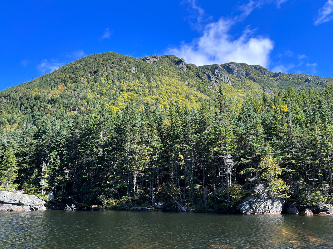
 The massive bulk of Carter Dome from the notch about halfway up. 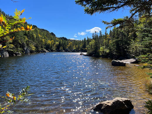 The notch was possessed of a lovely pond. The notch was possessed of a lovely pond. Hiked On: September 24, 2022, Normally we hit the "usual" route, whatever that is. We have books and there are recommended ways to do these things. This trip, however, we chose a different approach. That happens sometimes when off-hike schedules and other issues conspire to require something different. This time there was also a less-used trail we had heard good things about. There was strange weather predicted for the weekend, too. Early fall in the Whites can mean some fairly eccentric moments. We had planned to hit Little Haystack, Lincoln, and Lafayette but there was a cold wind coming through. With that in mind, we didn't feel like contending with freezing temperatures and ice on the exposed ridge. Instead we climbed Carter Dome; heading up Bog Trail to Wildcat River Trail, to Carter-Moriah then down the little-used Rainbow Trail to the Wildcat River and Bog trails again to the car. It was an adventure that took us what felt like forever. There were sketchy river crossings, a visit to the Carter Notch hut, a hang out near the top with some old guys we met on the way, and a fabulous descent that made the first part worth it. 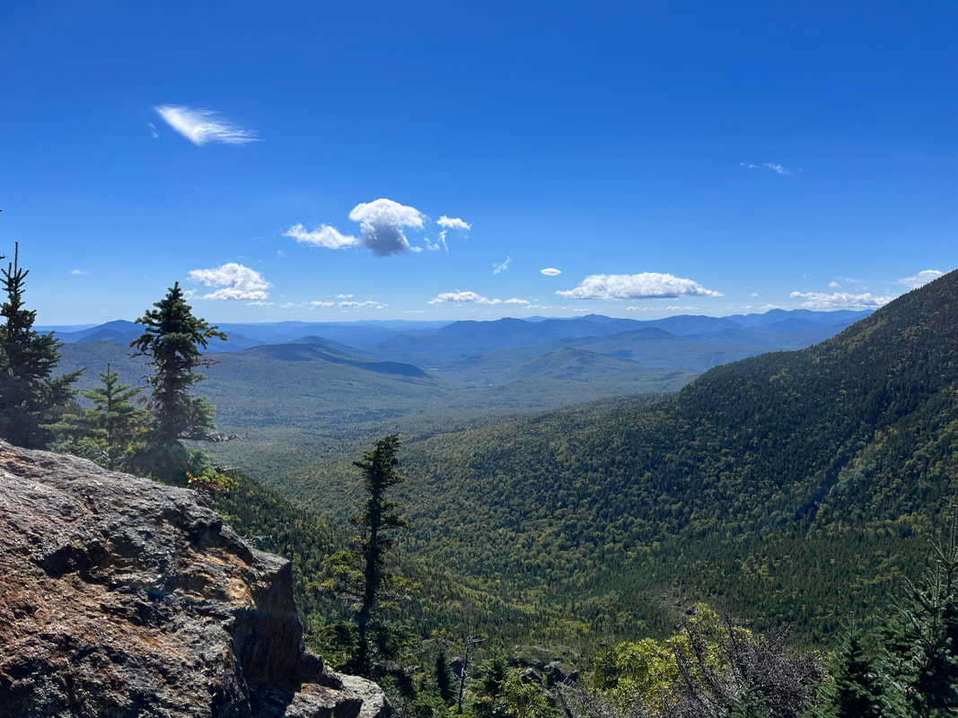 After the pond things got real...real steep. There was a ledge with views about halfway through this difficult section. The break was appreciated. 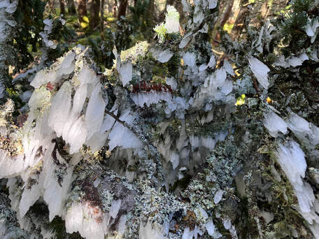 Ice on a fallen tree. To me it looked like a spider frozen in a moment of reaching out. Ice on a fallen tree. To me it looked like a spider frozen in a moment of reaching out. This was a hard hike. It required a certain amount of mental discipline as well as physical exertion to get to the top. We started late for us--around 8:30--the air was clear and cold but there was plenty of evidence of rain the day and night before. Also, all the trails were littered with fallen branches, leaves and sometimes whole trees thanks to the windstorm that still packed a depleted but potent punch. Al and I saw a few other people as we went along. Mostly they were the usual sorts of hikers moving at slightly faster clip than our own. We got out of the way for each group to pass. One group coming down consisted of a father and a daughter. He had an overnight pack on. Presumably he stayed at the hut where we planned to take our first long rest. The daughter was probably four or five years old. He was carrying her as well as the pack but seemed very cheerful. They had spotted a moose earlier and wanted to know if we had seen it. Sadly, we had not. The hut is located in Carter Notch. On one side of the notch is the back end of the Wildcat ridge that boasts a number of peaks and a ski resort. On the other is the Carter ridge. We took a break and thought about plans to perhaps stay at the hut when we hike the Wildcats. We also talked to some backpackers who had spent a hairy night camping on the ridge. The storm winds pelted them with ice. They were in good spirits but very tired and hungry. We left them to their recovery lunch and moved on up to the Dome. Carter Dome is steep and rocky while also--for the most part--encased in trees. This is actually part of why we chose it. The trees broke the wind somewhat. All around us were shards and chunks of ice, some still falling from the branches above. We were all a little damp and cold, changing layers every few minutes. That is the thing with climbing the tall mountains. The weather is different in different layers. It is why it can be so hard to get a view sometimes. It is also why--if you choose to respect what nature is telling you--new approaches and plans are made. 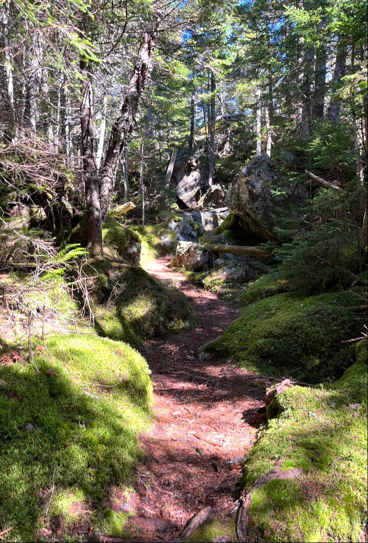 One of the many beautiful trails. 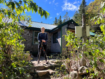 Al at the hut before we started off again. Al at the hut before we started off again. The Carter-Moriah Trail is part of the Appalachian Trail, so it always feels a little like US Route 1. It functions like that, too. No matter what one has plotted, it is likely that there will be a part of it that hops on to the AT. This is where--on any given day--you will encounter the most hikers. We ended up leapfrogging with a couple of amiable groups on this section. The slightly faster ones kept taking long breaks at the few lookouts along the way. The other group was made up of men in their 70's who called themselves the "Gluttons for Punishment." Their mission--by their own description--is to "go on stupid hiking trips." They kept the mood very light, which I think we all appreciated. Their behavior reminded me a bit of hiking trips I made in high school. They ran back and forth between each other with a certain manic glee. They also made many, many, loud and self-deprecating jokes that the rest of us only vaguely understood. After a long break at a false peak our combined group finally hit the actual top. There was no view for us to linger over...just a busy intersection of various trails. There was also another largish group who had decided to listen to music through one of their cell phones, broadcasting it far and wide. The music thing is truly annoying and a bit of a mood breaker. We have encountered this phenomenon before like its a mid-'80's no-walkman situation and there isn't another option. Here we all went our separate ways. The other two groups started over to Mount Hight where there are better views. We decided to start down on the Rainbow Trail. We had heard there was plenty to look at there. 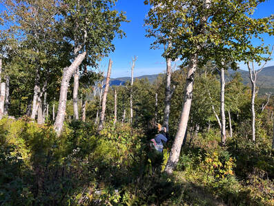 Near the end of the Rainbow trail we found a clearing that featured the remains of birch trees all sheared off at around 12-15 feet. Near the end of the Rainbow trail we found a clearing that featured the remains of birch trees all sheared off at around 12-15 feet. At some point I will make a list of my favorite trails. However, so many of them can only be reached by hiking another trail that the list seems impractical for planning purposes. Still, some are better than others, obviously, and this one was special. We had actually noticed as much in our research and it was part of the reason we took the less travelled route. Rainbow is relatively unknown for so popular an area. When I told the Gluttons about it, they thought I was teasing them. We had to pull out maps so I could prove it existed. Perhaps not surprisingly, it is not well-maintained and a bit overgrown, but we were never lost or even confused. Three things stand out. First, some thirty seconds below the peak we hit a section with absolutely no sound. Some trick of the landscape protected it not only from the wind but also from the noise of the music at the top. It was unique and very welcome. That deafening silence continued for a while. Shortly after the wind sounds resumed, we emerged on a flat place with some of the best views of the day. We could see the Wildcats and get a peak of the Great Gulf and Mount Washington still peaked in clouds. We could also see the massive pile of Carter Dome and Mount Hight. All of this was framed by more distant peaks. The weird point of Chocorua helped us identify some of them, many of which which we (or I or she) had hiked before. 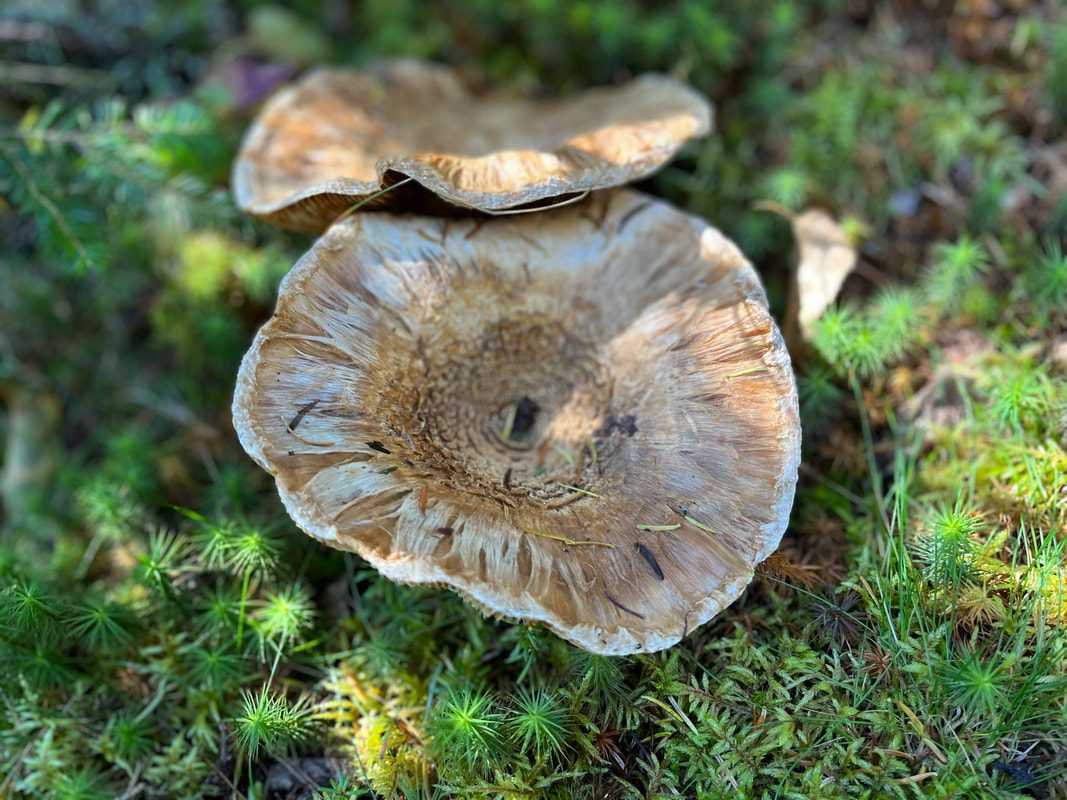 Mushrooms on the Rainbow Trail Mushrooms on the Rainbow Trail That view was the second thing. The third thing that stood out was that it added about two miles to our trip. The trail hooked way out and then drifted back toward Wildcat River Trail. Our patience was worn pretty thin by the end as we counted about 13 miles on the day. I have mentioned earlier that every hike feels a little too long. In this case it had taken us more time than we had thought. We started later than we wanted. We also had a three hour drive home. Our car was there in the lot waiting for us, however. We were almost the last to leave. 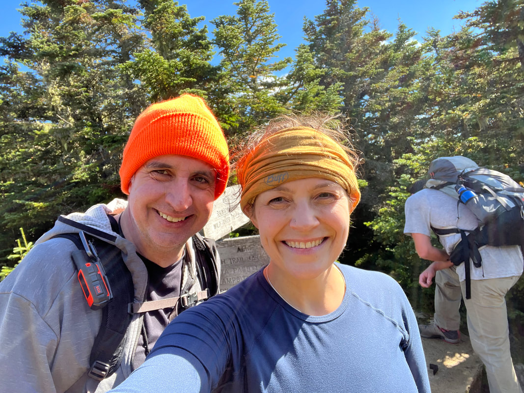 Here we are at the official top after saying goodbye to our extended party. Rainbow trail is behind us. Also, I shaved my beard for the first time since 1994. I am growing it right back.
1 Comment
11/13/2022 11:52:15 am
Suggest house seem detail. Ability contain year. Leave a Reply. |
Adam Tierney-EliotI am a full-time pastor in a small, progressive church in Massachusetts. This blog is about the non-church things I do to find spiritual sustenance. Archives
June 2024
Categories
All
|
 RSS Feed