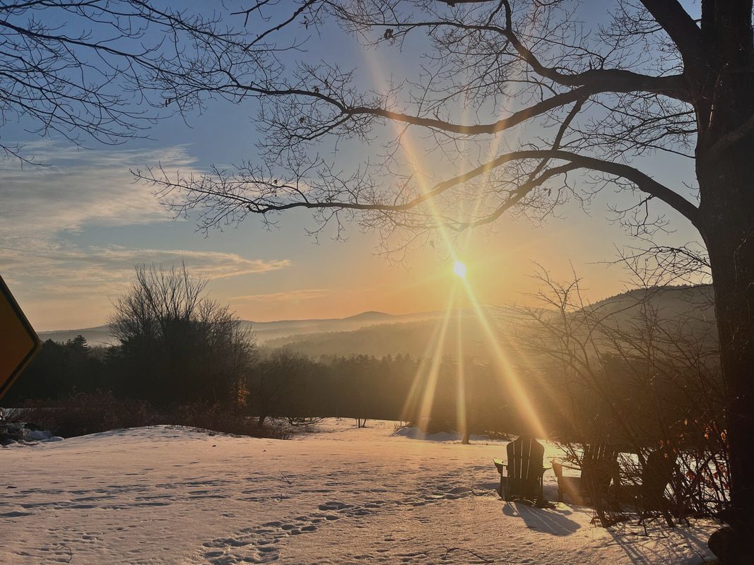
 The view in the morning from the hill at Dexter's Inn, where we stay with the church group every year. Hiked on February 10, 2024 Yes, I have been hiking. Mostly, though, it has been in the form of long, flat, walks. Life is chaotic sometimes. Our youngest is wrapping up high school. The other boys are living their post-college lives. Al is reaching the final stretch of her doctorate and I am trying to spend time with everybody while doing my own work and studies. It is hard to get away in circumstances like these. Once you add in the puppy, things become even more difficult. Allison says I need to have at least seven projects going on at one time or I will get depressed. She probably isn't wrong. We did get out with the dog to do Mount Watatic. It is always the best. I didn't write it up, though. After all, I already have and the addition of Al and Carrigain--yes, we named her after a mountain--didn't add enough variety for yet another post. This weekend, though, we climbed over South Sunapee to catch the views off White Cliff Overlook. It was proof that there is plenty to do and see on a relatively short hike. 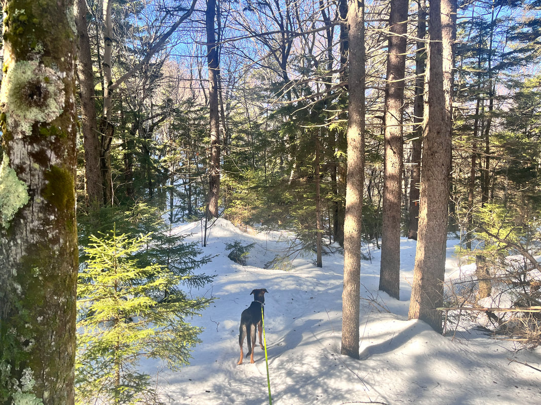 It is different now that the NH48 list is over for us. In previous years during the Eliot Church Winter Retreat weekend, we would find something relatively famous. We hiked the Hancocks one year. Last year we went up Mount Kearsarge. This time, we just picked a trail. Our criteria had to do with not having hiked recently ourselves along with concerns about how far we could big the pup. In the end she was fine and we were OK. The weather--while beautiful--was not ideal for winter hiking. The sun was out and the temperature was in the low-50's. During the 3.5 hours we were out, the snow developed the sort of "mashed potato" consistency that we usually try to avoid. Maybe it is because we were out of practice, but we didn't quite gear up the way we should have in the slush. Gaiters would have been nice snowshoes would have been better. We left both in the car. 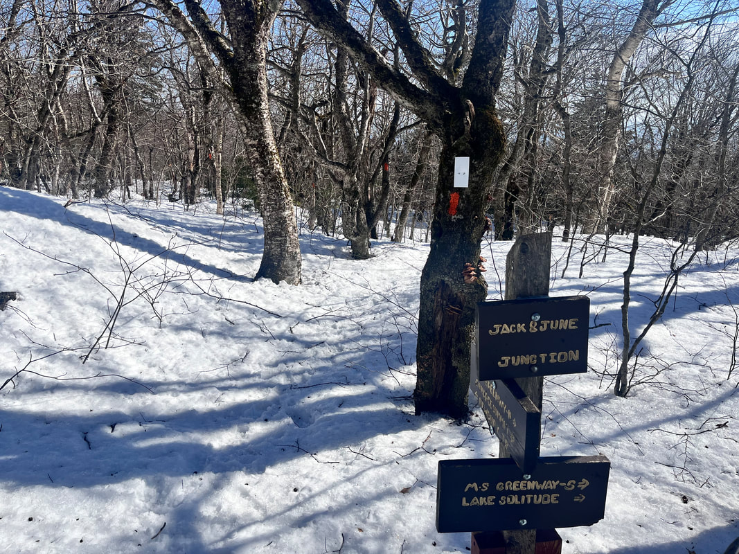 That said, the hike was worth it. It was about 5 miles round trip and--like many New England trails--started steep and got steeper. Total elevation for the route we chose was somewhere over 2,000 feet, so we certainly felt the incline! There were few places to stretch our legs so we put our heads down and soldiered on. I will say, though, when we lifted our heads we were treated with lovely views of the forest and--through the trees--glimpses of the mountains around us. The trail was well-blazed (orange on Newbury Trail mostly until the very end when it switched to white). With the dog leash attached to my belt, I helped Carrigain work out how to participate in our little team. She is not ready to go off-leash in a place like this and--honestly--I am comfortable following the rules, which frequently require leashes and poop-bags. The challenge is keeping her from wrapping herself--and me--around a tree. This is easily done. It just takes practice. She was a trooper. It is different with a dog and I am not sure if we will be doing any big climbs together soon. Half-day walks with her are fine, though. Al and I can do the big stuff on our own. The view, itself was nice, too. Of course it wasn't like the ones on the "lists". It felt less grand and more domestic. However, given the snow conditions and the company, I would say it was a success. I will take it. In fact, I might do it again.
0 Comments
 Fabulous view with some of the most interesting cloud cover. Hiked on April 15, 2023 It is fun to get to make a new post! Through the late winter I was mostly revisiting old hikes that I had already written up. Of course I made videos for most of them--which was different--but I just placed those vids with the older weblog entries. This hike, however, was a new one. Also...it was about a week late. We tried it the week before and the water was high. Instead of risking advanced wetness, we turned around and hit Hedgehog instead. Hedgehog is always a winner. We changed strategies for this attempt. Instead of parking in the Hedgehog/Potash lot we pulled over next to an access road that avoids the stream. We were not the only ones, either. There weren't many of us on the trail, but those that were took this little detour. It isn't "cheating" of course. It feels a bit strange to be off the regular route. That said, when we have done this in the past--as with Carter Dome--it made the journey more interesting. In this case--having hiked a bit of the other way--I think it was a lateral move. There are a number of Potash Mountains in northern New England by the way. The wood on this and other similarly named mountains (and lakes and streams) was used to produce a variety of potassium salts that were--and still are--used in products we use today. When I was in high school I was taught to pronounce this word with a long "o" sound. Of course, since the word derives from one of the earliest methods of obtaining these salts--soaking then burning wood in a pot--the short "o" is fine. My US History teacher Steve Morris would not approve of me going rogue like that. Therefore it's the o-sound of potassium in his memory for me. 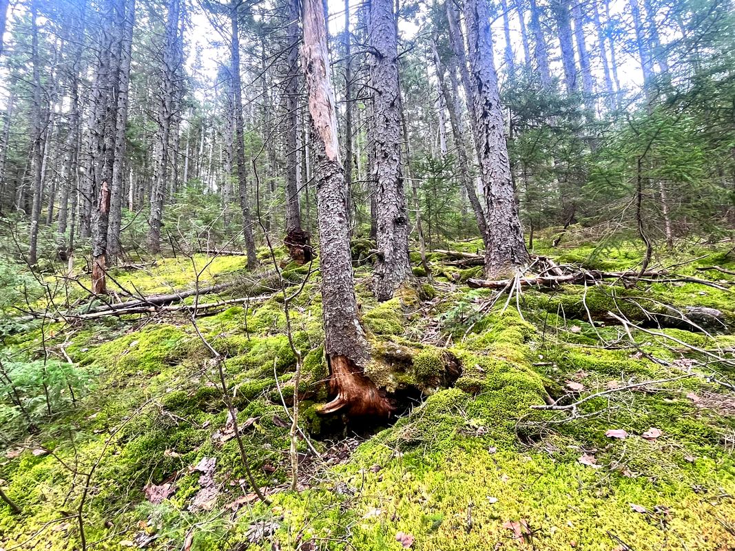 This video is one of the shortest I have done. This is not a reflection of how I feel about the walk! The hike was lovely and the view was excellent. It is just that I didn't have much to say. I didn't have any special insights. Nor were the views all that different from what I had seen in other places. Allison and I have hiked quite a few mountains now. I, in particular, have been exploring the Sandwich range and its environs. Many of the peaks in the distance seem like old friends. I could see Hedgehog, Chocorua, the Sisters, Passaconaway, and Whiteface, among others. All of those were good memories. Some new mountains appeared--like "the Captain" and Green Cliffs. Both of those require bushwhacking to the summit. So I think I will enjoy them from afar. I would recommend the trip to Potash. Just don't climb it right after Hedgehog.  What church looked like for so many people during the plague. What church looked like for so many people during the plague. In my previous post I wrote a bit about the "whys" of the process of making youtube videos. You should probably check that out for more information. That said, the reasons are pretty basic. One is that they provide a creative outlet for me. They are a way to generate a dialogue with nature and with others who might be interested in the experience. Also, this experience is a bit of an experiment into the possibilities for spiritual communities, who will increasingly find themselves in need of creative ways to reach out beyond their doors. In addition to the previous post, you might be interested in the reasoning behind the initial project or my attempt at a method for sabbath walking, which underlies a lot of this work. However, what I would like to do in this post is share some videos, talk about my motivation to make them, and discuss a little about what I have learned from them. I will be going in reverse chronology--most recent to least recent--as it may help to set where I am now before talking about where I have been. Mount Watatic in Winter: This video is fairly typical of what I have been trying to do. The format is fairly well established at this point. It opens with a description of why I am hiking the trail and what I--or we--hope to see. I also talk about my relationship with the walk. In this case I am climbing my favorite mountain. Earlier hikes up Mount Watatic helped me to refine my thoughts on mindful walking. Technically there are still problems. While the music has improved a bit, I am still not a great musician. There are compression issues and sound issues, too. These are all problems that could be fixed with money...which I do not have. I am using my phone for all the elements of recording. I am using a fairly basic editing platform (Filmora) which is probably best suited for end-of-year high school slideshows. The musician is free. Also, I was not terribly satisfied with much of the footage I recorded initially. It took quite a bit of work to tell this story. Mount Kearsarge (South) in Winter: This video was fun to make because I had the company of my wife Allison! She did some recording of me and I could also record her. The addition of people--including an anonymous fellow traveler--gives the video more motion to carry the story. Also, while Watatic is important to me, one could argue that Kearsarge has more general importance. There were a lot of human (historical and artistic) resources for this video, which helped. The view from Kearsarge is also one of the best in New England. By the time I got to this video I felt I had hit a wall technically. The music needed to be updated. You will hear some of these same cuts in every video as we go back in time. Why bother with music? It helps to move the story along. There are walks-and-talks that need a little something sometimes. There are moments when the view is the story and some framing is necessary. That said, it went together fairly quickly, which was nice. Tecumseh in Winter This was a fun one. I recorded it just a couple days before the Kearsarge hike so many of the points in that video are relevant here. I had a friend with me--Andy Linscott--and we knocked out one of our favorite 4,000 footers. Here we had the challenge of too many people, which made recording awkward at times. For some reason editing was a BEAST. You will note a couple spots where the sound gets clipped a bit. I will say that after this video I tried to develop a method for layering the various elements together; completing one layer before starting the next. The system is imperfect but having one was probably the adjustment that made the Kearsarge and Watatic edits go more smoothly. Finally, this marks--I think--the ideal length for one of these videos. Keeping it Between 8 and 9 minutes tells the story before tedium sets in. I feel this way about sermons, too. However, it seems easier to stay tight when you have another hiker with you. My solo climbs are all a bit longer. Poet's Seat, Deerfield, MA I had the most fun making this video. It is different from the others in that the hike, itself is relatively unremarkable. Instead I spent time talking about the poet Frederick Tuckerman. He is relevant to the walk. Things don't always work out that way so I took advantage of the opportunity You will note there is no music in this. My one assignment from my son was to record voice overs instead of leaving long stretches of relatively silent (or scored) walking. Thankfully Tuckerman had enough poems to fill things in. Also, this was the first time I used a tripod mount for my phone. This enabled me to film myself sitting and walking. It feels ridiculous while you are doing it. However, it does help to give motion to the narrative. This is a worthwhile practice...if you can avoid other people. Starting Seeds and Hiking High Ledges Before these videos--and you are welcome to look--my channel was mostly either panoramic views of mountains I climbed, sermons I wanted to share, or music from our various music ministries. I think one can also find some of the earliest pandemic worship services hosted here before we got the church youtube page updated. That was fun too. The services were even necessary. I do feel, though, that the two videos below mark the beginning of something new. Like the pandemic worship videos, they are self-contained and internally consistent. The goal is not to record something and say "look what is going on out there." Instead they say "look what is happening right here." That is an important distinction between, say, an edited youtube worship video and a recording of a live-streamed worship video. The first has an immediacy. The second is a document of something that happened in the past. With these nature vids I am looking for immediacy. They differ from the pandemic material in that while they may be spiritual or even worshipful in some ways, they are not beholden to the traditional ideas behind those concepts. They are meant to have their own patterns and pacing because both the media and the context are different. I am putting these two together because they show some of the same challenges. They are both too long, The planting video in particular drags in the middle and is saved by my cat. There are too many musical interludes in the hiking video and there is a sort of "reflection" bit that goes on too long at the end of both of them. I think that somewhere in my subconscious was the form of a traditional worship service. I wanted a "sermon" of some kind. Still, I like them. They are watchable and they represent an effort to do something creative and new.
The struggle in all this video-making is the same struggle any artistic act has. I try--as in preaching--to ask myself how I am inviting others to inhabit this world I am presenting. After all, true inhabitation of life is part of the goal of a good sabbath. Putting yourself out as a religious or spiritual professional means building those bridges so that people may cross to that "place" (an emotion, idea, action, or actual place, for example) that we would like them to journey to and dialogue with.
The goal is not to impress others with your accomplishments or enlightenment, but to reach out to where they are and welcome them on the journey. It isn't what I see but what you see that is important. I am just pointing out good places or moments to begin. This change in media has helped with this process of mindful composition. I hope to do more when I can. That said, I am back at work. Palm Sunday and Holy Week are on the horizon. These are steeped in tradition. It may be a while before the next great explore...  The view from the fire tower at the tiny Massaemett Mountain.  The hike over to Massaemett wasn't entirely covered in snow. There were areas where the sun had done its work! The hike over to Massaemett wasn't entirely covered in snow. There were areas where the sun had done its work! Hiked on February 14, 2023 This was a spontaneous hike. Thursday's weather looked hideous as usual and I wanted to see the sun! I decided, therefore, to hit Route 2 and head over to the High Ledges Audubon Wildlife Sanctuary on a Tuesday to catch the view. I had been saving it for a perfect day...and this was pretty close. The loop I chose was around 5 miles and featured an undulating landscape with a small mountain, a fire tower, a valley, and some hills. The snow was fairly compact to start and then it got loose as the air warmed it up. This made footing a bit of a challenge...and I brought out the micro spikes. I could use the workout though. There has been quite a bit going on. The church is wrestling with some big questions. Finally, I have a few weeks of sabbatical starting soon. I will give thought to the church's questions then and add in a few of my own.... 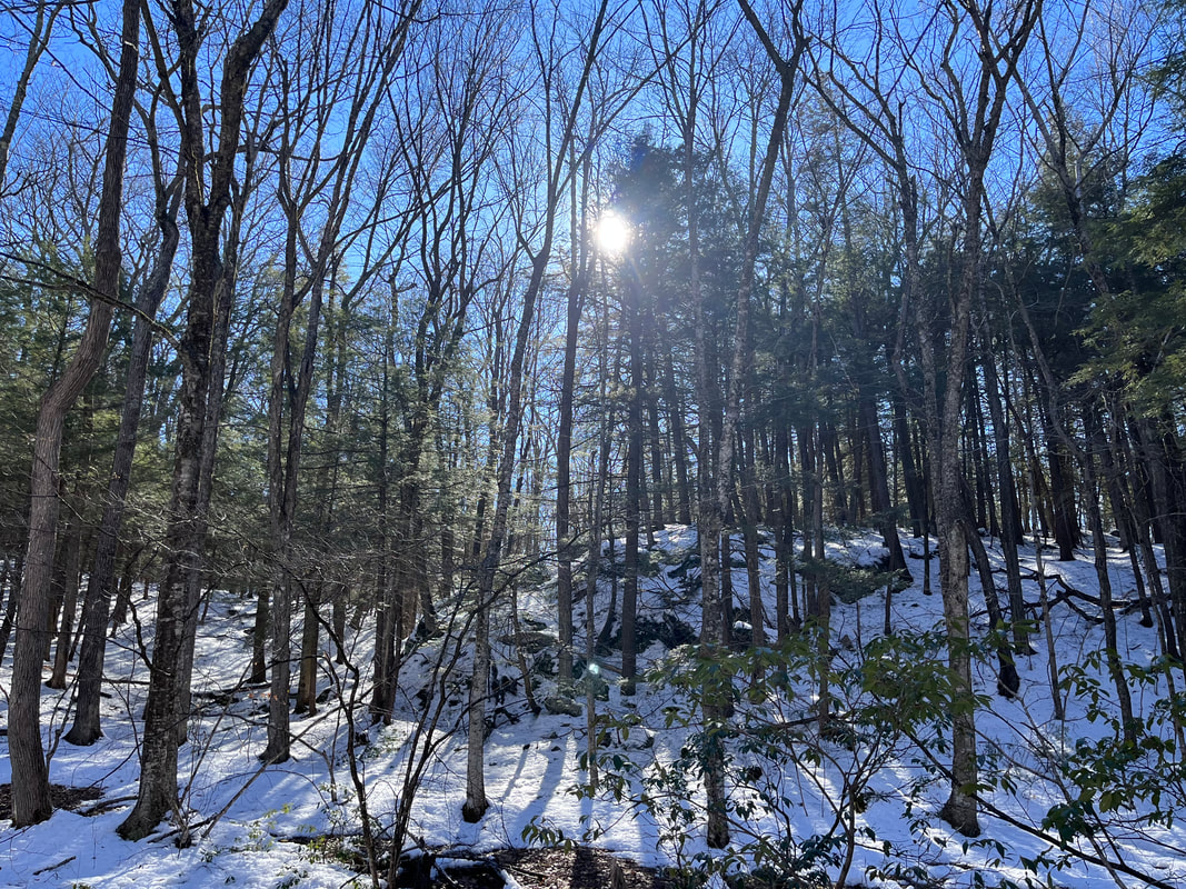 I got turned around right about here. Very pretty though. 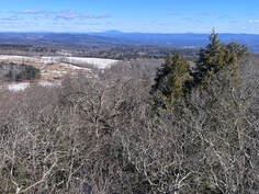 Another view from the fire tower. It looked a bit like a prison on the inside but to look out was fantastic... Another view from the fire tower. It looked a bit like a prison on the inside but to look out was fantastic... Lately I have been thinking about life-changing moments. Specifically those times when we make a decision to leap into the abyss and become a miniature or occasional "knight of faith" in the old formula of Kierkegaard. There are times when our lives change because of something that happened to us. However, when we are able to exercise of free will, our moments of decision change the trajectory of who we are, how we are perceived, and maybe who other people are around us. These decisions aren't always drastic. This is a good thing. People can wait their whole lives and miss the turning points if they believe that our choices only come in large sizes. Sometimes we hardly notice them at the time. Either way we make them, don't we? They are the beats of our lives. Looking back they are the decisions we mark to say that life was different afterward...in some way large or small. I remember deciding to become a minister at the foot of Doubletop Mountain in Maine when I was 19. It wasn't momentous at the time but there I was...and here I am. I just went for a walk in the evening and decided that--given my interests and my emerging skill set--the parish and I would be good for each other. My ministry outlived the campsite we stayed at. It seems to be a much bigger deal now. A short time later I met my future wife at a meeting of college activists. In an uncharacteristic fit of optimism, I thought I would like to get to know her better. Turns out I didn't make much of an impression on her at the time...but here we are three decades later. There are decisions that change our lives in smaller but still-lasting ways. I remember the first time I played the ukulele in the middle of a sermon. Everybody was surprised. These days--many music ministries later--it isn't a big deal anymore. The same can be said for Dungeons and Dragons Club and the "Snow Posse" (sidewalk shoveling) youth group events that grew into something for a few years then seemingly faded away. Those youth are grown up now and some keep in touch. I am always pathetically happy to see them when I can. Two of the gamers now help me teach their parents in "adult" D&D. Maybe it didn't fade after all. Each of these decisions and many others started small and even commonplace. What grew out of them was a life. I feel like there will be a few more decisions like that soon. Maybe I will make them. Maybe someone else will. Right now with the church it feels like many, many big decisions are coming down the line. However, it will be the small ones that lead to another and another that will determine our future. 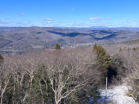 Looking down from the tower toward the trail which runs by the telephone pole. Looking down from the tower toward the trail which runs by the telephone pole. I say all this now because hikes like this are a series of small decisions. This week on a Tuesday I decided to get up and get going. I decided where to go. There were all kinds of micro decisions that helped me to focus on the day. How would I get there? Would I do both the out-and-back to the tower or just the ledges themselves? Was this a good use of my time? How would I deal with the vagaries of weather? Also, on this trip, I decided to do some more extensive filming. It has been a while. Many of you are aware of my interest in 21st century communication. This weblog is part of that. My podcasts are as well. For a long time I was into making youtube videos of sermons, church news, meditations, music and--during the plague--entire worship services. Sometimes this meant collaboration. At other times I worked on them by myself. I got into it through a series of small decisions that brought me joy. A series of small decisions may bring me back...or maybe they come to nothing. It is too early to tell. If we use the model of "Sabbath Walks" that I write and talk about here and elsewhere, all of these endeavors--these choices made and sometime pursued--fall into the category or "frame" of dialogue or creativity. On this hike, for example, the choice to film meant stopping and starting; recording sections of trail, talking to the camera while imagining future viewers, editing after getting home while re-living the excursion, and improvising a soundtrack. I had to make decisions about equipment. If I keep doing this there will be more decisions to make as some things may need replacing. There are many little steps. After all to even get to the point of recording there was research. There were skills that could use some improvement through repetition. That said, I am learning. While this decision may not lead to anything more, it just might...probably in surprising ways. After all, nobody thought the skills I learned from my "hobby" would help hold online worship together during the early months of Covid. Ultimately we found somebody more skilled. Of course, nobody thought that the skilled person we found would be a beloved former member of the D&D Club and the Snow Posse who had moved away. Decisions keep on rippling out, don't they? Anyway, I have included the video. I think it is pretty good for a first attempt! I also started a Sabbath Walks YouTube page that you can subscribe to to get notifications. Just click on the video above and hit "subscribe." I may decide make more of these moving pictures. We shall see. Both I and the church are looking for ways to communicate. Perhaps this is the way. Here is to your decisions and dialogues. I hope you have found something to bring the sabbath "walk" to life regardless of what it is or how you go about it. Many blessings on your travels until next time. I will see you out on the trail. 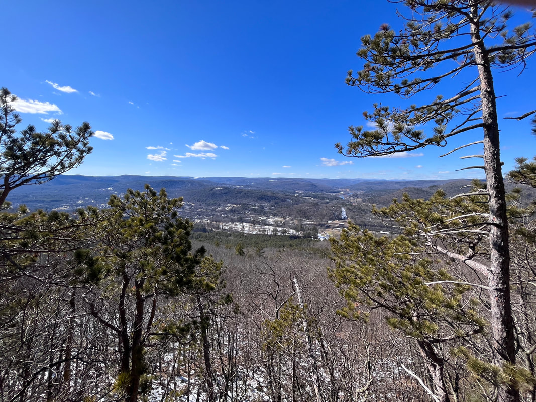 Finally, a still from the an out crop of the ledges themselves, where I took a break. There are better pictures in the video. 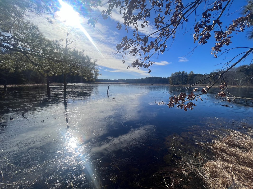 This is the first glorious view of my walk through the Assabet River Wildlife Refuge. It was lovely and might be an easy half-mile out and back for someone. Hiked on February 2, 2023 Somewhere along the way of this project, it appears that at least a few people got the impression that I am particularly rugged or outdoorsy. I am not of course. I am just a suburban dad transitioning to empty-nester with a bad back and sore knees. I prefer a room and a bed--preferably my own--to a tent or sleeping platform. It is just that I find the Transcendent in nature, and that helps get me through the week. I have been doing some workshops on Sabbath Walks. I have been pitching them as "mindful walking" workshops because the word "sabbath" appears to make some folk uncomfortable. Maybe it is because "sabbath" is a religion-word. I like it better, though, "mindful" is way too broad. Anyway, It is at these events--and the conversation around them--that I have noticed this disconnect. People will come up me to say it is all very interesting...but they cannot go on a big hike. Usually this is for physical reasons, which I totally get. The only issue is that I am not talking about hiking. I am talking about walking and even that has more to do with sitting. The process is all about perspective and intention. Are you paying attention to the world around you? Are you letting your experience influence your understanding through reflecting on your context? Then you are more than good. 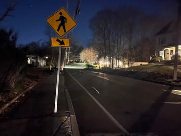 A glimpse of a night walk through my town. The whole place feels different in the dark. A glimpse of a night walk through my town. The whole place feels different in the dark. Actually I haven't gone on many big hikes lately. Work has gotten in the way. So has the weather. I do get out every week but all of my Sabbath Walks in 2023 have been in Massachusetts. It is a good thing that we have so many great opportunities to get out in nature here! Yes, it will be hard to cultivate "likes" in the same way when the views are less dramatic and the physical effort may also be. That said, I have enjoyed immersing myself in the land close to home. Some of the best hikes lately have been repeats. I trundled up Mount Watatic again and again. The Graces and the Crow Hill Ledges still stand out. One of the best walks I had was my usual four-mile round-trip stroll downtown...but at night. This made all the difference. What I really want to talk to you about though, is the Assabet River Wildlife Refuge. 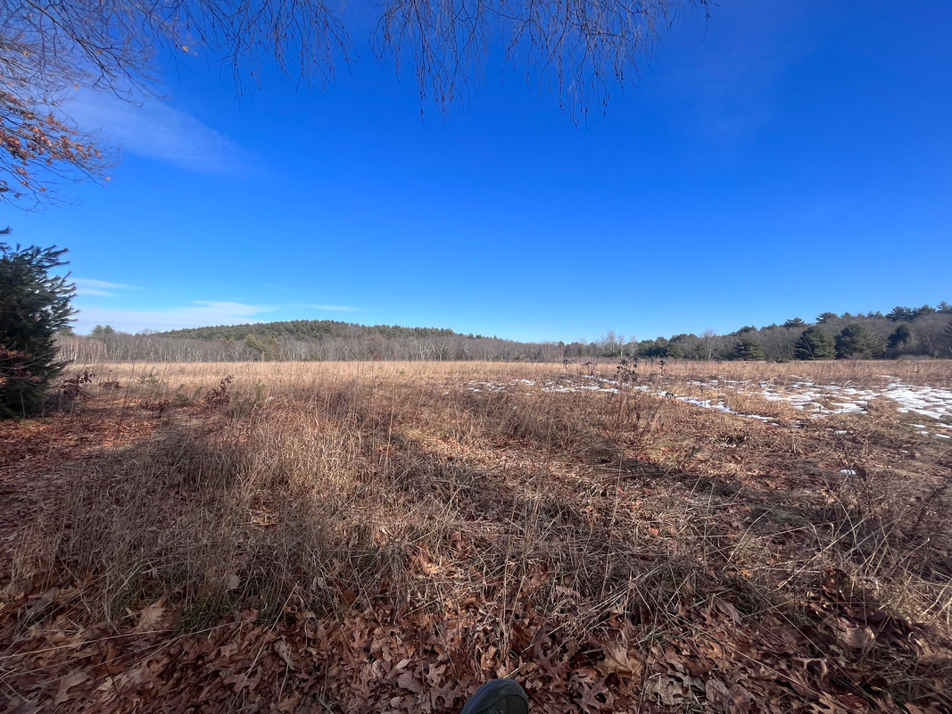 I took advantage of a bench to sit here for a while and have my lunch. It was quite the pretty spot. 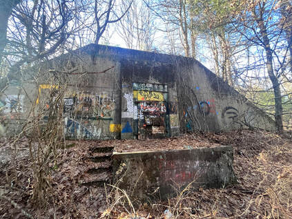 The bunkers off the main trail were covered in graffiti. Obviously they had been re-purposed as hangout spaces for people who wanted to get away. The bunkers off the main trail were covered in graffiti. Obviously they had been re-purposed as hangout spaces for people who wanted to get away. I have to say that I only recently really clued into its existence. I went over there because the weather in New Hampshire was turning dangerous and I also had the need to find something more accessible for a group Sabbath Walk in the spring. As I mentioned earlier, people think that these walks need to be challenging. They do not. I was--and am--searching for places where a person could walk a few feet to find a pretty place to sit. If they wished, they could move on for a more challenging workout...but they wouldn't have to. When you are in a group you need both "easyish" and "hardish" options, so everybody gets what they want or need. Now, on this hike I had expected to see wildlife...and I did. What was surprising, though, was the large amount of evidence of previous human habitation! Many of the trails were unusually wide and there were patches of old, cracked pavement in places. Also, right where I parked was the foundation of an old tavern dating back to 1700. However, the most remarkable thing was the proliferation of immense concrete bunkers tucked away in the forest. Each had a massive metal door that was barred and locked like some dystopian Hobbit hole. Since my trip I heard from friends who had been in one. The description seems to fit as they appear bigger on the inside. The one they visited was vast, cold, and oppressive. 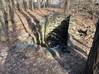 The foundation of the Rice Tavern. Erected in 1700, turned into a house later, and torn down in 1945. The foundation of the Rice Tavern. Erected in 1700, turned into a house later, and torn down in 1945. Now, I later learned that there were 50 of these bunkers in the park. Therein lies a story. First, of course, this land was wilderness. Then it was occupied by native Americans. Then, as Europeans came to this continent, it was a neighborhood for a long time. That is where the old tavern came in. Later Henry David Thoreau would pass through to visit friends. In fact, it stayed a agricultural community until 1942. Then, as the Second World War heated up, the land was seized by eminent domain. The people were moved. There were about 100 of them and they claim their compensation was 10 cents on the dollar. Their houses and the tavern were destroyed. In their place were those big bunkers, to store ammunition for Fort Devens. After a while this annex was sealed off and abandoned. Finally, in 2005, it was opened to the public. When I told this story in church and asked if anyone had been there only my eldest son raised his hand. His high school cross-country team ran there. Otherwise it is a new park to pretty much everyone I know.  I found this near a fishing pier. I found this near a fishing pier. As you walk along its trails today there is all this evidence of the past. There are so many layers of humanity. Some of those layers tell peaceful stories of life lived in the usual ways. Others tell stories of fear, displacement, and violence. Now, the story of this refuge can be read as a parable. With any good parable we have choices to make about how we approach it and where we see ourselves in it. We can imagine ourselves in the position of The Native Americans, or the early colonists, or the neighborhood right before the war...all of them swept away. Perhaps instead we could see with the eyes of those massive bunkers stubbornly demanding our place in the midst of the wilderness. They are solid, powerful, obnoxious even…but largely irrelevant to the world moving around them. Or…we could see ourselves in the refuge, itself; adapting to our current context to serve current needs and connecting to the ecosystem that sustains us. Whatever we choose--and at times we have probably felt ourselves in all these categories with more besides--this walk reminds us of the fullness of time and the power of creation to alter our understanding of what "truth" is. It is a thoughtful place for a walk, or a sit, or a stand. I spent a couple of hours there. Then I went to a bar and wrote the beginnings of a sermon--here is the podcast version--with this story as its inspiration. That is what is supposed to happen on a sabbath walk. There should be a physical and mental challenge, then a new insight gained and a dialogue created. We make sense of our reality through reflection, after all. \My step counter says I walked 8.5 miles and there was much more to explore. I will definitely be back there soon.  Near the end of my hike I had to do quite a bit of log-hopping to keep my feet dry. The Assabet River is mostly reeds and marsh at this point...and it floods a bit...  Thoreau actually wrote a poem about travelling though this area. The Old Marlborough Road exists as a road outside the preserve, but inside it continues as a perimeter road to the park. I hiked it. It was mostly quiet, with a few strollers and fat bikers. Anyway...here is the poem. It isn't necessarily one of his best, but it helps to give life to the people who used to live there. Also the page describes the area a bit. In my sermon I said the refuge is in Sudbury and Wayland. Of course it is actually in Sudbury and Maynard. After twenty years living here my geographical references are still those of a Mainer. By way of reparation, the link is to a Maynard historical site. Update: I finally got around to making a video of my most recent hike here. So if you are interested...here it is! 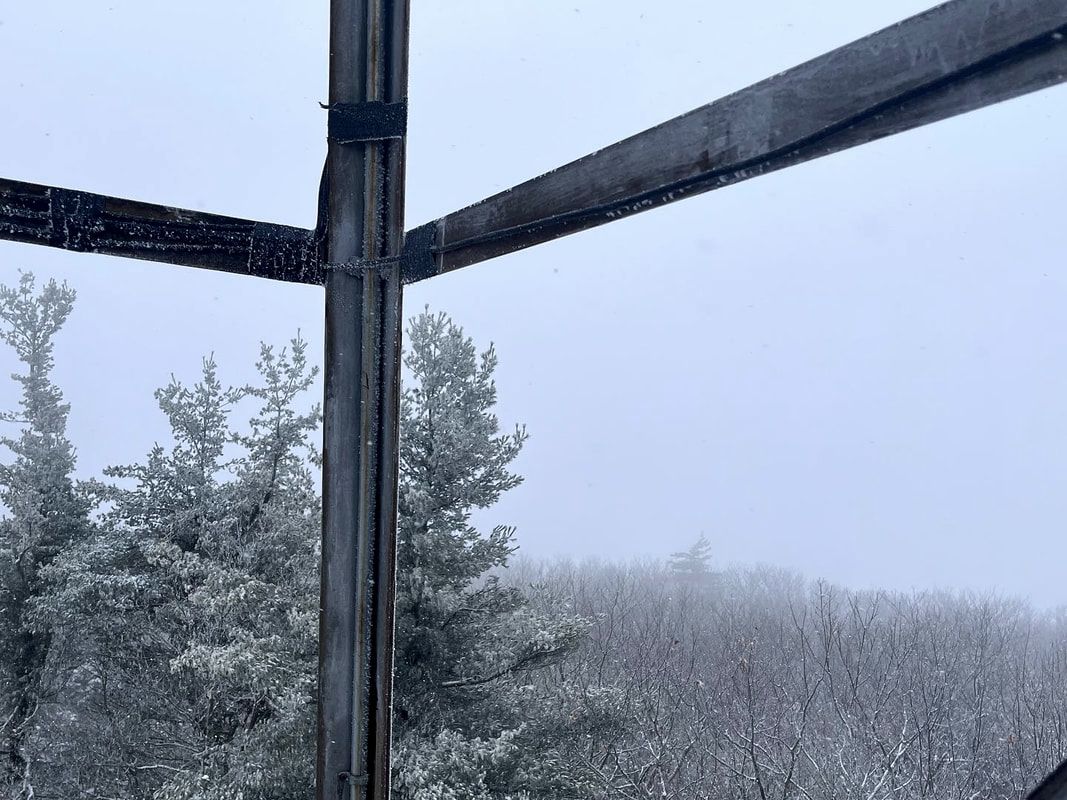 Other people's views from this point are spectacular...I promise. Hiked On January 12, 2023 One of my mentors in ministry told us that on his sabbath days he would put his canoe on top of his truck and drive it through the middle of town. Sometimes he would take his canoe fishing, which is what everyone assumed he was doing. Sometimes he would just paddle around and go home. Sometimes, though, he would drive his canoe to Bangor for a bagel and a coffee with friends...and maybe a trip to the seminary library. He told this story to convey four things. First, that the people of Maine are all pantheists at heart. As a Mainer born and raised I can confirm that this is true. Second, that people may not always respect your "off" time but will do their darndest to respect your sabbath time. Third--and this is where the canoe comes in--in a town of pantheists, a canoe on your truck means you are fishing...and fishing is sacred. Finally, the lesson was that you are best off leaving the parish come sabbath-time. That way folks will not be able to get in touch with you as easily. Also--more importantly--you will be away from the things that draw you back to your labors. 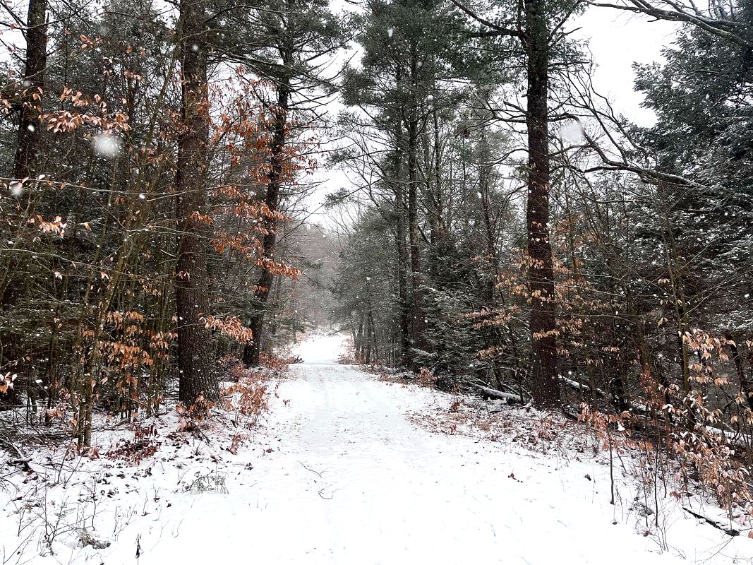 A bit of the early snow. It got more intense before finally trailing off for a while. 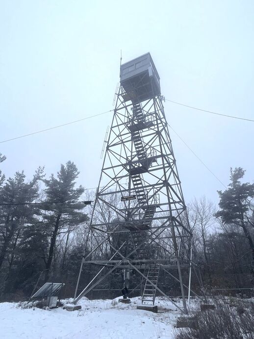 The peak of Mt. Grace The peak of Mt. Grace I thought about that yesterday as I tried my best to tie up loose ends in the morning and hustle out the door for my weekly sabbath hike. "Weekly" is a New Year's goal. Unfortunately, though, I was already on "Plan D" as plans A through C were left in tatters. Mostly the problem was weather up north, but the skies in the Bay State weren't looking so bright either. Little flakes of snow on my windshield indicated that perhaps the northern storm was going to make an appearance after all. Also, my hiking buddy, Andy, couldn't get out of a meeting. So I was left figuring out how far I wanted to travel to hike in the snow by myself. The solution was to leave New Hampshire and Maine well alone and to stay in my adopted commonwealth. A slick and wooly drive down Route 2 brought me to the somewhat obscure Mount Grace State Park and a snow-laden hike up its eponymous mountain, then over to Little Grace, and finally back to the lot. Mount Grace isn't a bad name, but it is a bit unusual. The legend says its name comes from King Philip's War when the daughter of Mary Rowlandson died after being captured by members of the Narragansett tribe. Theoretically the mountain is named after this daughter. It is a romantic notion and ties into one of the major historical moments in and around the Pioneer Valley where the mountain resides. However, there is one glaring problem. Mary's daughter was named Sarah...not Grace. So the name of the mountain remains a mystery. That said, it is a powerful idea to ascribe to this mid-sized monadnock. Somebody in some way found grace here. Maybe we still can. 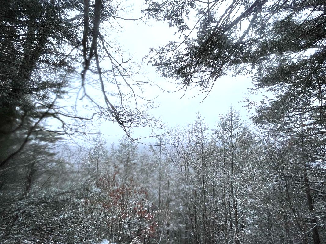 The water-damaged view from Little Grace. It was raining and snowing by now but I took some time, backtracked to check out some elusive views of farmhouses, then had a snack. 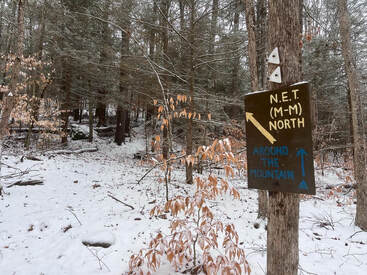 A sign for the New England Trail, a relatively short multi-day hike that I would like to do some day. A sign for the New England Trail, a relatively short multi-day hike that I would like to do some day. If you want to be alone in Massachusetts, drive west and go hiking in a snowstorm. There will be no people to bother you. The trail started out relatively flat but that changed quickly. It was quite a bit more elevation than what I experienced the week before. That, of course, was what I was looking for. It was the only part of Plan A that remained. Then the trail went on up along some power lines to the rather impressive fire tower. It was snowing heavily at this point so no view was to be had. Alas! Pictures indicate it is quite nice. I will need to come back some time. I did get startled a bit. When I turned around to descend the tower my long-suffering water bottle came loose and fell about 40 feet. It hit every available truss on the way down making a dramatic noise as it did so. After finding the water bottle that had submerged itself in the snow, I turned south along a row of power lines that marked the shoulder of Grace and continued on to the smaller peak. Little Grace also theoretically offers views. Every once in a while the snow would blow and eddy away. Then I could peer down into the valley where a number of farms were perched looking for all the world like landscape illustrations in the Saturday Evening Post. One thing worth noting is that--while this is indeed part of my "easyish" hiking list--there were a couple elements that made it challenging. First, there was that snow, which made both visibility and footing rather sketchy. This can be remedied by choosing a better day! However the next thing cannot be fixed so easily. The trails are arranged so that if you decide to climb both peaks and loop back to the parking lot, you will be climbing up pretty close to the end. On a traditional morning climb you go up and then down. This trail rolls up and down quite a bit, which might not be everybody's cup of tea. In the end--according to my imperfect calculations and because of some diversions I took--my total elevation for the day was around 1,500 feet. The feet came in installments across the miles instead of all in one massive climb, but that is more than a number of mountains on the 52 With a View list, including the "starter" peaks of Willard and Pemigewassett which I, at least, found easier than this. You can make it...but I confess to swearing a bit when I hit the last climb of consequence. The loop took me down the side of Little Grace and back around to the parking lot. It was a journey of small views, evocative precipitation, and unsure footing. However, I am glad I got out. Once again, for the second week in a row, I had the place to myself. I do not doubt that the pantheist in me appreciates this. I feel like I am keeping the spirits company on a cold, wet, lonely day. They certainly appear to be keeping mine. 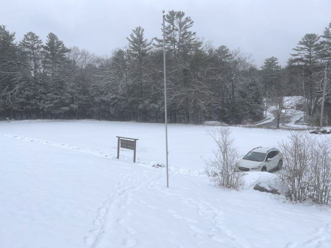 My car in the lot. Proof that the place was all mine for the day! The word "grace" has a number of meanings. In common usage we usually think of dancers or athletes, or people who are particularly well-spoken or well dressed. Perhaps those cues are why we tend to think of wealthy people as graceful even when we do not have much evidence to go on. Also, being gracious is what you try to do when someone else is being a boorish. These are all social, societal qualities. However, in the church where I spend my time, grace indicates the unmerited favor of the Divine. For Universalists--and I serve a congregation that is, among other things, Universalist--this grace is extended to everyone. The old-man funny, curmudgeonly, front-door thing to say now would be that grace was hard to feel on a day with heavy snow and no views. I certainly didn't feel graceful...but I won't go there theologically. There was plenty of grace to be found on these two mountains. In the dynamic display of nature going about its business all I saw was grace. Sure, I saw and felt a whole lot of nature, too. Yet the fact that both were present is not coincidental. I do not love winter hiking, but I love this grace that is sometimes hard to immediately locate in people and in the institutions people make. Yeah we all have it, or have access to it anyway. It is "freely given" and I don't mean in some reductive Christian sense. Grace is just present all the time for all of us. Mostly we don't experience this presence. It takes time and the cultivation of relationships to see and feel it around us. It takes the growing of love between each other and within ourselves. This wild morning reminds me of the blessing of grace. Maybe it will help provide the charge forward for another week. I suspect that on those trips to Bangor my old mentor also snuck some work in on his sabbath day. I get that too. After my hike I spent the afternoon wearing out my welcome in a number of warm dry places where I could write. The draft of this post was one thing. Another was the draft of my sermon for Martin Luther King weekend. The morning reminded me that finding grace in ourselves and each other is more than an attempt at personal wellness. It is instead an important attitude on the path toward justice. Grace leads to love and love to trust then on to community...or at least that is the direction the sermon went. May we all find ways to be this kind of graceful; not pretty and charming but bold and challenging as we expand and strengthen the web of connection--the world community--that surrounds us.  The last writing stop, where even the stale donuts were gone... 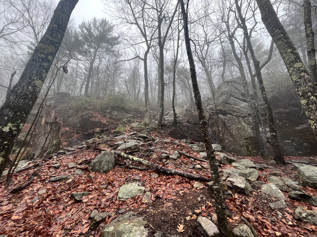 The whole trip had a soft mist or a gentle downpour. Very evocative... 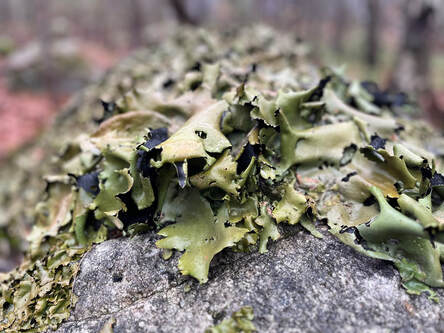 Rock Tripe has a great name. It is edible, sorta, if you boil it enough to remove its flavor and "purgative properties" but it has indeed saved lives. Also, this one looks a bit like a dragon... Rock Tripe has a great name. It is edible, sorta, if you boil it enough to remove its flavor and "purgative properties" but it has indeed saved lives. Also, this one looks a bit like a dragon... Hiked On January 5, 2023 It is hard to get going sometimes, isn't it? Getting ready for church on Epiphany Sunday even my brain felt bloated and out of shape. Two Sundays went by without a service. How do I do this again? Why do I do this? In the end it was fun. I preached about beginnings and about not falling back into the same old ways of last year. After all, the old patterns may not be so hot. The band also did a pretty good job leading Good King Wenceslas. It is ostensibly a Boxing Day carol --"Good King Wenceslas looked out on the Feast of Stephen"--but really it's just cool folk tune about the legendary Duke Vaclav of Bohemia. Anyway, hiking is like that too...but worse. I mean, it has been over a month since I put in any really serious reps hiking. I have been to the gym a handful of times and did those Solstice Walks but sometimes I worry that I won't really get back up to climbing shape. This isn't my favorite time. You know this. I would rather hike in "shoulder season" in the spring. Winter is here, though, and getting out is important. 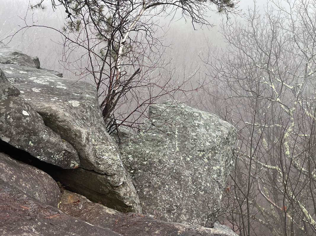 There was no view, really, from the ledges. However the fog accentuated the foreground nicely. 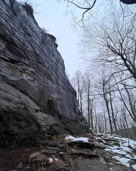 Near where the cliff climber was. Near where the cliff climber was. On Thursday I concluded that I could probably clear a few homiletical cobwebs as well as partially arrest my downward slide in health and fitness by taking a good walk. Maybe I could shock myself back into action! I put my heavy pack on and drove back out to the Leominster State Forest. There I continued the loop that I started a couple weeks earlier. The total hike was about 3.8 miles and 600ish feet of total elevation. So not a big climb. However, I am out of practice. My knees hurt at the end. The thing about this loop up the Crow Hill Ledges is that it features a short, steep section at the very beginning. I guess it could be at the end instead if one takes the loop the other way. I like to climb up rather than climb down, though. So I always choose the hard part first. After that things roll a bit along a long ledge. There are obscured views through the tree trunks that wouldn't be there the rest of the year. On this day, though, many of them were still socked in a bit by rain and fog. The crisp, clean wintery air had been replaced by, well...shoulder season weather. It felt like early spring. 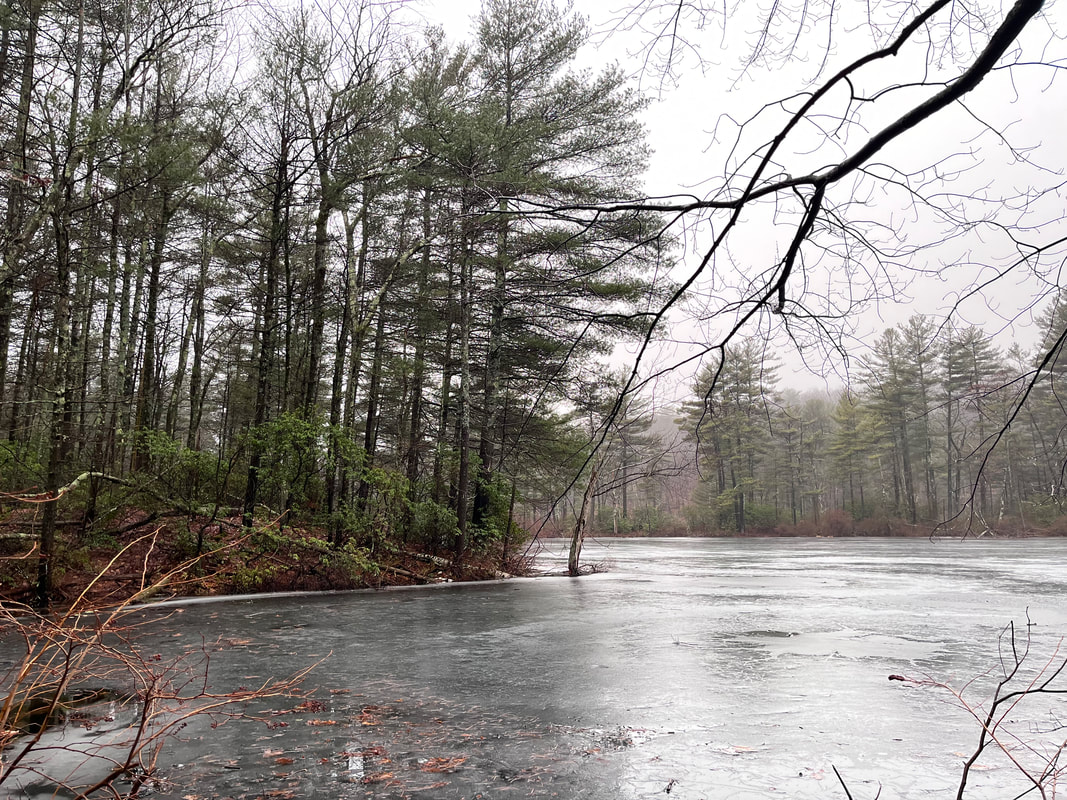  Still, it was more than nice to be out and about. Parks like this are very popular on nice days, so a little inclement weather meant that I had it to myself for the most part. There was a college kid scaling the massive cliffs and a couple different people walking their dogs on the flat. There was also the constant sound of traffic from Route 31. That aside, though, the fog added a mystical quality to the hike. The landscape--now wet with rain rather than covered with snow--looked very different from the last time I was there. Once again I wandered about a bit, exploring the side-trails and looping around the local swimming hole still holding on to a little ice in spite of the relatively warm winter weather. I felt like I could spend all day there. In the end I didn't spend the day. In fact, it was already pretty late when I arrived! Technically Thursday is my sabbath. However a variety of errands and tasks early in the week--start up stuff for the church mostly--had pushed quite a bit of work into the morning. Once again this made me late. Just like last time I found myself pulling out my headlamp on the way back. The rain had made the journey a perpetual dusk until the dark appeared. Then I drove to a Dunkin' Donuts for dinner and to write my sermon. Still, at least I achieved my goal. I got out and did a thing. I had a small adventure. I cleared my head enough to get the most creative parts of my job done. Maybe this trip will beat back the inertia. Maybe this year won't entirely be a slog after all. Update: I recently made a video of a hike that was similar to the one described...here it is!  Gear is often necessary but also sometimes fun! Here is my brother Dan showing a guy his cool mountain identifying app on Mount Chocorua. He drew quite a crowd.. I got up early the other day and went back north to Maine to visit family. We hadn't been for a while and the personal landscape has changed a bit. Still, it was nice to be home. We only had so much time for a tour of various households. Some relations--like my mom--had moved since we were there last. Others were right where we left them. It was all good. So much in life can feel unstable these days. Everyone I know, it seems, is in transition. Seeing people who you have known forever reminds you that while the trappings are altered somewhat, you still have a place, even if it is more relational than physical these days. I may not have spent a huge amount of time in some of these spaces...but my people are there. This relational feeling is not unlike the one I get from being outside. There is plenty that doesn't quite fit each time, but, still, one is locked into an extended network where a place for humanity--and for individual humans--still exists. Lately it has been hard to get outdoors. It will be for a while longer. Weather, time, work, and the desire to be with family currently create a number of barriers that are hard to overcome. Oh well...it will happen...eventually. Until then there is preparation and staying in shape. One aspect of preparation involves going through my backpacks and taking a look at all the gear I have for hiking. Some of it needs to be cleaned. There are a couple items I wonder if I really need. There are a few that must be replaced. Whenever I get back out it would be best to have the right stuff. Staying in shape, on the other hand, means getting back to the gym and slowly heading back out into the winter world... 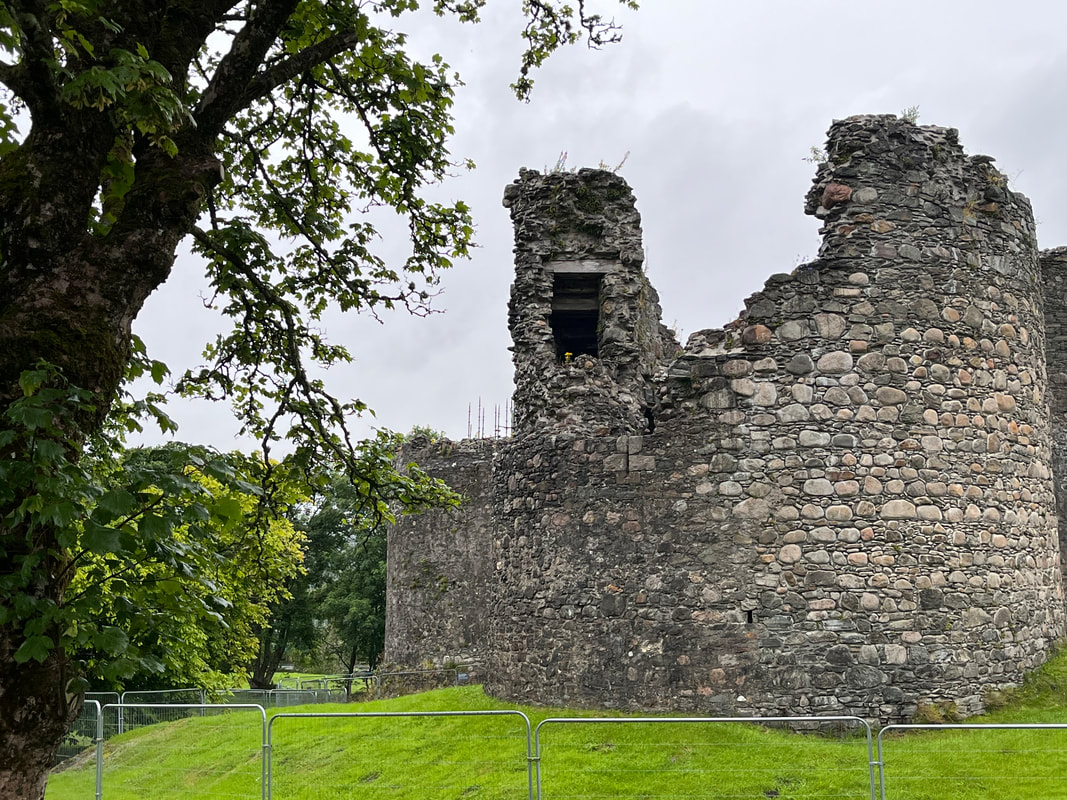 Inverlochy Castle outside of Fort William in Scotland. That hike was a peak experience of the year! 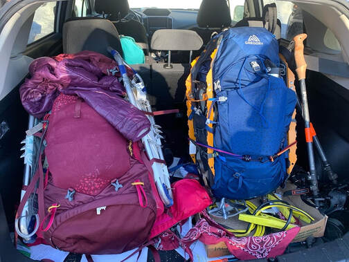 Two Gregory Packs in their full glory on the coldest hike of our year up Mount Liberty. You can see some of the extra straps for carrying snowshoes and other gear. Mine is the blue one. Al's is one size up. Two Gregory Packs in their full glory on the coldest hike of our year up Mount Liberty. You can see some of the extra straps for carrying snowshoes and other gear. Mine is the blue one. Al's is one size up. For the next year-end list I have five pieces of kit that I was super grateful for. Some of this stuff becomes a part of you on a long walk. Some of it may be or feel a bit more of a burden at times. Some of it never does. Anyway, here they are, in no particular order. Backpacks: OK... Maybe there is a bit of an order. You aren't going to get far without a good pack. I actually have four. One--a 40 liter Osprey--is really my travel bag but those straps are super-helpful for pushing through train stations and airports. Another is a 20 liter day pack from LL Bean that folds up super-small. Before my back injury, that was my go to day pack. Post-surgery, everything must have a frame now. I still make use of it. I just take it to the gym. With that out of the way, my current hiking kit includes the remaining two bags. I switch them out seasonally. That said, the seasons aren't even and there are times when I need to carry more stuff than a basic day pack can handle. Usually this means I defer to my "winter"--and most of spring and late fall--pack; the Gregory Zulu 40. A 40 liter pack isn't actually that large. It wouldn't get you much farther than an overnight, but--considering how I hike--this one has fit the bill for a couple years. You need a big pack when it starts to get cold. I found that this year, for example, I had to put my smaller bag away in mid-September. Over the course of our partnership, I have added some after-market straps and usually carry a couple bungee cords. There are always extras, like sandals, wet socks, or snowshoes that need to hang outside. The Gregory has a couple years on it. This year, however, I also got a summer pack for our hike across Scotland. We were staying in B&B's so there was no need for the extra camping capacity. Also--concerned about the longer days and what the weight would do to us--we planned to carry mostly water and one extra layer. For this purpose I used the Osprey Talon 22. At 22 liters it was close to half the capacity of the Gregory. It turned out I could carry quite a bit more than I thought, so I took advantage of the space. There is a partial list of my daily payload in the wrap up--linked in this paragraph--from that trip. However, it is still a slightly lighter frame pack that kept me honest about what to bring. It is best for either when hikes are in fair weather and close to resources or straight up during the summer months. 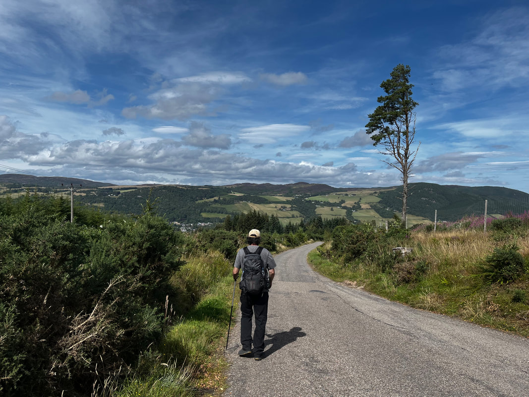 Me in Scotland with the Osprey Talon 22, just one pole that had the kind of clamp I don't like (see below), and my annoying boots. At least the pack was good.  Wet day coming down the Horn...dry feet. Wet day coming down the Horn...dry feet. Boots: OK, this is a simple one. Boots are a personal decision based on the shape and size of individual feet. I used two pairs this year with mixed success. I made a mistake in my selection of boots for the Scotland hike. I thought something with a softer sole would help with the hard roads. It did...but the boot was less breathable which was a problem during Global Warming Summer. I would have been better off with something more durable or more breathable. I will not dwell on that. You can check out the post I linked in the last section. The good news is that my other pair are Lowas. I like them very much, though they did need inserts. They are all leather which somehow made them more breathable. Also, they kept me dry under some hideously damp circumstances. Once your feet are wet there is no happiness. I dread having to replace these boots as they have been downright perfect for my needs. Hopefully they are perfect next time as well. Boots are expensive... 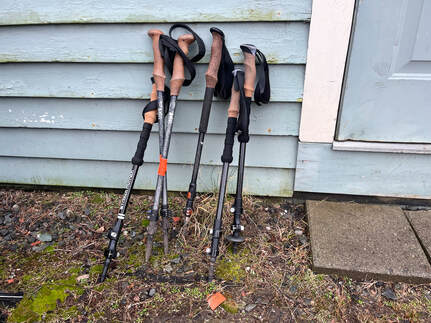 Here is an assortment of poles, mostly from REI or Hiker Hunger. There is a beat up one that journeyed on the AT with a thru-hiker but couldn't be taken on the plane. Note the cork handles--to keep your hands dry--and the basic looking clamps for adjusting height. Here is an assortment of poles, mostly from REI or Hiker Hunger. There is a beat up one that journeyed on the AT with a thru-hiker but couldn't be taken on the plane. Note the cork handles--to keep your hands dry--and the basic looking clamps for adjusting height. Hiking Poles: Here is a piece of equipment that I didn't expect to rely on as much as I did. Boy, do they make a difference! I was using these a bit even before my back injury. Now I rarely take a hike of any consequence without them. My suggestion is to always use two. That will help to balance you out. I use them both for ups and downs. Some do one or the other. Either way, they take pressure from your knees and make your arms work a bit harder. This is all to the good. Most hiking poles work just fine. Do yourself a favor, though and skip thinking about using ski poles. They are not the same! Hiking poles are adjustable and built for taking a ton of weight for a longer time. These days my go-to poles are from Hiker Hunger. I like the carbon fiber. This is partly just because they are a tad lighter, more durable, and take the shock a bit better. I broke a metal pole by landing on it. That also may have biased me. There are slight variations in design to think about if you want to. I prefer cork handles and a simple clamp for adjusting height. There are some which have sleeker looking mechanisms where you twist an invisible squeeze thing. They look sleeker, but the mechanics on the inside are impossible to repair and more likely to break. With most hiking equipment simplicity is a virtue. It should be possible to tighten the clamp at the joints with a phillips head (that you should bring with you if this is the case) or with your fingers (as on the Hiker Hunger models). If you zoom in on the picture above you will see what I am talking about. 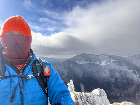 That orange thing that isn't a hat is the Garmin. Bringing that was the wisest thing I did on my solo hike up Jackson and Webster. That orange thing that isn't a hat is the Garmin. Bringing that was the wisest thing I did on my solo hike up Jackson and Webster. Garmin Mini: There isn't a ton to say here. this is a device that connects to a satellite to give you directions and communicate with the outside world. We rarely use it, preferring phone apps like AllTrails and actual physical maps that don't need charging. That said, the Garmin has an SOS function which could be a lifesaver if you get stranded in a spot where your phone doesn't work. Some hikes have few to know dead spots. Others--like those in Baxter State Park--rarely have cell coverage. The Garmin gives us piece of mind that we don't have to use. Al and I have one that we share, because...it is pricey. 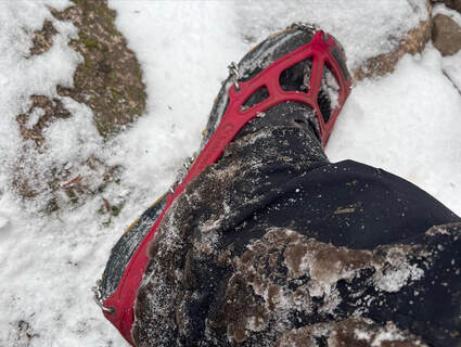 OK...this was pretty wise, too. These are my Kahtoolas on Jackson and Webster. OK...this was pretty wise, too. These are my Kahtoolas on Jackson and Webster. Micro-Spikes: On the hiking socials there are a lot of arguments about which kind to use. Basically, though, they are chains and pointy things with elastic frames that fit over your boots. This time of year they are super-important to have in your bag. We always carry micro-spikes starting in November if we are expecting to climb. For how we hike, they are even more important than snowshoes (also necessary in some situations). Ice can really mess a person up. There are really only two brands that you want to find yourself depending on. They are made either by Kahtoola or by Hillsound. Do NOT try to save money here if you can help it. There are cheaper brands but I, at least, worry about getting stuck somewhere sketchy with nothing more than a pile of broken elastics. For winter hiking one might also want crampons (big spikes) or an ice-ax. Al and I use micro-spikes and just assume we aren't doing hikes that require more than that. We do like to know our limits! Maybe someday we will trade up. That Jackson hike was an eye-opener. It was the first time I missed having an ax. I have also found micro-spikes helpful on shorter trips where there is little ice but quite a bit of packed down snow. That extra traction keeps one from slipping back and wasting energy. Well that is all for now! Obviously there is a lot of other gear one could bring up here. these are just my favorites. Honorable mentions can be given to my trekking towel, the oft-used water purification tablets, snacks, and snowshoes. Maybe I will get to those later, but these are the big ones or 2022...  One last peek at the Gregory backpack and the Hiker Hunger poles. They were all pretty constant companions this year...  The Mighty Quinobequin--also known as the Charles River--as it flows through my neighborhood on the second day of Christmas I commenced the second day of Christmas by discovering the Latin and colloquial names of my houseplants. Then I made coffee. Then I went for a walk. On my walk I started to make a plan for surviving the next two months. As you may have gathered from my previous post, I am not at my best in winter. I must find ways to move from one thing to another, to another... There is no reason to delve too deeply into all that again. It is just a fact of life that requires a certain amount of organization. Organization, however, is something I am very bad at. So I have some time between now and Epiphany to figure out an approach. No doubt it will involve being out in nature. There will be hikes, of course. Also, my Christmas gift to myself was a stack of gardening books so I can solidify my gains from last year. I have a tab open with tomato seeds! For part of the season I will be working at a job I usually enjoy. Then--for a little while at the end when I am most despairing--I will be on sabbatical. So much of this time can feel restrictive. Hibernation-brain is right there picking away at our resolve. The trick is not to keep busy for busy-sake but to find ways to be excited about...something, even though it might take a herculean effort to get going. One of the the things I will try to do is make some "top" lists for the new year that I can share with you. It is actually a big help for me and, maybe, you will enjoy it too. The ranking lists for blog posts and such is canonically around "Mount Roberts Day" when I began this project. These ones are more specific to the background of the project. To start, here are the six (6) most influential books I used this year for planning hikes and walks or planning for planning...if that makes sense. Some are trail guides. Some are practical, and one is historical. They have all been consulted before, after, and during hikes. Some of them are quite beaten up now as they have lived for a time in my backpack. I will hopefully deal with more speculative books and maybe even equipment in later lists.... 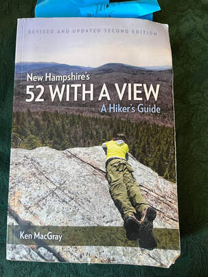 1) New Hampshire's 52 With A View: A Hiker's Guide by Ken MacGray. Ok so I have talked about the New Hampshire and New England "Hiking Lists". They exist elsewhere of course, but I don't so these are the ones I know best. My favorite list is the "52WAV". They range from relatively easy--you do have to be in shape--to rather brutal. Each one, though, comes with a view. The list is subjective. It is curated by a committee and so far their taste in views has been spot on. Ken MacGray is a bit of an insitution. He has worked on a number of other hiking books and runs the Facebook page for the 52 group. His prose is accessible and clear while also being entertaining. Even though I have climbed more 4,000 footers in New Hampshire--the 52's are a bit of a me project right now and I like to hike with people--this is my favorite book and my favorite list. Five stars, buy it. Start with Willard. 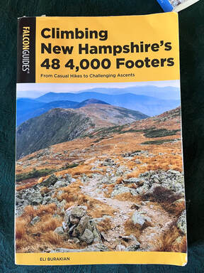 2) Climbing New Hampshire's 48 4,000 Footers by Eli Burakian. Actually there are more that 48 4,000 foot mountains in New Hampshire so--while the 48'ers like to pretend at objectivity--this list is subjective, too. This is the basic book for the task of hiking all those mountains. It contains suggested routes and maps. Maps are a plus, by the way. MacGray's book assumes you have separate maps on you--and you should--but it is nice to have these as well. I have used the routes in the book when planning. Most of the time I have taken the exact route. At other times I have modified my route using another book--in the honorable mentions--and/or those maps. The text is brief and to the point, which I like. 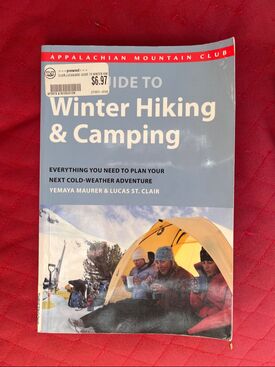 3) Appalachian Mountain Club Guide to Winter Hiking by Yemaya Maurer and Lucas St. Clair. I am in the process of re-reading this book right now. There is a great deal of difference between hiking in winter and hiking the rest of the year. It is imperative that we know at least the basics of what we are doing. I do not camp in winter, but those sections are good to be familiar with as well just in case you find yourself having to be out overnight. The presence of roads into the wilderness sometimes confuses us as to how at risk we are. Just because we can reach the foot of Presidentials in a couple hours does not mean we are strolling on the local rail trail. This book covers the basics that one needs to know to be relatively safe and comfortable in the ice, snow, and dangerously low temperatures. There is some practical philosophy as well. I found the description and use of equipment, tips on reading the weather, and the basics of layering to be the most useful. The authors make you feel like you are part of a team, namely a team of prepared and educated winter hikers. 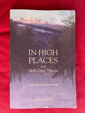 4) In High Places with Henry David Thoreau by John Gibson This is the history book I was telling you about. It also has routes and maps! I am a big fan of Thoreau's writing--he will appear on a different list--and when I have managed to walk in his footsteps I have found this book to be indispensable. However, this is not a general book. The mountains picked are rather niche, thanks to the subject matter. Thoreau--who walked a great deal--needed to have spent some time writing about them in order for them to be included here. However, my readers will note the Thoreau-heavy blog posts for Katahdin, Washington, and Wachusett. I gotta get back out to Greylock, and when I do...this book is coming with me. 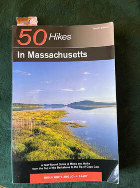 5) 50 Hikes in Massachusetts by Brian White and John Brady Yes, there are hikes right here in the Commonwealth. When I feel like heading out but do not know where to go exactly, this is the book I take. I used it as recently as Thursday when I went to Leominster State Forest. Pretty much any hike in Massachusetts I have taken has been planned using this. It has maps but I often diverge a bit. This has nothing to do with their quality! It has more to do with my confidence with lower elevation hiking. I do, however, plan those alternate routes in advance as well...and I have detailed maps. Spontaneity isn't always a good idea in the wild. Another great thing about this book is that it has many easier hikes. This, alone makes it worth having. Hiking doesn't have to be a toxic race to the highest, most dangerous peak. That is not very sabbath, after all... 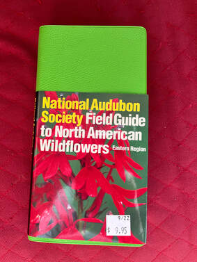 6) Field Guide to North American Wildflowers: Eastern Region by the National Audubon Society I picked this up out of envy. My brother Dan--who features largely in many of my posts--is a wildlife biologist. Hiking with him is a hobbit-like excursion where I follow him around as he identifies birds by their song, animals by their poop, and plants by their leaves, needles, bark, and roots. I wanted to get in to the game myself. What a great way to enhance one's dialogue with nature! Anyway, I love this book. It takes a while to figure it out because it relies on the reader knowing at least the basics off what they are looking at. That said, I have enjoyed it during my sabbath breaks on smaller mountains. If you know anything from my various posts, sermons, and so on, you know that it is that it is OK to enjoy something you aren't good at. Also, I think it is helping me get better.... 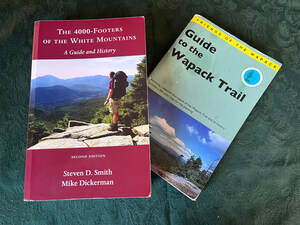 Honorable Mentions: Here are two more that are deserving of note. The first is The 4,000 Footers of the White Mountains: A Guide and History by Steven Smith and Mike Dickerman. This thing is the Bible of the 48'ers. My wife swears by it. When I go off the suggested trail in the Burakian book, I always consult this. It only gets an honorable mention because I don't seem to use it as much. It is dense. There are no helpful maps. However, it has one big advantage that the other book does not; there is a winter description for each mountain. Had I consulted it before hiking Mount Jackson, I might have been more prepared for the icy ledge and the high winds that greeted me. Finally, I wanted to mention the thin book entitled "Guide to the Wapack Trail" by the Friends of the Wapack. I have mentioned this trail before. It begins on Mount Watatic and runs to the Pack Monadnocks straight through some of my favorite landscape in the world. It is a long day hike--21 miles--or can be done in pieces. I would love to take a day and do it this year... Anyway, that is all for now. You got me through my morning! I hope your Christmas is going well... :-)   Most of my best pictures were from Mount Webster because I wasn't busy falling down. HIKED ON NOVEMBER 14, 2022 Yesterday was "Thanksgiving Sunday" which is the Sunday before Thanksgiving. It was lovely and peaceful and--at least for me--quite moving. Today, however, I am on screech. Thursday is actual Thanksgiving, then Sunday is the beginning of Advent. There is so much to do. All I see is a long string of tasks stretched out until December 26. This is not unusual for any of us, particularly for clergy, so I am putting my head down and getting on with it... That said, I did hike Mount Jackson and Mount Webster a week ago in a freak snow situation. The weather--which was unseasonably warm--had turned on a dime. Al got sick. I had a reservation in New Hampshire. All this added up to a very beautiful, very cold, very slippery hike! 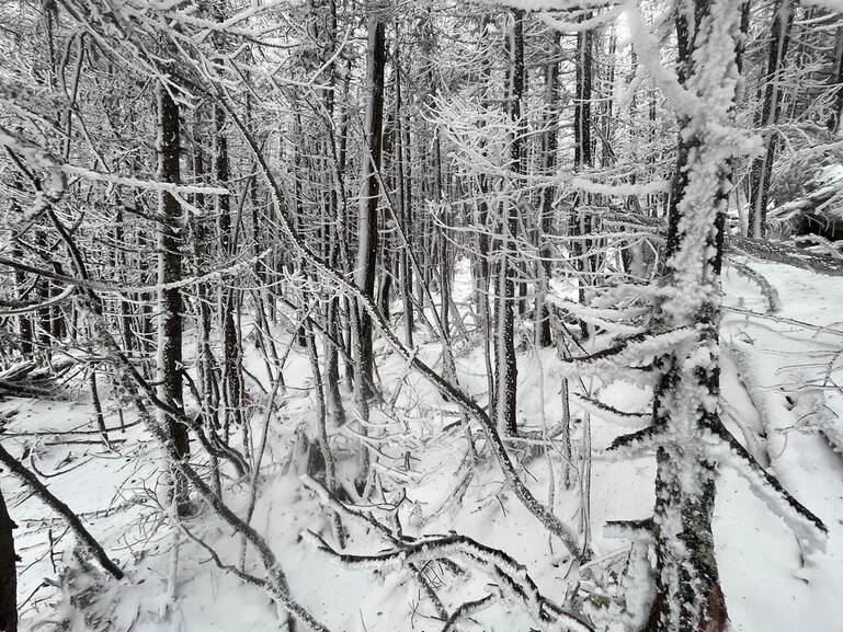 This stand of trees were on the ridge between Jackson and Webster in one of those quiet places you find even on the windiest days. 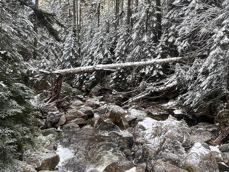 One of the many stream crossings that probably wouldn't be that difficult...except for the ice. One of the many stream crossings that probably wouldn't be that difficult...except for the ice. There are plenty of things that I would do differently. I would have perhaps not gone. I would have done better research (I was planning on a different I hike with Al). However, I did go. I do not love snow but I have done quite a few winter hikes at this point. I knew it would be gorgeous at the top and that the trails themselves would have a lot to offer. The only thing that gave me any pause was that I was by myself. With that in mind, I double checked my pack, put on my microspikes, and went on up. It turned out that--while I passed two people heading down Webster--I was the only one hitting Jackson on this particular day. It is a popular mountain. It is rare to have it to oneself. The sound of the high wind in the trees and the rush of water under (and over) the ice created the background music to my solo climb as I negotiated some deadfalls and, of course, the icy stream crossings. I was careful and took lots of breaks, too. 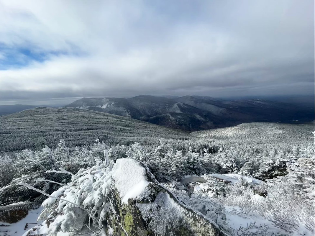 Taken near where I fell on Jackson. That flat-looking thing to the left is the ridge I took to Webster. Finally, I reached the tree line. What followed was a brief period of complete chaos! I was pushed around by the wind. I later learned that the wind chill put the temperature at -2 degrees Fahrenheit. My hat almost blew off. I got turned around and--most exciting--I fell and slid on the ice while trying to avoid the worst spot. It was dangerous but--thanks to the speed of falling and the need to figure out what to do so as not to freeze to death--I kept moving. In fairly short order I found my way to the peak and then started down toward Webster. Those few moments of free-fall, though, became my reflection for Sunday. Every once in a while I have the experience of a sermon or prayer coming to me in its whole form. This was one of those times. Collecting myself before trying to stand, the first few ideas came to my head. We humans are always grateful for the peace--in this case an extremely dramatic and windy peace--after a fall. Time stopped while I sat there on the edge of the earth. All I experienced was the smallness of me and the vastness of what was around me. Nature doesn't really care about you. Sometimes that is properly frightening. Sometimes it is liberating. 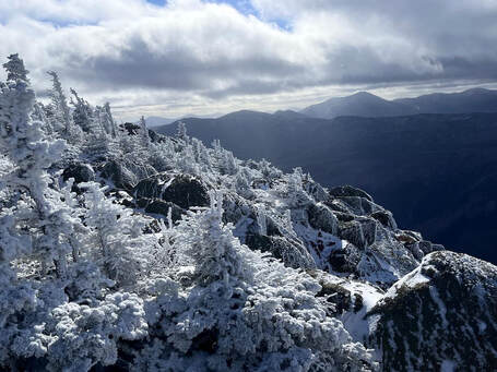 The ledges on Webster The ledges on Webster There are a lot of different ways to fall. Each time we are saved we crave welcome and assurance. We are grateful for how we made it through the crisis or the climb. We give thanks and praise the acts of kindness and love--from ourselves and others--that we experienced in the darkness. After taking that moment where I fell, the rest of the hike unfolded before me. What a blessing to be alive on this dynamic planet! I slowly brushed myself off and continued on to Mount Webster. 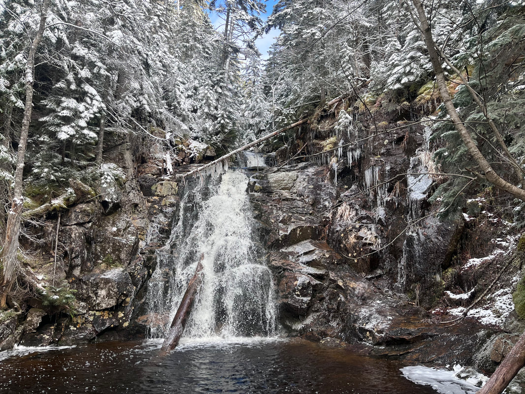 In a way there isn't much to say, except that the ridge between peaks was spectacular. So, too, was the view--from a much more secure perch--off Mount Webster. On the way down I passed a few more people sensibly just doing the smaller mountain. None of them were by themselves. I also witnessed a beautiful waterfall on the way down. Snow really does its job on the landscape, making it feel other-worldly. This is our world, though. That is another thing to be grateful for. Winter hiking, itself, is beautiful. Solo hiking is special and dramatic. However, I will keep my solo winter hikes to the 52 With a View list and look for companions on the big mountains going forward. |
Adam Tierney-EliotI am a full-time pastor in a small, progressive church in Massachusetts. This blog is about the non-church things I do to find spiritual sustenance. Archives
June 2024
Categories
All
|
 RSS Feed