|
From this elevation just on the skirts of the clouds, we could overlook the country west and south for a hundred miles. There it was, the state of Maine, which we had seen on the map, but not much like that,--immeasurable forest for the sun to shine on, that eastern stuff we hear of in Massachusetts. No clearing, no house. It does not look as if a solitary traveler had cut so much of a walking stick there. --HD Thoreau 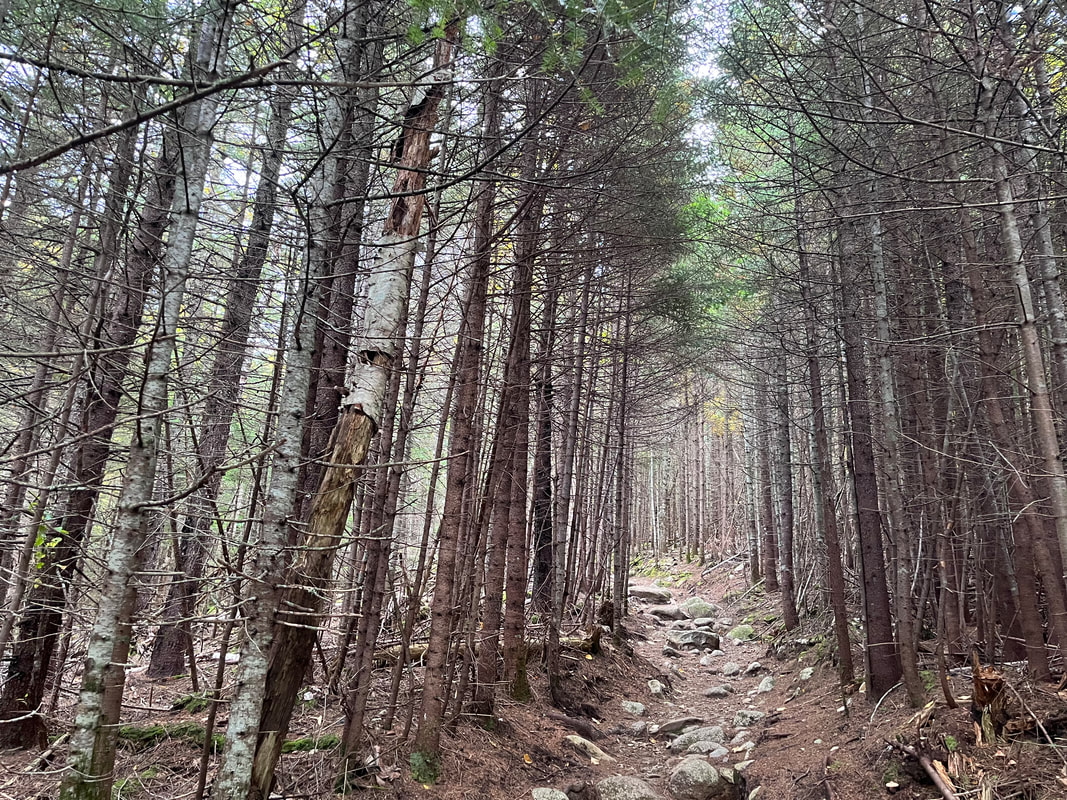 A pretty shot of the early part of the trail. 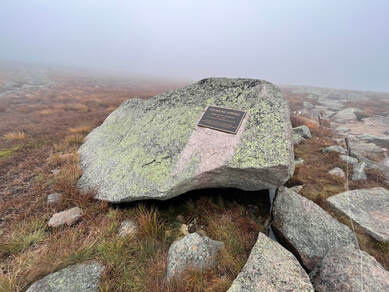 Thoreau Spring which is may have seen...or may not...but that is not the point. Thoreau Spring which is may have seen...or may not...but that is not the point. Hiked (via Hunt Trail/AT) on September 29, 2022 Henry David Thoreau gets a bad rap in some quarters. Specifically it is fashionable to accuse him of hypocrisy. I have done it, but now I relent. This accusation isn't because of something he did. Instead it is the result of what people in the 1970's and 1980's wanted him to be. Thoreau died in 1862 having spoken out for a changed relationship between human beings and nature. In fact, his position was a bit of a counter-movement. It remains so. Capitalist society wants what it deems "progress" which means--primarily--financial, technological, industrial progress. The natural world, for many people, has developed into a setting for humans to exploit. This could be mining, or it could be forms of eco-tourism like hiking. Either way the question is what it can do to serve us. Actually it isn't even a question of serving all of us...just the ones who can grab those resources. Thoreau, on the other hand, was interested in nature on its own terms. We want Thoreau to be some sort of Medieval holy-man living in a cave somewhere. Maybe instead we wish him to be an explorer, denying himself the trappings of a comfortable life. The problem is, he didn't think of himself as an adventurer or a hermit. He was a businessman. He manufactured pencils and worked as a well-respected surveyor. He was an essayist and public lecturer at a time when these were prominent expressions of art. He worked his whole life, actually. He lived that life in Concord Massachusetts. "I have traveled a good deal in Concord; and everywhere, in shops, and offices, and fields, the inhabitants have appeared to me to be doing penance in a thousand remarkable ways." is how he put his observations in Walden. The man was into deeply knowing a place. He liked people and saw their burdens. When he lived in Walden--just a mile or two from downtown Concord--he maintained a regular social schedule with his friends and, yes, had his mother do his laundry. Why wouldn't he? After all, she did everyone's laundry. In a time before washing-machines, it was her job. 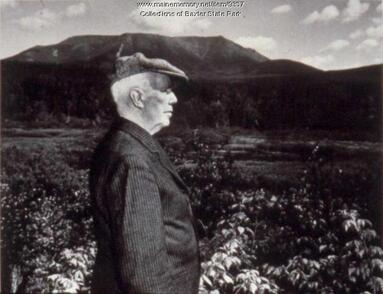 Percy Baxter with Mount Katahdin behind him. Percy Baxter with Mount Katahdin behind him. I bring this up now because Thoreau was also an adventurer, like many of us. It just wasn't his primary identity. He would plan expeditions around New England to the places that were still wild and relatively untamed. He wanted to see them. He wanted to record them so we would remember what they were like. Maybe, if we experienced nature on its own terms, we might value what it has to tell us. One of his greatest adventures was a multi-week trek to Mount Katahdin, mostly on foot and by canoe. There were no roads, after all, which is worth remembering. In the end he made it to the mountain, explored the region around it, and hiked to the tableland. That he doesn't seem to have hit one of the six major peaks is occasionally brought up like the laundry story. It is worth noting that peak-bagging wasn't a thing yet. He was there for the journey and he had a long one back to civilization ahead of him. Another reason to bring it up is that many years after his death he had an ally in Percival Proctor Baxter. Known to generations of Maine schoolchildren as "PP" Baxter, this former Governor of Maine purchased a massive section of land that included Katahdin. Then he donated it to the state on the condition that it remain "forever wild." Human needs were to be secondary to the cycles of the land. People could come to see it; to hike, fish, and sometimes hunt in it. However, it would also be rough by the standards of human parks. It privileges wildness. In fact, this was a very controversial move. The state had refused to purchase it outright because of the hopes for future development. Baxter forced their hand. That is plenty of context, I know. It is important, though. This mountain is not climbed like, say, Mount Washington where you park at the bottom after getting off the highway and hike between gift shops. There is no bumper sicker for your car. Just like the rest of the mountains in the park, Katahdin is special. Even on the somewhat over-populated southern section of Baxter there are no amenities. Nature is in your face and that is on purpose. That is the way here. Knowing this and planning accordingly is the difference between a good trip and a bad--possibly deadly--one. "Man is born to die. His works are short-lived. Buildings crumble, monuments decay, and wealth vanishes, but Katahdin in all its glory forever shall remain the mountain of the people of Maine." --PP Baxter 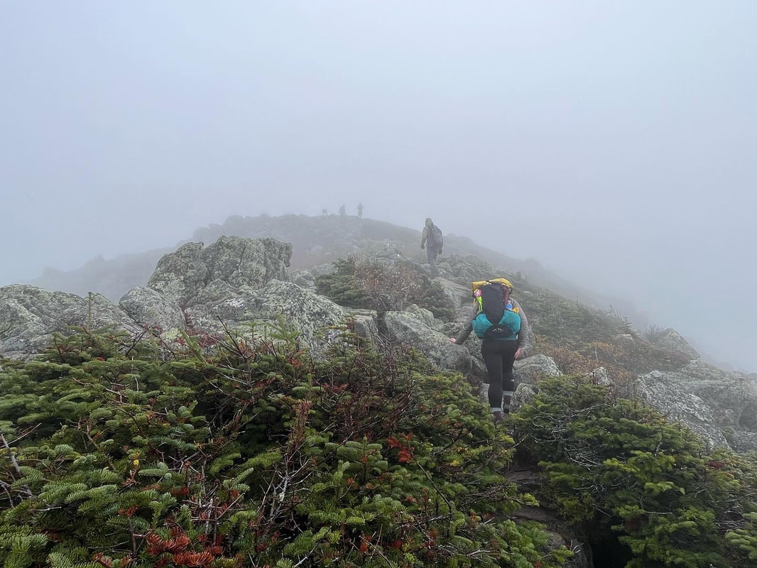 Heading up to the Gateway and the beginning of the relatively flat tableland after a long, long, technical climb. It is out of order but a cool pick that gets at the challenge a bit. 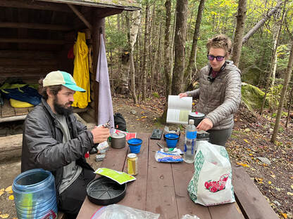 The thru-hikers Dan and I shared a lean-to with. We slept better than they did. It was a big day! The thru-hikers Dan and I shared a lean-to with. We slept better than they did. It was a big day! My own relationship with Baxter Park is a long one. When I was young my father served as a member and then chair of the Baxter Park Authority which functions as a sort of governing board for the park and overseer of its unique mission. Along with the activist Park Director Buzz Caverly, they pushed back human encroachment in an attempt to restore PP Baxter's vision. I got to spend a lot of time there, mostly in the northern section of the park away from Katahdin. My mom--a dedicated hiker herself who is trekking through the Dingle in Ireland as I write this--liked it better on that end. There were fewer people on the trails. I have climbed Katahdin, though, a number of times. The last time was many years ago. I was in my twenties and my little brothers, Matt and Dan, set off on what they hoped would be a southbound walk to Georgia on the Appalachian Trail. Which brings us--finally--to this climb. Once again it had to do with the AT. Astute readers of Sabbath Walks will remember that back in March I accompanied my eldest son to Georgia for his attempt at thru-hiking. Well...he made it. This trip was the last few miles of that epic journey of over 2,100 miles from Springer Mountain to Katahdin. His uncles are still picking away at the trail themselves. Dan and I had the chance to walk the last few miles with him and his "tramily" so we took it. 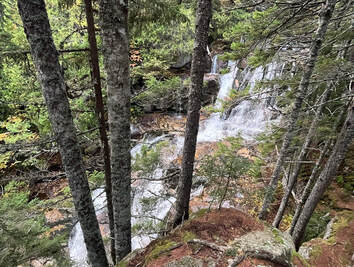 Katahdin stream. Reaching the falls on the way down was restorative. Katahdin stream. Reaching the falls on the way down was restorative. That is how I ended up sleeping outdoors in late September. The walk began in a lean-to so we could get an early start. This is not unusual for Baxter hikes. The peaks are hard to reach. Then, after a cold but not horrible night, we began the climb. There were other thru-hikers around and a couple groups of day hikers as well. Not surprisingly, I was the slowest in our group which was fine. I can hike my own hike, after all, and it was nice to have time in the silence of the park. However, I made sure to start off early with Dan so that I wouldn't slow folks down on the other end. I don't want to inconvenience people and we had a drive south ahead of us. Over the course of the day I would lose track of the others for a while after they passed me. Trust me, though. It was more than good. The trail starts relatively flat, just like most hikes I have done. The fall foliage was just beginning to make its presence felt. The practice of observation was useful at this point as the trees and undergrowth were putting on a show. So, too, was Katahdin Stream running next to the trail, creating a fabulous soundtrack as we worked our way up. 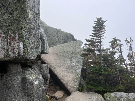 That is the trail. This is where it gets scary. That is the trail. This is where it gets scary. All this changed in a couple miles. After a while I encountered a big rock with "3 miles" painted on it and an arrow pointing up. Things started to get hairy shortly after that. After about another mile it became super-steep. The group condensed again as we helped each other over numerous rock hazards. The view also vanished (as it did for Thoreau) and we continued to stumble up toward the tableland that would welcome us to the last mile or so before Baxter Peak. 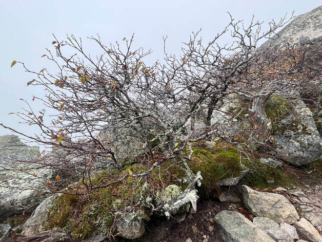 I contemplated this bush for some time as we negotiated a tricky bit of the trail. During the climb there was plenty of time to look around at the life that makes its home on the cold, rocky ledge. We were also looking for handholds and sometimes the actual hands of the people in front of us. Still, even in the hardest moments we couldn't help but be transported by what was around us in the clouds. The weather is often bad on Katahdin just as it is on most big mountains in New England. Yet people climb it anyway because it is always beautiful. 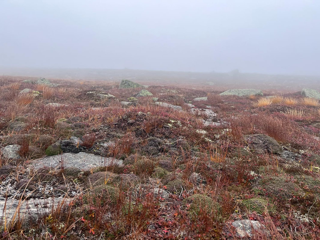 The much-sought tableland The much-sought tableland Finally, we managed to hit the tableland. At this point the thru-hikers gained some separation on me. They had waited six months for this moment and weren't going to wait another minute more than they had to. I couldn't blame them. Their excitement was infectious. Dan plodded along with me for a while but he slowly got ahead of me, too. Dan hikes in Baxter often. In fact, it was only two weeks since his previous ascent to Baxter Peak. What that meant was that I had the tableland to what felt like myself. There were people both ahead of and behind me but I could neither see nor hear them. I wondered if this was what it was like when Thoreau was separated from his party. It looked for all the world like the moors in Scotland that I had walked through in August...except on a very hostile day. The ground cover was different, of course. Here the red came from some relative of the blueberry rising just over any number of plant species clinging close to the rocks. I paused a moment to take it in. Then I remembered my mission and started up again. 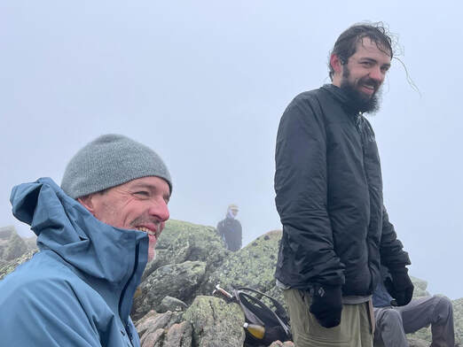 My son and brother looking like the mountain men they are. My son and brother looking like the mountain men they are. I was alone for the last twenty minutes of climbing, which was probably for the best. I had started singing in order to maintain a rhythm and keep my spirits up; Ain't No Grave, Voice Still and Small, If I May Speak with Bravest Fire, This Little Light of Mine. I trailed off on my third time through Amazing Grace as I saw (and then heard) the group at the top. The tramily was there and my brother. So, too, were a number of other thru-hikers and a couple muggles like me. It was a low-turnout day because of the weather but everyone was excitedly taking pictures of each other. I felt like an observer at somebody else's graduation party which--by the way--is a good feeling. I was proud of these humans, most of whom I had never met. I was proud of being human. What an amazing achievement for all of them! I arrived late and left early of course. I was the slowest and needed to get going again. Back down the peak and across the tableland I went. I encountered some day hikers I had passed and told them they were almost there. The others passed me again and then Dan and I started down the rough part behind them. 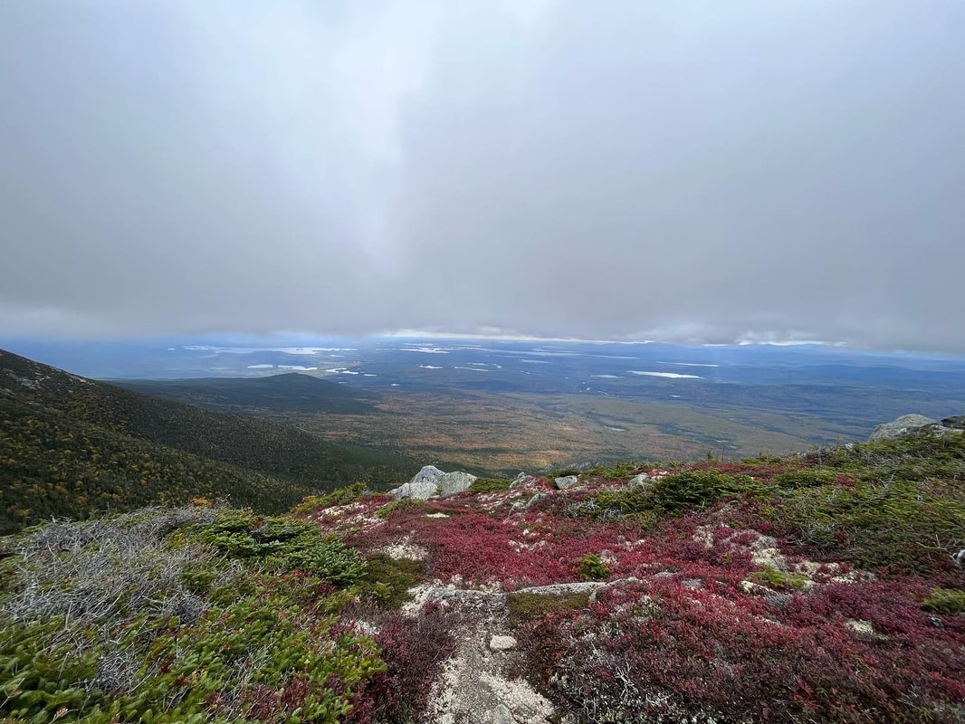 The first real view on the way down. It felt like we had to duck to get under the clouds. 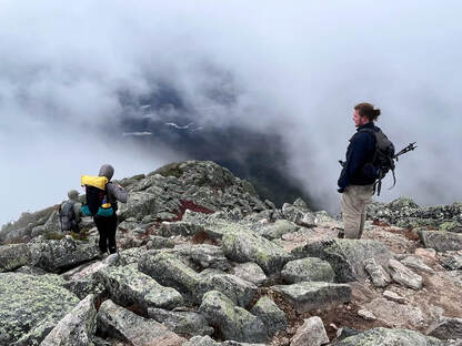 That first peek of the ground below. That first peek of the ground below. The best thing is...we had a view. Just as Thoreau had experienced on his journey, the clouds started to blow away as we descended. They continued to hover at the top of the mountain, of course. It wasn't that the clouds were moving so much as we were. On the way down, though, we caught glimpses of the land around us. It was an excellent backdrop to our labors. Going down a mountain is difficult. It is hard on the knees and the back. Gravity and the mountain conspire to do all sorts of things to your pack and to you so as to twist you into a crevice and a puzzle of their own making. Still, we had made good time and had nowhere to be, so we took as many breaks as we could. The tramily finally disappeared down into the trees and rocks. Dan and I took a long break to snack at the final viewpoint. From our spot we could see a number of mountains, some of which I have hiked in the past and some that remain for me to explore. Dan has hiked all of them. It is his happy place. This may have been the toughest hike I have done since surgery. It is hard to tell because I am in much better shape than I was and didn't suffer the way I did on the earliest hikes. Those early ones--like Tripyramids and the Osceolas--felt more arduous than this day. They also felt more arduous than Washington. After our break Dan sped up and I hiked the last couple miles relatively alone. There were other people out and we leapfrogged a bit, but no one was feeling conversational. For me it had been quite a day. For most of my companions it had been a life-changing one. It was great to be back on the park and on the mountain. I don't think I will wait quite as long for next time. 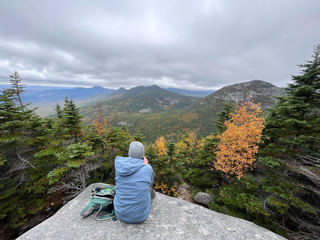 Here is Dan in his happy place. That is the Owl on the right, then OJI, then one of the Brothers, Far off you can just see the twin peaks of Doubletop Mountain, one of my favorites from childhood. We hiked that again a few years ago with the family.
1 Comment
Dear Folks, I am in the process of catching people up with some early hikes and other encounters with nature that I thought people might find interesting as part of a "How It Began" (HIB) series. Mostly this will describe specific hikes and perhaps some lessons learned along the way...if there are any. They are meant to be short and, perhaps helpful in some way to other hikers or fellow-travelers. I will post the dates of when I hiked a specific mountain since the ones in this series are NOT posted at or near the date I actually hiked them. 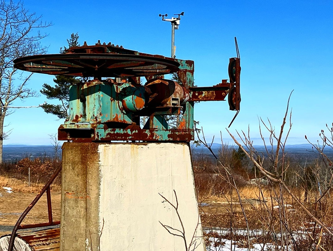 JANUARY 24, 2022 After our hike up the Osceolas, my brother Dan and I decided to head out closer to where he lives in Maine. Our eventual destination was Mount Agamenticus. This tiny mountain (about 600 feet) is yet another monadnock, boasting views well over its weight class. Also...you can see the ocean, which is cool. I am unsure the exact distance we hiked but it was probably between 4 and 5 miles. We intentionally explored a bit...then we were briefly lost. It was all good, though as it was a spectacular place to be. Most of my winter hiking up that point had been in the White Mountains of 2,500-4,500 feet (and yes, I will get to at least some of them). This, however, was different, not just because of the height but because there was very little snow. Of course the absence of snow sometimes means a great deal of ice, so microspikes were definitely in order. 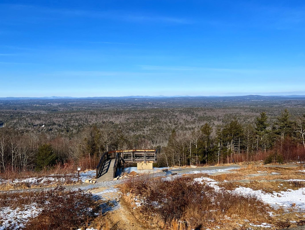 As promised, this little peak boasted some fabulous views. Back in the day, it was the home of the "Big A" ski area, with night skiing, snow cannons, and chair lifts. It is funny to think of this now when most ski mountains are quite more involved. That said, you can see how it made sense. The location of York in southern Maine near both Maine's and New Hampshire's population centers sustained the business from 1966 to 1974 but it must have been hard to compete against the big guys. Anyway, it was a great day. The company was fabulous and the trails had a lot to offer. As I have mentioned before, I also like a little decaying machinery in my views. There was plenty on Agamenticus in the form of Big A ski gear. 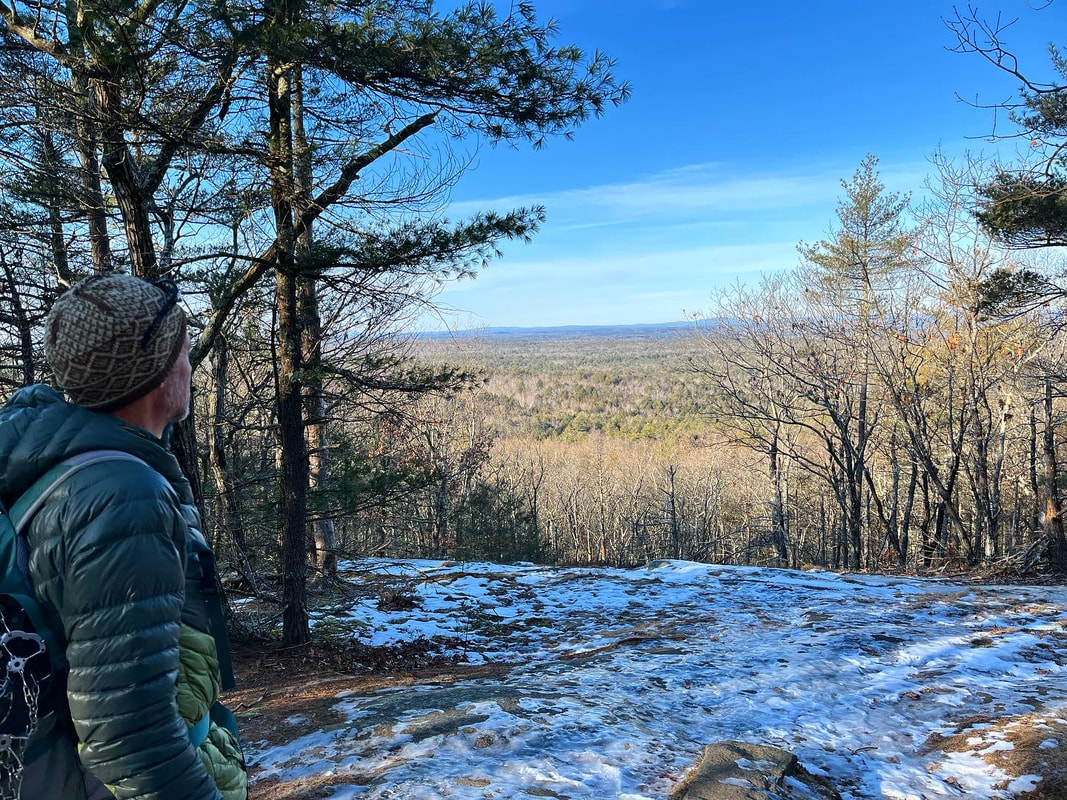 And that flat thing out in the distance? That is the ocean, my friends.... |
Adam Tierney-EliotI am a full-time pastor in a small, progressive church in Massachusetts. This blog is about the non-church things I do to find spiritual sustenance. Archives
June 2024
Categories
All
|
 RSS Feed