|
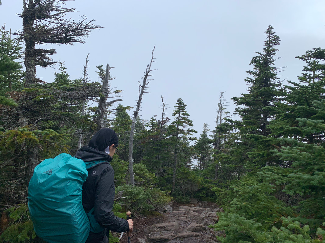
Dear Folks, I am in the process of catching people up with some early hikes and other encounters with nature that I thought people might find interesting as part of a "How It Began" (HIB) series. Mostly this will describe specific hikes and perhaps some lessons learned along the way...if there are any. They are meant to be short and, perhaps helpful in some way to other hikers or fellow-travelers. I will post the dates of when I hiked a specific mountain since the ones in this series are NOT posted at or near the date hiked. 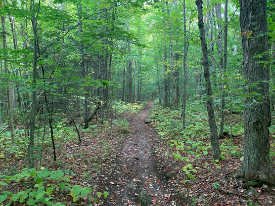 SEPTEMBER 28, 2021 As I sit here typing up this particular hike 8 months later, I am in the process of recovering from Covid and planning a return to backpacking--as opposed to day-hiking--which I haven't done in decades. I am finding the process of getting back on the trail to be a bit intimidating. I feel tired and out of shape. I am getting confused by pack weights and whether I can even move with something that heavy on my back. This hike keeps springing to mind. It is both encouraging and not. The first part--and the middle were I to be honest--remind me that these things can be miserable and exhausting. The last part, though, was very near the top of my favorite hikes of all time. Life is like that. We have peaks and valleys--literally sometimes--and we learn from them while also hoping that they drive us forward more than they hold us back. Deep right? That is what they pay me for... This hike was planned during the hike, itself. This is never a good idea or--at least--it comes with risks. We had planned an out-and-back route up Galehead. This 4,000 footer has its adherents as a solid hike with a reward--a cool AMC hut--at the end. For those who may not know, sprinkled about in hiking-land are a variety of lodges, "huts" and other cool support structures that make fun discoveries while you are out. When I was hiking the approach to the Appalachian Trail in Georgia I came across an entire eco-hotel! That, though, will be a different post. The Galehead Hut has bunk rooms and a small store for small hiker stuff (snacks, band-aids, puncture repair kits and the like). Also, they serve food...sort of. If you reserve a stay there, they feed you. If you don't and just swing by on your way to the top you can buy some leftover soup if there is any left. This is very cool and a key part of the tale. 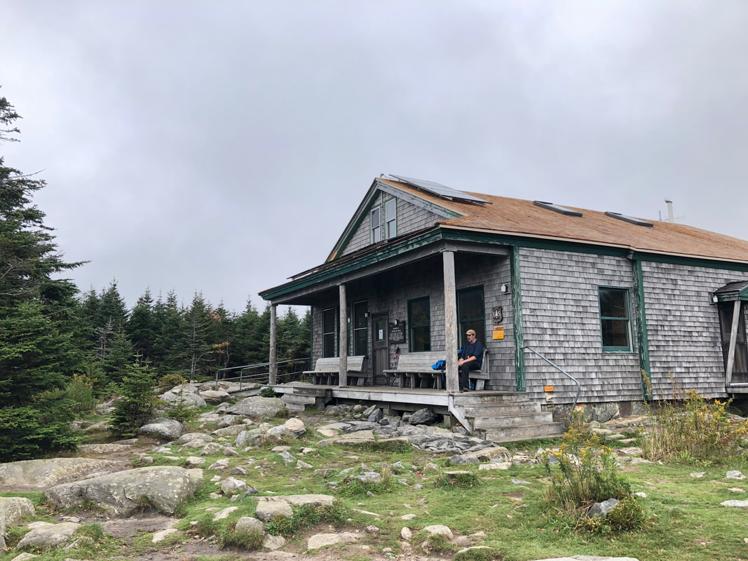
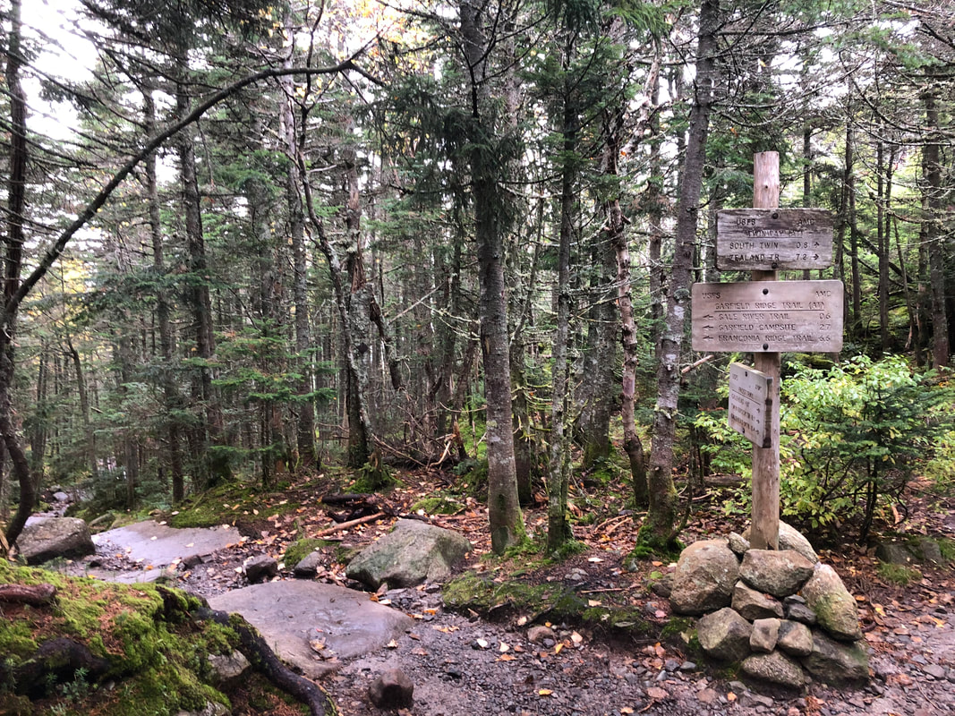 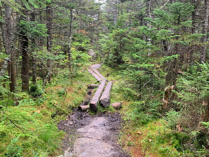 Generally--at that time in our hiking--it was just hard. At one point we met a guy who had made the same mistake in the opposite direction. He opened with a lament; "Why did I decide to take this trail so late in the day?" "Why did we?!" was our response. Then, when we inquired as to what the trail looked like behind him--and in front of us--he got a faraway look in his eyes. "The worst is yet to come for you...I am sorry," he told us. Then he turned his sweaty, mud covered face away to continue on to Galehead with a haunted look in his eyes. What we encountered shortly thereafter was a crazy cliff/waterfall that we had to scale with rocks rolling off our feet and nearly bonking the other as we scrambled forward. That said, I looked back at one point and admired the view. Then I looked down to where we had come. Sadly I ruled out taking a picture because I didn't want to fall. The stranger thought we would have the worst of it going up. I have no idea how he managed to get down. Finally? We made it to the top of Garfield around 4pm with 6ish miles to go. Needless to say we were well aware by this point that much of our hike down would be in the dark. However, we were content. Garfield's view is--full 360--spectacular. There was no reason to rush anymore with the damage done. We took our time with the view, dug out our headlamps, refueled, and started home. In the end we had a dinner of gas station snacks and BK cheeseburgers because everywhere else was closed. If I had it to do over again, I probably wouldn't have dallied at Galehead. We started our hike pretty early but were moving slow thanks to the four peaks we summitted the day before. Soup is nice and all but not worth the amount of time we spent. I would take a closer look at the map, too. The whole day was over 16 miles. Honestly, though, I don't see climbing Galehead again. I will just take the easy way up Garfield. 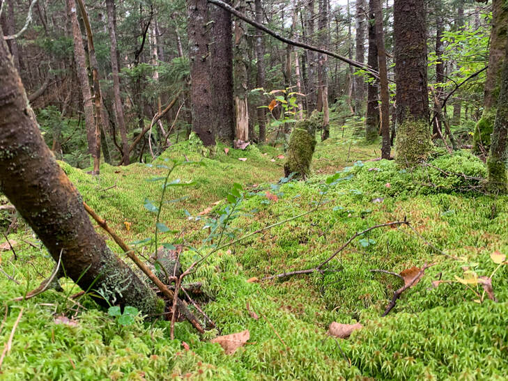
0 Comments
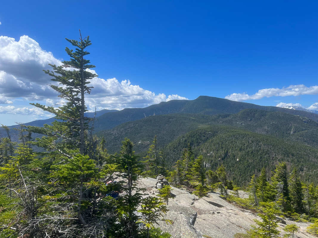 MAY 14, 2022 Mount Moriah was a bit of a compromise. It is on the list of New Hampshire's 48 4,000 footers. It was #20 for me, which feels a bit momentous. Allison is well over halfway at #25 now. The compromise had to do with time. We are getting to the point where overnights and such will be necessary. Ultimately this is a good thing. We (particularly Al) are getting more serious now. It will make better ecological sense when we are up there for longer strings of hikes. Moriah, however, is one of the last free-standing mountains on the list... We took the slightly longer route of Stony Brook Trail to Carter-Moriah Trail. The extra mile flattened things out a tiny bit. There is always plenty of elevation on a mountain like this--3,400 feet of it but the approach enabled us to do some very pretty ridge-walking which the other trail did not have. The other trail takes Carter-Moriah up from the other side and is generally faster. The book claims our hike was 10 miles out and back, but it felt a bit longer than that. Not in a bad way...it just did. The weather was beautiful on the way up. It started flatish for a couple miles and then the climb began in earnest. My biggest problem was water. I need a lot of it, apparently, and did not have either the water purifying iodine drops or the water filter. Careful rationing worked but I was sooo thirsty when I got back to the car! 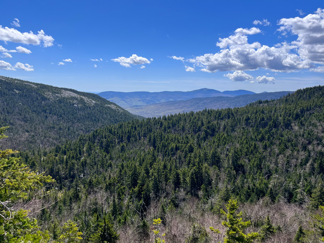 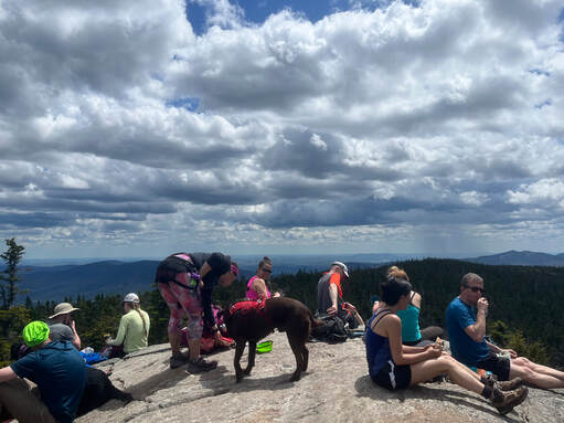 The extra views were totally worth it, by the way. It became clear that we had taken the road less travelled. There were a couple other groups slow-hiking, a trail runner, and a young hiker who was cruising up and down. Not a big crowd, though. We were evenly spaced as well, which means that we got our views in relative isolation. Microspikes were still needed for the last couple of miles as there was abundant ice and slush in the shade. Remember the views? Well, the peak involved a steep scramble and then we broke out on the tiny bald top, which was crowded! The road-most-taken was pretty popular on this particular glorious spring day so we settled in an ignored spot just off the peak and chatted to another 48er about our previous hikes, complained about the crowd, etc. It is spring now and weekends are packed. Most people I know are of two minds about the high hiker population this time of year. Partly it is good to have so many folks exploring and exercising. It is good for them and--even though it taxes the trails--it is good for the environment to have people feel a sense of connection. It makes them more likely to advocate for environmental legislation and regulation--including trail restrictions--and to make personal lifestyle changes. That said, I--along with most folks--prefer those days when no one is around. Also, it is totally OK to worry about the environmental impact. I don't recommend heading out to the big peaks in NH this time of year if you want isolation. It is crowded! Personally I prefer less-famous places in Northern New England and local hikes here in Massachusetts. I am working on a list, in fact, and will share it when it is done. There is more room to move on these hikes and the views aren't so obstructed by humanity. Al prefers the big peaks, though, so for our equivalent of "date night" the NH48 are almost always on the menu. After all, the crowds are bigger these days but the personal challenge is the same. What I don't think is cool is the level of hostility toward "visitors". I am one, after all. Yes, many hikers (though probably not most) are currently living out of state. However, you can't really tell who is who up there. People are making snap judgments based on appearance, accents, and whether one is "in the way" of the observer. The mountains are, for the most part, on federal land or in federally funded state parks. Everyone has the right to be there because everybody's taxes (and parking fees) pay for it. There have been some snide comments directed at us and other hikers from people who assume they have a greater right to the trail. What is weird to me is that everyone there is a visitor in some way. They just want to be the only one who actually belongs. I see this in other parts of my life, too. It can happen pretty much anywhere somebody has found their "special thing" that brings them joy. Then you are either "in" (or part of what the person has defined as what brings joy) or "out" (an obstacle or distraction from the sought after perfection). I have stopped going to festivals and retreat centers where this is the dominant vibe, particularly when I feel that I am becoming part of that "in" group. We watch for this bias at our church, too. It is a common one in many religious organizations that should be about everybody finding a home. Some people like to complain about all the interlopers on their day. I am not a fan of isolationism or of racism. At times--particularly online--that appears to be where we are going in so many of the communities I am a part of. I get being proud of your place--whether you live there or just visit a lot--but it still gets to be someone else's place, too. Culturally New Englanders--and I suspect many others--take great joy in drawing as tight a circle of belonging as possible. Though I have lived here for two decades it has been made clear to me many times--implicitly and explicitly--that I will never really "belong" in Natick. When I go home to Maine it is made clear that I don't belong there either. Hiking can be no different. We have to make room for each other. 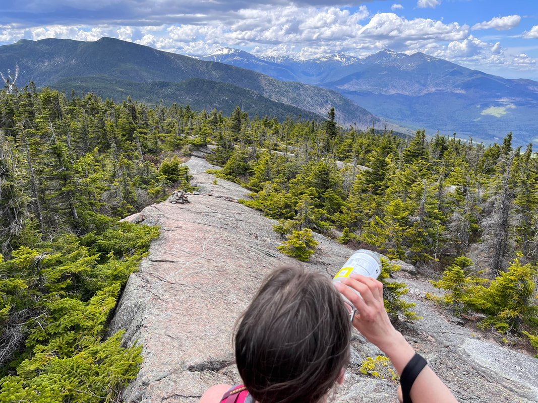 One way to make room is to hike the trail others aren't hiking. Back on the road-not-taken it was just us once again. We navigated the ice, ran out of water, chatted with an adventurous older couple, and made it back to the car in time to grab an early dinner.
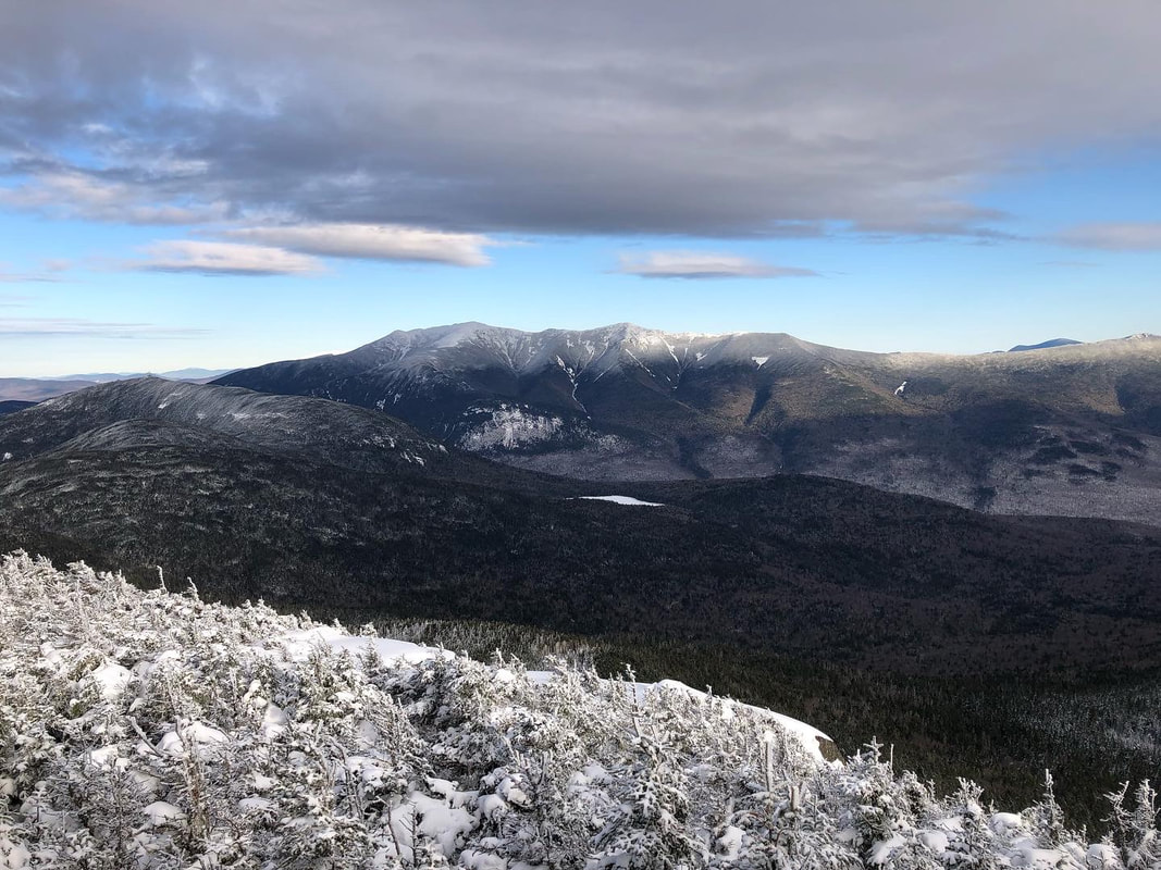 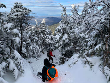 DECEMBER 4, 2021 and May 7, 2022 I will not lose, for even in defeat, there’s a valuable lesson learned, so it evens up for me. --Jay-Z So this is a story of failure and learning and later...success. I figured I would tell you that right up front. It took us two hikes to cover both of the Mount Kinsmans. They are almost always done together but...well... let's talk... On December 3, 2021, we went to party. At said party we decided to hike the Kinsmans (North and South) in New Hampshire the next day. It would be--for me and Al--our first "winter hike" and we were eager to try it out. Our friend Howard hiked with us as did Carly Simon (his lovely dog). I should say, for a first attempt at this level of complexity we did pretty well. These mountains are pretty tall, with North coming in at 4,293 feet and South at a slightly taller 4,358 feet. We chose the Mount Kinsman Trail instead of the more popular--and shorter--trails on the other side of the ridge. We usually favor lower inclines and accept the extra miles they bring. The trip was beautiful and the views were fabulous, including a spur to Bald Peak early in our climb. However, it was also pretty darned difficult and when we hit North K we were tired. OK...they were tired and I was super-tired. Also, we had gotten a late start and I don't think any of us were fancying the hours-long climb down in the dark. After a few moments of discussion on the approach to South we turned back. It was a depressing moment. In the end we hiked about 8 miles in the snow, bagged a peak, and congratulated ourselves on our accomplishment but...it still didn't feel quite right. It was not what we planned. 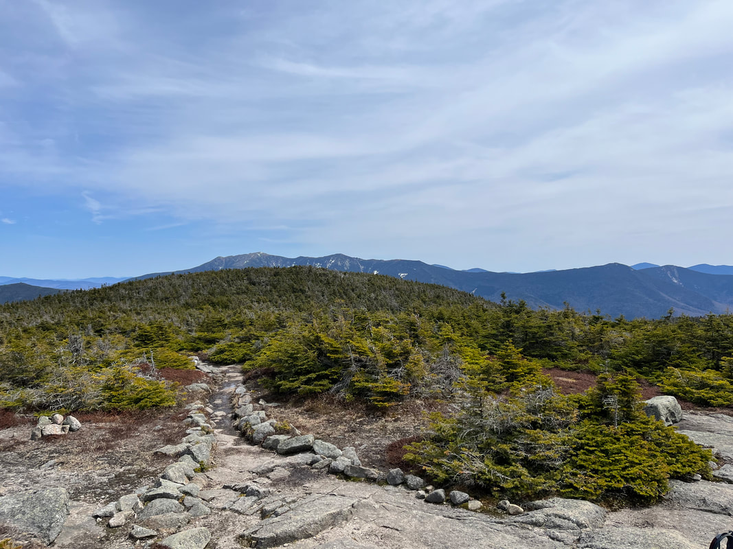 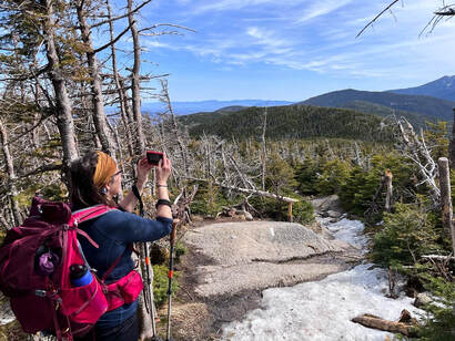 The one spring pic with ice. The one spring pic with ice. Fast forward to this past Saturday. We decided to attempt it once again. It was just me and Al this time and was our "Mother's Day Observed" celebration. Here is where I want to digress a bit. If this was some sort of morality tale or life lesson the easiest thing would be to hit the "try try again" button, take our bows, and move on. Yet that doesn't seem right, because that first hike was an important one. We learned--or I learned--a ton that made hiking in general (and therefore experiencing nature) easier and more enjoyable. After that December hike we did a few things. First, we made a rule to get plenty of sleep. No more parties the night before! Second, we took some shorter--but still quite challenging--winter hikes off the 52WAV list. Willard and Pemigewasset remain two of my favorites. This enabled us to figure out our gear and our winter pace. They also enabled me to appreciate the winter journey more than I did puffing up North K. Third, we made a decision to always start early. This is important. At our pace we really didn't have the time to get back before dark the first time. We could have hiked back in the dark. We weren't concerned about our abilities. We had hiked in the dark before. Still it would not have been pleasant and we do this because we enjoy it. Fourth and finally, I hit the gym and changed my diet a bit. Many hikers think of hiking as the way they exercise and it certainly is that for me. That said, There is a lot going on in my 51 year old vessel and if hiking is going to be more than exercise, I need to be caring for myself regularly. The Kinsmans taught me that too. At some point I will write about Willard and Pemigewasset, as well as three 4,000 footers we hiked in winter; Liberty, North Hancock, and South Hancock. There were other hikes as well where the snow wasn't as much of a factor. That is enough description of them for now. It's just a teaser for future posts. What is important to know is that first attempt made me--and us--change some things for the better. 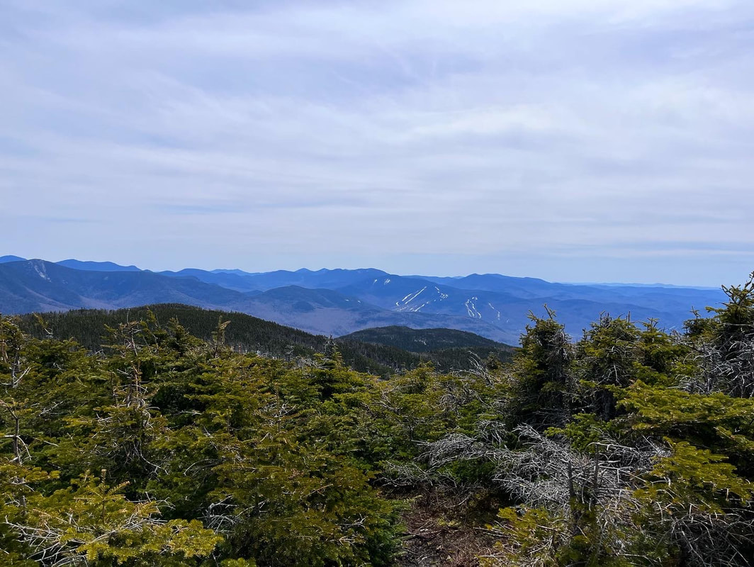 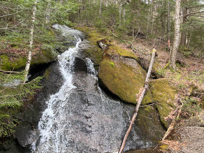 Anyway, that was the context for our return to the Kinsmans. We returned in better shape with a better understanding of what we were doing. The climb was mostly straightforward. We skipped Bald Peak, having already seen it and with a particular goal in mind. Then, as we headed up, we encountered...winter again. If you are hiking this in April or May, it is worth noting that, while you may not need your snowshoes, you still need your microspikes. Our pictures don't show it but after a while the trail was covered in a hard later of ice, which was more of a challenge than the snow. This slowed us down and created a different set of challenges. Al likes the snow. I like no snow ever. We both agreed that the ice below the tree line was worse. That said, we continued on over North Kinsman once again, then out to South Kinsman along the ridge and ultimately victory! I was glad we returned. Sure, existentially it was nice to get it done, but that ridge was lovely and worth experiencing on its own. the view from South--while not as breathtaking as the one from North--was pretty nice too. Of course we stopped at North on our way back to check it out one more time. There is something I will miss from the winter, though. Bad weather creates community. There are people I only see on the top of mountains as there is a loose group of hikers who do this regularly for fun. When we see fellow hiker we stop and talk even if we haven't met. We compare weather conditions and gear and where we are on the list. On Pemigewasset, for example, we had a lovely chat with a couple of young people about hiking and nature in general. If you were out that day you were pretty committed, after all, so there were plenty of overlapping interests. Over the winter and early spring this group has the mountains to ourselves and we know that the people we see are trail-nerds like us. We are likely in the same Facebook groups! However on this trip there were a bunch of normal people out. The regular hiker-sorts passed the time of day as usual and we took pictures of each other--I always hope my taking-portraits-of-strangers-on-mountains skills are up to snuff--but it was different. The muggles who were hiking were confused by the strangers trying to communicate. It was good they were getting out but the "list hikers" became "odd" people again. Next winter I will probably do more hiking even though I despise snow...I miss the people already. The whole trip was about 10.5 miles. The weather will only improve for a while. Neither hike was my favorite but it was worth doing and I am grateful for what it taught me.. Now on to the next one...whenever that will be. 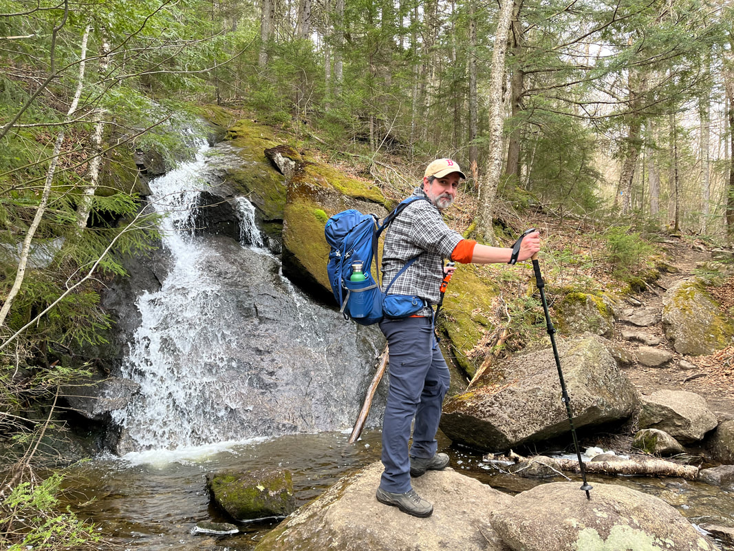 Dear Folks, I am in the process of catching people up with some early hikes and other encounters with nature that I thought people might find interesting as part of a "How It Began" (HIB) series. Mostly this will describe specific hikes and perhaps some lessons learned along the way...if there are any. They are meant to be short and, perhaps helpful in some way to other hikers or fellow-travelers. I will post the dates of when I hiked a specific mountain since the ones in this series are NOT posted at or near the date hiked. 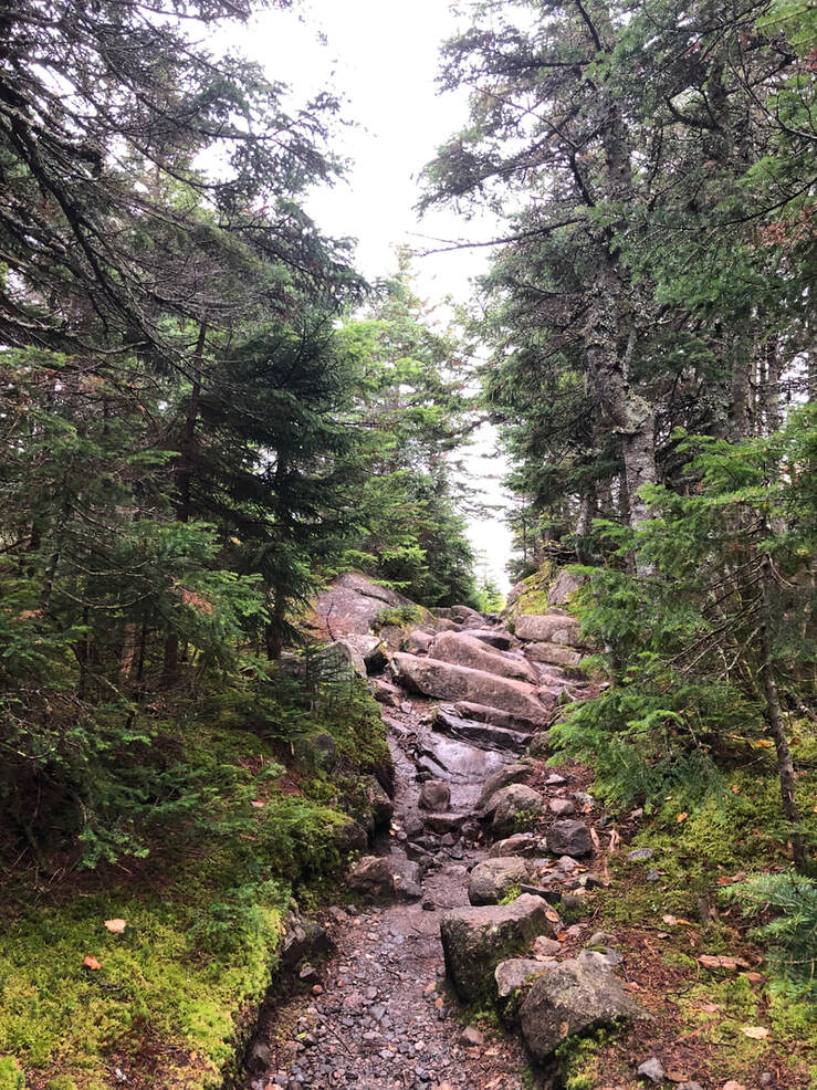  SEPTEMBER 27, 2021 What a hike this was. We took a few days and stayed up north to get some hiking done. First up was the 10.2 mile loop of Tom, Field, and Willey--all 4,000 footers--and the slightly smaller Mount Avalon. We had a somewhat rainy and overcast day for it, but we had taken the time off and up we went. When I say "loop" I am being somewhat generous. The map looks like a lollipop that was dipped in fuzz. We chose Mount Tom first (off a spur from the Main trail). Then we hit Field for the first time. Then there was a longish hike to Willey, then back to Field as the fog closed us in and a return to the actual loop onto Avalon where, blessedly, we experienced one of the best views ever. 
 Dear Folks, I am in the process of catching people up with some early hikes and other encounters with nature that I thought people might find interesting as part of a "How It Began" (HIB) series. Mostly this will describe specific hikes and perhaps some lessons learned along the way...if there are any. They are meant to be short and, perhaps helpful in some way to other hikers or fellow-travelers. I will post the dates of when I hiked a specific mountain since these are NOT posted at or near the date hiked. 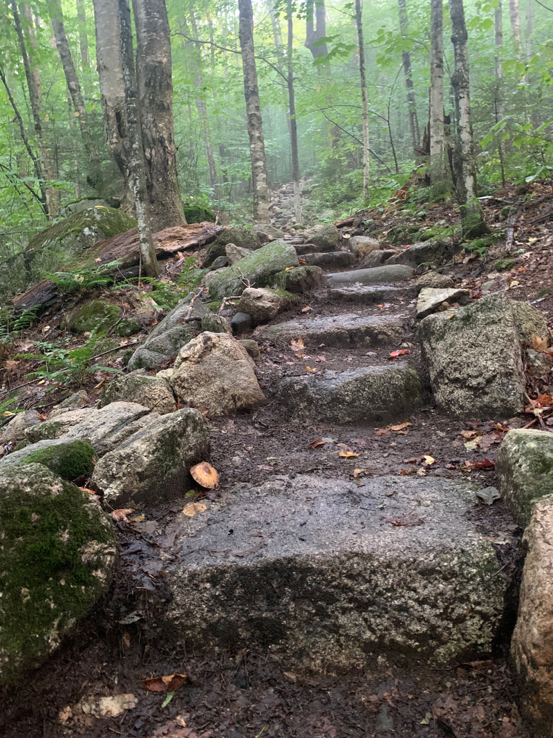 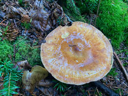 September 10, 2021 Tecumseh is another one of those NH 4,000 footers people argue about. Some folks suggest it as a "first hike" in the 48 since it is relatively short. Tecumseh is a mere 4,003 feet tall but the elevation gain on the 5 mile long trail is 2,250 feet. Also, the views from the top are just OK. The other views come thanks to yet another set of ski trails and require a little extra (easy) hiking to reach. I hiked this on my own as Allison had done it earlier. For the record, she didn't like it much. I loved it and it ranks as one of my top 10 all around hikes...ever. However, I get what folks are saying when they complain. It really depends on whether you think you might enjoy miles of stairs. Yup...miles... 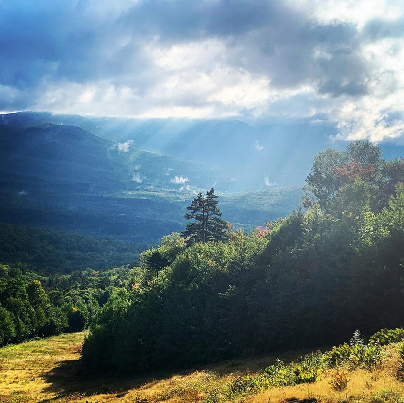 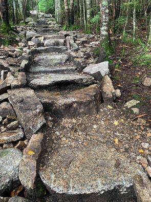 At first there are no stairs and the hike is fairly gradual, then there is a dip. Then a stunning view from a nearby ski trail off a side trail to your left. But the stairs begin shortly thereafter and go on and on. One of the books suggests--unironically--that you can distract yourself by thinking of how much work went into putting these steps in. Honestly that just made me even more tired. After the super-epic steps part, though, things smooth out a bit. The bigger challenge for me came from being by myself. I tend not to bring headphones on a hike so I am alone with my thoughts, which can be fine. That said, I do like talking. I spent a lot of those stairs singing to myself, which would have been weird if there was anyone to hear. However, I had the mountain pretty much to myself on the way up, with the exception of a trail runner...and they don't talk. 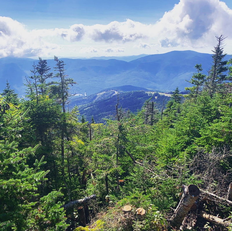  One of the great things about a straight climb like this was that the whole thing didn't take very long! It would have been even shorter except there were tons of people coming up as I was going down and almost all of them stopped me to ask how much longer they had to go and if there was a view worth working for. This actually was a bit strange as Tecumseh has the reputation for being under-hiked. As a verbose person I had developed quite a little song-and-dance by the end. After all, it is a "love it or hate it" mountain. I may not have been super helpful...but I think I was entertaining. This was another hike where the view was fine but the foliage was off the handle. Again, those stairs give you plenty of time to contemplate the trees, moss, and fungi that grow in abundance along the trail. On my way down I went out to see the side views, which were pretty nice, too. Then on down to the car. In the end, you can make your own opinion about whether it was worth it. The last half mile or so was very "elfy." I thought it was pretty magical even without the unobstructed view one might hope for. If elfy floats your boat, you will be pleased. If you need that view and don't want to do the extra stuff...there are other hikes. Update: I feel like when I wrote this post I didn't do the mountain justice. I was starting the weblog and managing my job, planning for sabbatical. I really loved it, though. So recently I went back with a friend for a winter climb and made a video of how things went... Dear Folks, I am in the process of catching people up with some early hikes and other encounters with nature that I thought people might find interesting as part of a "How It Began" (HIB) series. Mostly this will describe specific hikes and perhaps some lessons learned along the way...if there are any. They are meant to be short and, perhaps helpful in some way to other hikers or fellow-travelers. I will post the dates of when I hiked a specific mountain since these are NOT posted at or near the date hiked.   September 6, 2021 I don't remember the views from North and Middle Tripyramid, the 3rd and 4th of my NH 48. What I do remember is an LOTR-level pile of rocks that the trail went through. So, so many rocks. Also, I remember rain. As I crawled over the rocks I reached a particularly attractive bend and thought "This is beautiful. I will totally take a picture of it when I head down." Instead it poured on the way down and all I could do was watch my feet. Still...it was gorgeous. These two mountains (4,180 feet and 4,140 feet respectively) are pretty much always done together. There is an easier way (still hard) and a harder way. We took the easier one; a 9.6 mile out-and-back that presented us with plenty of pretty foliage and the occasional obscured view. The hike between the peaks was rather anticlimactic. The worst was over once we hit North. Then there was a relatively easy stroll to Middle--or that is how I remember it--and an acceptable view of 48's and 52's we have yet to climb.  Even though we took the "moderate" trail, the Tripyramids were no joke. None of these moutnains are, actually. It was long. Also, there were a couple of steep sections, including the massive boulder-strewn switchback that I resent not having photographed. For me the rocky grade meant a lot of crawling and I inched along well behind Allison, losing her frequently. Strangely, though, I found the challenge and the weather pleasantly distracting. It wasn't just wet and the footing wasn't merely sketchy. It was wet and sketchy in an interesting way which actually saved the hike. There was a problem to solve--namely forward motion--and I needed to take my time. Frequent breaks helped. So did snacks. This was one of the only mountains where I found it necessary to put my poles away for an extended period and put all my limbs on the ground. 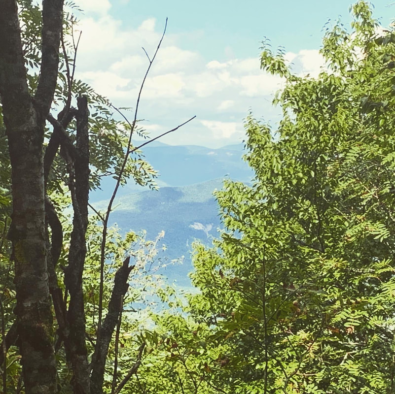  I don't think I would climb it again on purpose...but I did like it once I got into the groove. I did this by focusing on what I could most easily see. I could see the ground, mostly, and what was on it. I think I managed to appreciate what I saw for the noble facets of creation they were. Probably, upon reflection, I would hike back up for the photograph I missed. Then I would turn around with my Tripyramids experience complete. 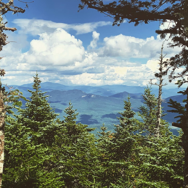 PS, On the way back Allison wanted to make sure I was OK. I had been so slow! But, honestly, it was--for the most part--a good time and the views, though limited, weren't that bad either. Finally, I am almost certain we grabbed a beer and a burger after this one. It definitely required refueling. 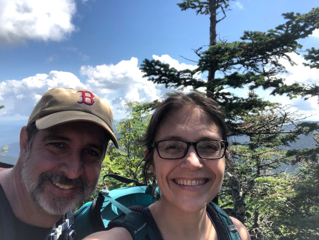 Dear Folks, I am in the process of catching people up with some early hikes and other encounters with nature that I thought people might find interesting as part of a "How It Began" series. Mostly this will describe specific hikes and perhaps some lessons learned along the way...if there are any. They are meant to be short and, perhaps helpful in some way to other hikers or fellow-travelers. I will post the dates of when I hiked a specific mountain since these are NOT posted at or near the date hiked. 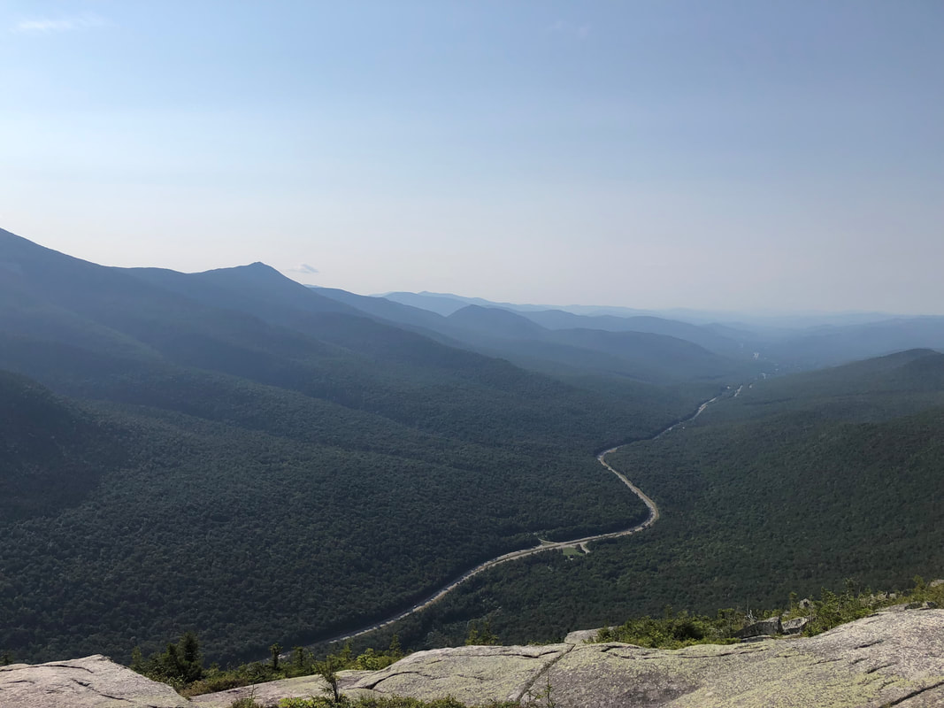 August 27, 2021 There are a range of opinions about Cannon Mountain (4,100 feet). The trail is relative straight but also rather sandy and there are parts where one struggles to maintain their footing on large, flat rocks that create a challenge going up and down. While this may be your thing, it isn't everybody's. Also, there are few hikers who enjoy the constant car noise that permeates most of the hike as it is right up against I-93. To add further insult to injury, we share it with a ski resort and a gondola. As a non-skier I find that rather interesting. Still, it is strange to arrive at the top and see a snack bar and random folks who took the easy (but scenic) way up. However....if you have ever driven on that part of the highway and looked out to see the massive stone lump that Cannon is, you know that there is a primal part of you that wants to go sit on that rock and look out over the valley. I have sat on that rock and...yeah...it is pretty damned impressive. 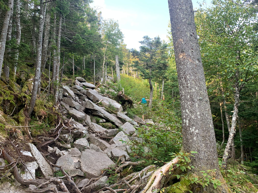 This is also sometimes considered a "starter" 4,000 footer, but I have to say that I did not find it easy. Yes, as these mountains go the hike is short (4.4 miles round trip). Still, the footing was rough and with my aforementioned post-surgery back, it was plenty challenging. The elevation gain is 2,300 feet and you feel every one of them. The view from the top was marred somewhat by the ski equipment--there is a tower with interesting views and that aforementioned snack bar and bathrooms that make up for it--but the real gift comes before that and on the way back. Do NOT miss the overlook! 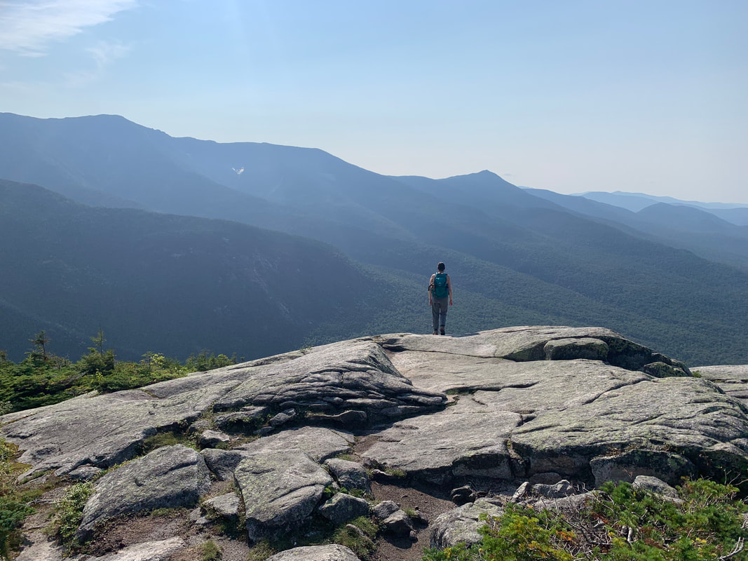  What I learned on this hike was that there are many different ways to tackle a mountain. The gondola folks seemed very happy, of course, but so did the slow moving party we passed on our way up. There were three people, one of them was talking constantly and stopping at steady intervals. We actually started by taking breaks whenever they took one, but we got impatient and moved past after they stopped us for a short chat. On our way back down--and after taking quite some time at the overlooks and the peak--we saw them again still heading up. They were still talking--and we chatted with them again--and they were still enjoying the day. I don't know if they were bagging 4,000 footers, or challenging themselves physically or if they even cared about those things. What I do know is that they we truly enjoying their time together and getting the most out of controversial Mount Cannon. I have nothing but respect. 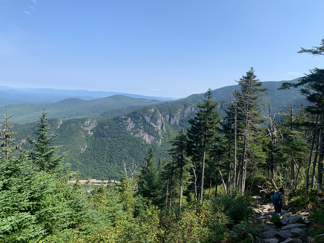 On the way down I wiped out in a big way that almost jeopardized future hikes. The bad footing is no joke! After much swearing I collected myself. Allison backtracked to find me. Shortly thereafter the now-welcome noise of the highway increased and we found ourselves at the bottom safe and sound. 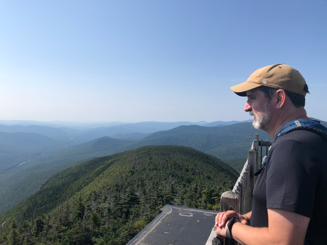 Dear Folks, I am in the process of catching people up with some early hikes and other encounters with nature that I thought people might find interesting as part of a "How It Began" series. Mostly this will describe specific hikes and perhaps some lessons learned along the way...if there are any. They are meant to be short and, perhaps helpful in some way to other hikers or fellow-travelers. I will post the dates of when I hiked a specific mountain since these are NOT posted at or near the date hiked. 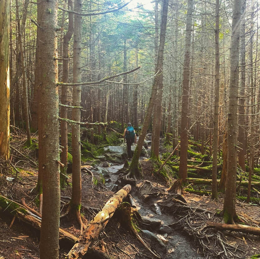 August 21, 2021 Moosilauke--pronounced many different ways by people who think they nailed the pronunciation--is a fabulous mountain. If you are planning to do all the 4,000 footers in New Hampshire. This one (4,802 feet) is a good candidate for your first one. It isn't the easiest but it is on the easy end and the views--while not the best you will find on your journey through the NH 48--are spectacular. Parking is strange, though. It is along a dirt road and, frankly, you can add a mile to your hike in the blink of an eye during the peak hiking season. Don't sleep in on this one! Get an early start. I spent much of the hike following behind my wife. It wasn't that long after Mount Roberts so I was still recovering and still--more pressingly--getting back in shape. She would wait for me, which was nice, but I took my time and was probably a bit of a burden. Our itinerary included the main peak and then a smaller one (South Peak) before heading down. The way up was relatively gentle for a big mountain...just long. There weren't any extended scrambles to worry about, just elevation and some pretty forest landscape. 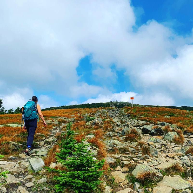 There was a broad ridge the last mile or so before the peak. Our energy picked up as the views did and we made it to the top. That said, I was gross and sweaty by the time we got there and it was crowded! It wasn't "Monadnock-mid-summer" crowded but...there was a lot going on, including a couple older hikers wandering around giving occasionally-welcome advice and perhaps snacks to promote their social media presence. This is where I remembered that I used to bring fruit with me when I hiked. I saw a couple of people eating apples and was so very envious. I really wish I had remembered then, but I have forgotten fruit on every hike since. It was a great place for a picnic and the energy bars and water just weren't cutting it. It is worth noting that when you are out for an entire day pushing yourself, your food and water choices are super-important! 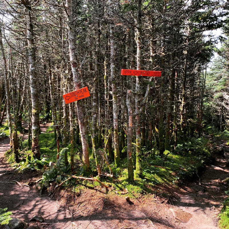 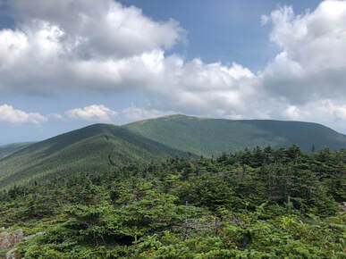 After South Peak, we started down. Here is where I need to talk to you a bit about despair. Pretty much every time I go hiking there is a moment where I completely fall apart. I question why I am there, of course. However, I often get more generally depressed. The hike feels like a mistake and so--in the moment--do pretty much all of my life choices. Hiking does not make me feel competent. I feel awkward and uncomfortable instead. For about a mile or so of the hike down I was feeling completely miserable. This wasn't Moosilauke's fault. It was just the logical result of a long, hard walk that pushed me pretty much to the end of my rope. This stuff happens. It is worth knowing that it happens to many folks who do this. I have learned to call it my "despair practice" and let it go once it passes. On my way down from this mountain, though, it felt like every little thing I had stored up during the plague came out in one rush. Since this time, I have had that feeling more than once. The highs are high and the lows are low no matter who your are and what challenges you. Hiking reminds me of that. 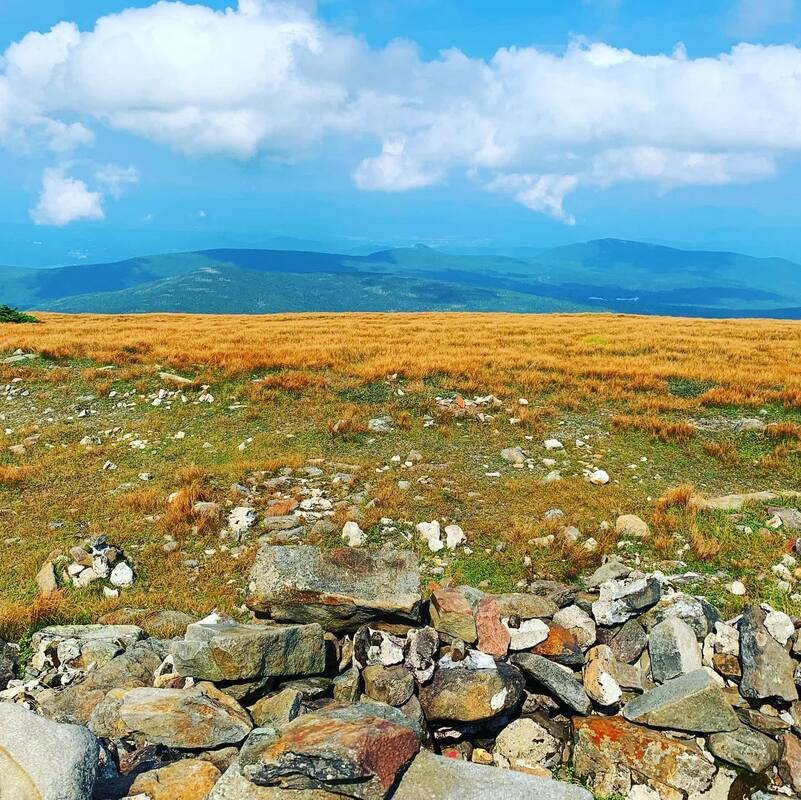 Anyway, the total hike was about 8 miles. It was my first of the 48 4,000 footers. At the time I didn't think it could be topped but, honestly, it was topped over and over again enough so that it doesn't actually come close to hitting my top 10. Still, what a great way to get going. We went home, posted some pics, and--and with the pain mostly forgotten--planned for another one.
|
Adam Tierney-EliotI am a full-time pastor in a small, progressive church in Massachusetts. This blog is about the non-church things I do to find spiritual sustenance. Archives
March 2024
Categories
All
|
 RSS Feed