|
Yup. Here is the last sermon of the series! It was quite a trip which contributed to a bit of a work bottleneck and a couple life stressors that still haven't been cleaned up. The great thing about nature is that in times of stress and chaos we can retreat to it, remembering our relative insignificance. It is therapeutic and we all could use a little therapy these days...
0 Comments
So I started posting my "Learning From Nature" sermon series and then sort of fizzled out. There was a big gap in the calendar between sermon #2 and sermon #3. In there we had our Annual Meeting right after the church's "Winter Getaway" where we close the church and all head to New Hampshire together. Then we had a guest preacher--Rev. Ciaran Osborne--for the beginning of Lent. However, we have been back to it for a while. Here is Sermon #3, "Let Us Not Despair." The road to despair seems pretty short these days in many aspects of our lives. It is important, however, to keep our eyes on the prize. Anyway...here it is... 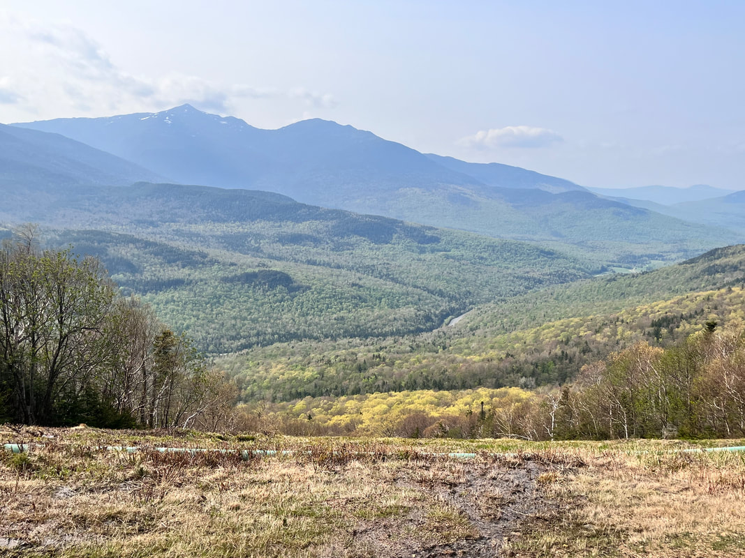 One of the many views from Wildcat I feel bad. I thought I had finished the wrap-up for the NH48 project months ago! Mostly I feel bad because I know that no one else really wants to hear about all these hikes. This is for me to remember. Still, I am storing them here. This final collection features the last push to the finish. Some of them were very difficult. Others less so. I sort of picked up in the middle of Allison's 48 list so had to go back to do the "easy" ones later. It was quite a time and quite an adventure. I am glad I did it. Anyway...if you are interested...here they are! 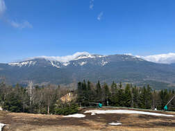 Another view of the Presidents from the ski trail. Another view of the Presidents from the ski trail. Wildcat D and Wildcat (A) #37 & #38 This was quite an undertaking! We decided to hike up one of the ski trails at the Wildcat ski resort. I suspect its presence on the slopes of Wildcat D is why the mountain has this strange alphabetized naming system. Actual Wildcat Mountain is sometimes referred to as Wildcat A. Anyway, there is a video you can watch if you wish. POST AND VIDEO 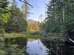 Early on there were a number of dark, flat, bodies of water. Early on there were a number of dark, flat, bodies of water. Owl's Head #39 One of our favorites, Owl's head has very little to offer on the face of things. It is an 18 mile round trip--the longest hike on the list. The trails up the mountain are not maintained. Finally, there is no view. However, the trip is beautiful. You just need to plan to be out there all day. If we were to do it again we would take two days and camp along the stream. It would be a nice place to sit and get away from everything for a while. There is a video for this one, too. Post and Video 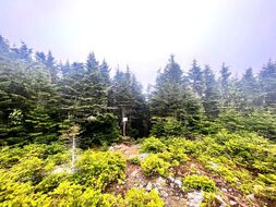 You can't see it, but it is snowing... You can't see it, but it is snowing... Hale #40 Hale is the smallest of the mountains and generally thought to be the easiest hike. Frequently it ends up late in people's lists, saved for a rainy day like I did. Allison was with me but she had already hiked it. Since it is relatively straightforward, many people also get it done early when they are getting in shape for bigger things. This is what Allison did. It was a fun climb though. We were treated to a June snowstorm! Post 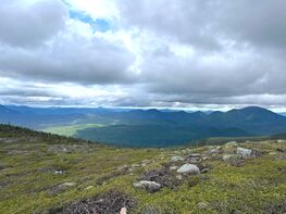 The view off Guyot, which is hard to get to, but maybe my favorite mountain in this project. The view off Guyot, which is hard to get to, but maybe my favorite mountain in this project. West Bond, Bond, and Bondcliff #41, #42, #43 In an ideal world we would have ended on this two-day traverse that took us over these three peaks as well as Zealand, which we had climbed earlier. We also climbed Guyot on our way to the bonds. We stayed at the Guyot campsite below the peak. This mountain was probably the best. Again, we have a post and a video...but this is nearly the last post and definitely the final vid... Post and Video 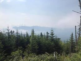 Al took this on her earlier hike. Al took this on her earlier hike. Waumbek #44 This mountain is also considered one of the easier ones. It, too, rather lacks a view. In order to get to it, however, one goes over Mount Starr King. Starr King is named after a minister and is referenced elsewhere, particularly in my Hedgehog post. He had a mountain named after him less for his contributions to American religion and more because he wrote "The White Hills," a proto-hiking manual that popularized the region. The hike, itself, was pretty straightforward. This--like Hale--was another one that Allison had already done. However, she had nothing better to do that day and accompanied me. 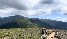 Looking off Eisenhower toward the bigger Presidents. Looking off Eisenhower toward the bigger Presidents. Pierce and Eisenhower #45 & #46 Al had also hiked these two before. You might recall that she started the list while I was rehabbing my back. When I hiked by myself, I frequently chose different mountains, which also put me behind. It was a somewhat crowded day when we went up. There had been warnings of thunderstorms--not a good mountain combo--but it became clear that if we got off early, we would be fine. Others had figured out the same thing. The climb up Pierce was straightforward and uneventful, though it did feel a bit more difficult that it should have. When we rested at the top, we met a number of people. One was from where we live. Another was an old guy filled with unsolicited advice. Old guys giving advice is a feature of the Whites. The one from around our part of the world joined up with us for the ascent of Eisenhower. He was a good talker. On the top of Eisenhower, we overheard an extensive debate about where to finish your 48. One side was pro-Isolation. The other was pro-Carrigain. We had already figured out that we were going to split the difference. On the way back to Pierce our companion got ahead of us. We are not fast, so we waved him on as he drifted from our sight. Anyway, it was a beautiful day on a hike that many people do much closer to the start of their NH48 adventure. I had wanted to get back up there this winter. However, I don't see that happening at this point. 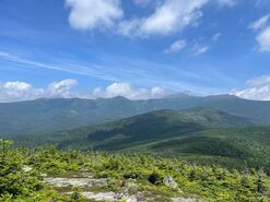 More Presidents off Isolation More Presidents off Isolation Isolation #47 This hike was ridiculous. I don't know how else to describe it. It was long (about 15 miles) and wet. There is about a mile or so, in fact, that is a stream you wade up and down. That said, it was an adventure to remember. Allison finished on the top and there was much rejoicing. On the way back we switched to crocs and waded for a long chuck in the middle. We have many stories from this trip that no one who hasn't don that hike will understand... This is a very popular mountain to end on. However, I am not sure why. It does provide a unique view but not a spectacular one. That said, we will probably do it again some time in the next decade. 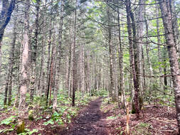 I could have had a more spectacular pic...but I loved this stand of trees. I could have had a more spectacular pic...but I loved this stand of trees. Carrigain #48
So we end on Mount Carrigain. I chose it by process of elimination. Al wanted to get hers over and done. She chose Isolation. Carrigain was what was left. At the time it seemed a bit anti-climactic for a hike, but it will always be special to me. It marked the end of the project and a turning to other things. I am a trifle annoyed, though. In order to receive the patch, I needed to write a narrative of my final hike. I posted the narrative here on the web page. It has been months of waiting now and I doubt that patch is ever going to arrive. Probably some confusion somewhere...oh well...I still did it right? I think of this mountain every day, mostly because we named our puppy after it. Of course, most people we know think we named her after Nancy Karrigan. That's OK. The mountain has grown on me. Whether it or the dog made that happen is immaterial at this point. It is a nice memorial to a time that I look back on with fondness... Post 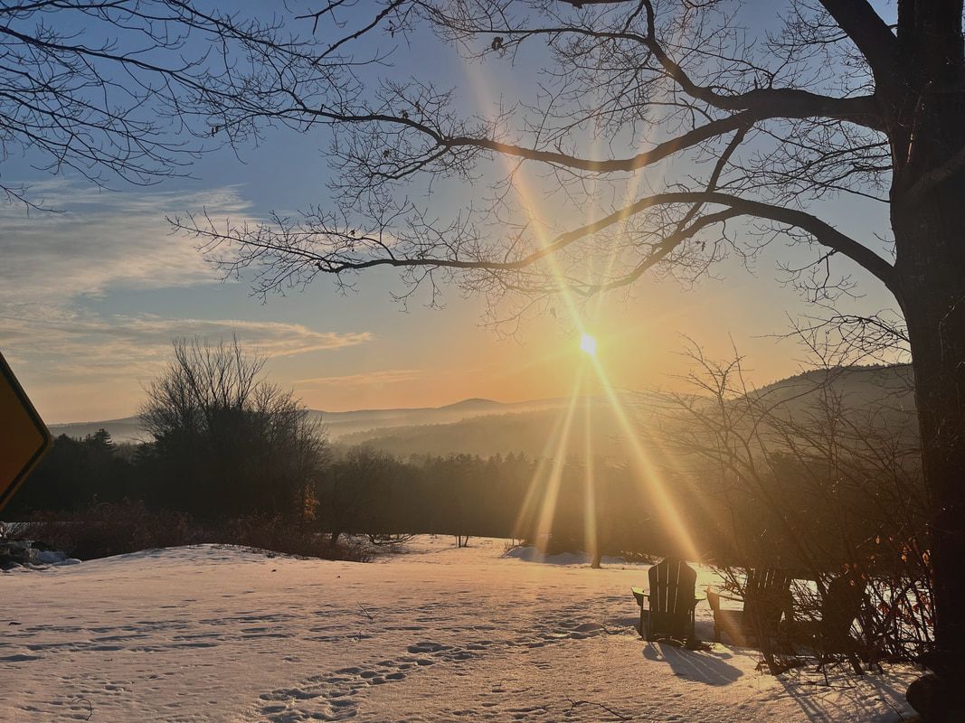 The view in the morning from the hill at Dexter's Inn, where we stay with the church group every year. Hiked on February 10, 2024 Yes, I have been hiking. Mostly, though, it has been in the form of long, flat, walks. Life is chaotic sometimes. Our youngest is wrapping up high school. The other boys are living their post-college lives. Al is reaching the final stretch of her doctorate and I am trying to spend time with everybody while doing my own work and studies. It is hard to get away in circumstances like these. Once you add in the puppy, things become even more difficult. Allison says I need to have at least seven projects going on at one time or I will get depressed. She probably isn't wrong. We did get out with the dog to do Mount Watatic. It is always the best. I didn't write it up, though. After all, I already have and the addition of Al and Carrigain--yes, we named her after a mountain--didn't add enough variety for yet another post. This weekend, though, we climbed over South Sunapee to catch the views off White Cliff Overlook. It was proof that there is plenty to do and see on a relatively short hike. 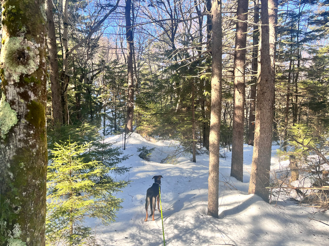 It is different now that the NH48 list is over for us. In previous years during the Eliot Church Winter Retreat weekend, we would find something relatively famous. We hiked the Hancocks one year. Last year we went up Mount Kearsarge. This time, we just picked a trail. Our criteria had to do with not having hiked recently ourselves along with concerns about how far we could big the pup. In the end she was fine and we were OK. The weather--while beautiful--was not ideal for winter hiking. The sun was out and the temperature was in the low-50's. During the 3.5 hours we were out, the snow developed the sort of "mashed potato" consistency that we usually try to avoid. Maybe it is because we were out of practice, but we didn't quite gear up the way we should have in the slush. Gaiters would have been nice snowshoes would have been better. We left both in the car. 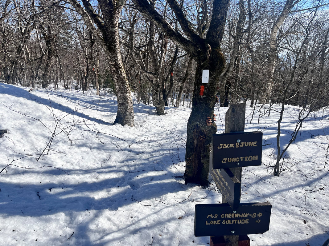 That said, the hike was worth it. It was about 5 miles round trip and--like many New England trails--started steep and got steeper. Total elevation for the route we chose was somewhere over 2,000 feet, so we certainly felt the incline! There were few places to stretch our legs so we put our heads down and soldiered on. I will say, though, when we lifted our heads we were treated with lovely views of the forest and--through the trees--glimpses of the mountains around us. The trail was well-blazed (orange on Newbury Trail mostly until the very end when it switched to white). With the dog leash attached to my belt, I helped Carrigain work out how to participate in our little team. She is not ready to go off-leash in a place like this and--honestly--I am comfortable following the rules, which frequently require leashes and poop-bags. The challenge is keeping her from wrapping herself--and me--around a tree. This is easily done. It just takes practice. She was a trooper. It is different with a dog and I am not sure if we will be doing any big climbs together soon. Half-day walks with her are fine, though. Al and I can do the big stuff on our own. The view, itself was nice, too. Of course it wasn't like the ones on the "lists". It felt less grand and more domestic. However, given the snow conditions and the company, I would say it was a success. I will take it. In fact, I might do it again. 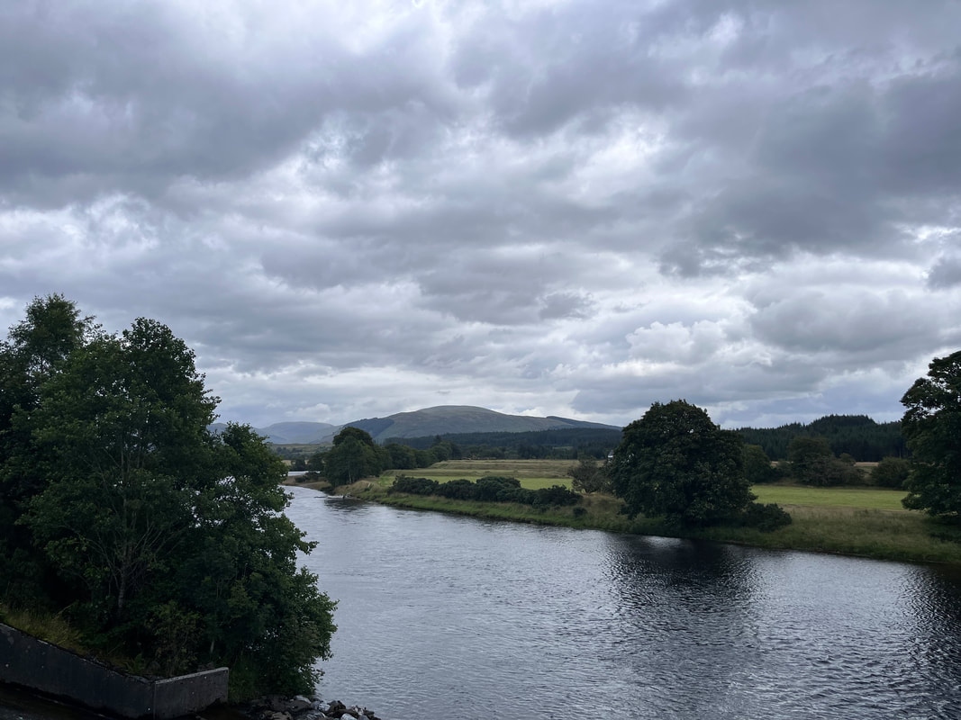 A morning view along the Caledonia Canal in the Scottish Highlands. It was represented to me that some people like to read sermons rather than watch the video and this Sermon from Sunday got a few requests. So here it is. It is slightly altered to be made readable. However, in essence it is the same as the video in the previous post. Knowing Nature Better Rev. Dr. Adam Tierney-Eliot 1/28/24 Texts: Luke 13:6-9, Genesis 1, Fern, Bog, and Swamp by Annie Proulx “From that family in that decade I was given a glimpse of the intricate complexities of the natural world…As I grew older and read and traveled I learned that the 1930’s were years of vile human behavior in a world that hubristically considered itself “civilized”...” –Annie Proulx Preparing for last week’s sermon about Jonah and the whale…or the big fish…or the sea monster, my first thought, was of a children’s book that I loved when I was younger. The book I thought of is a sort of Jonah story. At least is is a Jonah story with a twist; Burt Dow Deep Water Man by Robert McCloskey. Burt Dow continued McCloskey’s trend of stories like Make Way for Ducklings or Blueberries for Sal where the wilds of nature overlap with the powers of civilization…and somehow everything works out Now if you don’t know the story–it was his last book and not nearly as popular as the others–Burt was a lobsterman who was also swallowed by a whale, just like Jonah. He didn’t pray for assistance though, or wait for help from anyone, like Jonah did. For Burt the “big fish” wasn’t the representation of the ancient power of creation. It was an annoyance. Trapped in the belly of the beast, Burt used old buckets of paint in his lobster boat and covered the whale’s stomach lining with that paint. The whale got indigestion. Paint isn’t good for wild animals. Then, Burt, the boat, and a random friendly seagull were vomited out and back into the ocean When I was a kid–growing up at a time when we humans were more of a threat to the natural world than it was to us–I wondered why Jonah wasn’t more proactive, like Bert. I wondered why this Biblical prophet didn’t play the clever modern and outwit the big dumb whale. I think all my young friends did, too. Now, living where we did, it was still relatively easy to look around and see the vast, diverse array of Creation–which is to say the interconnected ecosystem, human and otherwise–around us. Like Annie Proulx–although much later–we understood when we were very young that nature was something to be respected and at times feared. After all, we had fallen through the ice. We had cracked our ribs sledding. We had broken limbs and gotten concussions falling out of trees. However, a great deal happened to the earth between the 1930’s and the 1970’s, so perhaps unlike Proulx we also had a sense that in the end nature could be outwitted when we humans put our minds to it. We knew it could and would be bent to human uses. We saw this in the farms next to our houses. We saw it in the municipal, state, and federal parks where we could hike and camp. We saw this human hand, too, in the Androscoggin River that ran through downtown. When I was born it was one of the top ten most polluted rivers in the country. It was where the mills dumped their dyes and their bleaches until the pillars of toxic foam rose above the banks, touching the bottom of bridges. It was a place where the “smell of money” –of the fumes from those liquefied chemicals–was a regular part of our lives. Now, we knew we probably would have had fewer injuries if we didn’t think like Burt Dow. We were able to see cause and effect, after all. Also, the river–which was injurious to all of us–was already designated a national problem; receiving some of the first funds from the Clean Water Act when I was two years old. The time and the tide had just begun to turn. You see, the 1930’s of Annie Proulx’s childhood had helped to create a crisis that could no longer be ignored in the 1970’s and 1980’s. During our time we were realizing that Creation, as dangerous as it had been to Jonah and could be to the unwary, was being made more dangerous through our actions But that idea–that we could and should control nature–was and is still ingrained in us at a young age. That idea contains within it the belief that human beings are at the top of the food chain. It is the unexamined assumption that we are the smartest and most creative species ever evolved and the spurious fact that we are destined–in the words of the Transcendentalist minister James Freeman Clarke to go “Onward and Upward Forever” through the strength of our minds. Now, whether we actually believe this anymore–this manifest destiny of humanity–isn’t entirely clear. We have experienced a great deal, from the toxic river and the stench in the air, to the bizarre weather patterns, drought, flooding and increased risk of pandemics. This experience might change our minds about human superiority. Either way, though, the way we humans act as a group still implies this sense of superiority, separation, and control. Whether we are stewards of the earth, or its exploiters, we like to be in charge. 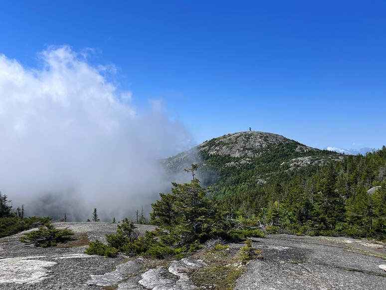 One of the best hikes in New Hampshire: the view of Mount Cardigan from Mount Firescrew Now the way we debate the future of our environment assumes this belief; a belief that we are empowered to decide what nature has to give us...and arrange things to our liking. It goes at least as far back as Genesis Chapter 1 “Be fruitful and multiply, and fill the earth and subdue it, and have dominion over the fish of the sea and the birds of the air and every living thing that moves upon the earth.” If you want to dive into the implications of this theology you are invited to the forum after church on March 3. Right now, suffice it to say that riding underneath the human practice of exploitation of the earth is the belief that it is ours and that we own it like we own a car. We think we can do as we see fit. It undergirds the thinking of those polluters of the river and the air as well as the folks who make the parks for our recreation. The question both sides are asking is what services it can provide us. Is the river power for the mill and a dumping ground for waste or a place to fish for food? Is the mountain a source of nickel, or iron or coal? Or is it a place to go skiing in the winter time? One set of answers are better for the planet. However, in both outcomes, the basic question is the same… How can the earth, how can creation serve humanity? Of course we could also ask a different question, namely how we can be of service to it and–through that service to the entire ecosystem–be of service to humanity. We also, as human beings, have subscribed to this question, sometimes simultaneously. We do this even though it isn’t really compatible with the dominant theology–secular and sacred–that our capitalist culture projects. This other way will be the topic of the forum on March 10. You see, there is no requirement for us to follow a rule extrapolated from an ancient story written by people who could not conceive of the industrial “advances” of the late 19th and early 20th centuries. There is no requirement that human beings stay perched on our privileged place while creation suffers “beneath” us. Again, as I said last week, we can learn and practice not rulership but relationship. However, that is harder to do than to keep on keeping on trodding our path to self-destruction. “Our species is not adept at seeing slow and subtle change.” Says Proulx “There is a tree, we cut it down—we immediately recognize that there is a change. Yet we see a tree and we see it again a year later without noticing the new growth tips” This is where those few verses from the Gospel of Luke come in. As with many parables, it features a rich man who doesn’t know what he is doing. The confused rich man gets angry because he has this fig tree that isn’t bearing fruit. He demands that his gardener cuts it down because it is taking up space. You see, the tree isn’t serving the man so in his mind…it doesn’t deserve to live. It must be a faulty tree. However, the gardener, the hero in the story, stops him and says “Sir, let it alone for one more year, until I dig around it and put manure in it.” He says this, because he, the gardener, is in relationship with the soil, with the tree, with the animals offstage, with the ecosystem that actually produces the fruit and actually sustains all living things. He is being patient. He is reading the signs. He is asking not “what does the ruler require” But instead, “what can we all contribute so that we all get what we need?” The soil needs the manure from the animals. The tree needs that fertile soil. The boss…needs that fig. This change, as we talked about last week, doesn’t arrive right away. Annie Proulx writes that “To observe gradual change takes years of repetitive Passage through specific regions week after week, season after season, noting sprout, Bloom and decay, observing the local fauna, absorbing the rise and fall of waters.” It takes time and knowledge. It takes listening and learning but then…in a years time there is the fruit…and the cycle starts again So let us take a moment to think of the subtle changes we have seen in creation and in our own lives as we are part of creation, too… 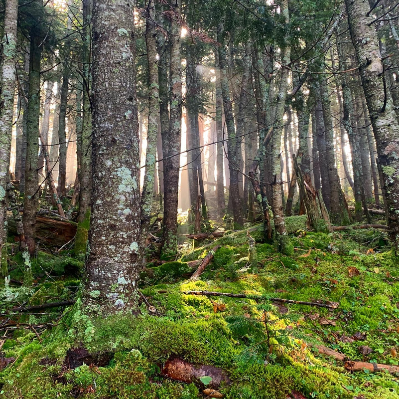 Moss, light and trees on Mount Tecumseh.  So here is the second sermon in my "Learning From Nature" series. The series will have to take a bit of a hiatus as we have Annual Meeting this Sunday. However, so far, I am enjoying it. I have decided to move slowly. Attendance is such that not everyone is in church every week and there are some key concepts here to help us consider how we can change how we relate to the natural world. I believe that most people--including myself--tend to believe that their (or our) connection to the natural world is closer than it is. This series is part of an effort to get us to think differently about our place in the ecosystem. Another part of this process will include a couple forums--essentially one hour workshops after church--on March 3 and March 10 to think about the theology around this relationship. There will be a Pub Theology as well, riffing off the previous "Pub" when we talked about eco-anxiety. You are welcome to attend if you are around! IT is slow process to change our cultural norms and values. However, we won't ever manage it if we never start. 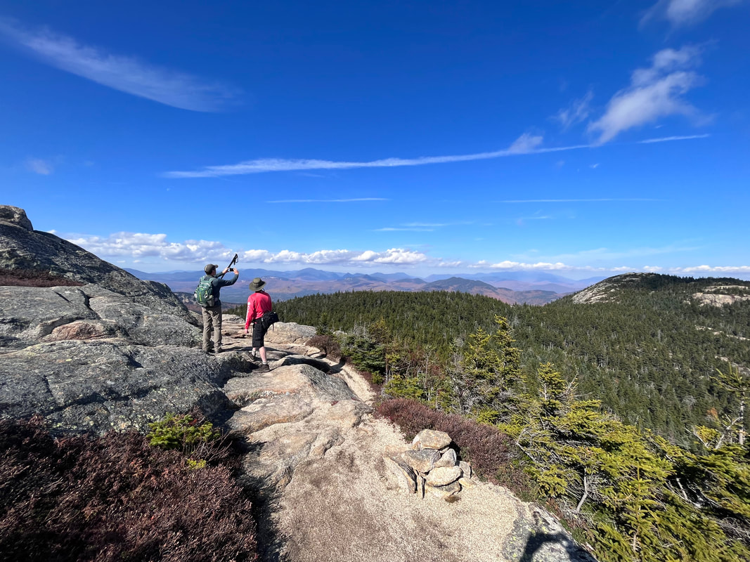 Neither of those people are me. Nor is it a picture of my online course! That is my brother the wildlife biologist demonstrating his peak finder to a passerby on our way from Chocorua over to the Sisters. I started an asynchronous online graduate course in Environmental Policy today. The reasons were varied. However, the biggest one had to do with my questions about the role of the church in the environmental movement. I have been a minister for a long time. Over the years environmentalism has been a regular topic or lens for me. I have led workshops and outdoor worship. We have examined the topic in the context of transcendentalism and other nature theologies. During all this time, though, I felt myself coming up against a blind spot. The fact is, I know a great deal about nature and spirituality. I have tons of practical experience with human beings and how they move through the world. However, I don't know as much about the science and economics around many of the problems and issues our planet faces. This isn't a shock. I am a pastor. I live and work in a community where my role is to "walk" with people to help them make sense of their lives, the world, their relationships, and their feelings. My biggest resource--among many--is a very ancient collection of texts written by people whose philosophical and theological chops were strong but whose economic and scientific chops were...well...lacking. This isn't a judgment of them necessarily. They weren't destroying the planet nearly as quickly as we are, after all... Anyway, as you know I spend a lot of time outdoors. My hiking adventures account for most of what is on this page. I have to say, when I am "out there" on a mountain or a local trail, I wonder how long it will be around. I wonder about the drastic shifts in weather. I want to know what is going on with Creation--church people use the term "Creation" frequently even though most of us are not creationists--and what I can do about it. Right now I am feeling the need to dip into a better understanding of the ecosystem and the dynamics that contribute to its health. Yesterday I began a sermon series on these subjects. It is independent of the course I am taking but I am sure there will be overlap. As it currently stands I will preach a number of sermons on Sunday mornings, host a number of workshops, and set up some "Pub Theology" sessions to talk about what the church can do to help the environment. I feel like we have a role to play that we--houses of worship regardless of faith tradition--are uniquely positioned for. We deal with hearts and minds. To truly save humanity, we need to re-take our place in the network of living things. This has to start with a change in attitude and conversation. Anyway, I will probably drop in here to wax lyrical on this subject from time to time. If you live in the area, check out the church newsletter. We would love to have you as part of this conversation! PS This is Sunday's Sermon... 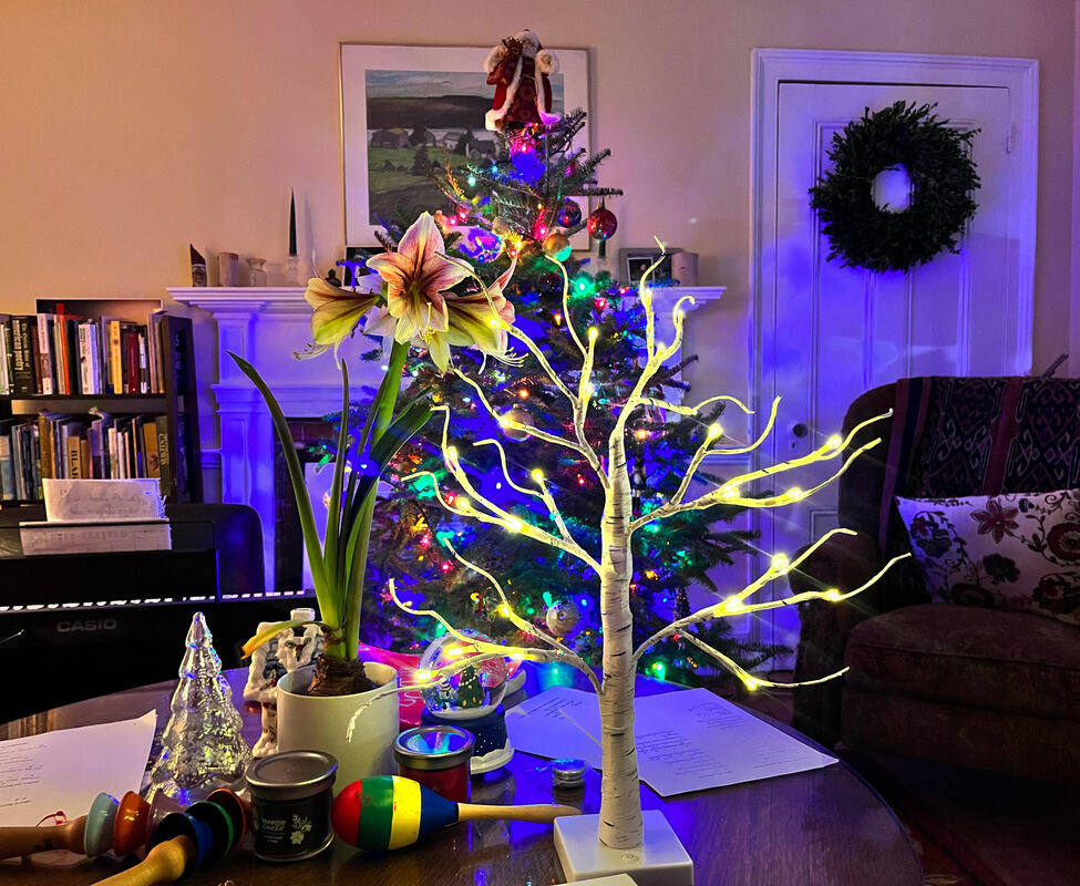 The state of our living room/my office in the waning hours of Epiphany. 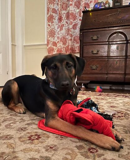 So the holidays are over...and that is OK with me. The first snow came over the weekend. It messed up some church plans but I will get over it. More pressingly, it is messing up my old bones which is making it hard to peel myself out of the bed, don my winter gear, and walk the dog for her accustomed four miles. It just didn't happen today. Even though I have done a great deal of hiking--much of it in the winter--it takes a while for me to recover these days. That is the way with time. It rolls on ahead of us and we need to pace ourselves. We are different people from moment to moment. Through the years this long line of who we have been changes. With each change we are less like the person we were when we were born. We are less like the person our parents dreamed of us being. We are--even--less like the one we thought we would be. You know this...but it is worth pointing out sometimes. That isn't always a bad thing, is it? Lost plans make us who we are. I remember in my undergraduate Anthropology class watching a documentary that followed two groups of children from elementary school well into their adulthood. In the first video all the kids said what they wanted to be when they grew up. By the end the rich ones had become just what their young selves said they would be. The others--working class mostly--went on some unpredictable adventures. Some stories were tragic. Mostly, though, they did things they never thought possible. In fact, they wouldn't even have had the words when they were young to describe the adults they became. Anyway, the new year is an arbitrary date but--as we talked about during Advent--all holidays are arbitrary. I have plans for 2024. I bet you do too. It is hard not to look both back and forward at the same time. Maybe you don't have a resolution. I don't. That is fine. However, in surveying 2023 I see good parts and bad parts. There have been times when I thought that I handled things well. There were times when it felt like whatever I did made things worse. This is normal. It takes a certain level of delusion or a high level of privilege to go through life thinking you are perfect, right? So what are you thinking about for the future? For me, the "tiny step" involves trying to figure out what to do with this dog. She came to us the Saturday before Thanksgiving Sunday (which--for the edification of non-church people--is before Thanksgiving). Right after that was the chaos of the holidays and of our lives which took an entropic turn. It has been a long time since we had a dog. The last one was a husky, who was very different from the one we have now. I hope to figure out our relationship over the next year. Things will come out of that, I am sure. Not all of them will be good or successful. However, my wife tells me I am not happy unless I have seven projects going at a time. So there yah go... 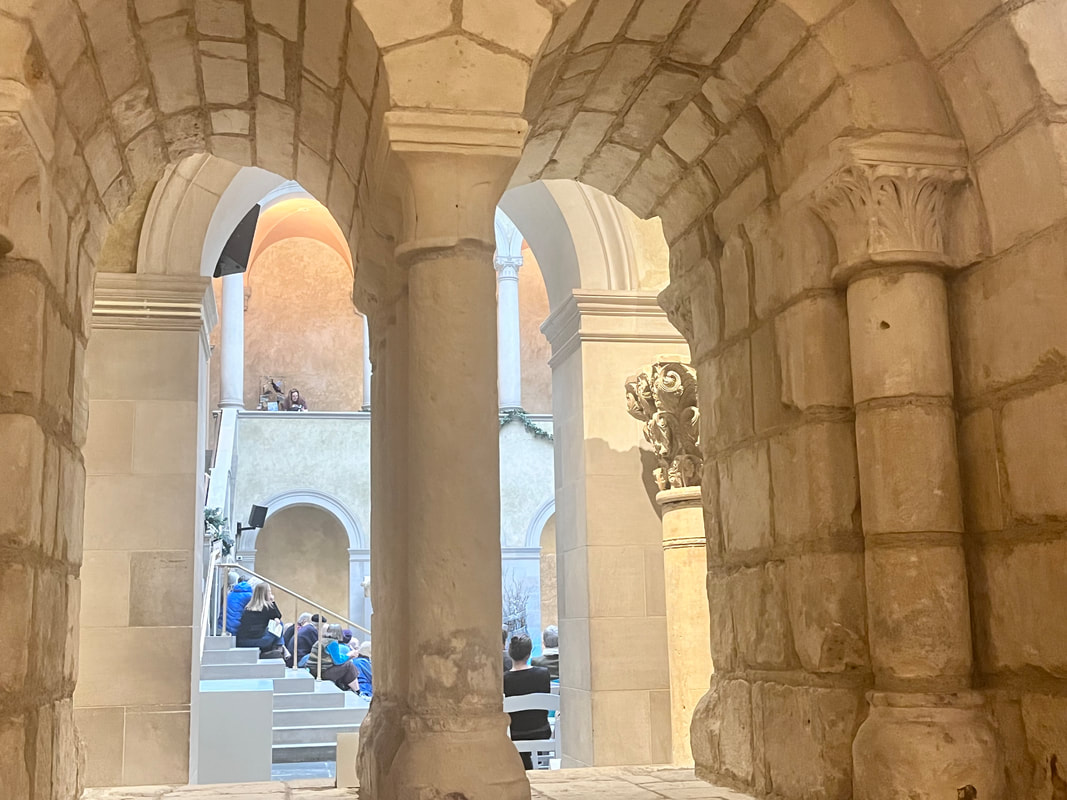 During the Christmas season we went to the Worcester Art Museum and sat for a while in the 12th Century Benedictine priory they have just off the main hall. A jazz band was playing. The band was great but the acoustics were not. Anyway, I sat there for a while, recovering from all the mess of the month before. I thought of the things I hadn't managed to get done. Then I did my best to let them go. Most plans don't work out. What is left, though, is a life.
Whatever your plan is, I hope you commit to it. I also hope you take it easy. Otherwise you might break something. Right now I would like to go for a big hike in the snow. The dog and I look out the window and all I can see is the potential for adventure and stories. She probably sees squirrels and frozen poop. That ankle though...I need to take my time now if hiking ever gets to be a thing for me again.... Such is the way with the new year. It is a lot like the old one. Old injuries and burdens continue. However, maybe the dreams change along with our ability and our commitment to live into them.  A little before lunch--and on my third cup of coffee--I opened the last door of the secular Advent calendar. That's it. A mere handful of hours after dark, Advent ends and Christmas begins. I hope you had a good one. I am getting ready to head up to church to prepare for the Christmas Eve service. As I have noted before, we have had as many as three in one night. This year it is just the one service. There are reasons, of course, but now is not the time to get into them. There will be carols and candles. There will be prayers. It will be a witness to Hope, Faith, Joy, and Love in a world that should do better with these things. Then we will go to our homes and rap whatever needs rapping...then go to bed. I have nothing clever or insightful to say. This is your holiday and--for good or ill--you have made what could be made of it. Thank you for reading! It looks like I only missed posting once, which is pretty good. I do not know if I will do this again. It was a writing project for myself, mostly. It is good to make sense of this season as it rolls along. Now I am ready for what is next. I hope you are too.  Middle Son has just arrived from out west (Hampshire County, Massachusetts) which is great. However, it is a pretty good indicator that we are too busy for reflection. The Christmas Eve service is as ready as it can be at this point. Presents have either been purchased or failed to be purchased. Everything is either stress, festivity, or festive stress. Oh well...it is what it is! Given the lack of reflection time and whatnot, I have an old video for you. It was recorded in 2019, when we were so much younger than today. I made it to promote the pageant of that year. The video, itself is...rough. Recording things for fun was still a novelty in my profession. It was enough a novelty that wandering around the mall was entertaining. Anyway, here it is! I hope you are all managing to do what you have to do for the time to come. |
Adam Tierney-EliotI am a full-time pastor in a small, progressive church in Massachusetts. This blog is about the non-church things I do to find spiritual sustenance. Archives
March 2024
Categories
All
|
 RSS Feed