|
Dear Folks, I am in the process of catching people up with some early hikes and other encounters with nature that I thought people might find interesting as part of a "How It Began" (HIB) series. Mostly this will describe specific hikes and perhaps some lessons learned along the way...if there are any. They are meant to be short and, perhaps helpful in some way to other hikers or fellow-travelers. I will post the dates of when I hiked a specific mountain since the ones in this series are NOT posted at or near the date hiked. 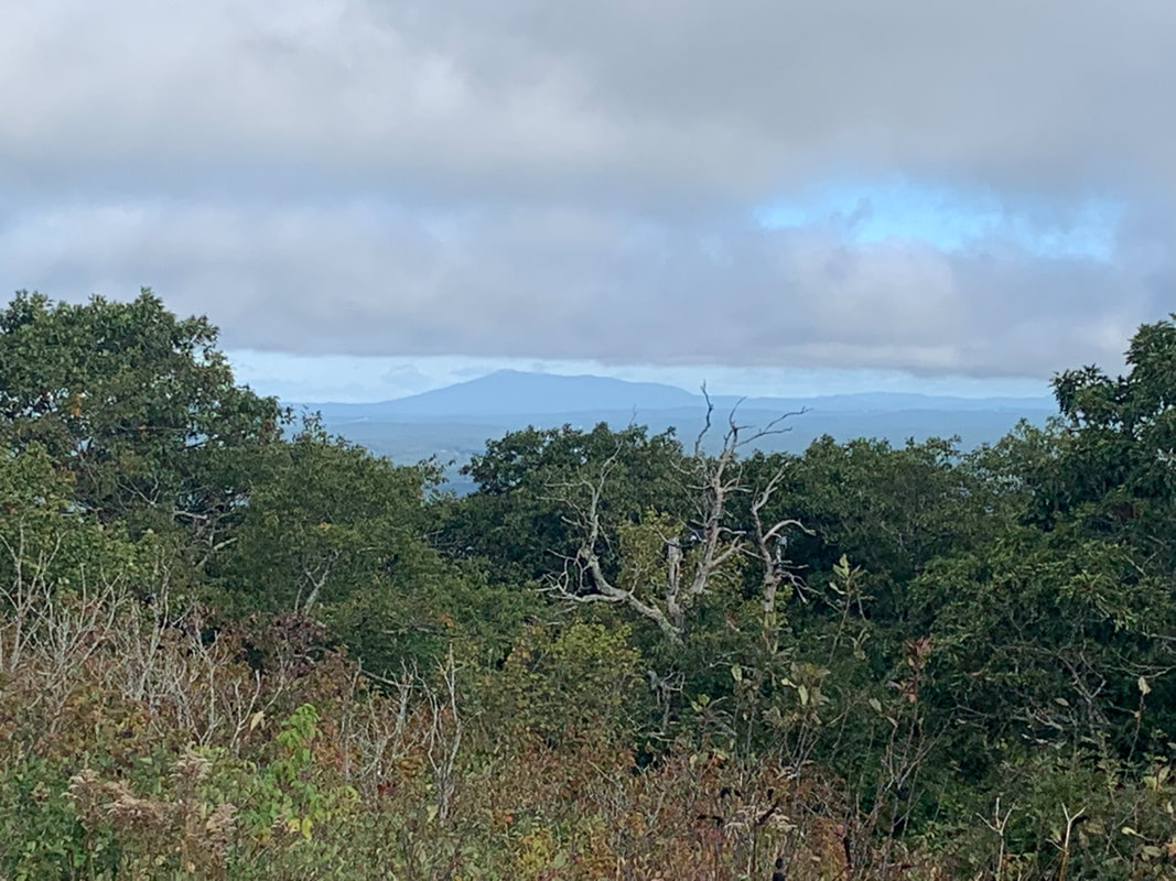 Wachusett's View of New Hampshire's Mount Monadnock in the distance 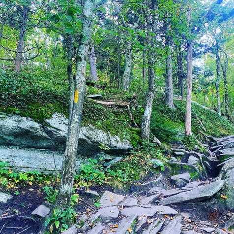 SEPTEMBER 21, 2021 But special I remember thee, Wachusett, who like me Standest alone without society. Thy far blue eye, A remnant of the sky, Seen through the clearing or the gorge, Or from the windows on the forge, Doth leaven all it passes by. Nothing is true, But stands 'tween me and you, Thou western pioneer, Who know'st not shame nor fear, By venturous spirit driven, Under the eaves of heaven, And can'st expand thee there, And breathe enough of air? Upholding heaven, holding down earth, Thy pastime from thy birth, Not steadied by the one, nor leaning on the other; May I approve myself thy worthy brother! from "A Walk to Wachusett" by Henry David Thoreau 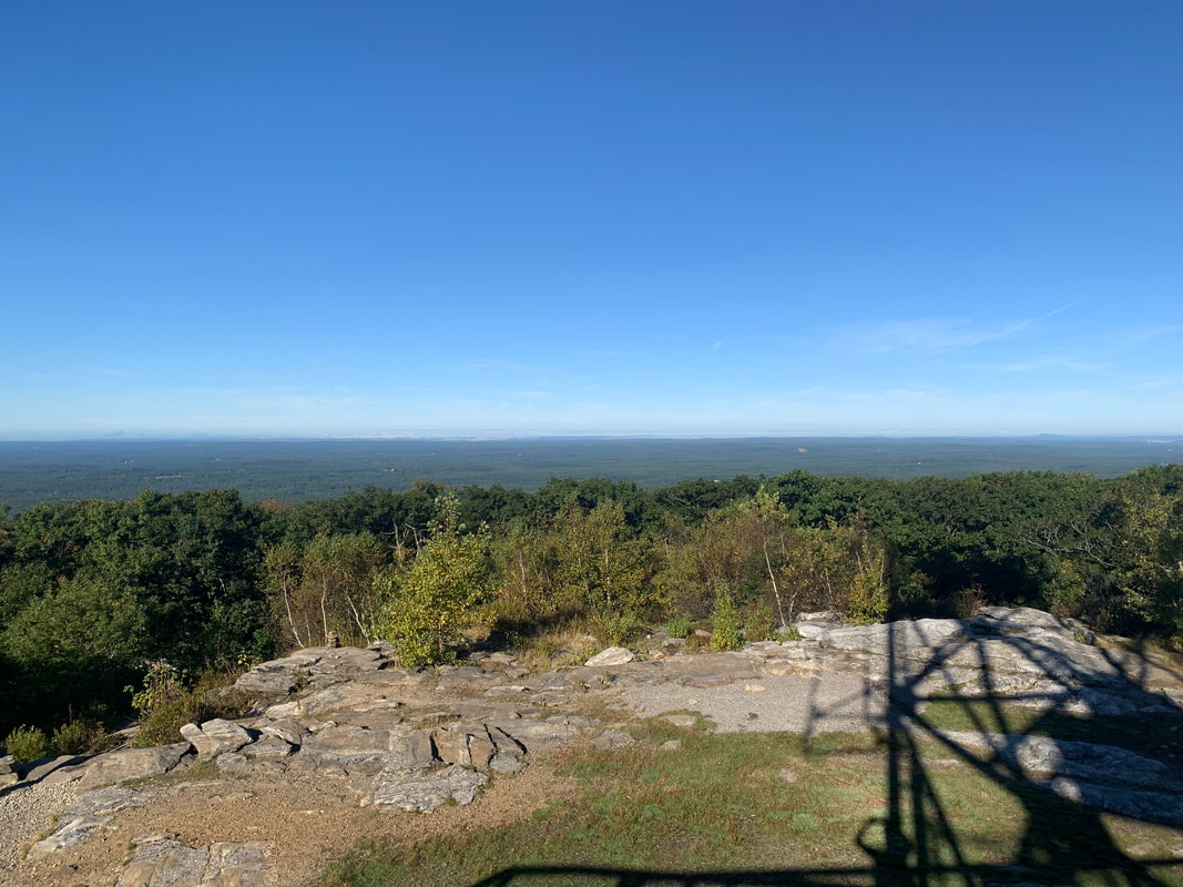 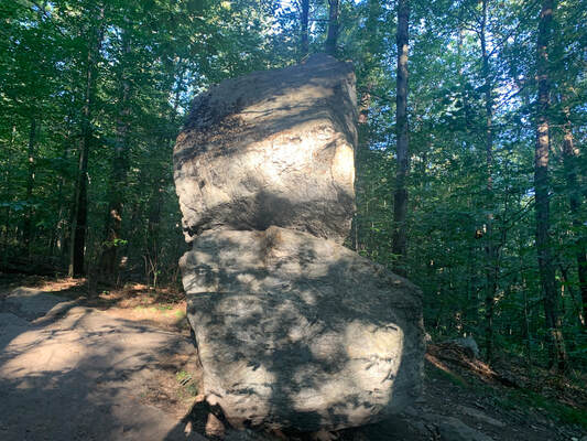 The less-photographed side of Balance Rock The less-photographed side of Balance Rock I don't really know where to start with this mountain. I have hiked it a number of times, sometimes with family and sometimes alone. This particular hike was a solo one on a fabulous fall day. I took some time at the top to work on a sermon before hiking back down to have coffee with a friend and colleague who lives and serves nearby. Wachusett is a monadnock, which is to say it "standeth alone without society" in Thoreau's words. Monadnocks rise up as a single hill in an otherwise lower landscape. There are a number of these in the area. Two of which--Watatic and Monadnock, itself--will be written up soon. This means that--much like the ridges of the Pioneer Valley--they have an unobstructed view in spite of the relative shortness of their peaks. My trip was about 4ish miles (give or take a mile). I started at Balance Rock Trail (because I am sucker for big rocks) and headed up Old Indian to Semuhenna to West Side Trail back to Old Indian Trail to the top. After exploring a bit, I settled on to the observation tower to do some work and to eavesdrop on a group of birdwatchers who were cataloguing raptors. My way down was even more of a ramble. Be sure to have a map with you. There are a bunch of trails leading to different locations and trailheads. Honestly it wasn't my favorite trail up. That would probably be Harrington/Mid-State Trail. However it worked for the day. 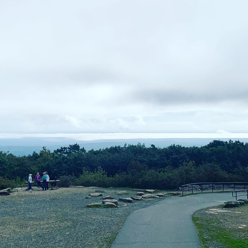 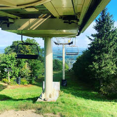 The one thing that is worth noting is that Wachusett is a ski mountain. In this case that means that there are many great views that would not otherwise be possible, thanks to ski trail clearings. On the other hand...it is not as remote or wild as Thoreau's time. It is an extremely accessible place, with both the good and the bad that go with that. Unlike even many ski mountains, it has a parking lot at the top. It can be a bit jarring walking off a secluded trail and encountering a scrum of humanity and their cars. This is still Henry's "Watchtower of Massachusetts" but now...it actually has a tower on it. I suggest weekdays in the morning. Then there are fewer people. That said, I do love this mountain. The walk up and down is always worthwhile. Both the views and the foliage are worth pausing and examining. Fall is best, but spring is nice too. Summer and winter can be a bit chaotic, but other people experiencing and loving nature isn't the worst thing, right? Update: I have been up Wachusett since I posted this and--in April of 2023--I made a short video of a slightly different hike from the one described here. I ended up on the same peak...but it was quite a bit longer. Here it is!
0 Comments
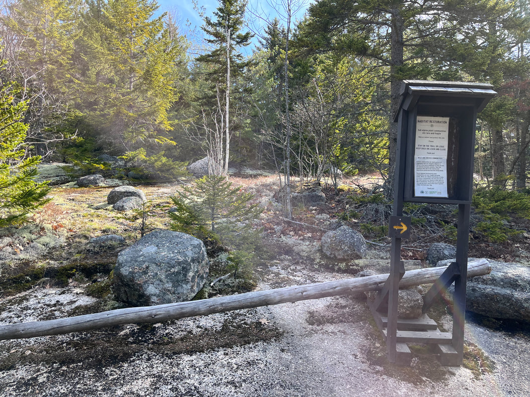
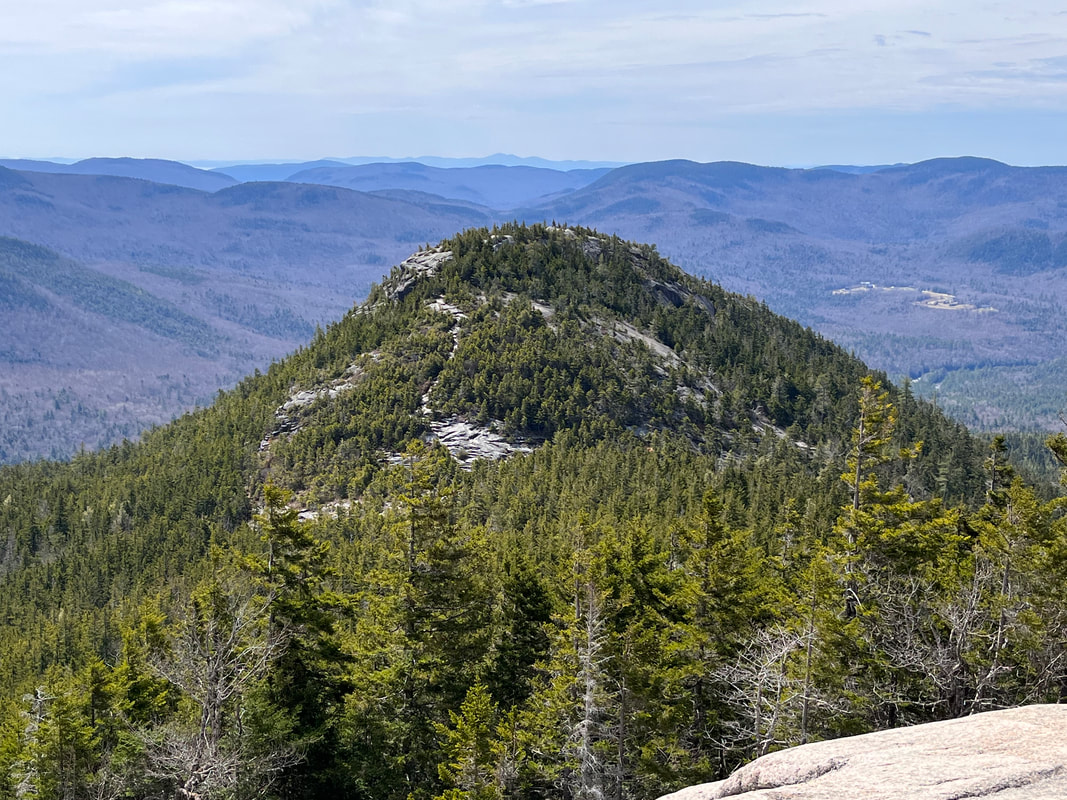 May 2, 2022 Today's Sabbath Hike was on the Welch-Dickey Loop. In spite of being two peaks (Welch and Dickey) it counts as one hike for the "52 WAV" list. This is my 7th so far on the list. The trail is roughly 4.4 miles but one should expect to get a bit lost going up Welch thanks to the large amount of exposed rock ledging where the blazes (yellow) have worn off. There are a number of false trails on Welch where people thought they were in the right place, realized they weren't...and drift to the correct location. My one big suggestion comes from my experience with those ledges. Some of them are steep and could be treacherous in less-than-ideal conditions. Definitely go up Welch and down Dickey so that you are working against gravity on the worst bits. That said, be sure to pause a bunch and look behind. The views were constant. I had a beautiful day for the walk. The threat of rain did not manifest until my drive home. I did--as you might have guessed--get lost a bit at various times on the open rock, but a combination of the map, the All-Trails app, and just keeping my head up pretty much did the trick. The first stop of import is an overlook on the way up Welch. Right before the view was a kiosk with a sign warning people (and their dogs) to beware the "crevice communities" living on the rock shelves. According to the sign "Crevice Communities are small pockets of vegetation that are uniquely adapted to thrive on the harsh conditions of rocky terrain on exposed mountain summits. They find footing in the thin soil in the crevices and depressions protected from the strong winds." The overlook had a fairly unique set of these communities so disturbing the vegetation is not a great idea. 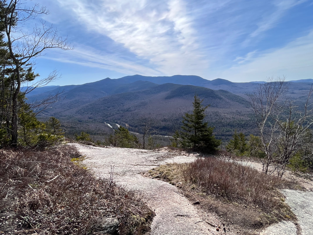 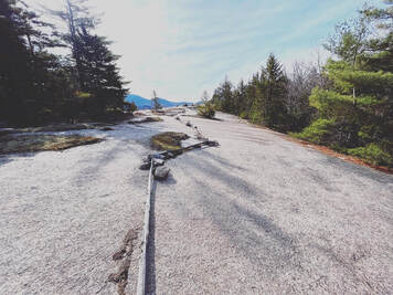 In addition they put a number of logs around key areas. I respected them, of course, and took my time checking out the tenacious plots on the other side of the symbolic barrier. It was certainly a case of life finding a way. It was also a good reminder of our own obligations to live close to nature and understand our relationship with it. I am not entirely sure we learn that in the cities or suburbs where most people live. There may be a class from time to time. However, the way we move across the landscape and order our lives shows that we--influenced by our culture--believe nature is something to be managed or manipulated for our immediate benefit. The simple act of placing a log around a tiny ecosystem indicating to passersby that "this is not for you" may be the beginning of deeper understanding for some people. Of course, it may also just be ignored, right? Let's not be that guy.
I have been thinking quite a bit lately about how we interact with our environment and, frankly, it is depressing. That said, being out in the relatively remote environment of the White Mountains on the off-season was pretty darn restorative. I took my time and I suggest you do, too. The first overlook opens up a phase of fairly challenging hiking and scrambling, first to Welch and then through a lovely ridge filled with spruce trees and then up Dickey Mountain. Dickey's views from the top are pretty nice, but a bit underwhelming after what has gone before. That said, there is more to come! The descent passes over more open rock and more awesome views. Finally--after a ledge walk--the trail dips back into the trees for the walk to the parking lot. Looking back from the ledge one can see the giant bowl that makes up the loop itself. 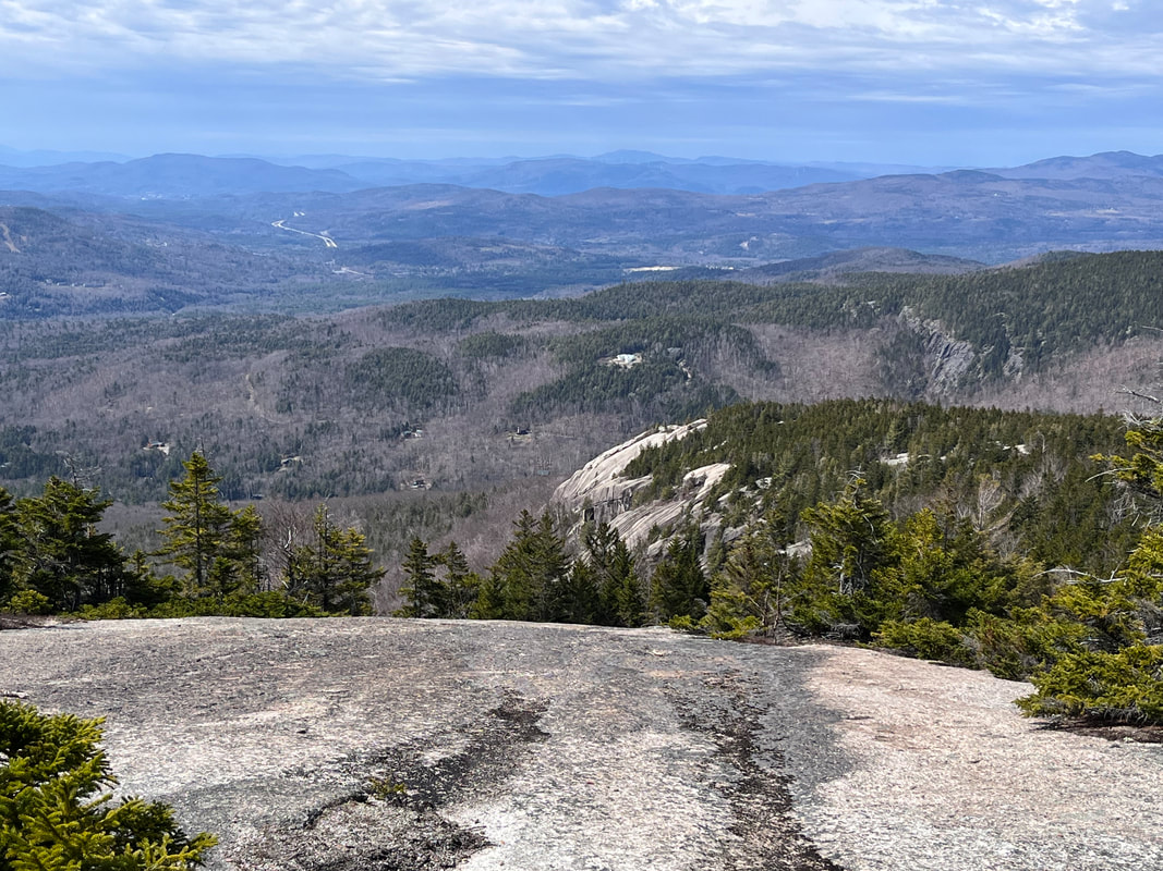 Here is a view looking down on that final ledge Here is a view looking down on that final ledge The hike was awesome and I did not do it justice with the pictures here. I suggest you go try it out yourself. I will say that it isn't an easy stroll. The mileage is much shorter than--say--Mount Shaw, but that that means the inclines are steeper and in this case do require a bit of gumption. My knees hurt a bit when I got home and I used poles! I would also note that this is a very popular hike in-season so spring is a great time to get out there so you can have it mostly to yourself.
Dear Folks, I am in the process of catching people up with some early hikes and other encounters with nature that I thought people might find interesting as part of a "How It Began" (HIB) series. Mostly this will describe specific hikes and perhaps some lessons learned along the way...if there are any. They are meant to be short and, perhaps helpful in some way to other hikers or fellow-travelers. I will post the dates of when I hiked a specific mountain since these are NOT posted at or near the date hiked.   September 10, 2021 Tecumseh is another one of those NH 4,000 footers people argue about. Some folks suggest it as a "first hike" in the 48 since it is relatively short. Tecumseh is a mere 4,003 feet tall but the elevation gain on the 5 mile long trail is 2,250 feet. Also, the views from the top are just OK. The other views come thanks to yet another set of ski trails and require a little extra (easy) hiking to reach. I hiked this on my own as Allison had done it earlier. For the record, she didn't like it much. I loved it and it ranks as one of my top 10 all around hikes...ever. However, I get what folks are saying when they complain. It really depends on whether you think you might enjoy miles of stairs. Yup...miles... 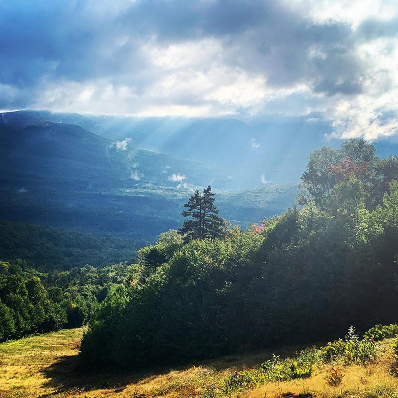 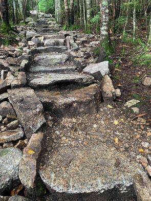 At first there are no stairs and the hike is fairly gradual, then there is a dip. Then a stunning view from a nearby ski trail off a side trail to your left. But the stairs begin shortly thereafter and go on and on. One of the books suggests--unironically--that you can distract yourself by thinking of how much work went into putting these steps in. Honestly that just made me even more tired. After the super-epic steps part, though, things smooth out a bit. The bigger challenge for me came from being by myself. I tend not to bring headphones on a hike so I am alone with my thoughts, which can be fine. That said, I do like talking. I spent a lot of those stairs singing to myself, which would have been weird if there was anyone to hear. However, I had the mountain pretty much to myself on the way up, with the exception of a trail runner...and they don't talk. 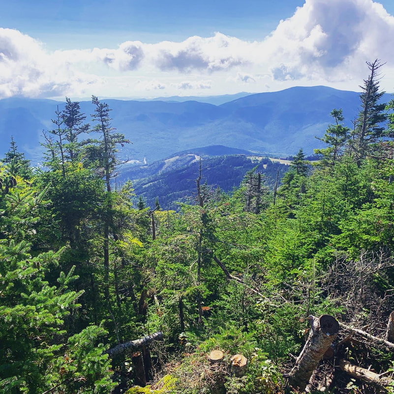  One of the great things about a straight climb like this was that the whole thing didn't take very long! It would have been even shorter except there were tons of people coming up as I was going down and almost all of them stopped me to ask how much longer they had to go and if there was a view worth working for. This actually was a bit strange as Tecumseh has the reputation for being under-hiked. As a verbose person I had developed quite a little song-and-dance by the end. After all, it is a "love it or hate it" mountain. I may not have been super helpful...but I think I was entertaining. This was another hike where the view was fine but the foliage was off the handle. Again, those stairs give you plenty of time to contemplate the trees, moss, and fungi that grow in abundance along the trail. On my way down I went out to see the side views, which were pretty nice, too. Then on down to the car. In the end, you can make your own opinion about whether it was worth it. The last half mile or so was very "elfy." I thought it was pretty magical even without the unobstructed view one might hope for. If elfy floats your boat, you will be pleased. If you need that view and don't want to do the extra stuff...there are other hikes. Update: I feel like when I wrote this post I didn't do the mountain justice. I was starting the weblog and managing my job, planning for sabbatical. I really loved it, though. So recently I went back with a friend for a winter climb and made a video of how things went... |
Adam Tierney-EliotI am a full-time pastor in a small, progressive church in Massachusetts. This blog is about the non-church things I do to find spiritual sustenance. Archives
March 2024
Categories
All
|
 RSS Feed