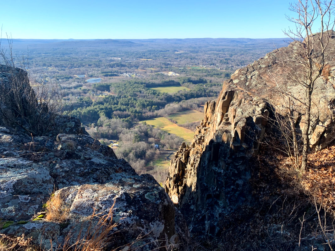
 Mount Tom Ledges  One of the views from Roberts, which didn't make the list but deserves a pic! One of the views from Roberts, which didn't make the list but deserves a pic! On July 25 of last year I hiked Mount Roberts officially ending (perhaps prematurely) my post-surgery "rehab" phase. I thought it was the first of my "52 With a View" (52WAV) mountains, which is a hiking list in New Hampshire that I planned to pick away at. Turns out I was wrong and we have photographic evidence that I climbed South Moat years before. Oh well....lets not let the perfect be the enemy of the good. Now--as we drift to the first "Roberts Anniversary" I thought it would be fun to do a "top ten" list of hikes that I have undertaken since then. The system I used was extremely unscientific. Essentially this list reflects the hikes I have thought about the most since. Perhaps they aren't actually the "best" so much as the most memorable. There is something about each of them that calls me back from time to time when I am doing something else. Since that is the primary requirement, they have little in common. There are 52WAV's and NH 4,000 footers (NH 48). However there are hikes in Maine and Massachusetts as well. Some mountains--like Watatic and Wachusett--that I always enjoy are not here. In the end, though, it is a pretty well curated list. Some are short and some are easy. Others are...otherwise. In any case, here they are in descending order as they rank in my memory: 1) Mount Tom Ledges (MA) 2) Welch & Dickey (NH 52WAV) 3) Mount Liberty (NH 48) 4) Mount Norwottuck (MA) 5) Mount Shaw (NH 52WAV) 6) Firescrew & Cardigan (NH 52WAV) 7) Galehead-Garfield Loop (NH 48) 8) Mount Agamenticus (ME) 9) Mount Whiteface and Rollins Trail (NH 48) 10) Mount Tecumseh (NH 48) I also wanted to include two "Honorable Mentions". The first, North and South Twin, may make it on next year's list. They aren't on it now because I haven't had a chance to let it settle in and actually "remember" them. It was just last weekend! Still...that was a pretty good hike. The second, Morgan/Percival and Kearsarge is really two hikes on the same day, which feels like its own category. The first was planned and the next was spontaneous. Barreling up Kearsarge after Morgan and Percival I realized that just maybe I know what I am doing...sometimes. I remember it during despair-time on other hikes. It, too, is special to me but I couldn't figure out how to separate the two hikes. Anyway, here it is. Maybe I should come up with a prize for anyone who hikes them from July 25, 2022-July 25, 2023. That would be fun...  Random view from Welch/Dickey
0 Comments
 I forget but...I think this is one of the spectacular views off the first overlook on North Twin. That would be the shoulder of South Twin on your right. 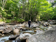 Wading through the second-widest of the crossings on the way down. My feet were so happy! Wading through the second-widest of the crossings on the way down. My feet were so happy! HIKED ON JULY 16, 2022 Man my legs hurt... This hike over the Twins was quite an undertaking. It was a twelve-miles total out-and-back over North Twin (4,760 feet) to South Twin (4,902 feet) then back over North and on down the way we came. We got off fairly early--a little before 5am--and were at the trailhead by 8. The parking lot was already full and we were among the many who found a parking spot by the side of the road. It wasn't the most crowded trail we've encountered--that would be our fall hike up Zealand--but it was still much more than we have seen at other times. It is a summer weekend in the Whites! This is what it looks like. Fortunately the crowd was one of the friendliest we have encountered. Occasionally you get grumpy people who are unhappy to see you. I believe I mentioned that in my Moriah post. Not on this day, though. I will spare you most of the details but there was a lot of shared picture-taking, friendly chit chat, and general encouragement both given and received. The hike up is different in a couple of ways worth mentioning. First, there are a number of somewhat challenging river crossings. This trail is not recommended during the spring runoff, in fact, when the crossings can be downright dangerous. There is also an unofficial "bushwhack" that helps folks get around them. However, we opted to ford them as the levels had gone down substantially and, well...it was fun. That said, instead of jumping from rock to rock, we bought our sandals and waded through. Taking the risks of an errant stick on the trail, we kept our sandals on until we crossed the last big stream. With boots back on--already a few miles in--we started our climb in earnest.  This is not the nasty gravel part, but part of the trail on the absolutely gorgeous ridge between the peaks. 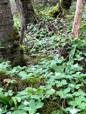 The next big problem we encountered was the condition of the trail. People have been hiking the Twins for a very very long time and the trail has been worn down over the years. Often when this happens (and on some parts of this hike) that means smooth and sometimes-slippery ledge. In this case, however, there were large stretches of small, loose rock that shifted underfoot. It wasn't a game changer by any means, but it was annoying. It would have been nice to gain some firmer footing. Our slow progress, however, gave us a chance to check out the foliage. This hike has incomparable ground cover with plentiful and diverse flowers and moss to examine during water breaks. I found it to be a nice consolation for the upward slog. On the way up North Twin we encountered a number of people going our way. We leapfrogged each other from time-to-time, talking each other through the river crossings in one case and celebrating the "first 4,000 footer" of a confused puppy in another. There really is a bit of a community among the people who do this frequently. Peak baggers belong to the same Facebook groups and follow the same folks on Instagram. My eldest son is hiking the Appalachian Trail and it isn't as intense as that--we don't camp together every night for months at a time--but we do occasionally see the same faces and we know we have the same hobby. On this day everyone was in a talkative mood, which helped in the darker moments of the climb. 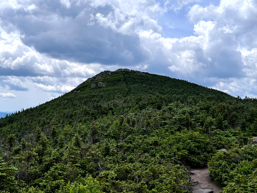 The peak of South Twin from the ridge. The peak of South Twin from the ridge. 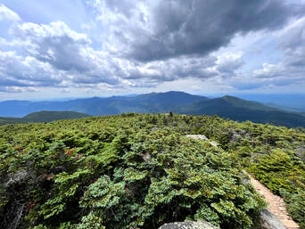 I have to admit there were moments when I was pretty close to despair on the way up, but once we reached the first overlook (and celebrated the puppy) things improved immensely. North Twin featured a couple of beautiful spots for a rest and a snack. Then we had the opportunity to hike across the ridge to the peak of South Twin. I have mentioned before that I love a good ridge trail. This one was special. Also, it was super-easy! I think I enjoyed it more than the peaks, themselves. On this hike, if you do all the work to climb the first mountain it is worth taking the time to bag the second. After all, the work is done! The 1.3 mile walk to South Twin was a great recovery opportunity with semi-obscured views and more of that diverse alpine ecosystem to enjoy. Once we made it to the summit, we were blessed with 360-degree views. I did not take a video because we were also surrounded by lots of fellow humans. Still, even with the crowd, it was quite a sight. Here on South we met a number of high schoolers, one of whom waxed lyrical about the mountain we were on and the mountains we could see. We had an excellent view of the "Presidents." Washington--with its towers and cog rail--was the most obvious, of course. However, the shear number of mountains within view rivaled the top of Liberty and seemed to stretch on forever. 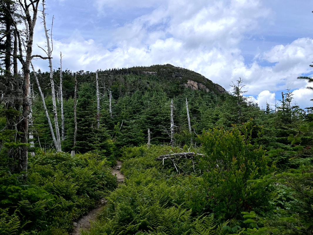 This is North Twin from the ridge. It was a bit more of a scramble back up. Turning around and crossing the ridge we once again approached the north peak. It was a bit of a struggle to climb back up the scrambles we had already climbed down but, really, it wasn't so bad. We stopped at both the outlooks on North once more and then proceeded to our cars. We crossed the river again, and again, and again. we leapt from rock to rock for the first one then I switched to sandals. Al jumped one too many rocks and got her feet wet so switched to sandals for the last crossing and hiked out that way. I will do this hike again sometime. It probably won't be too soon, though. South Twin was #24 for me on the NH 48 list which is exactly halfway. Also, I am at # 11 of the 52WAV. I would like to get back to those. Still, what a day... 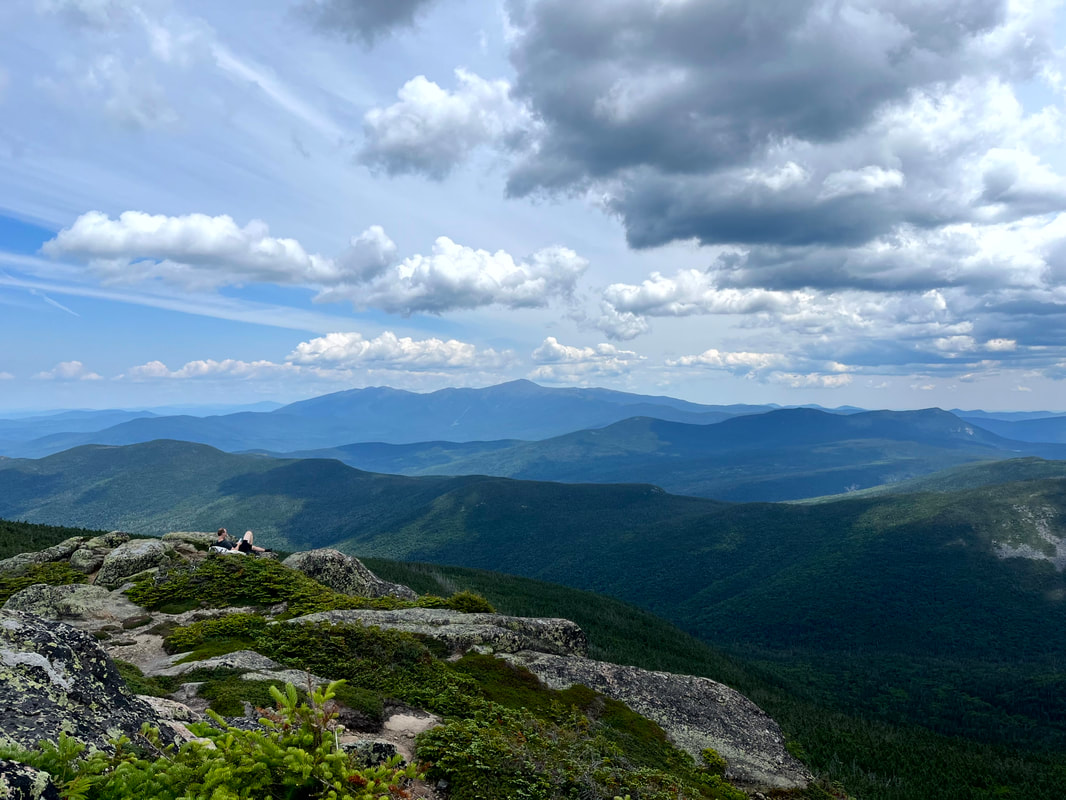 Part of the scene on South Twin. We all envied that guy and his sitting spot...but we did OK. Dear Folks, I am in the process of catching people up with some early hikes and other encounters with nature that I thought people might find interesting as part of a "How It Began" (HIB) series. Mostly this will describe specific hikes and perhaps some lessons learned along the way...if there are any. They are meant to be short and, perhaps helpful in some way to other hikers or fellow-travelers. I will post the dates of when I hiked a specific mountain since the ones in this series are NOT posted at or near the date I actually hiked them. To add further confusion, I am not doing them in order! Here is a post about a winter hike. We did so many and have posted so few... 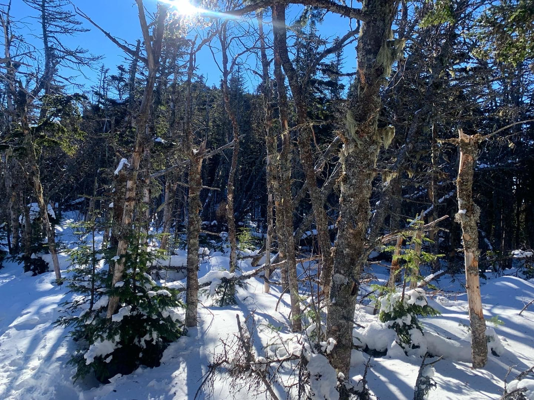 Hiked On: January 16, 2022 In the back of my mind during this whole hike was the idea that I might have done something very stupid. It was 15 degrees below zero at the trailhead when we started up Mount Liberty. The socials that we follow were filled with dire warnings about climbing on that day. Mount Liberty is 4,459 feet tall. The out-and-back we had selected was a little over 7 miles, which means it was steep. Other than the temperature (and the abundant snow and ice) this wasn't our hardest climb. The snow and ice do make a difference, though. The freezing temps make a difference too. Our packs were heavy with snow shoes, spikes, emergency equipment and layers. Still, there we were at 7am ready to go. So, again, I couldn't help but think I made a mistake and should have done something else with my day. 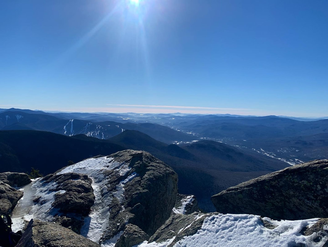 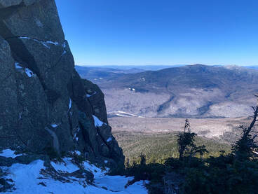 As a hike, it is fairly straightforward. It starts on a multi-use trail that we had been on before as there are a number of other climbs--for us winter climbs--that can be reached from that path as well. Then, we got a long period of relative flat before climbing...and climbing steeply all the way to the top. While on that flattish part, I started to have temperature regulation problems. As anyone who has spent time outdoors in the cold can tell you, there are moments when one's internal thermostat goes crazy. If you don't figure it out then hypothermia will set in. It took me a while to figure out what to do and we gave serious thought to turning back. Finally--after experimentation--I realized that I was running too hot for the amount of clothing I was wearing. This was the first lesson. I recalled going down Mount Willard a couple weeks before and witnessing a number of children on their way up desperately trying the shed layers while their parents just as desperately tried to make them keep the layers on. The kids were crying loudly, steam rising up out of their jackets. I remember thinking to myself that the kids needed to cool down to warm up--you don't have to wear all your layers all the time--and I realized I was doing the same thing. My concern over the temps had caused me to overdress for climbing. I was being just like those parents re-zipping jackets and cramming hats back on to sweaty heads. Since my parents were nowhere nearby I shed some layers and after a while things leveled out. I kept the hat, though, a hunter-orange number, and my gloves. Extremities are the first to go, my friends. Still, despair--my constant companion--was a problem. I have this issue below the tree line, particularly in winter. The trail, you see, just goes on and on and...I hate snow. The walk was slow and the struggle was real. We took many rests but the rests weren't that satisfying either. After all, I was cold. Finally we broke out onto a ridge and while there was still plenty of up to go, at least I could see out and around me to the winter landscape. Also I could see where I was going. Liberty is famous for its gigantic rock near the peak. We knew to point ourselves toward it and keep on keeping on. Also, the sun was out and that exposure warmed us up a bit after the shady trails below. As I have experienced in all seasons, a good ridge lifts the spirits immensely.  We finally broke out on the top and could see for miles all the way around. A small group had gathered there. Some were people we had been walking adjacent to for hours. Others had come over from Mount Flume, which we had done before the snow. About a third of them were carrying small sleds. I had done a bit of butt-sliding by this point but I had never imagined bringing a sled and treating a 4,000 footer as a personal sledding hill. It looked like fun. Butt-sliding is somewhat controversial in the Whites. Some love it. Some hate to hike down the shear track that they leave. I am a moderate on the issue. It is pretty convenient, though, and sometimes necessary of there have been a lot of sledders before you. We slid down a good chunk of this mountain ourselves using our snow pants, but I have to say...we never caught up to the actual sledders. In the end this was an important hike for me. It started rough and got dark (emotionally not meteorologically) a few times. In the end, though, I made it. I learned I could do something like this. I also learned that when people start saying "stay home unless you know what you are doing" sometimes at least...I do know what I am doing. Of course I have modified a number of hikes since because I knew what I was doing and didn't want to do a thing. After this hike, though, I learned to trust my judgement a bit more. I remembered that I had the authority to adapt to what my body was telling me. I also learned that even though I do not like snow...there are reasons to be outdoors in January.  That is Passaconaway on the left. The high point in the distace on the right is Chocorua and right in front of it is Paugus.  HIKED ON JULY 10, 2022 Hiking out of the parking lot on our way to the Blueberry Ridge trailhead we passed the time of day with another hiker who said two things that have proven pretty much true. One was that a person would have to look pretty hard to find a place as beautiful as the Sandwich Wilderness Area and the other was that--given the weather--there was no way that our various hikes would be any thing other than epic. We could only agree. The first we had already experienced. We have both hiked--alone and together--a number of trails in this area and each time we were struck by the foliage, views, and landscape. The second had special meaning. The last time we parked in that lot was to hike Passaconaway a couple of weeks ago on a day when the weather was definitely more dangerous. That story can be found in my Passaconaway post. This one is about a different day. 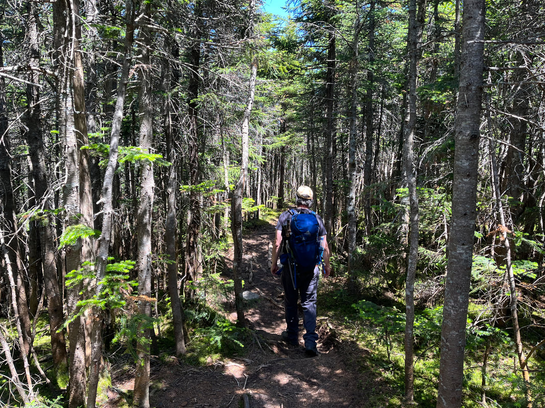 On the Ridge. 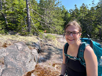 After that other hike we decided to make our return a priority, to climb up it's neighbor, Mount Whiteface. If we had enough in the tank we also thought we would hike the ridge--on the Rollins Trail--between the two mountains and peer into "the bowl". The space made by the two peaks and the ridge has never (at least during recorded history) been logged or experienced a fire. This, honestly, interested me more than the climb. The trail at first was just like Passaconaway, which is to say it was a road. You can check the other post for a further description. Then we turned into the woods and started to head up. Whiteface gets its name from the prominent stone cliff that can be seen from ground-level, so the trail--after a gradual start--became quite steep with a number of potentially-dangerous rock scrambles. We congratulated ourselves on waiting for a dry day for this. There were a number of ledges along the way, each with a similar, fabulous view of the wilderness area, some with Lakes Winnipesauke and Squam in the distance. We could see mountains we had already hiked and a number that we had yet to hike. Of course, we could also see into that bowl, which was breathtaking as well. I will say that the scrambles were a challenge. We stowed our hiking poles in order to use our hands to get better purchase. As we went up, we encountered a couple and their dog attempting a barely controlled descent. A few people we talked to over the course of the day decided to hike the ridge to Passaconaway instead out of concern for the potential for injury going back down the ledges. Al and I were not that worried, but we did end up on the Rollins Trail. The "true" peak of Whiteface is just a spot on the woods past all the cool stuff so we passed the point of no return in search of it. 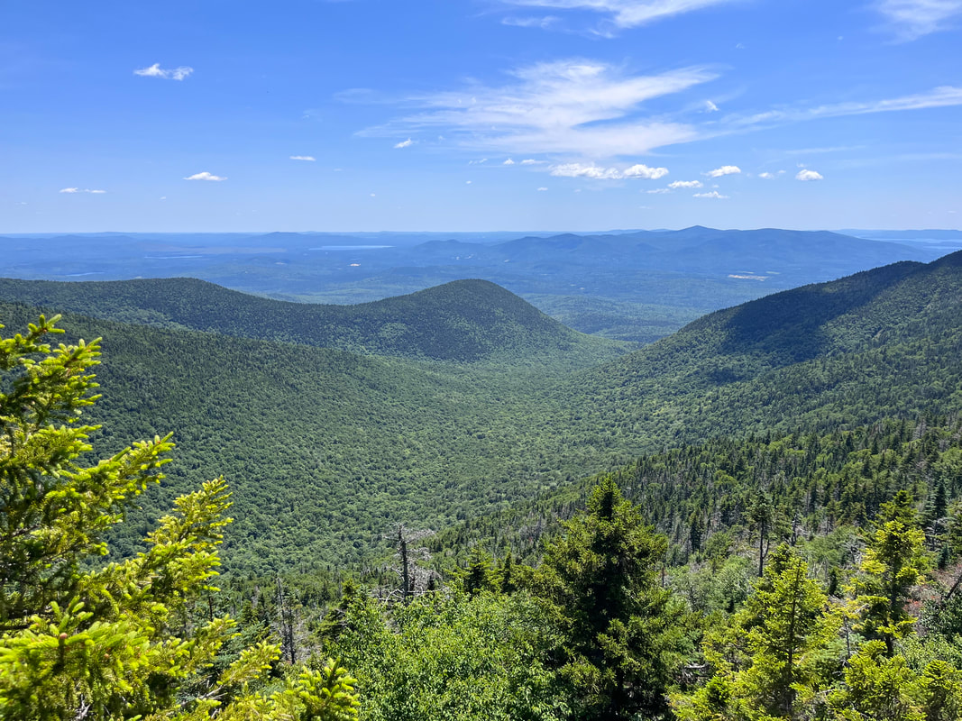 Looking down into the Bowl Research Area from the ridge. 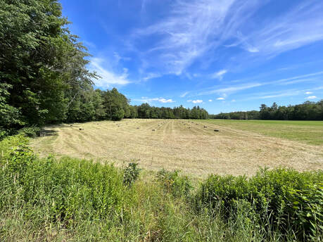 I have always loved a square bale. I have always loved a square bale. I have to say... the trail between the peaks was my favorite part. The relatively untouched nature of the ecosystem gave the whole area on the ridge a sort of elfy vibe. There were plenty of thin, straight trees and a diversity of species that changed every few yards. The abundance of rotting wood that supported this system was covered in various mosses. There was a breeze and every once in a while...a view into that bowl again. Also, this part was pretty flat, which was a nice change from the boulder climbing and the inevitable climb down Dicey's Mill Trail. After that experience, we turn right at the intersection of the spur to the peak of Passaconaway. The left would have taken us to the top and a loop with some limited views. However, we had just been there. Honestly, as an attraction on this journey, it came in a distant third anyway. I mean, it was worth climbing when we climbed it, but it will be a while before we feel moved to do it again. We walked down Passaconaway's side back to the road and then to the car, set in a hay field. This very hike I would do again in pretty much the same way. Both the ridge and the ledges of Whiteface lived up to the hype. It is a steep and rough climb in places, though. Also, it was a touch over 10 miles. If you decide to do this one, pick a clear day and take your time. Frankly you will want to because there is so much to see. Dear Folks, I am in the process of catching people up with some early hikes and other encounters with nature that I thought people might find interesting as part of a "How It Began" (HIB) series. Mostly this will describe specific hikes and perhaps some lessons learned along the way...if there are any. They are meant to be short and, perhaps helpful in some way to other hikers or fellow-travelers. I will post the dates of when I hiked a specific mountain since the ones in this series are NOT posted at or near the date I actually hiked them. 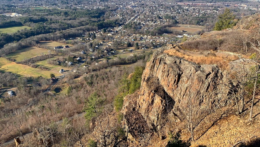 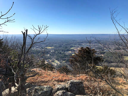 DECEMBER 14, 2021 Sometimes there are good things on even the least promising of days. This was a busy day for me. Holiday prep was in full swing. We had family things and church business going on. My post-surgery back had taken a turn in the wrong direction. There were other tragedies--not my story to share and therefore not discussed here--that occurred even as we took this walk. It is hard sometimes to separate all that from the trip up to Mount Tom by way of the Mount Tom Ledges, but I will. Somehow in the midst of all of the mess of life, this hike stands out as one of the best. Now, some of you may recall that the name "Mt. Tom" has already come up in my post about the Tom, Field, Willey, Avalon post about a loop over three 4,000 footers and one slightly shorter (and super-gorgeous) mountain in New Hampshire. This is not the same Mountain. Apparently "Tom" is an evocative name when it comes to these sorts of things. This hike occurs back in the Pioneer Valley, my old friend. It is yet another rocky ridge surrounded by flat plains enabling stunning views wherever the trees part, or are low enough. This hike was about seven miles out and back and featured around 1,200 feet of elevation. I really did not feel well. I was tired and distracted by a million things. We almost stopped at the first overlook (which was fabulous) but then--after a quick rest--we continued forward at first tentatively, then with purpose. I had to stop occasionally to answer emails and check messages which is something I never do on the trail. This really was a different time, though, so I made a couple exceptions. However, perhaps the chaos outside the moment made the time on the ledges that more special. 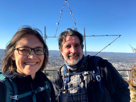 After that first overlook the landscape became rocky and rolling with constantly changing views into the farmland below. We covered a couple of smaller peaks and then moved along toward Mount Tom, itself. One of the big differences in hiking in Massachusetts is that there is much more evidence of humanity. With each view we could see houses and sometimes whole towns stretched out below us. We also passed cell towers, power lines, and windmills. There were decaying and somewhat-unidentifiable pieces of metal and glass sticking out from the bushes. There were service roads as well. Finally, on the very top of Tom there were a few industrial-looking buildings obviously there to maintain the radio towers that dominate the peak. Also on the peak was a massive metal and wood star with Christmas lights on it. It turns out that this star is a local tradition in Easthampton. I love Christmas lights. Somehow all this evidence of humanity worked. There wasn't any "litter" to speak of and I loved the industrial elements. They seemed to go with the gray and hardy rock that was everywhere. Yes there was evidence of people communicating, celebrating, and making the mountain a centerpiece of their lives. That--at least on this hike--made all the sense in the world. After a while we turned back around and experienced all the views again. I am tempted to hike this in every season eventually. I can only imagine that it has plenty more to give. 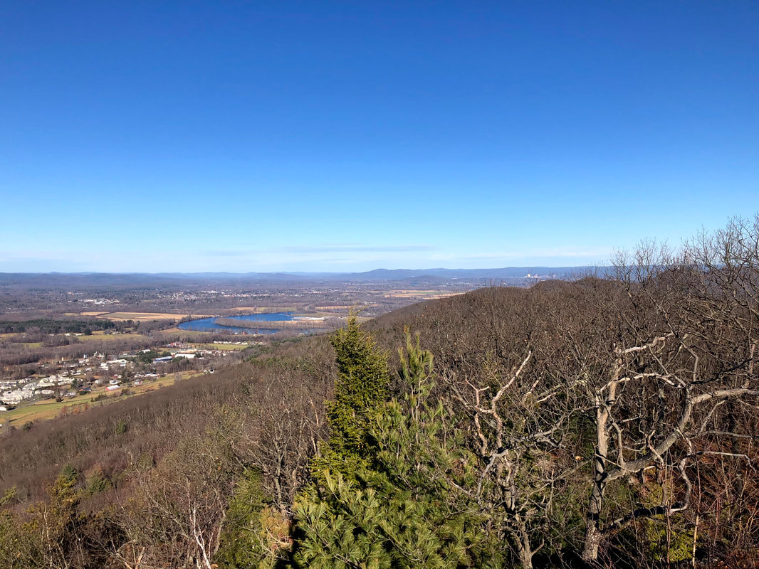 Dear Folks, I am in the process of catching people up with some early hikes and other encounters with nature that I thought people might find interesting as part of a "How It Began" (HIB) series. Mostly this will describe specific hikes and perhaps some lessons learned along the way...if there are any. They are meant to be short and, perhaps helpful in some way to other hikers or fellow-travelers. I will post the dates of when I hiked a specific mountain since the ones in this series are NOT posted at or near the date I actually hiked them. 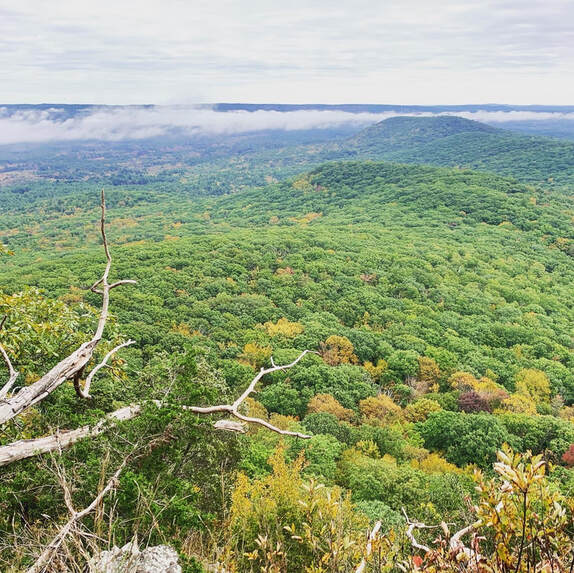 This is one of the views from Norwottuck. It reminds me a little of the view from the rebel base on Yavin 4. OCTOBER 8, 2021 History nerds will remember Shays' Rebellion, when a band of veterans from the Continental Army rose up to resist the entrenched interests of eastern Massachusetts and set off a series of events that ultimately culminated in the writing and ratification of the Constitution. If you don't remember, check it out. It was one of those iconic turning points in American history but in many schools you only get a day to digest the whole Articles of Confederation-to-US Constitution move and Daniel Shays gets merely a mention. These days folks with just enough information will try to shoehorn this second revolution into the mythology of today's "red v. blue" divide. It is a futile endeavor. They were protesting a number of issues, like not getting paid and being taxed without adequate representation. Underlying their oppression was the economic desires of the landed interests in Boston. The story is a Rorschach test for activists. You can make of it what you will. My suggestion is to just take it for what it is, on its own merits and in its own context. It is a moment in time, and a romantic one in its own way. The actors in their story are the closest we get to the legends of Robin Hood or Rob Roy MacGregor. I bring up this historical tidbit because you can check out Shays' old stomping grounds without too much difficulty. The Pioneer Valley--where the rebels were primarily from--creates a defensive bowl of ridges and rocks where Shays and Co. could hide out when the heat was on. I already mentioned the Seven Sisters hike. There are more to come, but this post is about Norwottuck, the site of their final stand. 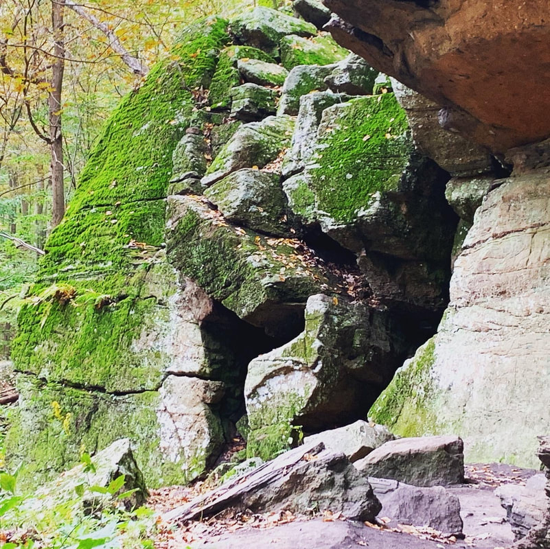 The legendary Horse Caves. 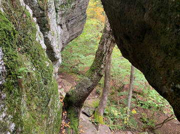 The view from one of the hike's many fun rocky challenges. This one enters into the theoretical final encampment of Shays' army. The view from one of the hike's many fun rocky challenges. This one enters into the theoretical final encampment of Shays' army. The hike, itself, isn't that long. Also, the elevation isn't very high. You don't have to go too far up to get a commanding view when the land around you is flat as a pancake. From the parking lot I head into the woods and then passed an active quarry to my right. After a bit of confusion, I managed to locate the trail I was looking for and found the footing easy for a while. Then it became ledgey and more difficult. The total walk was four miles round trip. It included the sort of rolling hills that I now know as a key part of hikes in the region. There are some steep parts up toward the peak and then down the other side. After a short scramble up the ledge to the top. I found numerous perches from which one could look out over the valley. That tacked on some time as I sampled many of them. I was working on a sermon, after all, and could use the inspiration. Even though they were farmers by trade, Shays' army had already fought one revolution. They knew how to choose the terrain. In addition to those many lookouts, the land is rough and rocky, with many places to hide and take cover. I had no trouble imagining a musket or two peaking around the corner. It would be an unsettling place to try to attack if you knew it was defended by locals. Dropping down from the top I eventually hit a flat area known as the "Horse Caves." Legend has it that Shays hid horses in holes in the cliff. If this is the case they must have very tiny horses! I would say there was room for maybe three goats. Still, it was a very cool spot to be. The flat area seemed like a likely location for their final encampment and it wasn't hard to imagine them there, waiting to face the militia from Boston. In the end, though, they surrendered. The commanding officer of the Boston militia claimed in his reports to have surprised them and captured everyone involved. Strangely, Shays was nowhere to be found. Nor were the other officers whose capture would have resulted in their trial and death. My guess is that neither side had much interest in killing and--perhaps after some negotiation--the leaders were allowed to slip away. A little research will reveal what happened to everybody from that point on. It did, in fact, prompt some reading for me. The hike was relatively easy, but it is one of my favorites. The story, the views, and the general vibe of the place got me going. I have tried to go back but it is also very popular with other folks and on the weekends it is hard to find a parking space. 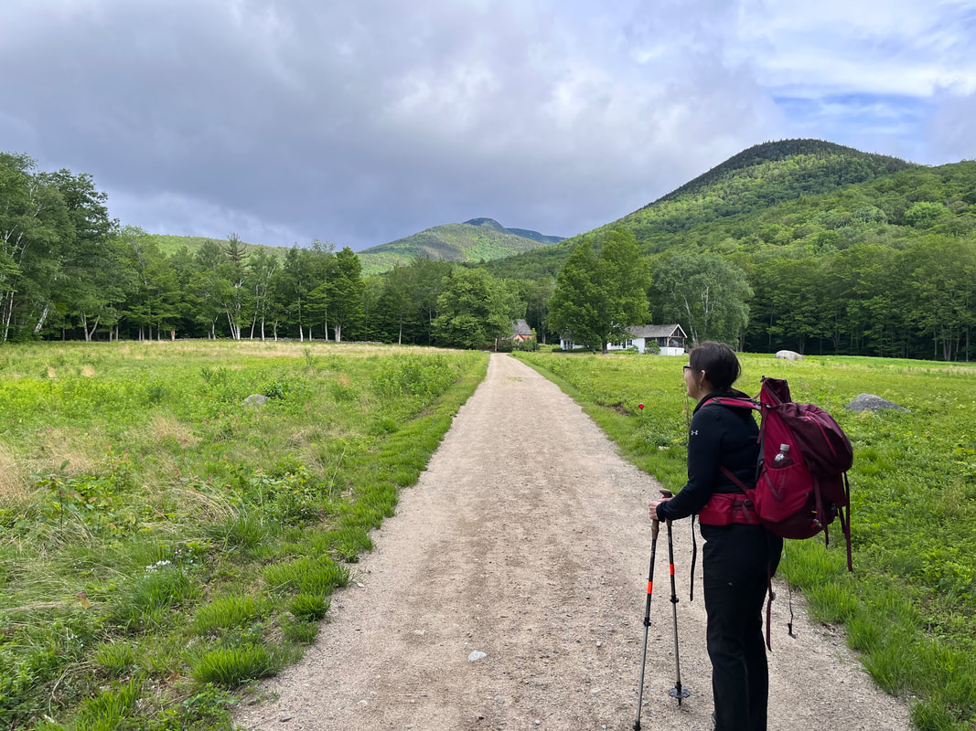 This hike was on our 28th wedding anniversary. Things have been so chaotic it was nice to just do the thing we do together. It almost didn't happen, though. While the weather below 3,500 feet was fine, if a bit windy and cold. Above 4,000 feet was downright wintery. The socials we subscribe to were ominous. We had previously planned for Jefferson, which is way past 4,000 feet--5,712 actually--so we opted for the 4,043 foot Passaconaway instead. Over the course of the day we considered a modified out-and-back to Whiteface next door...but in the end chose not to. What we did do was pack for colder weather before we started. Al and I both tend toward the heavy end of the packing spectrum. It is a comfort issue as much as anything else. We like water and snacks. We want the various layers that can get us through fluctuations in temperature both while walking and while resting. Who can argue with that, right? There are actually plenty of folks who would, preferring a lighter load that gets them up and down with greater ease. This hike, however, most of the people in the lot were playing it safe and adding a few items for comfort and safety. 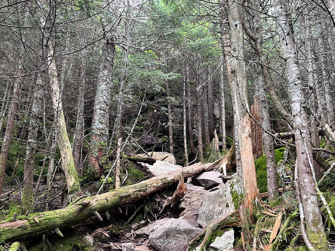 Most of the trail was long but relatively gentle. I had climbed three shorter mountains earlier in the week and the trail was longer but comparable to the combination of those. In fact the round trip comparisons for mileage and elevation for the two days were about the same. On Passaconaway, the big challenge occurred after the turn off for the ridge trail to Whiteface. Things got steep, cold, and wet about then. We started the ritual of adding and subtracting hats and jackets as the situation required. We even got as far as putting on our gloves! We passed a few people on the trail, all of whom were doing the same thing. Some had warnings for us. No one suggested we turn around, but they wanted us to know the conditions at the top. 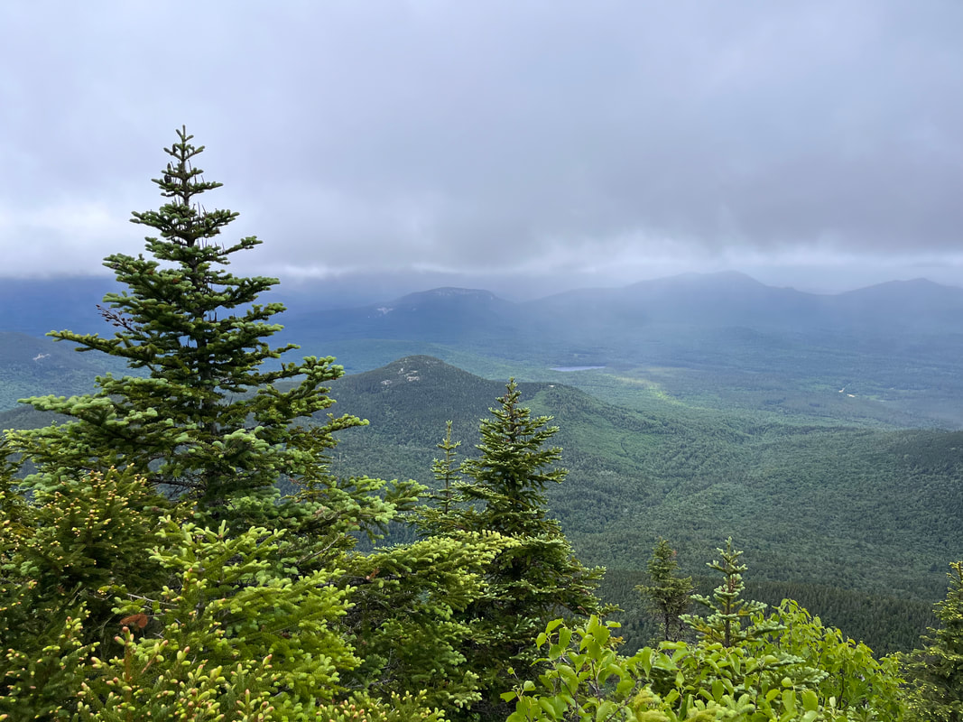  The conditions were...not ideal. They also were nowhere near as bad as what we encountered in the fall and winter. It was just a little unexpected given the lovely day at ground level. After the summit, we naturally struggled a bit with the possibility of hitting Whiteface. In the end--as I mentioned earlier--we chose not to. We were tired and wet and our plan would have just taken way too long. Still, it was a good hike on a good, if challenging day. I think it is probably worth noting that another hiker--an experienced and knowledgeable one--died that day while attempting a presidential traverse. The traverse involves hiking across a ridge of much higher mountains that are named after presidents. This includes Mount Washington--the tallest peak--and Mount Jefferson--which we expressly avoided--among others. We could not help but feel it. His family will miss him and, as fellow hikers, it is hard not to feel like we knew him a little bit. This tragedy put a bit of a damper on the day and reminded us of the need to respect the weather and understand our abilities, not just in general but on any specific day. There are times when we are strong and times when we are not. This is true no matter how good a condition we are in and how skilled we are at a particular task. Respecting nature means knowing when not to engage. The mountains do not care if you are ready for your attempt or not. Hiking, like many hobbies, comes with plenty of risk. This risk is part of what attracts people. When you climb a big mountain in the woods you come face to face with the vastness of the wilderness around you. You feel small and--perhaps conversely--in that smallness you feel empowered as part of something much, much larger. There is a spiritual element that is outward-facing. Yes, people go on these trips to challenge themselves, but that isn't all that is going on. Otherwise we could save a lot of time by hitting the treadmill or peloton. There is an attraction toward that smallness and the return to Creation that it represents. Still, it is good to know when to turn around or just stay home. We did not stay home and I am glad we didn't. However, we did change our plans and then we did turn around when we realized our tanks were close to empty. This was good too. I guess the lesson is to walk with humility and to not let the quest for perfection conquer the good before us. 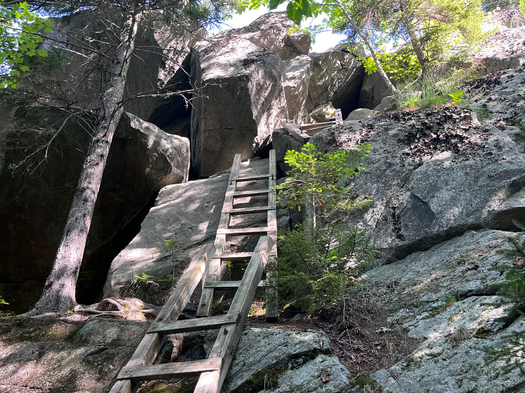 The crazy ladders to the tiny cave up Mount Morgan. It has been a crazy time here at the parsonage. The kids--some in their early 20's and one in his late teens--all have chaotic summer plans. Al and I have chaotic plans as well. The world seems to be on fire, too, adding to the general stress. Also the church--which needs to be essentially shut down for summer and reopened after Labor Day--has many complicated demands this time of year that are different from the ones at any other time. The last month has been a whirlwind and--I suspect--it will continue to be for the foreseeable future. It has put me behind on most things but...what can you do, right? We just plug away hoping to keep it all together. So let me tell you about a day of hiking that I took a while ago on June 15. Things had already gotten crazy. I had missed my usual weekend hike because I was officiating a burial service. Allison went without me up to Mount Carrigain. By Wednesday (the aforementioned 15th) I was toast. So when I couldn't sleep, I got up and drove to New Hampshire to get an early start on Mount Morgan and Mount Percival in New Hampshire. These are the two shortest peaks on the "52 With a View" list. In fact, before these the list had a height range of 2,500 to 3,999 feet. However, a recent exception was made when some other mountains lost their views. I should say, though, that this hike--they are usually done together--is not the shortest hike on the list. Nor is it the easiest hike. In fact, going up and down you even have options to make it even harder on yourself. As I chose to go up Morgan and down Percival, I opted for the scary ladder option on Morgan. I like my challenging parts when I am fighting gravity. In the end, it made for an interesting set of problems, including one very tight squeeze. Up until that point, this had been a total rage-hike. I had so much stress built up from long days and many, many meetings that I basically marched the first few miles, muttering to myself. The pause to figure out how not to tumble down a cliff helped to center me and once I came out on to the peak, I was ready for the spectacular view. 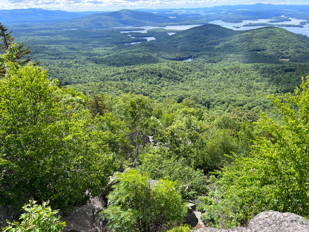 The view from Morgan
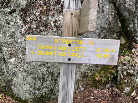 After the peak I started down again, careful to avoid the "caves" for the somewhat easier "cliffs." The cliffs were hard enough for me. Once that was over I began rage-hiking again. I knew my trip was over and I was headed back, ultimately to the cacophony of words. There were the spoken ones, of course, but emails and podcasts and videos too. At this point in the world there is so much to take us out of ourselves. Sometimes this is good. Justice work can do that. More frequently though, they can be words of futility and despair. Watch out for those! They are designed to run us down and put us out of sorts. They are designed to let "the man" get what "the man" wants; docility. 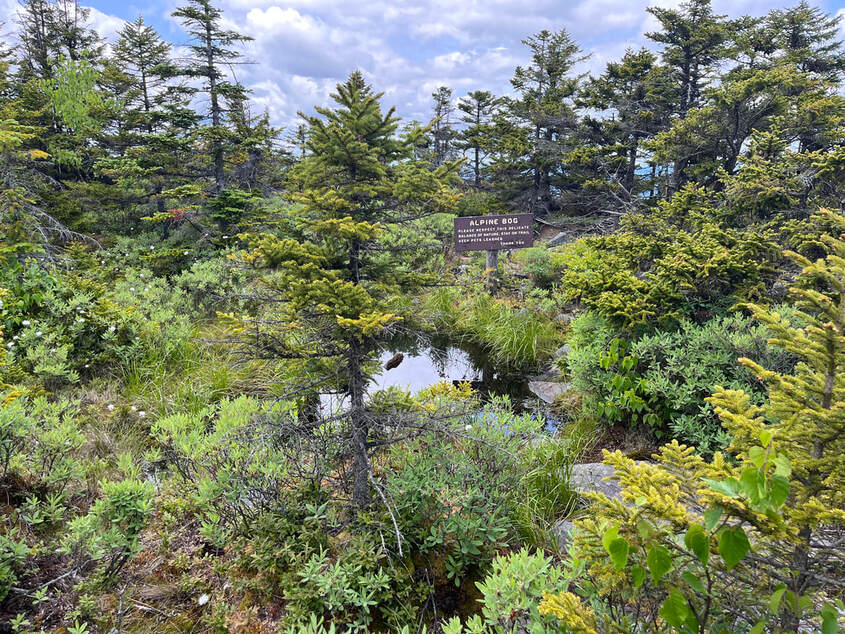 Yet another fragile alpine ecosystem, this one on Kearsarge South Yet another fragile alpine ecosystem, this one on Kearsarge South Right...hiking. I was talking about hiking... Long story short, I took a hard right halfway home. I didn't really mean to but I did. I wanted to get away from the noise just a little longer. This is how I ended up at Mount Kearsarge. Sometimes it is called "Kearsarge South" because there is another one (also on the 52 list) farther up. This mountain has one of the shortest hikes of the list but...it also isn't the easiest. The trail up is basically 1.1 miles up over rocky ground. Feeling a little bad about this unscheduled bonus walk I pounded up the trail. People coming down stopped me to chat--a normal occurrence--but I was determined to get up and down and back on the road. Once I reached the top, though...I relaxed a bit. The wind was back. So was the gentle whisper. The view was epic. I sat there for a short time and then headed down more slowly by another, gentler, route with a number of vistas that revealed themselves along the way and a few alpine bogs that made me stop for a while to take them in. It made me wish I was an ecologist rather than a pastor. Maybe I should have found a place working out in the field cataloging the abundance of life that survives in inhospitable locations. Anyway, that last hike did the trick. Maybe it was exhaustion from so much walking or maybe is was something more inspirational, but by the time I got back to the car I was ready to head home...with the radio off. Update: I feel like this post has more about me rage-hiking than it does about the mountains I climbed. I cannot remedy the entire situation right now, but I recently hiked up Kearsarge once again and made a video... 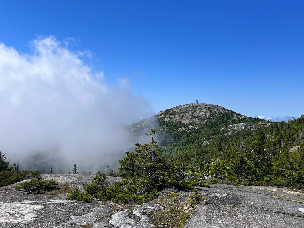 Clouds fight with our view of Cardigan from Firescrew.  JUNE 4, 2022 Maybe it is leftover Covid. Perhaps it has to do with the massive clouds of pollen creating an apocalyptic year for allergies...or both. Whatever it was, I couldn't manage an epic hike over 4,000 footers this weekend. Instead, we hit two 3,000 footers; Mount Cardigan and its neighbor, Mount Firescrew. Cardigan is a little higher and the views are wider, but Firescrew has views, too, along with fewer people and a cooler name. Our route (Manning Trail to Firescrew then Mowglis to Cardigan and finally Clark, Clark-Holt Cutoff, and Holt back to our car at the AMC Cardigan Lodge) Was about 6.2 miles round trip and the views were spectacular...at least once the coulds burned off. The directions for our route were provided by an older gentleman who was working at the AMC lodge at the trailhead. I will always listen to people like this. Every trail in the country has a team of often-retirees who do the heavy lifting to keep a place safe and looking good. Their relationship with their territory is frequently intimate and long-standing. I always learn something in these conversations, even if I don't always take the advice. This time, though, the advice was sound and we took it. I don't interrupt, either, when they tell me a thing I already know. In the aggregate, I am learning. They don't need to be aware of my limited areas of knowledge when they are trying to help me fill the gaps. I try to remind myself of the lesson from Epictetus, "Get rid of self-conceit...for it is impossible to anyone to begin to learn that which they think they already know." Strangely, there is something in a human that makes us simultaneously ask a question and try to prove we didn't need the answer in the first place. I am not sure why we do this but it happens all the time. On this trip someone asked me about the conditions on Manning and then--after I answered--assured me that he was already aware. If that was indeed the case, what strange behavior to take the time for asking! We started out in the fog and light rain. We saw little when we reached the first ridge area on the side of Firescrew. The trail was lovely, though, and lightly traveled with a group of three women somewhere ahead of us and--as far as we could tell--no one behind. We finally met up with the women as they were taking a lunch break on Firescrew with within sight of Cardigan and its fire tower ahead. We took a break as well and soaked in the emerging views as the overcast wore off.  Firescrew, a secondary peak of Cardigan but, at over 3,000 feet, pretty tall on its own. From then on we were accompanied by fabulous puffy clouds seemingly fighting with each other, the Sun, and the mountains themselves. What had started as a depressing limitation lifted enough to add to a general drama in the climb that unfolded along the exposed rock that began before Firescrew, over Cardigan and on down the other side. There was a bit of rock climbing to do. Also, pools of rainwater, with their own ecosystems, dotted the ridge in various places. We could see an abundance of "crevice communities" like the ones I found hiking Welch-Dickey, as well. We were careful, of course, not to step on any of them and the trail made them relatively easy to avoid...as long as we were comfortable leaping over the pools. The exposed rock, by the way, is part of the Cardigan Pluton; the remains of an ancient volcano or volcanic system. It is--according to Wikipedia--"approximately 20 km wide by 90 km long and on average about 2.5 km thick." That is a lot of now-cold magma! There were interesting white veins--the result of the dynamic cooling process long ago--hatching the rock in places. I am not a geologist (obviously) but the diversity of the stone beneath us made the journey that much more interesting.   Near the top of Cardigan we ended up talking to a young man and his two dogs. He had been climbing this mountain since he was a kid and had some good suggestions for other hikes. It looked like he planned to be up there for the day, having brought some beer and snacks. He was also packing heat, which was a bit of a surprise. I didn't ask about it. Maybe he always does or maybe he was worried about bears. A family of bears that we sighted on Shaw a few weeks ago have now become quite the challenge for hikers there. Either way, after a chat we declined his offer of a drink and headed down. On the way down we met a lot of people heading up. Once again, it is best to go early and avoid the rush! We passed a few more spectacular views and a lovely little stream before meeting up with the old guy who gave us directions at the beginning. This time he was pushing his wheelbarrow toward a trail-maintenance site. I am not sure he recognized us from earlier, but it was great to see him and others working on an accessible nature trail for folks who can't handle the climb but want to be in nature. In the end it was a great day out on a challenging and beautiful loop trail. I would totally do it again. 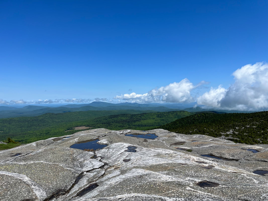 A good view of the mountains and of the striations on the pluton ledge at the top of Cardigan. Dear Folks, I am in the process of catching people up with some early hikes and other encounters with nature that I thought people might find interesting as part of a "How It Began" (HIB) series. Mostly this will describe specific hikes and perhaps some lessons learned along the way...if there are any. They are meant to be short and, perhaps helpful in some way to other hikers or fellow-travelers. I will post the dates of when I hiked a specific mountain since the ones in this series are NOT posted at or near the date I actually hiked them. 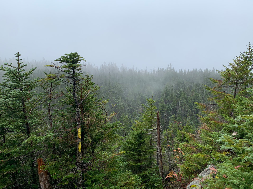 OCTOBER 4, 2021 This trip I completed with my brother Dan. Dan is the real hiker in the family. Many years ago after they graduated from high school, Dan and his twin brother (also my brother but we aren't twins) Matt decided to hike the Appalachian Trail north-to-south. Some of my own most ambitious hikes came from tagging along after them on various practice runs. I am a few years older than they are, however, and that window for a months-long adventure had closed for me. Anyway, they got pretty far over some of the hardest parts, but eventually they took a break and joined me working in the retail hub of Freeport, ME. Good times. Dan has kept on picking away at the AT, though. More recently than this hike, he actually joined my son on the AT for ten days going south-to-north through the Great Smoky Mountains. This particular day was wet and cold when we started. This is not an unusual state of being for New Hampshire in October and we planned accordingly. Our goal was to climb up Mount Osceola and over the ridge to East Osceola and then back, crossing Osceola again upon our return. We got a slightly later than usual start because we misjudged the time to get there. However, once we got underway things went smoothly for a while. On the way up there weren't any stunning views, nor were there any at the top. Fog will do that to you. Still, the foliage was wonderful and the company was fine.   Actually, it was more than fine. Thanks to the plague most of our interactions for the year had been over zoom, which is not ideal. Being outdoors meant being able to interact like normal humans. A lot of the time was spent catching up. We talked about our families, kids, parents, siblings, and so forth so the time flew by. Another great perk of hiking with Dan is that he knows a huge amount about the outdoors. Dan is a wildlife biologist for NOAA and I appreciated the "enhanced video" aspect of having an expert with me. Since he also walks quite a bit faster, I also appreciated the fact that mushrooms and birds distract him. Most serious hikers--my wife and brother included--seem to think of hiking as an isolated activity. It is just the lone walker in the natural world. I am in that minority who thinks of it as social. You can identify the social types pretty easily out on the trail because--whether we are solo or not--we begin talking to strangers the moment they come into view and then continue talking until well after we pass them. We take seriously the idea of a "hiking community" but...we also make a bunch of noise with our mouths. Thankfully both Dan and Al tolerate this behavior in me. Maybe that is why it is so great to have them. The first socked-in peak over, we proceeded to cross to East Osceola. This ridge is a bit of a challenge. It is hiked less often than the rest because there isn't actually much of a view off of East and there is the issue of a fairly substantial scramble called the Chimney which one must first go down and go up on the return trip. Theoretically there is an easier way around it...but I didn't notice. 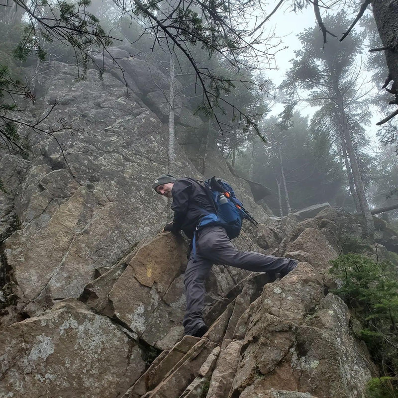 Or...if this was the way around...it wasn't much different.  We continued to East and then headed back. It was still wet and cold but the mushrooms were off the handle and we were enjoying the challenge. The Chimney was actually a bit easier--straight up--on the way back. I mentioned this same phenomenon on the Garfield Ridge. Climbing is just easier than descending when it comes to cliffs. When we emerged onto Osceola for the second time the clouds finally parted and we got one of those classic White Mountain views. I would say it was worth the trip but the trip had been pretty cool up to that point. Still, it was nice to see. On the way home I wiped out on some wet ledge rock, tangled myself in a tree, and broke my hiking pole. At this point I was still not entirely rehabilitated from my back surgery so I opted for the spectacular spill instead of twisting something to maintain my balance. Dan sorted me out. That is another good reason to hike with somebody. I felt the fall for a while though. In the end the trip was 8.5 miles and about 3,200 feet of elevation. It was quite a day.  |
Adam Tierney-EliotI am a full-time pastor in a small, progressive church in Massachusetts. This blog is about the non-church things I do to find spiritual sustenance. Archives
March 2024
Categories
All
|
 RSS Feed